




- My Forums
- Tiger Rant
- LSU Recruiting
- SEC Rant
- Saints Talk
- Pelicans Talk
- More Sports Board
- Fantasy Sports
- Golf Board
- Soccer Board
- O-T Lounge
- Tech Board
- Home/Garden Board
- Outdoor Board
- Health/Fitness Board
- Movie/TV Board
- Book Board
- Music Board
- Political Talk
- Money Talk
- Fark Board
- Gaming Board
- Travel Board
- Food/Drink Board
- Ticket Exchange
- TD Help Board
Customize My Forums- View All Forums
- Show Left Links
- Topic Sort Options
- Trending Topics
- Recent Topics
- Active Topics
Started By
Message


 2
2


Posted on 3/5/19 at 9:30 pm to TulaneUVA
quote:
Looks like a big white nutsack draped over the south
mother nature teabagging Dixie

Posted on 3/5/19 at 9:32 pm to rds dc
Don't like the severe weather, but I prefer it on the weekend. That way my car can be in the garage, and my arse can be in the house.
Posted on 3/5/19 at 9:33 pm to jcaz
quote:
Wtf am I supposed to drive to California for the weekend or something?
Cali is a no go! They are under attack by lightning tonight



Posted on 3/5/19 at 9:35 pm to Jackie Chan
Ever been to the grocery in LA ahead of impending severe weather? Looks like everyone is going to a party. fricking love this state.
Posted on 3/5/19 at 9:37 pm to rds dc
quote:
Cali is a no go! They are under attack by lightning tonight
they've just been getting hammered by rainmaker after rainmaker after rainmaker

Posted on 3/5/19 at 9:58 pm to rds dc
rds dc

This post was edited on 3/5/19 at 9:59 pm
Posted on 3/5/19 at 10:02 pm to rds dc
I hope they don’t cancel the catalina wine mixer.

Posted on 3/6/19 at 9:05 am to AA77
What's the latest
Posted on 3/6/19 at 9:38 am to LSUsmartass
well so far the "experts" have changed their forecasts daily. Nice of you to try and get everyone wound up, but its still 3 days away and I'm confident nothing will be the same Saturday as it is today.

Posted on 3/6/19 at 9:43 am to rds dc
Thanks for the heads up. Hope all the Baws in Louisiana and Houston stay safe


Posted on 3/6/19 at 10:29 am to Mudminnow
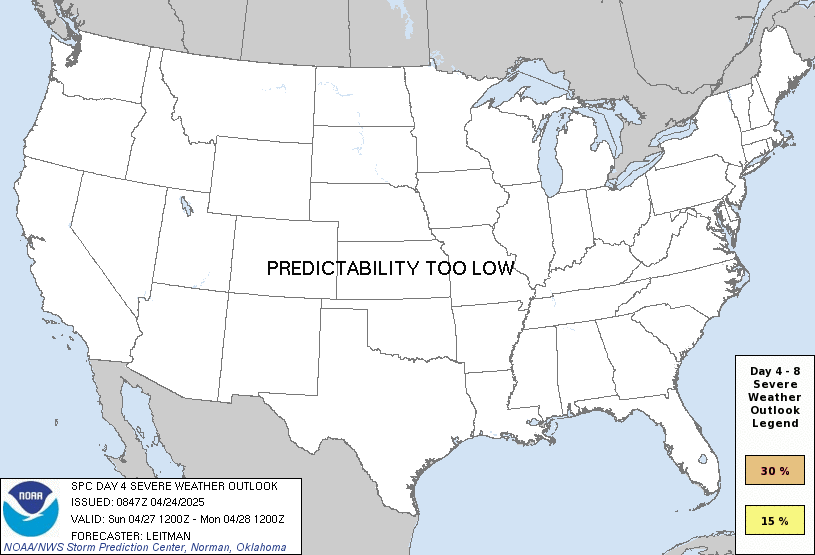
Severe weather outlook for Saturday. 15% chance of severe weather within 25 miles of a given point. Tomorrow we will be within 3 days so they will actually do the risk categories (moderate, slight, enhanced, etc).
Posted on 3/6/19 at 10:31 am to jcaz
quote:
Wtf am I supposed to drive to California for the weekend or something?
No, but you can know where you’re going to be, have a plan for seeking shelter should you go under a tornado warning, and have a way to get warnings.

Posted on 3/6/19 at 10:59 am to Roll Tide Ravens
That severe risk bubble includes areas in 13 states.

Posted on 3/6/19 at 11:02 am to GeauxxxTigers23
quote:Half stickers are gay. 140.6 or nothing.
You can still put the sticker on your car.


Posted on 3/6/19 at 11:07 am to Roll Tide Ravens
RDS the new GFS isnt really showing anything severe, what am I needing to look at??
Posted on 3/6/19 at 9:42 pm to rds dc
Just saw video from L.A. last night. Yikes that offshore lightning was crazy.

Posted on 3/6/19 at 9:46 pm to rds dc
why is new orleans where baton rouge should be on that map?
is the weather gonna blow it away?
is the weather gonna blow it away?

Posted on 3/6/19 at 9:49 pm to rds dc
Just do take note that the EF4 that popped up in South East Alabama this past Sunday was not fully predicted in that strength until a few hours before it hit.
Not saying this or any future forecast a few days out will underestimate the power of any storm, just saying don't take these lightly.
Have your plan NOW of what to do, where to go.
If you find out a tornado is heading your way, you'll have maybe 20 minutes to do what you need to do.
He'll, it would take me 10 minutes just to get everyone rounded up and back out of the driveway.
Not saying this or any future forecast a few days out will underestimate the power of any storm, just saying don't take these lightly.
Have your plan NOW of what to do, where to go.
If you find out a tornado is heading your way, you'll have maybe 20 minutes to do what you need to do.
He'll, it would take me 10 minutes just to get everyone rounded up and back out of the driveway.

Posted on 3/6/19 at 10:30 pm to rds dc
From NWS Shreveport forecast discussion earlier today
I've only got a very very basic knowledge of exactly what these things mean but that doesn't seem great.
quote:
Moderate instability (SB CAPE 1500- 2500 J/kg) and strong shear (0-6km bulk shear 50-60 kts) will develop across the area ahead of the front in the warm sector when the best forcing related to the trough crosses the area.
With this in mind, the Storm Prediction Center continues to highlight our entire area with a 15% probability for severe weather in day 4. The biggest limiting factor could be instability that becomes limited due to more widespread convective development with this system upstream. We will need to continue to monitor this closely, as unlike the severe systems on March 3rd and February 22nd, this system appears to cross much of area during peak heating hours on Saturday.
I've only got a very very basic knowledge of exactly what these things mean but that doesn't seem great.

 Page 2 of 6

Popular
Back to top
 Follow TigerDroppings for LSU Football News