




 1
1






- My Forums
- Tiger Rant
- LSU Recruiting
- SEC Rant
- Saints Talk
- Pelicans Talk
- More Sports Board
- Fantasy Sports
- Golf Board
- Soccer Board
- O-T Lounge
- Tech Board
- Home/Garden Board
- Outdoor Board
- Health/Fitness Board
- Movie/TV Board
- Book Board
- Music Board
- Political Talk
- Money Talk
- Fark Board
- Gaming Board
- Travel Board
- Food/Drink Board
- Ticket Exchange
- TD Help Board
Customize My Forums- View All Forums
- Show Left Links
- Topic Sort Options
- Trending Topics
- Recent Topics
- Active Topics
Started By
Message
re: Size of Africa on the map
Posted on 9/9/26 at 10:44 am to Bamafig
Posted on 9/9/26 at 10:44 am to Bamafig
You can't make Africa or any other land mass bigger or smaller.
This whole thing is about uneducated people not understanding map projections and what it take to print a 3d object on a 2 dimensional surface.
if you'd have paid attention for more than 10 mins in your high school geography class, you'd already know the answers.

This whole thing is about uneducated people not understanding map projections and what it take to print a 3d object on a 2 dimensional surface.
if you'd have paid attention for more than 10 mins in your high school geography class, you'd already know the answers.
This post was edited on 9/9/26 at 10:46 am
Posted on 9/9/26 at 10:48 am to ragincajun03
quote:
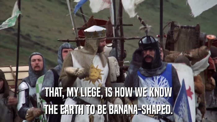
Agree. The Earth is much more triangular shaped.
I hate to break it to you...
Posted on 9/9/26 at 12:23 pm to BPTiger
quote:
lol it already has 54 dumbass!
:sigh:
30 other Countries including all of China, India and the lower 48 states of the USA...
All you had to do was click on the link I conviently provided.
Posted on 9/9/26 at 12:27 pm to Lonnie Utah
quote:
if you'd have paid attention for more than 10 mins in your high school geography class, you'd already know the answers.
I assume that you are talking in generalities, of course, I know this. That’s the point. People are ignorant and blame others for their failures. It just fits the narrative of black history being the shortest month, etc.
Posted on 9/9/26 at 12:27 pm to Bamafig
The only push is for an accurate map. The Mercator projection was intended for navigation and shouldn't be the standard for large areas.
Posted on 9/9/26 at 12:50 pm to Bamafig
People forget Africa is a continent. So you would need to compare other continents. The ones I see put countries next to it.
Posted on 9/9/26 at 1:03 pm to AUCE05
quote:
People forget Africa is a continent.
If true, what level of stupidity have we reached?
Posted on 9/9/26 at 1:08 pm to heypaul
quote:
the globe
everyone with more than 6 brain cells knows the earth is flat
Posted on 9/9/26 at 1:10 pm to High C
quote:
f true, what level of stupidity have we reached?
This is still far less baffling than not knowing what a man and woman are.
Posted on 9/9/26 at 1:11 pm to heypaul
quote:
Most people are baffled when they learn you can fit 30 different Countries into Africa.
NM, it's already been said too many times.
This post was edited on 9/9/26 at 1:15 pm
Posted on 9/9/26 at 1:21 pm to heypaul
quote:
:sigh:
30 other Countries including all of China, India and the lower 48 states of the USA... All you had to do was click on the link I conviently provided.
Or you could have simply added the word “more” to your post and eliminated the confusion that omitting it caused. It’s everyone else’s fault, though.
Posted on 9/9/26 at 1:58 pm to heypaul
quote:
Most people are baffled when they learn you can fit 30 different Countries into Africa.
Well you know the answer by now!
This post was edited on 9/9/26 at 2:03 pm
Posted on 9/9/26 at 3:59 pm to LSUballs
Yes
Posted on 9/9/26 at 4:04 pm to Bamafig
I'm pretty sure I learned about Mercator projections in elementary school. Anyone with a basic education should know that a flat Mercator map distorts scale.
Posted on 9/9/26 at 4:12 pm to LSUballs
quote:
It's obvious that if one person is standing upright on top of "the globe", a person on the opposite side would be upside down. And yet IRL neither us nor the Australians are walking around upside down
I just know you are trolling, but just in case…
We define down as toward the center of the earth, so no, no one is walking around upside down.

Posted on 9/9/26 at 4:19 pm to Bamafig
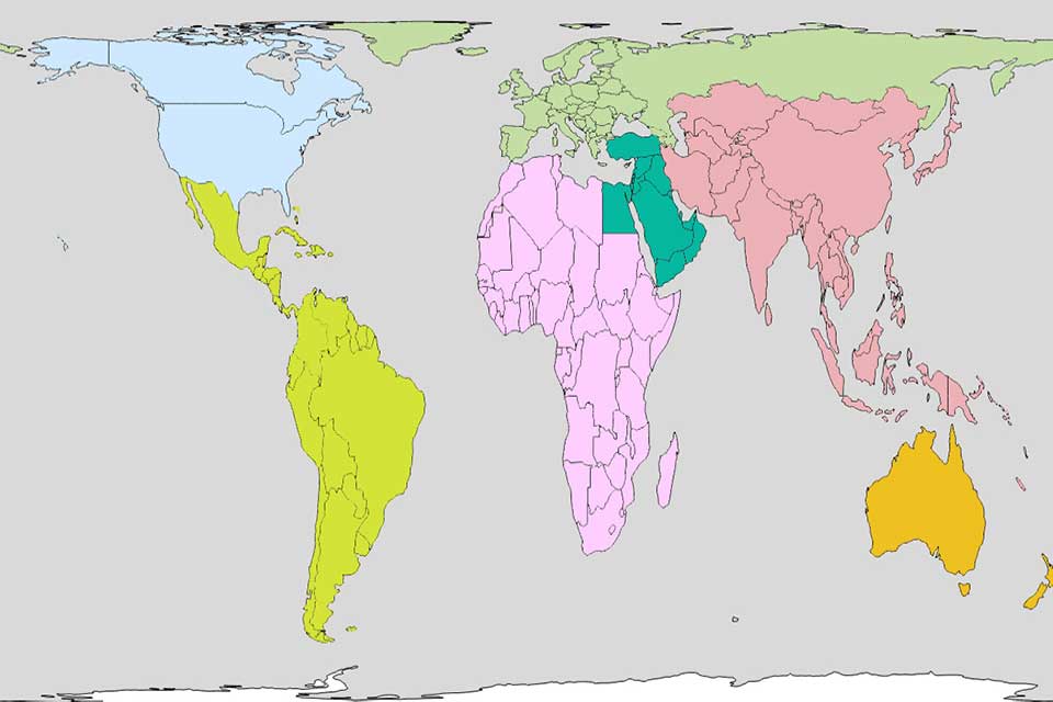
Gall-Peters has a good representation of relative prorportionality.
Posted on 9/9/26 at 4:51 pm to Bamafig
Almost as dumb as renaming a body of water.
Posted on 9/9/26 at 4:54 pm to Bamafig
Its size actually is underrepresented on Mercator projections.
But most people are aware of that even when they look at Mercator projections.
And really enlarging Africa's size just shows how Africa is an even bigger failure than is shown on Mercator. That big of a continent and nobody was able to move out of mud huts?
But most people are aware of that even when they look at Mercator projections.
And really enlarging Africa's size just shows how Africa is an even bigger failure than is shown on Mercator. That big of a continent and nobody was able to move out of mud huts?
Posted on 9/9/26 at 5:19 pm to Volvagia
quote:
The only thing close I’ve to move away from the Mercator projection in maps, that overemphasizes the size of higher latitude countries but Africa stays about the same, ditto for South America.
Some (definitely not all) are pushing maps were this way due to racism instead of for marine charts or like it’s a victory for Africa as maps stayed this way for too long due to racism or thinking Africa isn’t important. One “new” map that I have seen has made Africa a little bigger, but it mainly looks larger in comparison some of the far north areas as well as especially Antarctica looking smaller.
This post was edited on 9/9/26 at 5:40 pm
Posted on 9/9/26 at 5:25 pm to Volvagia
(no message)
This post was edited on 9/9/26 at 6:10 pm

 Page 3 of 5



Popular

Back to top
 Follow TigerDroppings for LSU Football News