- My Forums
- Tiger Rant
- LSU Recruiting
- SEC Rant
- Saints Talk
- Pelicans Talk
- More Sports Board
- Fantasy Sports
- Golf Board
- Soccer Board
- O-T Lounge
- Tech Board
- Home/Garden Board
- Outdoor Board
- Health/Fitness Board
- Movie/TV Board
- Book Board
- Music Board
- Political Talk
- Money Talk
- Fark Board
- Gaming Board
- Travel Board
- Food/Drink Board
- Ticket Exchange
- TD Help Board
Customize My Forums- View All Forums
- Show Left Links
- Topic Sort Options
- Trending Topics
- Recent Topics
- Active Topics
Started By
Message

 0
0

Posted on 8/23/20 at 9:58 pm to Will Cover
quote:
The official forecast is still Hurricane Marco, but this nowhere close to a hurricane. Marco has been decimated by shear and has steadily been weakening. The pressure has come up around 10 MB and winds are under hurricane force. The mid-level center is racing away to the north-northeast. The low-level center is moving to the north-northwest. I do not think southeast Louisiana will receive significant impacts. Far eastern Louisiana could, but other than not much rain either. Very localized flooding remains and storm surge possible as wind on the eastern side pushes water against the north Gulf coast. Wind threat will be on the eastern side as well
Sounds like they watched Levi's last video.
Posted on 8/23/20 at 9:58 pm to slackster
quote:
but 60-70% of storms spend their entire life within the cone.
It’s like saying pick a number from 1-10 and then the answer being 12.

Posted on 8/23/20 at 9:58 pm to Will Cover
That sounds correct. Why the downvotes? 

Posted on 8/23/20 at 9:58 pm to LegendInMyMind
Come on NHC give us the new Marco cone.
Posted on 8/23/20 at 9:59 pm to Roll Tide Ravens
Looks like Marco gonna be a dud
Posted on 8/23/20 at 9:59 pm to Roll Tide Ravens
Marco is really not the one I am worried about. Precursor to the entree.
Posted on 8/23/20 at 9:59 pm to Roll Tide Ravens
10pm CDT Tropical Storm Marco cone

Posted on 8/23/20 at 9:59 pm to slackster
quote:
Laura is currently forecast for the Hurricane Lili trek across GOM...
Just picked different sides of Cuba.
Posted on 8/23/20 at 10:00 pm to NorthEndZone
Both Marco and Laura have a pressure of 1000 millibars.
One is strengthening and the other is weakening.
Tropical Storm Marco Advisory Number 15
NWS National Hurricane Center Miami FL AL142020
1000 PM CDT Sun Aug 23 2020
...HURRICANE HUNTERS FIND MARCO HAS WEAKENED...
...HURRICANE AND STORM SURGE WARNINGS REMAIN IN EFFECT FOR
PORTIONS OF THE NORTHERN GULF COAST...
SUMMARY OF 1000 PM CDT...0300 UTC...INFORMATION
-----------------------------------------------
LOCATION...26.8N 87.6W
ABOUT 185 MI...295 KM SSE OF THE MOUTH OF THE MISSISSIPPI RIVER
MAXIMUM SUSTAINED WINDS...70 MPH...110 KM/H
PRESENT MOVEMENT...NNW OR 345 DEGREES AT 12 MPH...19 KM/H
MINIMUM CENTRAL PRESSURE...1000 MB...29.53 INCHES
Tropical Storm Laura Advisory Number 17
NWS National Hurricane Center Miami FL AL132020
1100 PM EDT Sun Aug 23 2020
...LAURA STRENGTHENS A LITTLE NEAR EASTERN CUBA...
...HEAVY RAINS CONTINUE OVER EASTERN CUBA AND JAMAICA....
SUMMARY OF 1100 PM EDT...0300 UTC...INFORMATION
-----------------------------------------------
LOCATION...20.1N 76.6W
ABOUT 125 MI...200 KM SE OF CAMAGUEY CUBA
MAXIMUM SUSTAINED WINDS...65 MPH...100 KM/H
PRESENT MOVEMENT...WNW OR 285 DEGREES AT 21 MPH...33 KM/H
MINIMUM CENTRAL PRESSURE...1000 MB...29.53 INCHES
Posted on 8/23/20 at 10:00 pm to Roll Tide Ravens
quote:
Marco is feeling the effect of strong southwesterly shear. The
center, as identified by an Air Force Reserve Hurricane Hunter
aircraft, is displaced to the southwest edge of the convective
canopy. That said, Marco has not quite fully decoupled yet and has
moved well right of the previous forecast. Data from the plane
indicates that Marco has weakened; the highest flight-level winds
were only 58 kt with unflagged SFMR winds just above 50 kt.
Marco's intensity has been lowered slightly to 60 kt, but this is
probably generous.
As expected.
This post was edited on 8/23/20 at 10:00 pm
Posted on 8/23/20 at 10:00 pm to Roll Tide Ravens

Posted on 8/23/20 at 10:00 pm to CaptainJ47
quote:
Marco is really not the one I am worried about. Precursor to the entree.
If Laura keeps slipping East, not good for BR Area
shite could get real over next few days.....hoping it doesn't

Posted on 8/23/20 at 10:00 pm to LaBR4
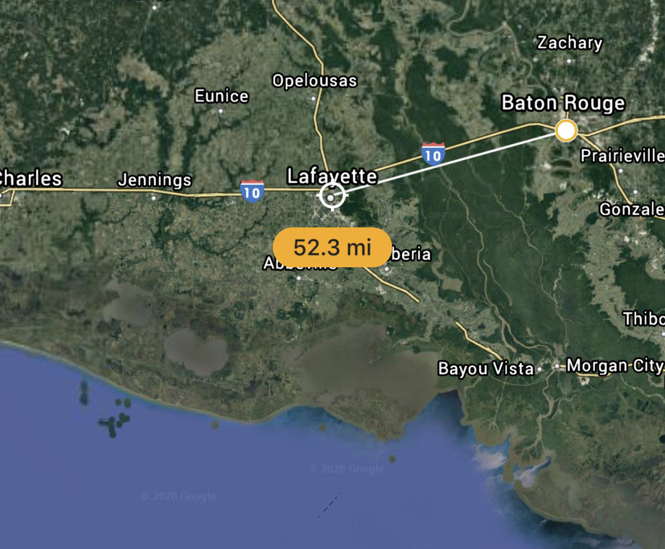
quote:
as the crow flies.. New Iberia to Baton Rouge? 50 miles?
52.3
Posted on 8/23/20 at 10:00 pm to Roll Tide Ravens
I feel like this Marco is moving NNW more than this model gives credit for
Posted on 8/23/20 at 10:00 pm to t00f
quote:
Why the downvotes?
Whoever it was should have at least credited Levi.

Posted on 8/23/20 at 10:01 pm to Roll Tide Ravens
Marco is just the pre-bar beer you drink to prep your system
Posted on 8/23/20 at 10:02 pm to Duke
quote:
Decoupling starting? Looks like it.
About 12hrs behind our thinking but as long as it happened before landfall is all that really mattered. However, this has been a pesky little system but shear is finally winning out.
Posted on 8/23/20 at 10:02 pm to LaBR4
Sigh. The nursing home where I work is in new Iberia. I’m guessing they’ll shelter in place — idk at what point they evacuate.
Posted on 8/23/20 at 10:02 pm to Duke
quote:
Marco's intensity has been lowered slightly to 60 kt, but this is
probably generous.
quote:
As expected.
You get the points on that one. You called it word for word.

 Page 193 of 815

Popular
Back to top