- My Forums
- Tiger Rant
- LSU Recruiting
- SEC Rant
- Saints Talk
- Pelicans Talk
- More Sports Board
- Fantasy Sports
- Golf Board
- Soccer Board
- O-T Lounge
- Tech Board
- Home/Garden Board
- Outdoor Board
- Health/Fitness Board
- Movie/TV Board
- Book Board
- Music Board
- Political Talk
- Money Talk
- Fark Board
- Gaming Board
- Travel Board
- Food/Drink Board
- Ticket Exchange
- TD Help Board
Customize My Forums- View All Forums
- Show Left Links
- Topic Sort Options
- Trending Topics
- Recent Topics
- Active Topics
Started By
Message

 0
0

Posted on 8/26/16 at 5:33 pm to rds dc
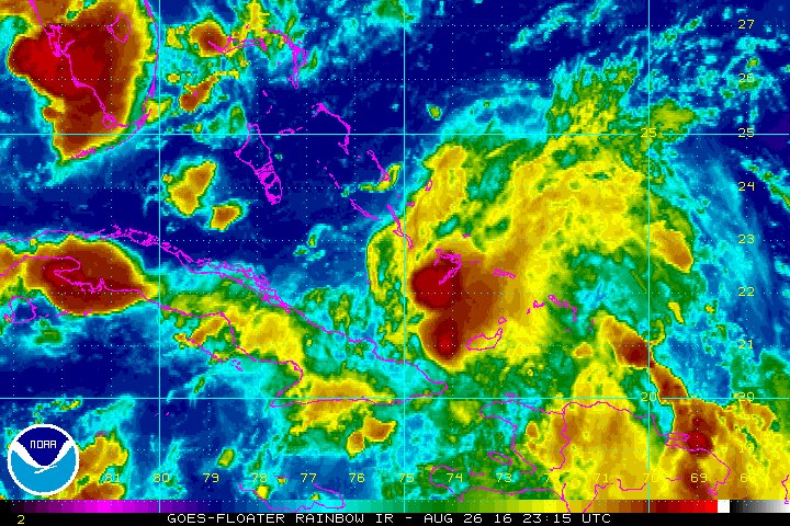
I will say watching out local meteorologist in Baton Rouge on wafb, he showed the water vapor image and showed the ULL to the northwest of 99L moving slowly southwest and said that is what the models show weakening the ridge. He also said they intensify the ULL to cause this so that will be something to watch to see if that does materialize.
Posted on 8/26/16 at 5:48 pm to Thib-a-doe Tiger
Near Gaston something is targeting east coast but it appears the models show it turning before it hits the east coast and going out to sea.
Posted on 8/26/16 at 6:11 pm to rds dc
Why is the HWRF bombing out?

Posted on 8/26/16 at 6:17 pm to lsuman25
Saw this on FB
This post was edited on 8/26/16 at 6:19 pm

Posted on 8/26/16 at 6:34 pm to theunknownknight
quote:
Saw this on FB
Link?
Posted on 8/26/16 at 6:59 pm to TheArrogantCorndog
NHC drops percentages to 20/50%
TROPICAL WEATHER OUTLOOK
NWS NATIONAL HURRICANE CENTER MIAMI FL
800 PM EDT FRI AUG 26 2016
For the North Atlantic...Caribbean Sea and the Gulf of Mexico:
The National Hurricane Center is issuing advisories on Tropical
Storm Gaston, located about 1000 miles east-southeast of Bermuda.
1. Shower activity associated with a weak area of low pressure located
in the central Bahamas has increased during the past several hours
but it remains disorganized. Upper-level winds are not favorable
for significant development during the next day or so while the
system moves west-northwestward at about 10 mph. Environmental
conditions could become a little more conducive for some development
when the system reaches the eastern Gulf of Mexico early next week.
Heavy rains, with the potential to cause flash floods and mud
slides, are likely to continue over Hispaniola tonight and Saturday.
This activity is expected to spread over eastern and central Cuba
through the weekend. Gusty winds and locally heavy rainfall are
likely over portions of the Bahamas, and will spread into parts of
southern Florida and the Florida Keys over the weekend. Interests
elsewhere in Florida and the eastern Gulf of Mexico should continue
to monitor the progress of this disturbance.
* Formation chance through 48 hours...low...20 percent
* Formation chance through 5 days...medium...50 percent

Posted on 8/26/16 at 7:18 pm to rds dc
So maybe our prayers are working! 

Posted on 8/26/16 at 7:20 pm to CorkSoaker
quote:
So maybe our prayers are working!

Posted on 8/26/16 at 8:16 pm to CorkSoaker
Actually it's my predictions that are being validated. This foshizzle has fizzled out and will continue to do so. Sorry hardups, limpdick time.
Posted on 8/26/16 at 8:36 pm to tigerbutt
3 year olds w crayola are making model runs now

Posted on 8/26/16 at 8:41 pm to rds dc
quote:
NHC drops percentages to 20/50%
Great news.
Posted on 8/26/16 at 9:21 pm to ctiger69
All of the Internet wantabe meteorologists and storm chaser who responded are going to be pissed
Posted on 8/26/16 at 9:26 pm to Purple Spoon
quote:
All of the Internet wantabe meteorologists and storm chaser who responded are going to be pissed
Thanks for your great contribution. Now go play in traffic please.

Posted on 8/26/16 at 9:29 pm to Chad504boy
00z model suite. Western trend, which is against the Euro. Keep in mind, even if this doesn't organize into a tropical cyclone, it still has the potential to be a rain maker.


Posted on 8/26/16 at 9:42 pm to Roll Tide Ravens
Down vote Roll Tide as I don't care for those westerly tracks. Hoping this ends up being nothing!
This post was edited on 8/26/16 at 9:53 pm
Posted on 8/26/16 at 10:11 pm to tiger91
This thing should hit somewhere else because La. has been chastised enough this summer.
Posted on 8/26/16 at 10:27 pm to tiger91
FWIW, I don't necessarily buy that idea, and most other knowledgable weather folks probably don't either.
Still just a wait and see game.
Still just a wait and see game.
Posted on 8/26/16 at 10:38 pm to RummelTiger
What did he post?

Posted on 8/26/16 at 10:49 pm to ctiger69
quote:
What did he post?
Something about a hurricane warning being issued for the south coast of LA through Wednesday, and a Cat 2 hurricane expected IIRC.
Posts like that are why people want a thread that only knowledgeable posters can update. Everyone should view this as a precaution; don't post unsubstantiated rumors and FB rumors in here, especially as fact. It wasn't allowed to get too far this time, fortunately.

 Page 106 of 175

Popular
Back to top