- My Forums
- Tiger Rant
- LSU Recruiting
- SEC Rant
- Saints Talk
- Pelicans Talk
- More Sports Board
- Fantasy Sports
- Golf Board
- Soccer Board
- O-T Lounge
- Tech Board
- Home/Garden Board
- Outdoor Board
- Health/Fitness Board
- Movie/TV Board
- Book Board
- Music Board
- Political Talk
- Money Talk
- Fark Board
- Gaming Board
- Travel Board
- Food/Drink Board
- Ticket Exchange
- TD Help Board
Customize My Forums- View All Forums
- Show Left Links
- Topic Sort Options
- Trending Topics
- Recent Topics
- Active Topics
Started By
Message
 1
1

Posted on 3/15/25 at 2:15 pm to OldManRiver
BR area and places to the SE spin up these storms, but they rarely get going with a tornado until they’re north of 1-10/12
Posted on 3/15/25 at 2:16 pm to The Boat
Hope everyone stays safe today. A follow up to yesterday’s high winds and fires - OK Governor lost his farm too.
Pic of west Stillwater too

Loading Twitter/X Embed...
If tweet fails to load, click here. Pic of west Stillwater too
This post was edited on 3/15/25 at 2:18 pm
Posted on 3/15/25 at 2:16 pm to LSUChamps03
quote:
like Max Velocity. Funny listening to him butcher the names of the towns… but seriously, he’s good.
I get a kick out of people always mispronouncing Belzoni and Isola.
It’s pronounced Bel zone uh and Eye Sole uh
They always say Bel zon ee and Iss ola
Posted on 3/15/25 at 2:17 pm to Jake88
The darker clouds look to be NW of where I am in Franklinton.

Posted on 3/15/25 at 2:17 pm to Paul Allen
quote:1989 an F2 hit where the Exxon plant is now
Has a significant tornado ever touched down inside the Baton Rouge city limits?
Posted on 3/15/25 at 2:17 pm to Paul Allen
quote:
Has a significant tornado ever touched down inside the Baton Rouge city limits
I have a very distinct memory of being in a closet as a tornado went right by as a kid living in Monticello Subdivision about 40 years ago. I guess that's not technically city limits, nor do I know how "significant" it was, but it was enough to make me know I never want to do it again

Posted on 3/15/25 at 2:17 pm to Paul Allen
quote:
Has a significant tornado ever touched down inside the Baton Rouge city limits?
June 8, 1989
Classic A team WAFB broadcast
LINK

Posted on 3/15/25 at 2:19 pm to Roll Tide Ravens
Posted on 3/15/25 at 2:19 pm to Paul Allen
quote:
Has a significant tornado ever touched down inside the Baton Rouge city limits?
All of the confirmed tornadoes to have ever impacted the area:
Posted on 3/15/25 at 2:20 pm to Drank
It's picked up in SW Spalding/NE Pike also.
Posted on 3/15/25 at 2:20 pm to LegendInMyMind
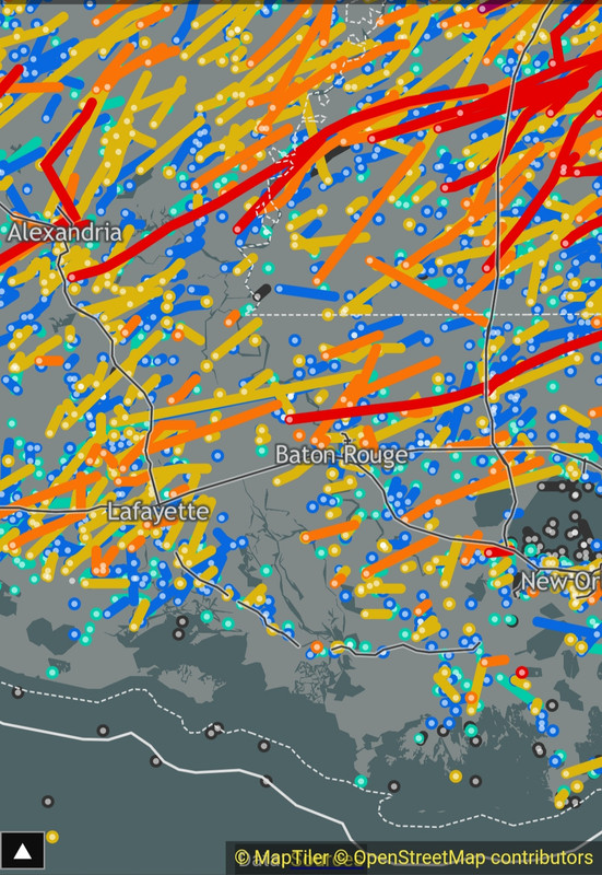
Those cells in La along the cold front look like the Techtop electrical logo


Posted on 3/15/25 at 2:21 pm to gizmothepug
Looks to be getting rough over there.
Posted on 3/15/25 at 2:21 pm to The Boat
Terrance Jackson is ten times better than any reporters we have today.
Posted on 3/15/25 at 2:21 pm to LegendInMyMind
Weak rotation on a bowing segment of the line going through Watson. A spot to watch as it moves NE into a more favorable environment.
Posted on 3/15/25 at 2:21 pm to gizmothepug
Good. Stay safe.
Posted on 3/15/25 at 2:21 pm to LegendInMyMind
Bay Springs cell is becoming a right turner
Posted on 3/15/25 at 2:22 pm to Roll Tide Ravens
I'm hunkered down in a PDS tornado warning. Wish me luck baws.
Posted on 3/15/25 at 2:22 pm to LSUBFA83
Heavier rain picking up in North AL ahead of the storms in NW AL. Nothing severe in it at the moment. That is a good development.
This post was edited on 3/15/25 at 2:23 pm
Posted on 3/15/25 at 2:23 pm to The Boat
quote:
Reading radar is easy to pick up and the best way to protect yourself. You don’t even have to go to school for it, like Ryan Hall.
It helped me successfully navigate around 2 warned cells earlier.
Beautifully if I may say so myself
These margaritas are going down so smooth

 Page 56 of 88

Popular
Back to top