- My Forums
- Tiger Rant
- LSU Recruiting
- SEC Rant
- Saints Talk
- Pelicans Talk
- More Sports Board
- Fantasy Sports
- Golf Board
- Soccer Board
- O-T Lounge
- Tech Board
- Home/Garden Board
- Outdoor Board
- Health/Fitness Board
- Movie/TV Board
- Book Board
- Music Board
- Political Talk
- Money Talk
- Fark Board
- Gaming Board
- Travel Board
- Food/Drink Board
- Ticket Exchange
- TD Help Board
Customize My Forums- View All Forums
- Show Left Links
- Topic Sort Options
- Trending Topics
- Recent Topics
- Active Topics
Started By
Message
re: Hurricane Season - October -96L No Threat- Watching WCAB for System w/ High End Potential
Posted on 10/10/23 at 7:45 pm to rds dc
Posted on 10/10/23 at 7:45 pm to rds dc
Friend,
As Front Day, the official close of tropical season for New Orleans, has yet to happen, tropical weather for the city is still possible. We trust Mother more than the National Hurricane Center, whose capricious June to November season is almost never right. Mother’s system has a 100% accuracy.
Yours,
TulaneLSU
 1
1


Posted on 10/13/23 at 10:02 am to TulaneLSU
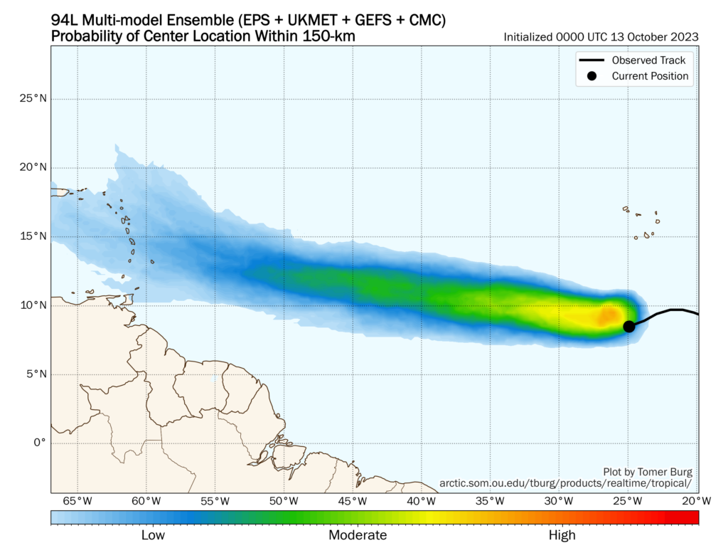
Do our resident weather gurus have any ideas about this? Hopefully a nothing burger...

Posted on 10/13/23 at 10:27 am to alphaandomega
That’s a long arse way out to really have any kind of predictions on what it may do
Posted on 10/13/23 at 11:01 am to alphaandomega
Biggest threat to the Caribbean yet. Too early to know much beyond that.
Posted on 10/13/23 at 11:30 am to rds dc
October long tracker?
Lets go
Lets go

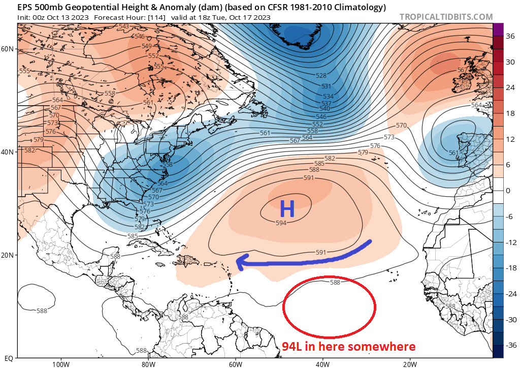
Posted on 10/13/23 at 12:28 pm to Duke
GFS spins up something in the Gulf around October 29th .
Posted on 10/13/23 at 1:38 pm to Duke
Too many fronts coming through. That one won’t make it on a long track before going OTS
Only way we get a gulf storm is a spin up in the Caribbean at this point
Only way we get a gulf storm is a spin up in the Caribbean at this point
Posted on 10/13/23 at 2:22 pm to deltaland
If it forms before the islands and goes ots, thats a long track. The synoptic pattern looks pretty good for the east coast, with troughing going into the last week of the month. Might start to flatten out as this approaches though.
Posted on 10/16/23 at 9:54 am to Duke
Spaghetti models mostly show this going out to see.
Can anyone tell me how they come up with the names of these waves?
Invest 94L, 90E etc... I know storm names are assigned at the beginning of the season but how are these preliminary designations made?
Can anyone tell me how they come up with the names of these waves?
Invest 94L, 90E etc... I know storm names are assigned at the beginning of the season but how are these preliminary designations made?
Posted on 10/16/23 at 9:55 am to rds dc
It was 50 degrees in south Louisiana. Gulf is closed for the season. It's over. We survived....
...shite
quote:
rds dc
...shite
Posted on 10/16/23 at 10:00 am to alphaandomega
Posted on 10/16/23 at 10:05 am to alphaandomega
quote:
Can anyone tell me how they come up with the names of these waves?
Invest 94L, 90E etc...
Those are used to define areas of interest. The NHC uses the numbers 90 - 99 and rotate back to 90 when they get to 99. The L, E, etc. refers to the area/basin the invest/system is in. L is for "Atlantic", E is for "Northeast Pacific", and so on, with every basin having it's own letter. The National Hurricane Center isn't the only forecasting body to use this method, pretty much all of them use it.

Posted on 10/16/23 at 10:28 am to alphaandomega
Nothingburger for the Gulf
Posted on 10/29/23 at 6:18 pm to rds dc
quote:
2. Southwestern Caribbean Sea:
A broad area of low pressure could form in a few days over the
central or southwestern Caribbean Sea. Gradual development
thereafter is possible while the system moves generally westward at
10 to 15 mph.
* Formation chance through 48 hours...low...near 0 percent.
* Formation chance through 7 days...low...20 percent.
Keep an eye on this. It probably gets pushed into Central America but has high end potential if it turns northward.
Posted on 10/29/23 at 6:22 pm to rds dc
quote:
rds dc
We're a couple days from November. Your hurricane services are no longer required. Report back when you're predicting snow.
Posted on 10/29/23 at 7:12 pm to rds dc
frick that

Posted on 10/29/23 at 7:18 pm to rds dc
quote:
Keep an eye on this


Posted on 10/29/23 at 7:24 pm to rds dc
GFS has a nasty looking hurricane for south FL in the 230 hr range mid next week. Is this what you're referring to?
Posted on 10/29/23 at 7:28 pm to trussthetruzz
Wonder what’s going to happen to all those 1” cracks in my yard

Posted on 10/29/23 at 7:40 pm to CuseTiger

oof

 Page 3 of 4

Popular
Back to top