




- My Forums
- Tiger Rant
- LSU Recruiting
- SEC Rant
- Saints Talk
- Pelicans Talk
- More Sports Board
- Fantasy Sports
- Golf Board
- Soccer Board
- O-T Lounge
- Tech Board
- Home/Garden Board
- Outdoor Board
- Health/Fitness Board
- Movie/TV Board
- Book Board
- Music Board
- Political Talk
- Money Talk
- Fark Board
- Gaming Board
- Travel Board
- Food/Drink Board
- Ticket Exchange
- TD Help Board
Customize My Forums- View All Forums
- Show Left Links
- Topic Sort Options
- Trending Topics
- Recent Topics
- Active Topics
Started By
Message
re: Storm Tracking: Bertha - It's Over
Posted on 7/19/26 at 1:36 pm to Motorboat

Posted on 7/19/26 at 1:36 pm to Motorboat
Thing is barely moving ; still weak only 1011 millibars. Fairly large system still needs to consolidate battling dry-air.
How far from the coast will it trek as it finally moves West>??
Will this actually become a 60mph Tropical Storm>?
How far from the coast will it trek as it finally moves West>??
Will this actually become a 60mph Tropical Storm>?
 1
1


Posted on 7/19/26 at 1:38 pm to RBTiger
quote:
How far from the coast will it trek as it finally moves West>??
Will this actually become a 60mph Tropical Storm>?
If it consolidates and is stronger, it will get tugged to the south and west. If it doesnt,it will move further north.
Regardless, if northerly shear exists most of the classical "worst" tropical rains will be to the South.
This post was edited on 7/19/26 at 1:42 pm

Posted on 7/19/26 at 1:45 pm to friendlyobservation
quote:
They seem to be predicting that because they also think El Nino is going to be historically strong this season which negatively impacts hurricanes in our region but brings a lot of rain
Next year will be the one to watch. Historically really bad hurricane seasons in the Atlantic occur the year after a strong El Niño. 1998 and 2017 were after strong El Niño years
Posted on 7/19/26 at 1:52 pm to Disco Ball
The Air Force Hurricane Hunters out of Keesler AFB are doing their thing
"Teal 71" if you want to track them
The area of low level circulation is farther south than expected which is good news

"Teal 71" if you want to track them
The area of low level circulation is farther south than expected which is good news
Posted on 7/19/26 at 1:55 pm to lsutigernosaint
quote:
Planning to drive to Panama City Beach tomorrow. Is this a safe idea?
Not looking good, already seeing some surge in PCB. Friend of mine in PCB sent me this pic of I-10 and earlier
Posted on 7/19/26 at 2:00 pm to deltaland
quote:
Friend of mine in PCB sent me this pic of I-10 and earlier
BINGO!!!
Posted on 7/19/26 at 2:01 pm to deltaland
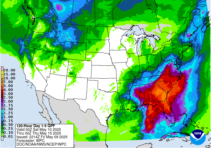
Posted on 7/19/26 at 2:03 pm to Disco Ball
Good news for SELA to Florida. Not good news for west of there thru Texas.
Posted on 7/19/26 at 2:05 pm to LSUEnvy
quote:
LSUEnvy
Well New Orleans floods when you sneeze in their general direction so...guess it finally ready for them to turn into Water World


Posted on 7/19/26 at 2:09 pm to rds dc
Supposed to be flying home to Nola on Thursday
Yippee
Yippee

Posted on 7/19/26 at 2:29 pm to PhillyTiger90
Am I gonna be able to play golf in Destin at 7am tomorrow?

Posted on 7/19/26 at 2:33 pm to fightin tigers
quote:
Will be fun to see what happens if HLS production comes offline for southeastern refining.....
Bro…I’m trying to not think about Production and HSE issues right now. Want to enjoy my Sunday.
Posted on 7/19/26 at 2:39 pm to SWLA92
quote:
Good news for SELA to Florida. Not good news for west of there thru Texas
SeLA and Florida are going to get way more from this than swla and Houston area
If anyone should be worried it’s Matagorda and south along Texas coast because if it totall misses LA coast it’ll be stronger and headed towards them
This post was edited on 7/19/26 at 2:40 pm
Posted on 7/19/26 at 2:44 pm to Midtiger farm
TX Hill Country definitely doesn’t need anymore water right now.

Posted on 7/19/26 at 2:53 pm to rds dc
Well this will be fun. On vacation at Fort Morgan. Never been anywhere close to any tropical depression/storm/hurricane before
Posted on 7/19/26 at 2:55 pm to rds dc
So much for global warming.
Atlantic Niña needs cooling.
Atlantic Niña needs cooling.
Posted on 7/19/26 at 3:47 pm to BallHawg10
quote:Then you're either going to be greatly relieved or greatly disappointed by this one...
Never been anywhere close to any tropical depression/storm/hurricane before
Kinda like this weather guy.
LINK
Posted on 7/19/26 at 3:53 pm to LSURussian
000
WTNT42 KNHC 192044
TCDAT2
Tropical Depression Two Discussion Number 2
NWS National Hurricane Center Miami FL AL022026
400 PM CDT Sun Jul 19 2026
The depression has generally changed little over the past several
hours. The circulation remains well organized, and deep convection
is gradually increasing near the center and in bands. An ASCAT pass
from around 15Z showed peak winds of around 25 kt, and data from the
Air Force Reserve reconnaissance aircraft show winds of about that
same value. Therefore, the initial intensity is held at 25 kt for
this advisory. The depression remains rather large and somewhat
diffuse, with the associated shower activity covering much of the
eastern Gulf.
The system has barely moved today. In fact, it has drifted
southeastward over the past few hours. This slow motion is due to
very weak steering currents, with the depression currently caught
between a ridge over the western Atlantic, another ridge over the
south-central and southwestern U.S., and a trough over the
northeast U.S. Most of the models show the cyclone drifting
northwestward over the next couple of days, and its outer bands
could bring tropical storm conditions to portions of the Florida
Panhandle beginning late Monday. A turn to the west or
west-northwest is likely on Tuesday as the ridge over the U.S.
builds eastward and becomes the primary steering feature. That
motion should take the system along or just offshore of the
northern Gulf coast during the middle and latter portions of the
week. The NHC track forecast has been shifted a bit to the south,
in best agreement with the usually best-performing aids HCCA, TVCN,
and GDMI.
The depression is expected to only slowly strengthen, especially in
the short term, due to its sprawling structure, nearby dry air, and
northeasterly vertical wind shear. Nonetheless, the system is
expected to become a tropical storm on Monday when it is offshore of
the Florida Panhandle. The shear could briefly let up during the
middle of the week, and if the system is still over water at that
time, it could strengthen some more. There remains a large spread
in the model solutions that range from the system remaining a
tropical depression to even becoming a hurricane. Given the mixed
environmental conditions and some expected land interaction, the NHC
intensity forecast lies between those solutions, but leans closer to
the upper end of the guidance. However, it is worth emphasizing
that the intensity forecast is of low confidence given the
uncertainty of how much land the system will interact with.
Key Messages:
1. The depression is expected to gradually strengthen and
could bring tropical storm conditions to portions of the Florida
Panhandle beginning late Monday, where a Tropical Storm Watch is in
effect,
2. Interests in Alabama, Mississippi, Louisiana, and Texas should
monitor the progress of this system, as watches could be required
for portions of that area over the next day or two.
3. Areas of flash flooding will be possible through Thursday along
the eastern and central Gulf Coast from western Florida to southern
portions of Alabama, Mississippi, and Louisiana.
FORECAST POSITIONS AND MAX WINDS
INIT 19/2100Z 27.5N 85.0W 25 KT 30 MPH
12H 20/0600Z 27.9N 85.2W 30 KT 35 MPH
24H 20/1800Z 28.2N 85.5W 35 KT 40 MPH
36H 21/0600Z 28.5N 86.0W 40 KT 45 MPH
48H 21/1800Z 28.9N 86.7W 40 KT 45 MPH
60H 22/0600Z 29.2N 87.5W 45 KT 50 MPH
72H 22/1800Z 29.4N 88.8W 50 KT 60 MPH
96H 23/1800Z 29.2N 91.9W 50 KT 60 MPH
120H 24/1800Z 29.3N 96.5W 40 KT 45 MPH...INLAND
$$
Forecaster Cangialosi
WTNT42 KNHC 192044
TCDAT2
Tropical Depression Two Discussion Number 2
NWS National Hurricane Center Miami FL AL022026
400 PM CDT Sun Jul 19 2026
The depression has generally changed little over the past several
hours. The circulation remains well organized, and deep convection
is gradually increasing near the center and in bands. An ASCAT pass
from around 15Z showed peak winds of around 25 kt, and data from the
Air Force Reserve reconnaissance aircraft show winds of about that
same value. Therefore, the initial intensity is held at 25 kt for
this advisory. The depression remains rather large and somewhat
diffuse, with the associated shower activity covering much of the
eastern Gulf.
The system has barely moved today. In fact, it has drifted
southeastward over the past few hours. This slow motion is due to
very weak steering currents, with the depression currently caught
between a ridge over the western Atlantic, another ridge over the
south-central and southwestern U.S., and a trough over the
northeast U.S. Most of the models show the cyclone drifting
northwestward over the next couple of days, and its outer bands
could bring tropical storm conditions to portions of the Florida
Panhandle beginning late Monday. A turn to the west or
west-northwest is likely on Tuesday as the ridge over the U.S.
builds eastward and becomes the primary steering feature. That
motion should take the system along or just offshore of the
northern Gulf coast during the middle and latter portions of the
week. The NHC track forecast has been shifted a bit to the south,
in best agreement with the usually best-performing aids HCCA, TVCN,
and GDMI.
The depression is expected to only slowly strengthen, especially in
the short term, due to its sprawling structure, nearby dry air, and
northeasterly vertical wind shear. Nonetheless, the system is
expected to become a tropical storm on Monday when it is offshore of
the Florida Panhandle. The shear could briefly let up during the
middle of the week, and if the system is still over water at that
time, it could strengthen some more. There remains a large spread
in the model solutions that range from the system remaining a
tropical depression to even becoming a hurricane. Given the mixed
environmental conditions and some expected land interaction, the NHC
intensity forecast lies between those solutions, but leans closer to
the upper end of the guidance. However, it is worth emphasizing
that the intensity forecast is of low confidence given the
uncertainty of how much land the system will interact with.
Key Messages:
1. The depression is expected to gradually strengthen and
could bring tropical storm conditions to portions of the Florida
Panhandle beginning late Monday, where a Tropical Storm Watch is in
effect,
2. Interests in Alabama, Mississippi, Louisiana, and Texas should
monitor the progress of this system, as watches could be required
for portions of that area over the next day or two.
3. Areas of flash flooding will be possible through Thursday along
the eastern and central Gulf Coast from western Florida to southern
portions of Alabama, Mississippi, and Louisiana.
FORECAST POSITIONS AND MAX WINDS
INIT 19/2100Z 27.5N 85.0W 25 KT 30 MPH
12H 20/0600Z 27.9N 85.2W 30 KT 35 MPH
24H 20/1800Z 28.2N 85.5W 35 KT 40 MPH
36H 21/0600Z 28.5N 86.0W 40 KT 45 MPH
48H 21/1800Z 28.9N 86.7W 40 KT 45 MPH
60H 22/0600Z 29.2N 87.5W 45 KT 50 MPH
72H 22/1800Z 29.4N 88.8W 50 KT 60 MPH
96H 23/1800Z 29.2N 91.9W 50 KT 60 MPH
120H 24/1800Z 29.3N 96.5W 40 KT 45 MPH...INLAND
$$
Forecaster Cangialosi
Posted on 7/19/26 at 4:06 pm to uncommon sense
quote:
Tropical Depression Two Discussion Number 2
The depression has generally changed little over the past several
hours.
This is like a Mitch Hedberg routine.
"Here's the latest on this potentially killer storm:
Nothing has happened!"
Posted on 7/19/26 at 4:48 pm to rds dc
Hoping some rain cools it down a bit

 Page 9 of 38

Popular
Back to top
 Follow TigerDroppings for LSU Football News