




- My Forums
- Tiger Rant
- LSU Recruiting
- SEC Rant
- Saints Talk
- Pelicans Talk
- More Sports Board
- Fantasy Sports
- Golf Board
- Soccer Board
- O-T Lounge
- Tech Board
- Home/Garden Board
- Outdoor Board
- Health/Fitness Board
- Movie/TV Board
- Book Board
- Music Board
- Political Talk
- Money Talk
- Fark Board
- Gaming Board
- Travel Board
- Food/Drink Board
- Ticket Exchange
- TD Help Board
Customize My Forums- View All Forums
- Show Left Links
- Topic Sort Options
- Trending Topics
- Recent Topics
- Active Topics
Started By
Message
re: Laura - President Trump visits Lake Charles, Louisiana for Hurricane Response Update
Posted on 8/26/20 at 7:18 am to JonTheTigerFan
Posted on 8/26/20 at 7:18 am to JonTheTigerFan

 0
0


Posted on 8/26/20 at 7:18 am to Bobby OG Johnson


Posted on 8/26/20 at 7:18 am to CLane33
quote:
So all the talk yesterday about a potential turn a little more east is pretty much over?
It’s going to make landfall in Cameron.
quote:
was trying to wait until this morning to see for sure. But probably going to tell our employees in BR it's business as usually the next two days.
With a midnight or so landfall, the impacts will be gone by sunrise for BR. May still get some rain bands and 40-50 mph wind gusts, but losing power and perhaps a few trees are your biggest concerns in BR.


Posted on 8/26/20 at 7:19 am to GREENHEAD22
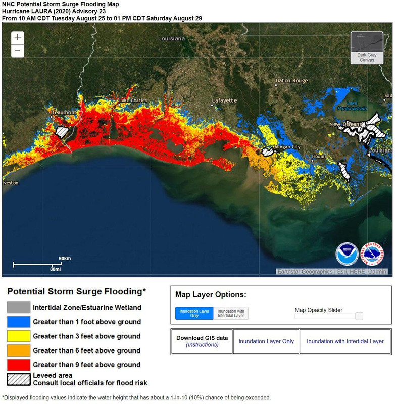
Here you go.

Posted on 8/26/20 at 7:21 am to Bobby OG Johnson
.
This post was edited on 8/26/20 at 7:48 am

Posted on 8/26/20 at 7:21 am to Noryev
So Nola is just looking at some rain pretty much?
Posted on 8/26/20 at 7:21 am to Noryev
anyone else think it’ll make landfall closer to lake aurthur area? Last couple of seconds looks like it trying to take a nnw path
Posted on 8/26/20 at 7:22 am to JonTheTigerFan
quote:
The wind projection map on the previous page looks like 60-70 mph winds east of the Mississippi River to me. Not saying it will happen but the NHC seems to think so.
WAFB keeps showing a graffic that BR has somewhere around a 60% chance of sustained tropical storm force winds (>40mph)


Posted on 8/26/20 at 7:22 am to More beer please
Coach O probably isn’t going to be happy when Laura does significant damage to Golden Nugget.
Posted on 8/26/20 at 7:22 am to JonTheTigerFan
The way I am reading the tropical storm projection map is that those east of the Mississippi have a 5-10% chance of experiencing TS force winds. So no chance for hurricane-force winds that far east and only a low chance of TS force winds.


Posted on 8/26/20 at 7:22 am to roguetiger15
My wife’s family is in Kake Arthur, but I can’t see em missing landfall that far
Posted on 8/26/20 at 7:22 am to JonTheTigerFan
quote:
The wind projection map on the previous page looks like 60-70 mph winds east of the Mississippi River to me. Not saying it will happen but the NHC seems to think so.
NHC says there is a 67% chance of seeing 34kt sustained in Baton Rouge, and a 14% chance of seeing 50kt sustained winds.

Posted on 8/26/20 at 7:23 am to roguetiger15
Alert! If anyone wants to make a pass at Stephanie Abrams they’re staying at the Golden Nugget.


Posted on 8/26/20 at 7:23 am to ragincajun03
quote:
Unless the Sheriffs departments allows those who stay camp out in the Cameron Parish courthouse. They let some residents stay there during Rita, and it was about the only thing still standing. It’s fortified pretty well.
i know of some people staying in the golden nugget
Posted on 8/26/20 at 7:23 am to slackster
quote:
With a midnight or so landfall, the impacts will be gone by sunrise for BR. May still get some rain bands and 40-50 mph wind gusts, but losing power and perhaps a few trees are your biggest concerns in BR.
Thanks, That's what i figured. We'll pretty much sleep through the worst of it.
Posted on 8/26/20 at 7:24 am to roguetiger15
Posted on 8/26/20 at 7:24 am to CLane33
Levi

quote:
Latest recon data from the strongest side of #Laura reports surface wind estimates of ~115 mph


Posted on 8/26/20 at 7:25 am to JonTheTigerFan
quote:
The wind projection map on the previous page looks like 60-70 mph winds east of the Mississippi River to me. Not saying it will happen but the NHC seems to think so.
That map was the Tropical Storm Wind Speed Probability so the numbers connected with the colors are percentage chance vs wind speed.
Posted on 8/26/20 at 7:26 am to Noryev
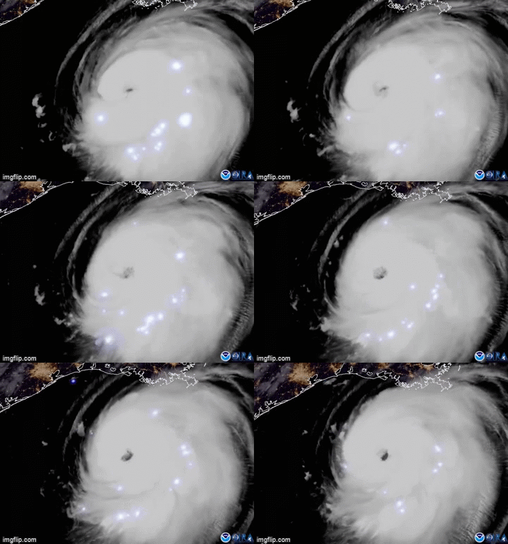
For a point of reference, the center of the eye is due south of Franklin and New Roads at 91.5 right about now.


Posted on 8/26/20 at 7:26 am to man in the stadium
quote:
As one may recall, Ivan holds the record for 90+ foot waves generated
Jesus, what does an 100’ wave even look like

 Page 424 of 815

Popular
Back to top
 Follow TigerDroppings for LSU Football News