- My Forums
- Tiger Rant
- LSU Recruiting
- SEC Rant
- Saints Talk
- Pelicans Talk
- More Sports Board
- Fantasy Sports
- Golf Board
- Soccer Board
- O-T Lounge
- Tech Board
- Home/Garden Board
- Outdoor Board
- Health/Fitness Board
- Movie/TV Board
- Book Board
- Music Board
- Political Talk
- Money Talk
- Fark Board
- Gaming Board
- Travel Board
- Food/Drink Board
- Ticket Exchange
- TD Help Board
Customize My Forums- View All Forums
- Show Left Links
- Topic Sort Options
- Trending Topics
- Recent Topics
- Active Topics
Started By
Message
 3
3

Posted on 9/5/17 at 8:49 am to jlc05
quote:
How well did the models perform with Katrina?
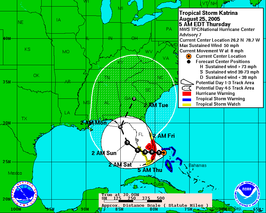
Can't compare models of today to 2005. Also, research on storm motion has unlocked a lot of doors and NHC is way better at interpretation of available data than in 2005.
Posted on 9/5/17 at 8:50 am to b-rab2
I would not be in S. Beach when this thing hits. I hope your travel plans hold and you make the right choice.
Even if it rides the middle of the state north. You will be on that NE quadrant that is most destructive. We saw Charley cut an island in half. That was enough for me.
Even if it rides the middle of the state north. You will be on that NE quadrant that is most destructive. We saw Charley cut an island in half. That was enough for me.

Posted on 9/5/17 at 8:50 am to rt3
quote:
NW eyewall has ~ 140 mph winds at the surface
~180 mph winds at 1,045 ft up

Posted on 9/5/17 at 8:51 am to b-rab2
If this stays the course like the latest GFS run, you won't be 150 miles out of the eye. You'll be in the front leading edge as it comes ashore in Florida at its peak of power. Personally, I would evacuate or go to a safe government shelter designed to stand up to 185 - 200 mph winds. As of today, in your spot, I would at least be preparing for the worst.

Posted on 9/5/17 at 8:52 am to rt3
With the current track predictions, is that eyewall going to hit those leeward islands?
Posted on 9/5/17 at 8:52 am to tgrbaitn08
quote:
Katrina was heading to Florida Saturday morning when I left to go fishing.
By noon that same day they were calling for mandatory evacuation in New Orleans.
The storm hit Monday morning.
Bob Breck told us it was going to hit South Carolina on Thursday.
Posted on 9/5/17 at 8:53 am to 50_Tiger
AF309's dropsonde in the NE quadrant of the eyewall...
~150 mph winds at the surface
~185 mph winds at ~685 feet up
~150 mph winds at the surface
~185 mph winds at ~685 feet up
Posted on 9/5/17 at 8:53 am to HubbaBubba
This thing has every anus in coastal Georgia puckered. If I was in Miami, you wouldn't be able to drive a needle up my arse with a sledgehammer.

Posted on 9/5/17 at 8:55 am to yurintroubl
quote:
"Awesome" weather has turned me into a disaster junkie.
Awesome as in "great and terrible" - Anything that looks like it would commission Spirograph to create its wind portrait.
If something gets rated a "Strong 3" and above - hurricane and tornado alike - This will consume a high percentage of my attention for the duration. The percentage increases inversely with proximity to myself or those I care about.
Yes, large discharges of energy in any form put most normal humans in awe.
Posted on 9/5/17 at 8:55 am to b-rab2
quote:
Since it looks like its shifting west, if you're in south beach would you evacuate? I have a flight scheduled for tomorrow at 2:30 PM but Id rather stay if its not gonna be horrible here. Im in a really big,safe building, but its ocean front. It keeps shifting west, would you leave?
#yolo
Posted on 9/5/17 at 8:55 am to rt3
rt3 can you link the NOAA website that updates the flight info?

Posted on 9/5/17 at 8:55 am to More beer please
quote:
With the current track predictions, is that eyewall going to hit those leeward islands?
I think it will in Anguilla.

Posted on 9/5/17 at 8:56 am to Dick Jacket
Lots of butt talk in your post you got something to tell us dick?
Posted on 9/5/17 at 8:56 am to rt3
quote:Really appreciate your diligence in reporting these soundings.
rt3
Posted on 9/5/17 at 8:56 am to rds dc
quote:
Can't compare models of today to 2005. Also, research on storm motion has unlocked a lot of doors and NHC is way better at interpretation of available data than in 2005.
Even then, Katrina always stayed within the cone, albeit on the extreme western edge.
This post was edited on 9/5/17 at 8:57 am
Posted on 9/5/17 at 8:57 am to b-rab2
quote:
Since it looks like its shifting west, if you're in south beach would you evacuate? I have a flight scheduled for tomorrow at 2:30 PM but Id rather stay if its not gonna be horrible here. Im in a really big,safe building, but its ocean front. It keeps shifting west, would you leave?
If I were anywhere in Florida, I'd be leaving for Tennessee this morning.
Posted on 9/5/17 at 8:57 am to 50_Tiger
Posted on 9/5/17 at 8:57 am to colorchangintiger
So this begs the question.
We are still at 5 days out, but when do you consider moving 5.5 million people?
We are still at 5 days out, but when do you consider moving 5.5 million people?
Posted on 9/5/17 at 8:58 am to slackster


 Page 135 of 711

Popular
Back to top