- My Forums
- Tiger Rant
- LSU Recruiting
- SEC Rant
- Saints Talk
- Pelicans Talk
- More Sports Board
- Fantasy Sports
- Golf Board
- Soccer Board
- O-T Lounge
- Tech Board
- Home/Garden Board
- Outdoor Board
- Health/Fitness Board
- Movie/TV Board
- Book Board
- Music Board
- Political Talk
- Money Talk
- Fark Board
- Gaming Board
- Travel Board
- Food/Drink Board
- Ticket Exchange
- TD Help Board
Customize My Forums- View All Forums
- Show Left Links
- Topic Sort Options
- Trending Topics
- Recent Topics
- Active Topics
Started By
Message
Hurricane Dorian - Headed to Canada
Posted on 8/23/19 at 9:29 am
Posted on 8/23/19 at 9:29 am
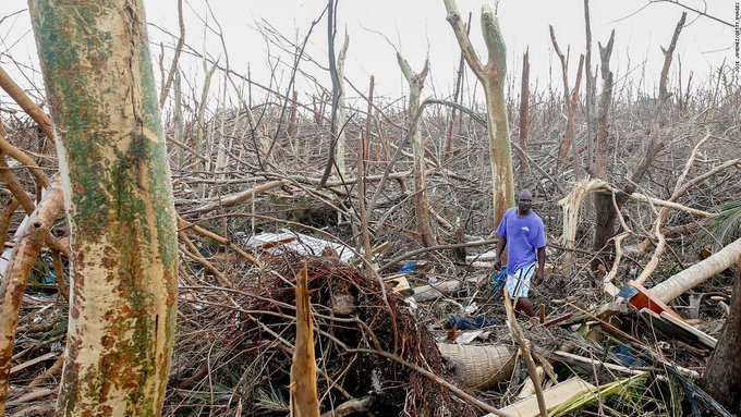
24 Hours Over Grand Bahama

This post was edited on 9/7/19 at 9:22 am
 124
124

Posted on 8/23/19 at 9:30 am to rds dc
What about the western Gulf?
Posted on 8/23/19 at 9:31 am to rds dc
98L is not a Gulf threat and will most likely slide out to sea.
99L is a long ways off but has some low end Gulf potential.
Also, there is a wave after 99L that will also need to be watched.
99L is a long ways off but has some low end Gulf potential.
Also, there is a wave after 99L that will also need to be watched.
Posted on 8/23/19 at 9:41 am to rds dc


Posted on 8/23/19 at 10:27 am to rds dc
Day 45 of Louisiana National Guard Activation in preparation for this storm.
LaPlace has been evacuated. NOLA in gridlock during contra flow. BTR is currently on fire.
LaPlace has been evacuated. NOLA in gridlock during contra flow. BTR is currently on fire.
Posted on 8/23/19 at 10:33 am to rds dc
*checks calendar
Yup, almost dove season. Guaranteed storm to f up opening day.
Yup, almost dove season. Guaranteed storm to f up opening day.

Posted on 8/23/19 at 10:37 am to rds dc
The 99L GFS ensemble is concerning for the gulf but the Euro hasn't picked up anything yet from what I have seen.

Posted on 8/23/19 at 10:41 am to rds dc
quote:
Hurricane Season - Heating Up
quote:
TS Dorian - FL & Gulf Concerns Growing


This post was edited on 8/28/19 at 8:50 am

Posted on 8/23/19 at 10:59 am to rds dc
Thanks to this thread, Peej is, like Nash Roberts, officially on the clock.

Posted on 8/23/19 at 12:07 pm to rds dc
ETA:
I like to post this table that helps determine just how strong a hurricane can be when looking at the forecasts that just list a low pressure value

I like to post this table that helps determine just how strong a hurricane can be when looking at the forecasts that just list a low pressure value
This post was edited on 8/27/19 at 10:15 pm

Posted on 8/23/19 at 12:28 pm to rds dc
If George Strait is right, those x’s will end up in Texas

Posted on 8/23/19 at 12:48 pm to rds dc
quote:
Hurricane Season - Heating Up
Will my 7 loaves of bread get stale by the time we evacuate?
Posted on 8/23/19 at 1:24 pm to rds dc
Experts say this could mean possible hurricanes
Posted on 8/23/19 at 2:05 pm to rds dc
At least 4 spins of moisture over water...


Posted on 8/24/19 at 10:10 am to rds dc

That’s going to affect my trip to Punta Cana

Posted on 8/24/19 at 12:08 pm to rds dc
Damn. This shite coming right up Punta Cana’s a-hole.
Posted on 8/24/19 at 3:55 pm to rds dc
Euro EPS takes this along the NHC track but does show potential for trouble if the storm can move north of the bigger islands.

Posted on 8/24/19 at 9:12 pm to rds dc
00z early cycle tracks

18z GEFS

18z GEFS
Posted on 8/25/19 at 8:57 am to rds dc
Pretty good agreement b/w the 00z Euro EPS and 06z GEFS of a track into the Caribbean that will send Dorian into a high shear environment. If this holds, the most likely scenario, which hasn't really changed over the last couple of days, is that Dorian gets sheared out and dies as it interacts with the Islands.

This post was edited on 8/25/19 at 12:34 pm

 Page 1 of 7

Popular
Back to top