




- My Forums
- Tiger Rant
- LSU Recruiting
- SEC Rant
- Saints Talk
- Pelicans Talk
- More Sports Board
- Fantasy Sports
- Golf Board
- Soccer Board
- O-T Lounge
- Tech Board
- Home/Garden Board
- Outdoor Board
- Health/Fitness Board
- Movie/TV Board
- Book Board
- Music Board
- Political Talk
- Money Talk
- Fark Board
- Gaming Board
- Travel Board
- Food/Drink Board
- Ticket Exchange
- TD Help Board
Customize My Forums- View All Forums
- Show Left Links
- Topic Sort Options
- Trending Topics
- Recent Topics
- Active Topics
Started By
Message
re: Laura - President Trump visits Lake Charles, Louisiana for Hurricane Response Update
Posted on 8/24/20 at 10:52 pm to rds dc
Posted on 8/24/20 at 10:52 pm to rds dc
quote:
quote:
It was fed the upper air data from the plane tonight yes?
Yes, and the drops came back with a stronger ridge.
Now to see if it changes the Euro. The Euro data assimilation is so good that sometimes the extra upper air data doesn't really impact the next run.
 0
0


Posted on 8/24/20 at 10:52 pm to The Boat
quote:
That will not happen if it makes landfall west of Lake Charles.
My guess got a boat seal of approval!

Posted on 8/24/20 at 10:52 pm to SlowFlowPro
Leaving NOW wouldn’t be a horrible idea

Posted on 8/24/20 at 10:53 pm to X123F45
quote:The local weather In Baton Rouge didn’t say anything like that
As of right now it is shoeing 70mph winds on accuweather in BR wednesday
Posted on 8/24/20 at 10:53 pm to lsuman25
GFS a little more west in Gulf but still goes about straight due North into western Cameron parish


Posted on 8/24/20 at 10:53 pm to SlowFlowPro
quote:
I really don't want to leave
Same here. I dread it actually.
Posted on 8/24/20 at 10:53 pm to Tyga Woods
quote:
I live in Shreveport. My mom is in Ellick. Got a kid at ULL. We’re all leaving for Colorado in the morning. I was kinda looking for an excuse to go anyway. The threat of losing electricity for a few days in August was all the justification I needed
If I was single I would be there, Austin, or SD
Posted on 8/24/20 at 10:53 pm to stout
Go read some stories about people who rode out hurricanes
Posted on 8/24/20 at 10:54 pm to stout
I mean, at this point, you’re basically guaranteed to lose electricity. I’m not down with that bullshite.

Posted on 8/24/20 at 10:54 pm to papasmurf1269
quote:
The local weather In Baton Rouge didn’t say anything like that
Those dumb shits posted a model earlier showing it going straight across to corpus and treated it like gospel.

Posted on 8/24/20 at 10:54 pm to stout
I still have court Friday 
I did my payroll today in your honor
I did my payroll today in your honor

Posted on 8/24/20 at 10:54 pm to Tyga Woods
quote:
We’re all leaving for Colorado in the morning

Posted on 8/24/20 at 10:55 pm to SlowFlowPro
quote:
If I was single I would
Add SFP mentioning his relationship status to the bingo card
Posted on 8/24/20 at 10:55 pm to lsuman25
All that shucking and jiving and the GFS is about 15 miles west of the 18z run.


Posted on 8/24/20 at 10:55 pm to SlowFlowPro
Baton Rouge would get about 40 mph with the current track. That can knock out power but structurally wise BR won't have any problems unless your house has a million trees around. In Baton Rouge it will be very similar to Rita on the current track.
That's not to say it's a guarantee it'll be like Rita for SW Louisiana. There's too many unknown factors at play like what size it'll be, speed, direction of motion at landfall. But you can make a pretty good educated guess what it would be like in BR.
That's not to say it's a guarantee it'll be like Rita for SW Louisiana. There's too many unknown factors at play like what size it'll be, speed, direction of motion at landfall. But you can make a pretty good educated guess what it would be like in BR.


Posted on 8/24/20 at 10:56 pm to SlowFlowPro
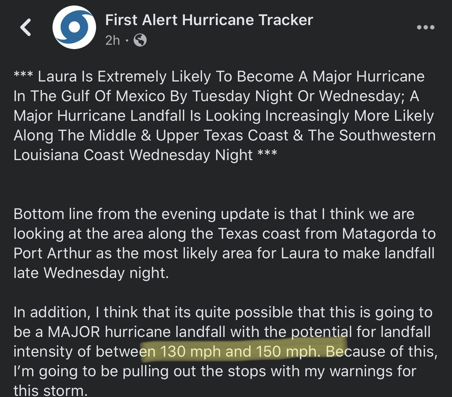
My Facebook feed has exploded with shares of pages from “hurricane pages.” It’s a clusterfrick. Doomcasting left, right, top, bottoms.
Posted on 8/24/20 at 10:56 pm to rds dc
Now that we are getting closer to landfall, reminder that some our state institutions like The Water Institue of the Gulf and LSU help put on a little-known but very important website for storm surge predictions LINK
It’s the most accurate predictor for surge out there presently.
Looking like Cameron all the way east to pecan island could see 10’ or surge. Vermilion bays area also could see elevated surge in the 5-10’ range that could back up a lot of the waterways in the Teche-Vermilion basin. Mermentau will also see tail water effects.
It’s the most accurate predictor for surge out there presently.
Looking like Cameron all the way east to pecan island could see 10’ or surge. Vermilion bays area also could see elevated surge in the 5-10’ range that could back up a lot of the waterways in the Teche-Vermilion basin. Mermentau will also see tail water effects.
Posted on 8/24/20 at 10:57 pm to The Boat
I figured everyone is going north it West so eat is optimal if it keeps up this westerly movement
Posted on 8/24/20 at 10:57 pm to slackster
quote:
All that shucking and jiving and the GFS is about 15 miles west of the 18z run.
Which in the grand scheme of things, means absolutely zero
Posted on 8/24/20 at 10:58 pm to SlowFlowPro
I’ve got rooms in Shreveport. I understand that it’s in the path, but obviously will be significantly weaker by the time it gets up there.

 Page 278 of 815

Popular
Back to top
 Follow TigerDroppings for LSU Football News