




 0
0






- My Forums
- Tiger Rant
- LSU Recruiting
- SEC Rant
- Saints Talk
- Pelicans Talk
- More Sports Board
- Fantasy Sports
- Golf Board
- Soccer Board
- O-T Lounge
- Tech Board
- Home/Garden Board
- Outdoor Board
- Health/Fitness Board
- Movie/TV Board
- Book Board
- Music Board
- Political Talk
- Money Talk
- Fark Board
- Gaming Board
- Travel Board
- Food/Drink Board
- Ticket Exchange
- TD Help Board
Customize My Forums- View All Forums
- Show Left Links
- Topic Sort Options
- Trending Topics
- Recent Topics
- Active Topics
Started By
Message
re: Hurricane Season - We back - NHC 10% Gulf Action
Posted on 7/14/25 at 2:59 pm to LSUDUCKMAN67
Posted on 7/14/25 at 2:59 pm to LSUDUCKMAN67
quote:
Rather be in the models and cone early than towards the end. Always moves.....
There's no cone yet, baw. You're right though, models still move all over the place until an actual center is formed.
Posted on 7/14/25 at 3:03 pm to rds dc
Unusual location for formation but it is starting to crank up
Posted on 7/14/25 at 3:06 pm to rds dc
quote:I was working in a downpour late last week and had the thought that with everything already soaked from the past few weeks of rain, it wouldn’t take much to get some flooding. FML.
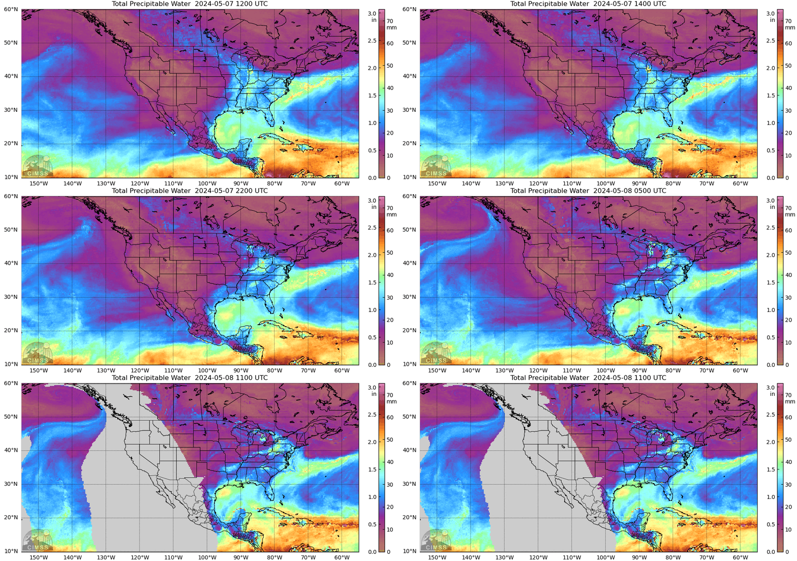
extreme rainfall signal.

Posted on 7/14/25 at 3:14 pm to Mr Roboto
quote:
He's talking about getting it zoomed into the local regions
That is available, too.
Above map > Zoom > Click on US > Select the blue dot for the region you want
ETA: Nevermind, I see you're zoomed in more. The base website gets what the guy is looking for, though.
This post was edited on 7/14/25 at 3:18 pm
Posted on 7/14/25 at 3:15 pm to FCP
All this unfettered cloud seeding already wreaking havoc on the hurricane season
Posted on 7/14/25 at 3:16 pm to East Coast Band
quote:
All this unfettered cloud seeding already wreaking havoc on the hurricane season

Posted on 7/14/25 at 3:25 pm to TDsngumbo
Nothing but Icon runs the last few pages. Wonder why no one is posting anything else.
Posted on 7/14/25 at 3:25 pm to TDsngumbo
It was a joke. TDs. lol
Posted on 7/14/25 at 3:28 pm to The Boat
quote:
Nothing but Icon runs the last few pages. Wonder why no one is posting anything else.
Sex and drama sells! Nobody wants to be told Friday is going to be business as usual. That's boring! We want to know about titty milk, local river hydrology, and how to repair generators last minute.
Posted on 7/14/25 at 3:29 pm to Paulburbank
quote:
My money is on Mississippi between Biloxi and Pascagoula
Sooo...Ocean Springs?
Don't make it t'landmass of t'landmass
This post was edited on 7/14/25 at 3:30 pm
Posted on 7/14/25 at 3:32 pm to The Boat
quote:
Nothing but Icon runs the last few pages. Wonder why no one is posting anything else.
What are you, the no fun police?
Posted on 7/14/25 at 3:33 pm to NorthEndZone
quote:
Unusual location for formation but it is starting to crank up

Posted on 7/14/25 at 3:35 pm to East Coast Band
quote:
All this unfettered cloud seeding already wreaking havoc on the hurricane season
No they use lasers for the hurricanes. Cloud seeding is just used to cause floods.
Posted on 7/14/25 at 3:42 pm to LSUDUCKMAN67
quote:
Rather be in the models and cone early than towards the end. Always moves.....
Bingo
Posted on 7/14/25 at 5:35 pm to SWLA92
I feel models are underestimating that northerly shear and could make 93L slip little further south after passing Florida
Posted on 7/14/25 at 5:50 pm to SWLA92
quote:
It looks quite impressive on the Melbourne radar. Wasn’t expecting it to look as cyclonic
Radar only captures the mid-levels at that range and showed a robust MCV. That convection has faded this evening. The MCV from earlier today could work to tighten up the surface trough, but another burst of convection will be needed this evening to keep that process going.
One thing to note is that convection this afternoon over Florida has sent outflow boundaries racing eastward towards the surface trough. The dry, stable air associated with those could limit convection this evening.
Posted on 7/14/25 at 5:54 pm to rds dc
quote:
outflow boundaries
Have you seen the segment of society that believes these are geoengineered and created to help fire storms over areas that "they" want to destroy?
It is always fascinating when certain members of the public discover something new about the weather.
Posted on 7/14/25 at 5:54 pm to lsuman25
quote:
I feel models are underestimating that northerly shear and could make 93L slip little further south after passing Florida
Yeah, persistent downshear convection could favor the circulation tightening up further south along the surface trough.
Posted on 7/14/25 at 5:57 pm to LegendInMyMind
quote:
Have you seen the segment of society that believes these are geoengineered and created to help fire storms over areas that "they" want to destroy?
Wouldn't it be simpler to fire the storms right over the target area? Firing storms elsewhere, having them collapse and spit an outflow boundary, and then hoping that said boundary fires another storm seems overly complicated.
Posted on 7/14/25 at 5:59 pm to lsuman25
quote:
lsuman25
quote:
I feel models are underestimating that northerly shear and could make 93L slip little further south after passing Florida


 Page 13 of 35



Popular

Back to top
 Follow TigerDroppings for LSU Football News