




 2
2












- My Forums
- Tiger Rant
- LSU Recruiting
- SEC Rant
- Saints Talk
- Pelicans Talk
- More Sports Board
- Fantasy Sports
- Golf Board
- Soccer Board
- O-T Lounge
- Tech Board
- Home/Garden Board
- Outdoor Board
- Health/Fitness Board
- Movie/TV Board
- Book Board
- Music Board
- Political Talk
- Money Talk
- Fark Board
- Gaming Board
- Travel Board
- Food/Drink Board
- Ticket Exchange
- TD Help Board
Customize My Forums- View All Forums
- Show Left Links
- Topic Sort Options
- Trending Topics
- Recent Topics
- Active Topics
Started By
Message
Posted on 10/7/26 at 6:48 am to Mempho
quote:
Largest one I seen down here was 143k a few years ago.
quote:
Lots of corruption IMO.
It’s deferred maintenance being rolled into storm damage assessments.
None of those boards are good about keeping up with non aesthetic stuff and so a storm comes and it turns into a hot potato where the current owners get stuck for all the money the previous owners didn’t pay.
Posted on 10/7/26 at 6:53 am to Mempho
What’s the google model say? How often does it run?
Posted on 10/7/26 at 6:54 am to lsurulz1515
quote:at the sailaway on the lido
meetup still happening on the Valor?
Posted on 10/7/26 at 6:59 am to Mempho
quote:
Euro is west to Mississippi.
Last Euro I see out there is 00Z

GFS has 006 run and is Miss/Ala border
Posted on 10/7/26 at 7:02 am to Mac
pretty sad that our tech is still this bad predicting storms. that’s a substantial shift in the track for a storm right off the coast
Posted on 10/7/26 at 7:04 am to Lsut81
AI has this hitting OB-ish
Models have this Biloxi to GS
Models have this Biloxi to GS
Posted on 10/7/26 at 7:05 am to Herschal
quote:
quote:
Hopefully this shift east saves us
From the hurricane at least
:golfclap:
Posted on 10/7/26 at 7:06 am to udtiger
So whos going to be first in line from oyster?
Posted on 10/7/26 at 7:09 am to Craft
quote:
pretty sad that our tech is still this bad predicting storms. that’s a substantial shift in the track for a storm right off the coast
??
It is currently 600 miles from the expected point of landfall as the crow flies. How is that "right off the coast".
Posted on 10/7/26 at 7:11 am to Obtuse1
anything in the gulf should have minimal error in the track at this point.
Posted on 10/7/26 at 7:12 am to Obtuse1
Social Media has been a curse. I swear, people are acting like this is the damn apocalypse. Idiots talking about canceling a game that takes place 250 miles inland for what will probably be a Cat 1 at landfall. Not every every hurricane is Ivan or Katrina.
Yeah, be cautious, be prepared, but the level of panic amateur meterologists generate is not helpful.
Yeah, be cautious, be prepared, but the level of panic amateur meterologists generate is not helpful.
Posted on 10/7/26 at 7:16 am to Mempho
quote:
Gotta appreciate the Pensacola, Perdido and Orange Beach peeps for taking the hit again for everyone to keep the NOLA intact.
FYI- always rent/never buy property down there.
The special assessments from the condo towers for hurricanes will eat you alive.
My folk's place was remarkably spared by Ivan (Dad's Kenner ended up in in the Region's bank parking lot on Canal) but had some roof damage, so they decided to replace the roof. Contractors came in and blue tarped it. Tropical storm hit a few weeks later, ripped off the tarp and rained into the house for two days. Fun times.
Posted on 10/7/26 at 7:17 am to Mac
quote:
Well, dickhead, the cone has a TD in Kentucky on Sunday morning
Cone has a TD in Indiana at 1am Sunday. The previous forecast point is an H near Foley, AL.
Posted on 10/7/26 at 7:18 am to Craft
quote:
anything in the gulf should have minimal error in the track at this point.
You people are frickin DUMM holy shite

Posted on 10/7/26 at 7:20 am to PurpleandGold Motown
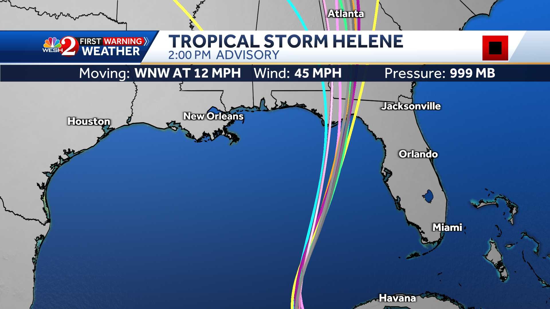
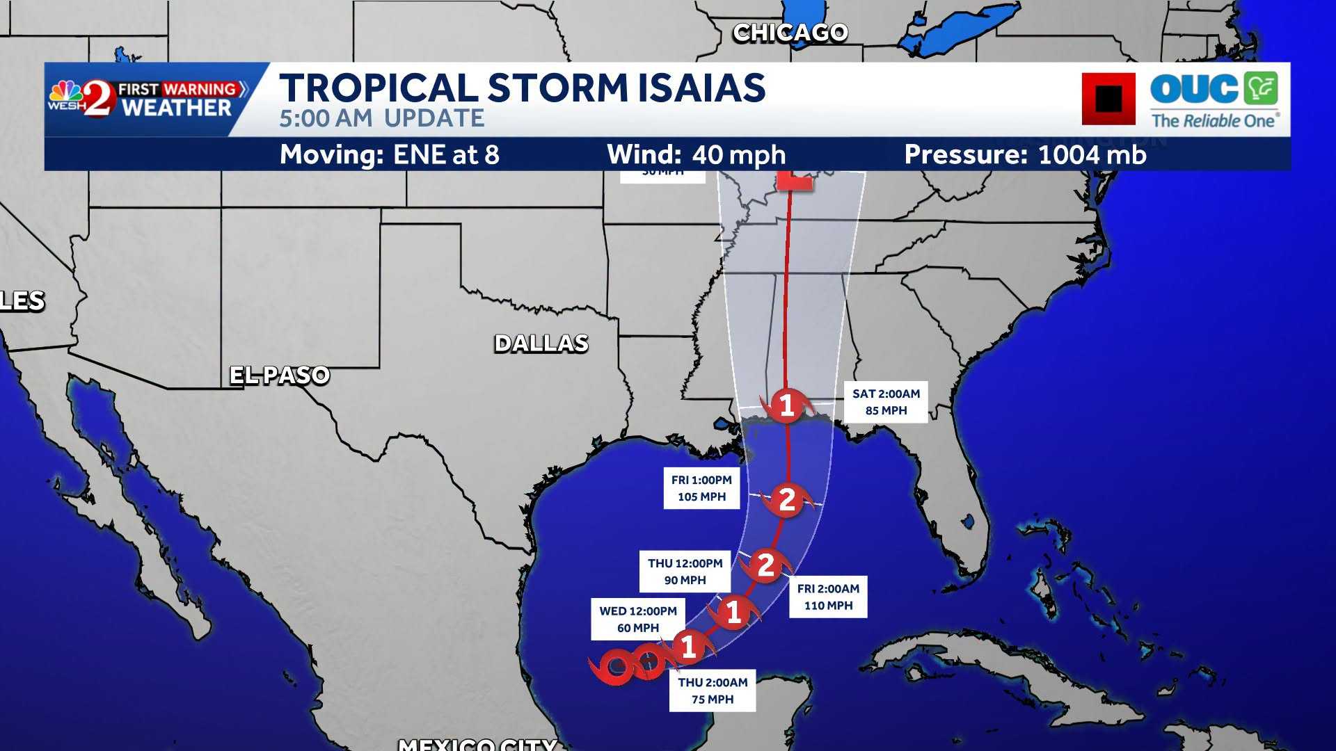
Some models still have it going over the New Orleans area, but the cone centers over the Mobile area.
Posted on 10/7/26 at 7:21 am to TheRouxGuru
How furiously are yall hacking off now that there is a named storm?
Posted on 10/7/26 at 7:21 am to Mempho
quote:
Models pushing this into KY as a TS
Living about 200 miles inland from the coast, one thing I've learned is that they almost 100% of the time over predict the storms strength as it moves over land.
In other words, you're not gonna get a tropical storm in Kentucky
Posted on 10/7/26 at 7:23 am to Shorts Guy
So I guess it’s safe to say New Orleans won’t get the brunt of this
Posted on 10/7/26 at 7:23 am to Craft
You know nothing of mathematical models and their complexity. Stfu

 Page 46 of 107



Popular

Back to top
 Follow TigerDroppings for LSU Football News