- My Forums
- Tiger Rant
- LSU Recruiting
- SEC Rant
- Saints Talk
- Pelicans Talk
- More Sports Board
- Fantasy Sports
- Golf Board
- Soccer Board
- O-T Lounge
- Tech Board
- Home/Garden Board
- Outdoor Board
- Health/Fitness Board
- Movie/TV Board
- Book Board
- Music Board
- Political Talk
- Money Talk
- Fark Board
- Gaming Board
- Travel Board
- Food/Drink Board
- Ticket Exchange
- TD Help Board
Customize My Forums- View All Forums
- Show Left Links
- Topic Sort Options
- Trending Topics
- Recent Topics
- Active Topics
Started By
Message
re: Hurricane Dorian - Headed to Canada
Posted on 8/29/19 at 5:35 am to FLBooGoTigs1

Posted on 8/29/19 at 5:35 am to FLBooGoTigs1
GFS .

Edit:
Edit:
This post was edited on 8/29/19 at 5:44 am
 1
1

Posted on 8/29/19 at 5:54 am to Zephyrius
frick that guy
-signed Jax Beach
-signed Jax Beach
This post was edited on 8/29/19 at 5:56 am

Posted on 8/29/19 at 6:14 am to Penn
Seconded.
- St. Augustine
- St. Augustine

Posted on 8/29/19 at 6:17 am to CajunTiger92
quote:
Not a guru but the latest European model shows it taking a hard right when it gets in Florida and going north over land through Florida, into Georgia and up the east coast. The GFS is more or less in alignment.
Saw the same. Looks like it wants to go straight up through FL now. What a difference a day makes.
Posted on 8/29/19 at 6:18 am to onelochevy
quote:
I get my storm updates from here until it gets in the gulf and close to Louisiana. Otherwise, just listening to the blowholes on TV try to drum up ratings annoys the shite out of me.
Is this before or after the climate change nuts are trotted out?
Posted on 8/29/19 at 6:22 am to FLObserver
quote:
The last 2 hurricanes that have come thru jax have done the same dam thing. I just got a new roof this better not be bad if it hits us
Moving map of path

Posted on 8/29/19 at 6:22 am to Tchefuncte Tiger
I cant watch TWC it’s too much. Catastrophic this catastrophic that
Posted on 8/29/19 at 6:26 am to FLBooGoTigs1
quote:
I cant watch TWC it’s too much. Catastrophic this catastrophic that
Mute it and watch Stephanie and Jen's theatrical hand movements. Stephanie deflated the sweater pies but still looks OK. She has a pancake following her though.
Posted on 8/29/19 at 6:39 am to Rhino5
quote:
Looks like it wants to go straight up through FL now. What a difference a day makes.
They were always thinking it was gonna turn north once it got to the edge of the ridge that’s sitting over the Bahamas, they just didn’t know if the ridge would push it over the gulf and up to the panhandle. Looks like all the models are fairly confident that ridge is not going to stay in place. Good for us on the gulf coast, potentially really bad for the entire state of Florida.
Posted on 8/29/19 at 6:50 am to Tarps99
quote:
Definitely, bad for them. But not something that hasn’t already happened.
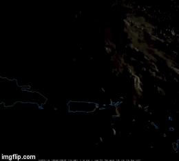
Hurricane Frances in 2004 slammed into central Florida and then curved back into the panhandle after getting into the gulf. Here is her track:
Seeing that model coming across southern Florida gives me nigthtmares from Andrew, which laid waste to Miami and across southern Fl., then becoming the most costly and most destructive hurricane in US history, came out the other side of Fl. into the gulf then turned up the Mississippe River and kicked our a$$ in Baton Rouge. I don't think anyone expected that when it was east of Florida.
This post was edited on 8/29/19 at 6:51 am
Posted on 8/29/19 at 7:19 am to CCT
Oh wow and oh my, that's nasty

Posted on 8/29/19 at 7:21 am to wfallstiger

Posted on 8/29/19 at 7:30 am to Hangit
Deflated the sweater pies? Why would she do that, it was the main reason to tune in, I’m certainly not into watching Cantore flex. Not that there’s anything wrong with that.

Posted on 8/29/19 at 7:31 am to MiDixon Yermouth
If the high pressure to the north weakens it will steer toward Jax. If the high pressure strengthens it will be tracking where I am in West Palm.
Posted on 8/29/19 at 7:43 am to Bobby OG Johnson
Those sunrise pics of Hurricanes are always fascinating.
Posted on 8/29/19 at 7:44 am to Bobby OG Johnson
When is Trump going to Nuke this thing?
Hopefully it steers clear of NE FL.
Hopefully it steers clear of NE FL.
Posted on 8/29/19 at 7:52 am to tigerpimpbot
quote:
If the high pressure to the north weakens it will steer toward Jax. If the high pressure strengthens it will be tracking where I am in West Palm.
We won’t know where it is going until it closes in on Florida.
On the same level as waiting for ridge to build or weaken, Hurricanes can also create their own weather patterns if it has momentum. If a system stalls out then, we are at mercy of something to nudge it in one direction or another.
Posted on 8/29/19 at 7:55 am to rds dc
12z Early Cycle Tracks

Pretty tight cluster. Some changes on the overnight guidance and things get a lot less certain as the system approaches landfall. Euro EPS came in with a stronger Northern Stream disturbance and that weakens the ridge and a number of members see a way out for Dorian, esp when compared to 12z.
00z

12z yesterday

Looking much more impressive than last night when it was trying to mix out some drier air.

Pretty tight cluster. Some changes on the overnight guidance and things get a lot less certain as the system approaches landfall. Euro EPS came in with a stronger Northern Stream disturbance and that weakens the ridge and a number of members see a way out for Dorian, esp when compared to 12z.
00z
12z yesterday
Looking much more impressive than last night when it was trying to mix out some drier air.
Posted on 8/29/19 at 7:55 am to Tarps99
quote:
Hurricanes can also create their own weather patterns if it has momentum.
I'm no expert, but I think that's false.

Posted on 8/29/19 at 8:00 am to rds dc
Interesting to see all the models agreeing to path this far out.
Will probably see some RI during the early morning/afternoon as it pulls away into a more favorable environment.
Will probably see some RI during the early morning/afternoon as it pulls away into a more favorable environment.

 Page 47 of 263

Popular
Back to top