- My Forums
- Tiger Rant
- LSU Recruiting
- SEC Rant
- Saints Talk
- Pelicans Talk
- More Sports Board
- Fantasy Sports
- Golf Board
- Soccer Board
- O-T Lounge
- Tech Board
- Home/Garden Board
- Outdoor Board
- Health/Fitness Board
- Movie/TV Board
- Book Board
- Music Board
- Political Talk
- Money Talk
- Fark Board
- Gaming Board
- Travel Board
- Food/Drink Board
- Ticket Exchange
- TD Help Board
Customize My Forums- View All Forums
- Show Left Links
- Topic Sort Options
- Trending Topics
- Recent Topics
- Active Topics
Started By
Message
 0
0

Posted on 7/2/24 at 8:17 pm to SWLA92
quote:
if she doesn’t weaken much between where she’s at now and Jamaica will she weaken before the Yucatan?
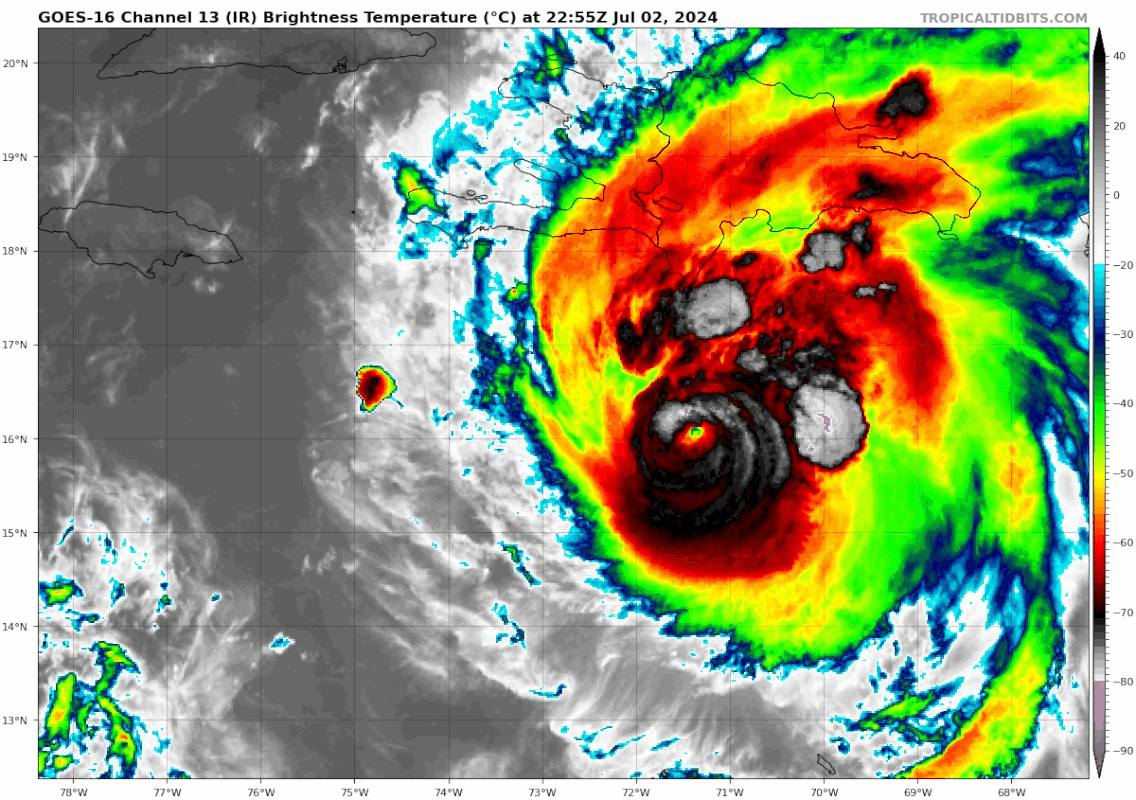
It depends on what the interaction with Jamaica does to the inner core. The 18z hurricane models were a step back from 12z as far as intensity, but they do show a period of strengthening before the Yucatán. Also, being weaker than 12z resulted in tracks shifting back south some.
00z early cycle guidance is in pretty close agreement with the NHC forecast cone.

Posted on 7/2/24 at 8:22 pm to rds dc
Posted on 7/2/24 at 8:22 pm to whiskey over ice
quote:
eye wall replacement?
Nah, just the diurnal cycle doing work.

Posted on 7/2/24 at 8:25 pm to rds dc
Those tracks look more west than prior tracks. I like that the eastern update trend has stopped
Posted on 7/2/24 at 8:29 pm to TigerTatorTots
quote:
I like that the eastern update trend has stopped
I thought the same. Then I saw this. I don't know what to believe.

Posted on 7/2/24 at 8:34 pm to LegendInMyMind
That's not the loop of a weakening storm.

Posted on 7/2/24 at 8:36 pm to LegendInMyMind
Looks like the opening day of Red Snapper Season lol.
Posted on 7/2/24 at 8:36 pm to rds dc
It’s almost like she’s making her own weather by pushing through the shear and not batting an eye.
Posted on 7/2/24 at 8:36 pm to rds dc
Beryl like screw your wind shear. Least for now
Posted on 7/2/24 at 8:38 pm to TigerTatorTots
quote:
Those tracks look more west than prior tracks. I like that the eastern update trend has stopped
We're at a point, Im not finding the model shifts particularly useful. Its a strength forecast that determines the position forecast and its hard to know a lot on that until it crosses Jamaica.
If Beryl is mostly in tact, it can strengthen some on the Yucatan part of this trip. This also suggests a slightly more northern track.
Conversely, a less organized Beryl will trend more south and weaker plus land interaction would bury Beryl to the south into Mexico.
Posted on 7/2/24 at 8:38 pm to LegendInMyMind
quote:
LegendInMyMind
Eek.
Thats pulsing up again.
Posted on 7/2/24 at 8:43 pm to SWLA92
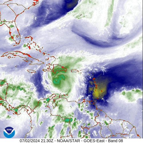
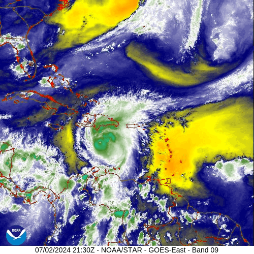
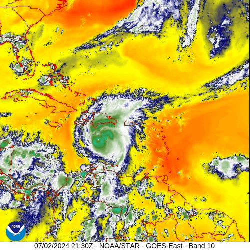
All three levels if water vapor showing how well it has wrapped up those recent bursts.
Posted on 7/2/24 at 8:47 pm to CuseTiger
That I can agree with. I sure as hell wouldn’t want to be in a 37 for that flight to FCO.

Posted on 7/2/24 at 8:48 pm to rds dc
So…this storm is headed to the north side of Jamaica?
This post was edited on 7/2/24 at 8:55 pm
Posted on 7/2/24 at 8:51 pm to LegendInMyMind
I don't know what I'm seeing but the colors are pretty

Posted on 7/2/24 at 9:04 pm to Mr Roboto
Jamaica is so fricked
Posted on 7/2/24 at 9:04 pm to LegendInMyMind
This satellite loop is fascinating from a meteorological nerd view. Just look at those thunderstorms blowing up and wrapping the south and east side of the circulation. Definitely not weakening just yet.

 Page 56 of 218

Popular
Back to top