- My Forums
- Tiger Rant
- LSU Recruiting
- SEC Rant
- Saints Talk
- Pelicans Talk
- More Sports Board
- Fantasy Sports
- Golf Board
- Soccer Board
- O-T Lounge
- Tech Board
- Home/Garden Board
- Outdoor Board
- Health/Fitness Board
- Movie/TV Board
- Book Board
- Music Board
- Political Talk
- Money Talk
- Fark Board
- Gaming Board
- Travel Board
- Food/Drink Board
- Ticket Exchange
- TD Help Board
Customize My Forums- View All Forums
- Show Left Links
- Topic Sort Options
- Trending Topics
- Recent Topics
- Active Topics
Started By
Message
re: Back flooding and built up neighborhoods
Posted on 1/21/20 at 8:37 am to ashy larry

Posted on 1/21/20 at 8:37 am to ashy larry
quote:
Unless this new development is blocking the drainage/flow from the old neighborhood and not diverting/correcting it, I don't see why this is a problem. A piece of land being higher does not mean the neighboring land will flood.
Yep. People all too often confuse flash flooding with river flooding. Unless you build a damn levee around your home, you’re going to flood when the river comes up.
This post was edited on 1/21/20 at 8:37 am
 0
0


Posted on 1/21/20 at 8:37 am to Bedhog
The pond is to collect sediment during construction, where it settles to bottom rather then being discharged to creeks and streams and damages the ecosystem. There are regulations that dictate this. Any construction that disturbs more than an acre of soil requires you to have a stormwater construction permit through the state environmental agency. You then have to adhere to stormwater quality criteria during construction. The state will inspect for compliance during construction and post construction. The ponds are generally left in place.
Posted on 1/21/20 at 8:37 am to Bedhog
quote:
exactly my point. Once full of water they do no good.
Theres a hydrological reason they do this...
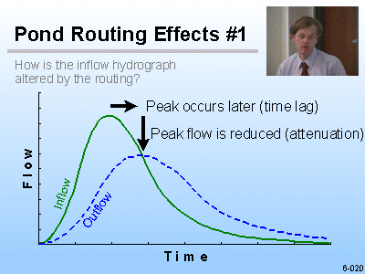
Detention pond
Detention ponds work by lowering the peak discharge in a given rainstorm. Their being full or empty does not reduce their usefulness.

Posted on 1/21/20 at 8:37 am to statman34
Look at the massive neighborhood in the field between highland and Burbank across from the soccer fields. That thing was a pond in 2016 and now it’s about 10 feet higher than it was before. Where did they get that much dirt and where will the water now go?
Posted on 1/21/20 at 8:37 am to AtticusOSullivan
quote:
As long as proper stormwater management infrastructure is put in place it shouldn't be an issue.
I agree, but the key word in that is PROPER and that is not happening. They are basing permits on (besides the "influence" factor) historical flood maps that do not reflect the recent developments. Hell, they won't even reflect any PROPER stormwater management that has been added since the maps were developed. The permit evaluations SHOULD be based on a dynamic map/condition. Every day, literally, the drainage characteristics change due to constant subdivision and commercial land development.
Posted on 1/21/20 at 8:39 am to Bedhog
I'm thinking that some reasonable number of houses built on raised dirt is not going to appreciably raise the flood plain of the area. Would have to represent much less 1/1000 of the area of the entire flood plain.
Would have to be uber MASSIVE widespread monumental fill volume = and to get that much dirt, they could dig a canal to shunt the water off to the Gulf easier than raising that much land area.
concern = misplaced.
Would have to be uber MASSIVE widespread monumental fill volume = and to get that much dirt, they could dig a canal to shunt the water off to the Gulf easier than raising that much land area.
concern = misplaced.
Posted on 1/21/20 at 8:39 am to LSUsmartass
quote:I was on airboats in both during the flood. Watson did get the most rainfall. I'm not sure who got it worst, just a statement from what I saw first hand. I was in airboats in Bellingrath to Tanglewood.
Watson got their share of flooding, but not the worst...see Central which lies in both the Amite basin and the Comite basin
Posted on 1/21/20 at 8:42 am to Bedhog
quote:
Also see this at the intersection of Tiger bend and Babin in Baton Rouge where huge earth moving machines are moving massive amounts of dirt to raise the new neighborhood being developed.
quote:
How are developers being allowed to do this?
i believe if they are taking if from the site in the creation of lakes it is considered a net neutral impact of flooding. IE, you raise an acre by two feet and you lower an acre by two feet it is not a net change to the area.

Posted on 1/21/20 at 8:43 am to Bucktail1
quote:
These retention pond they are being forced to build should be empty until a big rain.
Those are called detention basin (or dry ponds). I'm no expert in the field but they aren't used here much. They are usually in dryer climates I believe. The retention ponds are used around here and help with sediment and water quality b/c it doesn't simply pass everything through downstream. Besides a dry pond would probably have a similar capacity a retention pond simply b/c you can't just dig a giant hole and decide that it has to stay dry year-round. Our soil is always wet and it would fill itself with groundwater.
Posted on 1/21/20 at 8:43 am to Oilfieldbiology
quote:
Look at the massive neighborhood in the field between highland and Burbank across from the soccer fields. That thing was a pond in 2016 and now it’s about 10 feet higher than it was before. Where did they get that much dirt and where will the water now go?
They dug a massive lake along the Bayou and used that dirt
Posted on 1/21/20 at 8:44 am to Bedhog
Lots of development in the corridor between Highland and Nicholson. Burbank Dr cuts through the middle of South BR’s natural drainage to Manchac and Spanish Lake. I think next time around you will see flash flooding in plenty of subdivisions that have never flooded before. Lots of impediments to drainage in those areas. Back flooding along Nicholson occurs a few times a year now after a fast 6 inch rain event. EBR has not required the developers to properly account for drainage and has not kept up with it in that part of town. Ascension and Iberville are using water dams to block drainage into their parishes. It’s just a matter of time before we have a shite show.
Posted on 1/21/20 at 8:44 am to Bedhog
quote:
I was on airboats in both during the flood. Watson did get the most rainfall. I'm not sure who got it worst, just a statement from what I saw first hand. I was in airboats in Bellingrath to Tanglewood.
Watson experienced both flash flooding and later backwater flooding.

Posted on 1/21/20 at 8:45 am to Bedhog
quote:
How are developers being allowed to do this?

Posted on 1/21/20 at 8:45 am to Ignignot
quote:you call that living?
i lived in keystone of galvez in 2016
Posted on 1/21/20 at 8:48 am to CarRamrod
quote:No, I think there should be no new development in an area that flooded.
So you think they should be required to build to the elevation as everyone else that flooded?
Posted on 1/21/20 at 8:49 am to Bedhog
quote:Do some research on land development and come back. Those ponds in neighborhoods are just so developers can charge 30k more for the lake lot.
I do not see how a pond being dug is good water management.

Posted on 1/21/20 at 8:49 am to Bedhog
There is a massive subdivision being developed next to me and they are trucking in shite loads of dirt and there is barely any drainage. Should be a real hoot. Already filling up the ditches in front of my house with barely any rain.

Posted on 1/21/20 at 8:50 am to Bedhog
quote:
How are developers being allowed to do this?
Weak Planning and Zoning commissions. They also pay for Flood studies that say there won't be any issues. Planning and zoning are open to the public. I would urge everyone to pay attention to the agendas and go to the meetings and voice your opinions. Also you can get your own flood study done. Its not that expensive if you get other people to go in with you.
This post was edited on 1/21/20 at 8:51 am

Posted on 1/21/20 at 8:51 am to Bedhog
quote:
the intersection of Tiger bend and Babin in Baton Rouge
This area had been flooding for close to 20 years, routinely gets 3-5ft of water on on a heavy rainy weekend...in2016 it got close to 10ft of water. Three developers were denied building in this area, but Corbin Ladner convinced someone that he would be bring in extra dirt and build bigger lots. The back end of Lake at White has never flooded, it will begin to when "the Sanctuary" is finished being developed. 4 houses are for sale on the first street next to the new development $$$$$$$$$$$$$ fixes problems and $$$$$$$$$$ creates problems
Posted on 1/21/20 at 8:52 am to ashy larry
quote:
Those are called detention basin (or dry ponds). I'm no expert in the field but they aren't used here much
They use them a lot up north (i.e. here in NYC) to lower the peak flow (Q) to within stormwater runoff standards. If the peak runoff is higher than the allowable you need a detention pond, tank, storage, drywell, etc. They reduce the liklihood of a flash flood event.
Up here it is mainly caused because of the unavailability of stormwater infiltration into the ground- in other words because everything is either paved or asphalted the water runs off rather than being absorbed into the ground.

 Page 3 of 7

Popular
Back to top