- My Forums
- Tiger Rant
- LSU Recruiting
- SEC Rant
- Saints Talk
- Pelicans Talk
- More Sports Board
- Fantasy Sports
- Golf Board
- Soccer Board
- O-T Lounge
- Tech Board
- Home/Garden Board
- Outdoor Board
- Health/Fitness Board
- Movie/TV Board
- Book Board
- Music Board
- Political Talk
- Money Talk
- Fark Board
- Gaming Board
- Travel Board
- Food/Drink Board
- Ticket Exchange
- TD Help Board
Customize My Forums- View All Forums
- Show Left Links
- Topic Sort Options
- Trending Topics
- Recent Topics
- Active Topics
Started By
Message
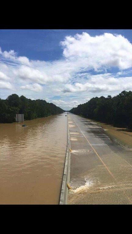
re: 1,800+ East Baton Rouge Parish homes may need to be raised because of 2016 floods
Posted on 5/10/21 at 7:45 am to member12
Posted on 5/10/21 at 7:45 am to member12
Burbank in 2016 fared ok but I can almost guarantee if that rain comes again, there will be devastation. Since 2016, there has been mass development and removal of forestry along Burbank. More concrete and less land to soak up water is a bad combo. The new Walmart, new neighborhoods along the Burbank and siegan curve (hilarious how close those homes are to the creek).
 6
6

Posted on 5/10/21 at 7:58 am to TulaneUVA
quote:
Burbank in 2016 fared ok but I can almost guarantee if that rain comes again, there will be devastation. Since 2016, there has been mass development and removal of forestry along Burbank. More concrete and less land to soak up water is a bad combo. The new Walmart, new neighborhoods along the Burbank and siegan curve (hilarious how close those homes are to the creek).
And lets not even discuss what would happen to all living West of Highland rd to the levee if the Levee would break.
Posted on 5/10/21 at 7:59 am to TulaneUVA
quote:
Burbank in 2016 fared ok but I can almost guarantee if that rain comes again, there will be devastation. Since 2016, there has been mass development and removal of forestry along Burbank. More concrete and less land to soak up water is a bad combo. The new Walmart, new neighborhoods along the Burbank and siegan curve (hilarious how close those homes are to the creek).
shift the heavy rains from 2016 a little more west, and the burbank area gets destroyed. the flood waters in burbank area were from back water through amite, manchac, and then bayou fountain/Ward's Creek.
if that rain dumped into the bayou fountain/Ward creek drainage area, then it would of had no where to go and flooded all near those areas....
go look at the LSU flood maps for EBR, nearly all the older areas west of highland are blue.....
LSU flood maps

Posted on 5/10/21 at 8:01 am to member12
So either raise or raze
Posted on 5/10/21 at 8:03 am to Strannix
EBR is unprepared, Shocking.
Posted on 5/10/21 at 8:05 am to nes2010
quote:
Raise them or raze them.
Came in here to go grammar nerd on some folks. Turns out my reading comprehension skills suck.
Posted on 5/10/21 at 8:15 am to member12
It’s amazing that we allow this. Insurance companies want you sending that monthly check but don’t want to assume any risk. We allow it so we deserve it.
Posted on 5/10/21 at 8:26 am to Dustydubs
quote:
It’s amazing that we allow this. Insurance companies want you sending that monthly check but don’t want to assume any risk. We allow it so we deserve it.
Overwhelming majority of flood is through NFIP/FEMA. Has literally nothing to do with private insurance.

Posted on 5/10/21 at 8:33 am to member12
quote:
shift the heavy rains from 2016 a little more west, and the burbank area gets destroyed. the flood waters in burbank area were from back water through amite, manchac, and then bayou fountain/Ward's Creek.
if that rain dumped into the bayou fountain/Ward creek drainage area, then it would of had no where to go and flooded all near those areas....
go look at the LSU flood maps for EBR, nearly all the older areas west of highland are blue.....
History will bite you in the arse if you are not careful. The area of Burbank south of Gardere was once sugar cane fields. The area between Gardere and Lee Dr. was a swamp. The corner at Burbank and Nicholson was an oil field. At flood stage the Mississippi river still tries to find its ' outlet at the Vet school to get into Bayou Fountain, an ancient distributary of the River.
Posted on 5/10/21 at 9:06 am to member12
When the Comite Diversion Canal is completed isn’t the base flood elevation going to change for a lot of people? The flood maps would have to be redrawn.

Posted on 5/10/21 at 9:18 am to Kramer26
quote:
Comite Diversion Canal
This was supposed to be completed in December of this year, but as is the case with any project in LA, it’s been pushed back to December of 2022. Have they even broken ground yet?
Posted on 5/10/21 at 9:26 am to sec13rowBBseat28
quote:
Have they even broken ground yet?
Yes

Posted on 5/10/21 at 9:30 am to sec13rowBBseat28
Isn’t this the same canal which has been in the “committee” stage since the early 80s?
Posted on 5/10/21 at 9:34 am to teke184
Yes. I just looked at the latest google earth image and they’ve already got a lot of the land cleared. Image was taken in January of this year. At least they have broken ground.
This post was edited on 5/10/21 at 9:35 am
Posted on 5/10/21 at 9:35 am to TulaneUVA
quote:
removal of forestry along Burbank. More concrete and less land to soak up water is a bad combo.
People completely miss this. They think just adding a pond will take care of it. But, those cow pastures soak up a lot of water. Concrete and rooftops shed it way too fast.
Posted on 5/10/21 at 9:35 am to Dustydubs
quote:Dumbest comment on here, flood insurance is provided by the feds and subsidized by taxpayers. Taxpayers shouldn't have to suffer because people aren't intelligent enough to not build in a FLOOD zone.
It’s amazing that we allow this. Insurance companies want you sending that monthly check but don’t want to assume any risk. We allow it so we deserve it.

Posted on 5/10/21 at 9:41 am to Upperdecker
quote:
We making rules for a once in 500 years disaster event now? Seems unreasonable
I wonder if they are taking the I-12 Dam into account in this?
Posted on 5/10/21 at 9:46 am to Limitlesstigers
quote:
flood insurance is provided by the feds and subsidized by taxpayers. Taxpayers shouldn't have to suffer because people aren't intelligent enough to not build in a FLOOD zone.
This all day long. I love how Louisiana is so Red and Small Government but loves them some Flood Insurance.
Posted on 5/10/21 at 9:48 am to lsu13lsu
quote:
People completely miss this. They think just adding a pond will take care of it. But, those cow pastures soak up a lot of water. Concrete and rooftops shed it way too fast.
I agree. That development is gonna make someone flood that wouldnt have otherwise.
Posted on 5/10/21 at 9:53 am to SantaFe
What I recall was that backwater levels rose pretty steadily in the Bayou Manchac system until it got high enough to spill over into Spanish Lake. At that point everything from Burbank area to Hoo Shoo Too area pretty much stabilized.

 Page 2 of 5

Popular
Back to top