- My Forums
- Tiger Rant
- LSU Recruiting
- SEC Rant
- Saints Talk
- Pelicans Talk
- More Sports Board
- Fantasy Sports
- Golf Board
- Soccer Board
- O-T Lounge
- Tech Board
- Home/Garden Board
- Outdoor Board
- Health/Fitness Board
- Movie/TV Board
- Book Board
- Music Board
- Political Talk
- Money Talk
- Fark Board
- Gaming Board
- Travel Board
- Food/Drink Board
- Ticket Exchange
- TD Help Board
Customize My Forums- View All Forums
- Show Left Links
- Topic Sort Options
- Trending Topics
- Recent Topics
- Active Topics
Started By
Message

 1
1

Posted on 9/14/19 at 7:00 am to Bestbank Tiger

This one?
Posted on 9/14/19 at 7:45 am to BPTiger
quote:
This one?
That one works. But I was thinking this one.


Posted on 9/14/19 at 7:51 am to BPTiger
Space city weather on some rain that may be coming from the gulf
https://spacecityweather.com/

https://spacecityweather.com/
quote:
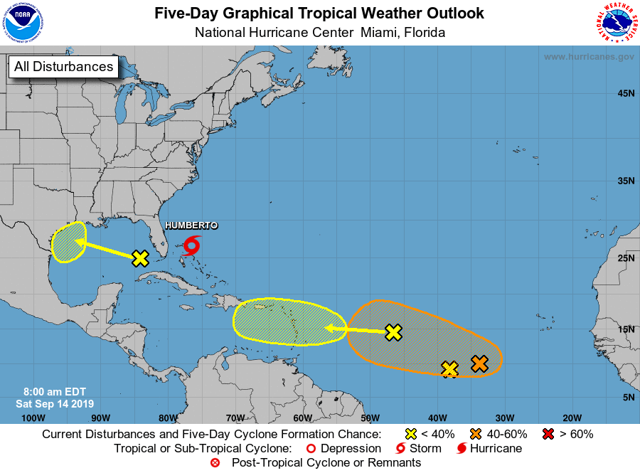
Some readers may note that the National Hurricane Center has begun tracking an upper-level low pressure system over the eastern Gulf of Mexico (note, this is distinct from Tropical Storm Humberto). This is because the forecast models have gotten a little bit more excited about the possibility of this system evolving from a low pressure system in the upper levels of the atmosphere into a low pressure circulation at the surface.
quote:
The hurricane center gives this feature a 30 percent chance of developing into a tropical depression or storm as it moves westward toward the lower or central Texas coast, probably coming ashore on Monday or Tuesday. I’m sure there will be a lot of hoopla about this system over the next couple of days, and some of that is justifiable because one never likes to see low pressure over the Gulf of Mexico in mid-September. With that being said, this one has a long way to go before becoming organized. All of the best global models keep it at tropical depression status right now. So while we cannot rule anything out. I am reasonably confident that we are not looking at a situation in which a hurricane approaches Texas early next week.
quote:
However, even disorganized tropical systems can produce heavy rainfall, and that will be a threat along the Texas coast beginning on Monday. How much of a threat remains to be seen, as there is a considerable spread in the model forecasts. The European model paints a bullseye of 4-6 inches around Matagorda Bay and Victoria, with lesser amounts north and south of there, including for the Houston region. The GFS model keeps totals mostly confined to 2 to 3 inches along most of the Texas coast. Another model we’ve been following more, the Germany-based ICON forecast system, keeps the heaviest rain offshore but does bring 4 to 6 inches into Harris County during the middle of next week.
Posted on 9/14/19 at 10:47 am to Dire Wolf
Funny.
Dorian had an upper low with him for a while and then it crossed into the gulf, got named, and hit Mexico as a TS.
Really similar play here, just Humberto and the ULL are offset to the right. Well that and Humberto is weak vs Dorian at this location which wasn't.
Dorian had an upper low with him for a while and then it crossed into the gulf, got named, and hit Mexico as a TS.
Really similar play here, just Humberto and the ULL are offset to the right. Well that and Humberto is weak vs Dorian at this location which wasn't.
This post was edited on 9/14/19 at 10:48 am
Posted on 9/14/19 at 11:00 am to Duke
Duke-
Regarding Humberto, is outdoor work in the BR area a safe bet next week? Or is “dirt work” a bad plan?
Regarding Humberto, is outdoor work in the BR area a safe bet next week? Or is “dirt work” a bad plan?
Posted on 9/14/19 at 11:19 am to tigerinthebueche
quote:
Regarding Humberto, is outdoor work in the BR area a safe bet next week? Or is “dirt work” a bad plan?
By "Regarding Humberto", do you mean is it going to be dry in Baton Rouge next week?
If so, yeah it looks like another pretty dry week in our area. High pressure reigns. Like a typical summer set up, might see an isolated afternoon thunderstorm but in general hot and sunny.
Posted on 9/14/19 at 3:29 pm to Duke
We can't let this thread fall to the second page.
What kind of weather might Fort Polk get next week? We've got some folks on Rotation here next week. They came from afar so they are looking forward to some "exotic" weather.
Or was it exotic women? Either way, what's the weather look like next week? Thanks very much.
What kind of weather might Fort Polk get next week? We've got some folks on Rotation here next week. They came from afar so they are looking forward to some "exotic" weather.
Or was it exotic women? Either way, what's the weather look like next week? Thanks very much.
Posted on 9/14/19 at 3:31 pm to Champagne
Remember the last two weeks?
Pretty much that.
Pretty much that.
Posted on 9/14/19 at 3:34 pm to Duke
I’ve noticed there has been a lot of hurricane activity in the pacific by Mexico headed up toward Cabo lately. Has a hurricane ever hit California around San Diego? I don’t remember hearing about anything major, but was just curious.
Posted on 9/14/19 at 3:52 pm to TigerStripes06
quote:
Has a hurricane ever hit California around San Diego? I don’t remember hearing about anything major, but was just curious.
There was a hurricane that hit San Diego in the 1850s or 1860s. Otherwise, it's typically just rain from decaying systems.
Typically the water is too cold and they get turned out to sea most of the time.
Posted on 9/14/19 at 5:18 pm to Duke
Here at MSY, only 0.02 inches of rainfall for September so far. Usually it is October that is the driest month.
Posted on 9/14/19 at 5:24 pm to Klingler7
I've seen about 2" where I'm at in the SE part of EBR. Practically all of it Monday night.
Posted on 9/14/19 at 5:25 pm to Duke
Thank you Duke 
Posted on 9/14/19 at 5:31 pm to Duke
Correct. You guys had some small hail close by last week too. We had thunder this morning at MSY but no rainfall in the gauge. Hit or miss isolated convection. The QPF doesn’t do well if a small TS dumps 2-3 inches over Prairieville or Greensburgh but 90 Percent of the CWA stays dry.
Posted on 9/14/19 at 5:55 pm to Duke
TWSS?
Posted on 9/15/19 at 6:11 am to Dire Wolf
Heading to Galveston Friday... doesn’t look like it’ll be a dry trip
Posted on 9/16/19 at 8:39 am to rds dc
Was so hoping the OTS on Humberto would have this dead for a while...but then I look at modeling toward Houston for the yellow blob.
Euro dropping 20", but at least it's a narrow band.

QPF isn't crazy yet but keeping an eye down that way.
Euro dropping 20", but at least it's a narrow band.
QPF isn't crazy yet but keeping an eye down that way.
Posted on 9/16/19 at 2:51 pm to Duke
It's 9/16 in middle of hurricane season and the hurricane thread has stayed on the same page for 2 days. This is awesomeness at its best.
Posted on 9/16/19 at 3:24 pm to Chad504boy
Ryan Maue
@RyanMaue
·
2m
ECMWF model has a classic Cabo Verde hurricane well out in the Atlantic in 10-days -- developing into a Major east of 40°W. This would be the first real "deep tropical" or MDR hurricane of the 2019 season. Nothing to worry about.

@RyanMaue
·
2m
ECMWF model has a classic Cabo Verde hurricane well out in the Atlantic in 10-days -- developing into a Major east of 40°W. This would be the first real "deep tropical" or MDR hurricane of the 2019 season. Nothing to worry about.

 Page 19 of 30

Popular
Back to top