- My Forums
- Tiger Rant
- LSU Recruiting
- SEC Rant
- Saints Talk
- Pelicans Talk
- More Sports Board
- Fantasy Sports
- Golf Board
- Soccer Board
- O-T Lounge
- Tech Board
- Home/Garden Board
- Outdoor Board
- Health/Fitness Board
- Movie/TV Board
- Book Board
- Music Board
- Political Talk
- Money Talk
- Fark Board
- Gaming Board
- Travel Board
- Food/Drink Board
- Ticket Exchange
- TD Help Board
Customize My Forums- View All Forums
- Show Left Links
- Topic Sort Options
- Trending Topics
- Recent Topics
- Active Topics
Started By
Message

 0
0


Posted on 8/14/16 at 11:38 am to supernovasky
So is Springlake subdivision flooding eminent?
Posted on 8/14/16 at 11:38 am to The Boat
I got some friends at Highland and Lee, will they be okay or do they need to leave?
Posted on 8/14/16 at 11:38 am to The Boat
Kennesaw homes took water?
How far South?
How far South?

Posted on 8/14/16 at 11:38 am to LSUtoOmaha
Eastgate at S. Harrell's ferry
Forest Park
Lake forest park
Bridge on s. Harrell's ferry by woodland ridge
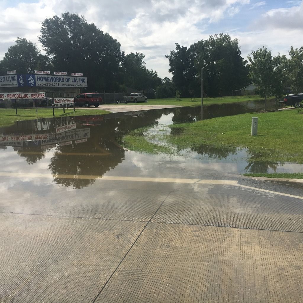
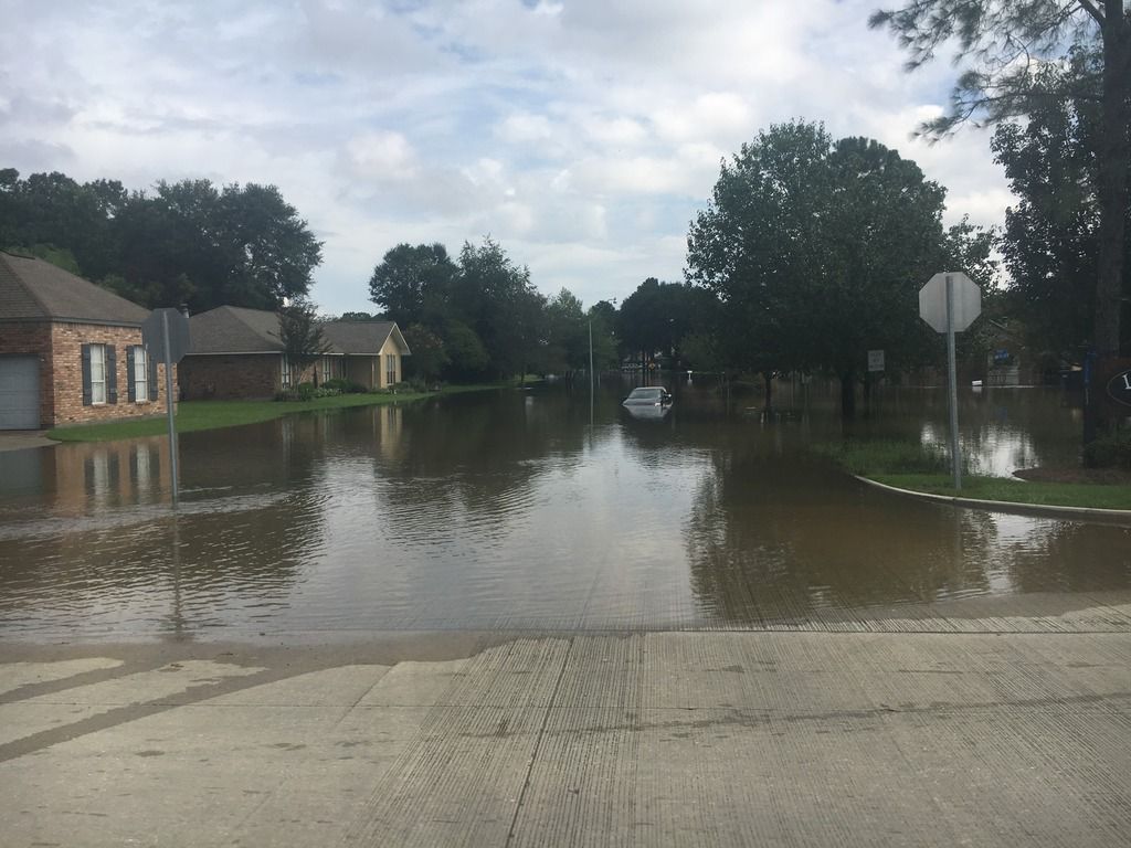
Woodland ridge is under. Boats going in. Camelot and eastgate have water up to the yards.
I still have power and wifi.
Folks, I'm gonna ride this out but if you have family in the area...it ain't looking too hot the more towards the Amite you get.
Forest Park
Lake forest park
Bridge on s. Harrell's ferry by woodland ridge
Woodland ridge is under. Boats going in. Camelot and eastgate have water up to the yards.
I still have power and wifi.
Folks, I'm gonna ride this out but if you have family in the area...it ain't looking too hot the more towards the Amite you get.
Posted on 8/14/16 at 11:38 am to supernovasky
Anyone have information about ponderosa at old Hammond hwy? Specifically the Mobil station and the town houses across the street?
Posted on 8/14/16 at 11:39 am to Hu_Flung_Pu
quote:
The Great Flood of 2016: Backwater Flooding Occuring (8/14/16)
I got some friends at Highland and Lee, will they be okay or do they need to leave?
Depends on the extent of backwater flooding.
If it's as bad as what happened on Jones Creek, it could be very bad for them.

Posted on 8/14/16 at 11:39 am to larry289
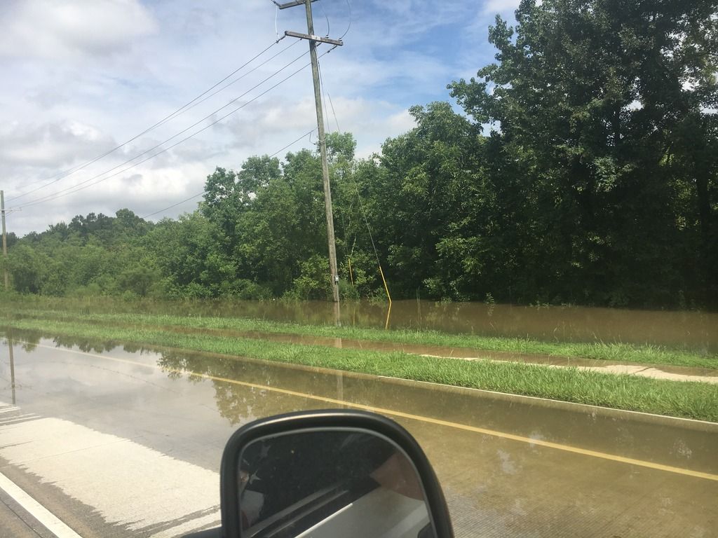
we are in Gonzales near 621/airline and we didn't even have water covering the street. but, the video of gonzales up by brewbachers looks pretty bad.
Posted on 8/14/16 at 11:39 am to doubleb
Where do you find the gauges online?

Posted on 8/14/16 at 11:39 am to rds dc
quote:RDS it could go a lot higher than that. Depending on the timing/rate of the backflow, it could equalize with the Amite, which would be 21.5'.
Any guess on how much higher it will go? In my uneducated guess, another 1 to 1.5 feet puts water in the houses on this side of the street.

Posted on 8/14/16 at 11:39 am to Hu_Flung_Pu
quote:
Highland and Lee
If they're on Highland, it's really high (intended) ground there. The neighborhood walmart sits at like 48 feet elevation

Posted on 8/14/16 at 11:39 am to LSUJuice
quote:
Okay, I am looking at these maps and I'm a little worried about my sister and her family. They are zone X but are, to me, uncomfortably close to the blue. She lives in an apartment complex just north of Jefferson Highway between Stumburg Lane and Morning Dove Drive...I can't remember the name of the complex. Everything south of her is blue. I might do it anyway, but should I advise her that she should prepare a bug-out bag and be ready to move?
quote:
Man, it's close. Clay Cut Bayou @ Antioch is at 26.76' right now, and it looks like the area of that apt complex is at 29-30. The 100-year elevation there is 29, and based on the gauge at Denham cresting right around the 100-year, my guess is it will be damn close to that 29'. If the complex pad/foundation is raised at all, should be ok. But it's close.
Thanks to the information from this board, I was able to convince my sister to pack bags just in case. This morning, they decided to bug out and came my way. So thanks for the good links and advice everyone. I got more information of what is going on from this board and the police scanner in five minutes than what I can get from the media in an hour. All they want to show are dramatic rescues, but people need INFORMATION. No coverage nationally. There is a crisis going on and no one outside of Louisiana (unless you have LA. connections, of course) seems to care.
This post was edited on 8/14/16 at 11:41 am

Posted on 8/14/16 at 11:40 am to fr33manator
Thanks for the pics and update
Posted on 8/14/16 at 11:40 am to doubleb
Street flooding is happening in Jeffereson Terrace currently
Posted on 8/14/16 at 11:41 am to prplhze2000
Posted on 8/14/16 at 11:41 am to doubleb
quote:
The Jones Creek gauge at Old Hammond has leveled off at 34.32 for several hours so I'm guessing the crest of the Amite is where JC flows into the Amite.
I don't trust that gauge. It doesn't just go flat like that.
Posted on 8/14/16 at 11:41 am to supernovasky
That place has flooded before
Opened as Lou Macs and flooded in 77
Opened as Lou Macs and flooded in 77
Posted on 8/14/16 at 11:41 am to prplhze2000
quote:
Where do you find the gauges online?
Port vincent gauge
You can move up and down the river from there.
Posted on 8/14/16 at 11:41 am to fr33manator
quote:
fr33manator
thank you so much.
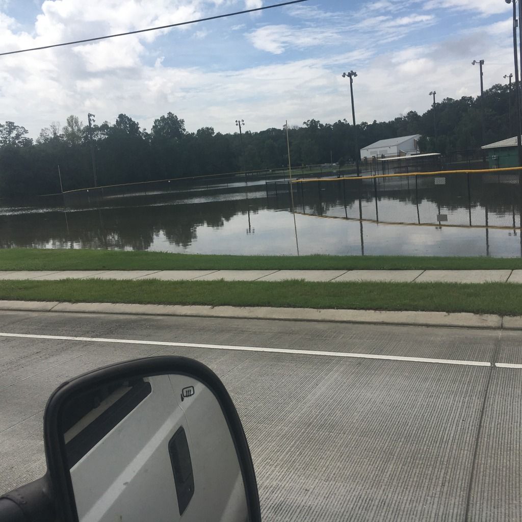
eastgate and harrell's ferry looks bad but at least not up in the houses
Posted on 8/14/16 at 11:41 am to LSUJuice
Rain is coming down hard in NOLA

 Page 189 of 472

Popular
Back to top