- My Forums
- Tiger Rant
- LSU Recruiting
- SEC Rant
- Saints Talk
- Pelicans Talk
- More Sports Board
- Fantasy Sports
- Golf Board
- Soccer Board
- O-T Lounge
- Tech Board
- Home/Garden Board
- Outdoor Board
- Health/Fitness Board
- Movie/TV Board
- Book Board
- Music Board
- Political Talk
- Money Talk
- Fark Board
- Gaming Board
- Travel Board
- Food/Drink Board
- Ticket Exchange
- TD Help Board
Customize My Forums- View All Forums
- Topic Sort Options
- Trending Topics
- Recent Topics
- Active Topics

supernovasky
| Favorite team: | |
| Location: | |
| Biography: | |
| Interests: | |
| Occupation: | |
| Number of Posts: | 588 |
| Registered on: | 7/5/2012 |
| Online Status: | Not Online |
Recent Posts
Message
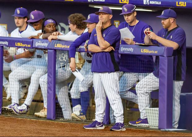
re: If you realized Orgeron would be the permanent replacement
Posted by supernovasky on 11/26/16 at 10:34 pm to Sentrius
Probably not. Orgeron has a similar ceiling and a waaaaay lower floor.

 0
0
re: What does Miles do better than Orgeron?
Posted by supernovasky on 11/26/16 at 5:20 pm to Mako_fin
quote:
True but lsu is a way different and better program than ole miss was at the time O was there. Based on that alone, O should do much better here.
I wish we'd do away with this shite. This is the same thinking that got people believing coaches like Saban, Harbaugh, and Meyer would make lateral moves from successful programs because "LSU is just that great a program."
re: What does Miles do better than Orgeron?
Posted by supernovasky on 11/26/16 at 5:16 pm to rocket31
IF the idea was to hire a coach that loses at home to Bama and drops a couple random SEC games, why not keep Miles, at least you know he has historical upside.
re: What does Miles do better than Orgeron?
Posted by supernovasky on 11/26/16 at 5:14 pm to Lethrill
Honestly I don't think Coach O does many of those things better than Miles either. That's the problem. It's a wash with a less proven history.
re: LSU announcing new coach at noon; reports say Orgeron
Posted by supernovasky on 11/26/16 at 9:57 am to LosLobos111
THIS is what all of the people in support of keeping Les were talking about. The common refrain was, "Ok, if you fire him, who are you going to hire?" There were no good coaches out there. Jimbo or Herman are both OK, but this whole year there is a smaller supply than usual of good coaches and a greater demand. The answer was, "Well, ANY coach would want to coach here, we'll even have a shot at Saban or Harbaugh!" Lol, yeah right. This was the worry, that we'd end up with a poor coach who was no better and possibly worse than Miles. If Miles had been kept and ended the season now, we'd probably all be calling for him to get fired right? But suddenly coach O does it and he gets hired.
This is dumb.
This is dumb.
re: LSU announcing new coach at noon; reports say Orgeron
Posted by supernovasky on 11/26/16 at 9:07 am to craigbiggio
Lol. Maybe this will shut up the fans that thought we had a chance at Saban or Harbaugh because LSU is ZOMG THE BEST PROGRAM IN THE WORLD EVERYONE WANTS TO COACH HERE.
Here's to 10 years of being Tennessee.
Here's to 10 years of being Tennessee.

re: Storm Tracking Thread: Post Tropical Storm Hermine
Posted by supernovasky on 8/26/16 at 10:48 am to larry289
quote:
99L - Potential Gulf Threat
Your hurricane structure diagram.
Northern hemisphere. Winds entering a LP area, due to Coreolis, cause a counterclockwise rotation. Due to location on earth's surface are "deflected" to the right which sets-up this rotation; my understanding anyway. Your diagram indicates "storm rotation clockwise".
Is this in reference to the cirrus outflow shield?
I'm confused?
Notice that the low level winds are entering counterclockwise in the correct direction. The upper outflow exits in a clockwise direction.
This is actually why you might hear some people say, "models place an anticyclone over it" in reference to it potentially strengthening at times. Upper level anticyclonic flow helps vent the storm.
re: Storm Tracking Thread: Post Tropical Storm Hermine
Posted by supernovasky on 8/26/16 at 10:34 am to Aspercel
quote:
99L - Potential Gulf Threat
I just want to say thanks to all our weather posters for keeping is updated. This is always the first place I check for anything.
Also, this may have been answered in the long flood thread but what do you do supernovasky?
I'm a statistician that really loves weather :)
re: Storm Tracking Thread: Post Tropical Storm Hermine
Posted by supernovasky on 8/26/16 at 9:39 am to supernovasky
Likewise, shear is decreasing over the storm. I anticipate today will be a better day for 99L.

re: Storm Tracking Thread: Post Tropical Storm Hermine
Posted by supernovasky on 8/26/16 at 9:36 am to Chad504boy
quote:
But where are you proposing the center is?
Who knows, Chad, we don't have recon out there right now. I suppose it's probably under that convection or pretty near it.
re: Storm Tracking Thread: Post Tropical Storm Hermine
Posted by supernovasky on 8/26/16 at 9:36 am to bbap
Yup. Imagine you have three layers (lower, middle, and upper atmosphere). The lower atmosphere is where these tropical storms are often swirling about, and in fact a lower level circulation (LLC) is essential to one of these tropical storms forming.

You can see that at the bottom, you have all of these storms firing up, and at the top, you've got the outflow. What shear does is it cuts off storms before they can establish proper outflow (literally chops the entire top part of the storm off).
When you have shear as bad as we had yesterday, it cuts off ALL thunderstorms and all you are left is a little naked swirl at the lowest level of the atmosphere. You could have been in the middle of the swirl on a boat yesterday and had a light breeze and sunshine.
re: Storm Tracking Thread: Post Tropical Storm Hermine
Posted by supernovasky on 8/26/16 at 9:18 am to MightyYat
quote:
Thanks for chiming in. Much appreciated.
super, where is it clear? The thing looks like a total mess. Are you talking about that big red flare up?
Yes, MightyYat. Yesterday, this was the naked swirl:

See how there are no thunderstorm clouds around that center? They were getting blown off by shear.
You can see how there are no storms in the IR:

Just a lonely swirl.
Compare to today:

And of course, on IR near the center:

This all happened in the last couple hours and it remains to be seen if these storms get blown off again by shear, but I didn't think I'd get much pushback here saying it looked more alive today than it did yesterday.
re: Storm Tracking Thread: Post Tropical Storm Hermine
Posted by supernovasky on 8/26/16 at 9:09 am to MightyYat
quote:
quote:
No y'all can't.
Bc you're obsessed with getting the last word in. Like a bunch of elementary school kids.
This thread pretty important to lots people.
Go to anther thread and continue your dick measuring contest.
Thanks for chiming in. Much appreciated.
super, where is it clear? The thing looks like a total mess.
Basically yesterday, it was a naked swirl. Today, storms are re-firing much closer to the center. It is still an absolute mess, to be sure, but I personally think it looks much better than yesterday. I wasn't convinced yesterday that it would survive, but as long as there is convection firing near the center, it is still something to watch for future development. I'll preface by saying that I am not of the opinion that we all need to be terrified of this thing - I just think that it did not die yesterday like many people believed it would.
re: Storm Tracking Thread: Post Tropical Storm Hermine
Posted by supernovasky on 8/26/16 at 9:07 am to lsu2006
quote:
quote:
it clearly has and is regaining convection today.
In what way is that clear?
re: Storm Tracking Thread: Post Tropical Storm Hermine
Posted by supernovasky on 8/26/16 at 9:04 am to MightyYat
I think anyone claiming it is dead would be wrong - it clearly has and is regaining convection today.
re: Storm Tracking Thread: Post Tropical Storm Hermine
Posted by supernovasky on 8/25/16 at 11:06 am to Jack Bauer7
I don't think, at least I hope, that anyone here is cheering this storm on. Louisiana needs to not even get a whiff of this thing - I'm far more concerned with the rain it might bring than its strength.
re: Storm Tracking Thread: Post Tropical Storm Hermine
Posted by supernovasky on 8/25/16 at 10:28 am to OneMoreTime
Well, if you weren't paying attention before, now you most likely are with these models. Got a lot of friends asking me what I think.
One bit of comfort is that we are still a ways out and these models are changing a lot, and the storm has not formed yet.
One bit of comfort is that we are still a ways out and these models are changing a lot, and the storm has not formed yet.
re: Traffic I10 in BR lately
Posted by supernovasky on 8/24/16 at 5:52 pm to OweO
Took me an hour 45 to get from highland and state to highland and Siegen. LSU traffic accounted for the first hour to get across LSUs campus to highland and lee. After that it's usually easy going but took 45 minutes because that corridor has been packed with flood related traffic.
re: Storm Tracking Thread: Post Tropical Storm Hermine
Posted by supernovasky on 8/24/16 at 4:18 pm to loogaroo
A heads up with the map and the forecast cone going around - a lot of times, Oil and Gas companies want well advance warning that these things are coming this way. They'd rather err on the side of caution and thus have a lot more tolerance for wrong forecasts, hence bigger cones, cones established before a storm even forms, etc. TBH when a system does form and a cone comes out, it wouldn't surprise me if it were close to what this company is putting out. Thing is, the purpose of the company is to give WAY advanced, overly cautious warning. They have much higher tolerance for saying something will form and it not forming, than saying nothing will form and something does.
re: Storm Tracking Thread: Post Tropical Storm Hermine
Posted by supernovasky on 8/24/16 at 4:13 pm to GEAUXmedic
quote:
99L - Potential Gulf Threat
quote:
For those interested, these are the historical paths for storms passing 60 miles from the southern tip of Florida, coming from the Atlantic side.
Any way to narrow that down to August 21st-September 20th?

re: Storm Tracking Thread: Post Tropical Storm Hermine
Posted by supernovasky on 8/24/16 at 4:03 pm to supernovasky
(Did not mean for Katrina to be highlighted in that picture, nothing meant by that)
Popular