




- My Forums
- Tiger Rant
- LSU Recruiting
- SEC Rant
- Saints Talk
- Pelicans Talk
- More Sports Board
- Fantasy Sports
- Golf Board
- Soccer Board
- O-T Lounge
- Tech Board
- Home/Garden Board
- Outdoor Board
- Health/Fitness Board
- Movie/TV Board
- Book Board
- Music Board
- Political Talk
- Money Talk
- Fark Board
- Gaming Board
- Travel Board
- Food/Drink Board
- Ticket Exchange
- TD Help Board
Customize My Forums- View All Forums
- Show Left Links
- Topic Sort Options
- Trending Topics
- Recent Topics
- Active Topics
Started By
Message
re: Weather Board: Enhanced (3 out of 5) Risk for Yankees This PM. Tornado Watch For Masters
Posted on 4/11/19 at 5:45 pm to slackster

Posted on 4/11/19 at 5:45 pm to slackster
He's being a chick and was the entire weekend. Why he would bother correlating his little sphere with a thread about NETx and NWLa is all you need to know. He's the white Port Hudson Playa.
This post was edited on 4/11/19 at 5:48 pm
 0
0

Posted on 4/11/19 at 5:49 pm to Duke
Some potentially limiting factors for Saturday:
- VBV noticeable in some soundings
- potential for morning rain and clouds north of early warm front
- atmosphere may not
recover in N. LA
- early storms in warm sector
- rapid upscale growth into clusters or line
Tornado potential is certainly there but, at this time, models are showing plenty of reasons for this setup to be messy
- VBV noticeable in some soundings
- potential for morning rain and clouds north of early warm front
- atmosphere may not
recover in N. LA
- early storms in warm sector
- rapid upscale growth into clusters or line
Tornado potential is certainly there but, at this time, models are showing plenty of reasons for this setup to be messy
Posted on 4/11/19 at 5:51 pm to slackster
quote:
Link?
To what? Nothing happened, so there’s nothing to link


Posted on 4/11/19 at 5:51 pm to Duke
I’m just hoping the weather rolls through earlier than anticipated
This post was edited on 4/11/19 at 11:40 pm

Posted on 4/11/19 at 6:18 pm to rds dc
quote:
VBV noticeable in some soundings
Been seeing a little more each run I check over the last day or so.
quote:
rapid upscale growth into clusters or line
Seems likely. Plenty of moisture, no cap. Figure all it'd need would be a little outflow from other storms to give it a kick and they'd be going up everywhere.
quote:
potential for morning rain and clouds north of early warm front
Good point.
I see the higher end potential here for sure but I've also seen enough good conditions provide messy storms to not be just posting "wedges" for two pages.
Posted on 4/11/19 at 6:55 pm to Sao
quote:
I'm intrigued about the next 30 days for the Mississippi River. I follow a YouTube channel hunter/bushcraft guy and it's still pissing snow in Ontario and other parts of Canada that has feeders into the MR.
Big blizzard in the dakotas too.

Posted on 4/11/19 at 6:55 pm to tgrbaitn08
quote:
To what? Nothing happened, so there’s nothing to link
The official doomsday predictions.



Posted on 4/11/19 at 9:07 pm to rds dc
quote:
- potential for morning rain and clouds north of early warm front
- atmosphere may not
recover in N. LA
- early storms in warm sector
Every system of course is unique. But on the predawn hours of April 27, 2011 there were a number of tornadoes and rough weather that came through central Alabama. The forecasts by this time had been predicting such dire conditions, that many schools closed for the entire day. When those early morning storms rolled through, many people felt this would shake up the atmosphere and settle it down. So wrong they were.
Posted on 4/11/19 at 9:36 pm to East Coast Band
quote:
When those early morning storms rolled through, many people felt this would shake up the atmosphere and settle it down.
Had all day to recover though and cleared up IIRC. Moisture tap was wide open to the south. Got a little sunlight and it was off to the races.
You had me reading through the SPC archives for 4/27 and those mesoscale discussions were chilling. Half of Alabama circled on the map, with the caption "Tornado Outbreak Ongoing".


Posted on 4/11/19 at 9:54 pm to East Coast Band
quote:
Every system of course is unique. But on the predawn hours of April 27, 2011 there were a number of tornadoes and rough weather that came through central Alabama. The forecasts by this time had been predicting such dire conditions, that many schools closed for the entire day. When those early morning storms rolled through, many people felt this would shake up the atmosphere and settle it down. So wrong they were.
No one anticipated that morning event, but that day was very unique. In most cases, a line like that would work over the atmosphere and limit the threat later in the day. However, on April 27th the atmosphere recovered rapidly (sun was out in Bham by 8:30am) and all of the dynamics, factors, parameters, etc. for severe weather were absolutely perfect that day. In most severe weather events things are not as perfect as they were that day.
This post was edited on 4/11/19 at 9:55 pm
Posted on 4/11/19 at 10:13 pm to slackster
quote:
The official doomsday predictions.
You want me to link past forecast? Can’t you do that yourself?
I thought you were a weather guru
Posted on 4/11/19 at 10:25 pm to slackster
Posted on 4/11/19 at 11:12 pm to tgrbaitn08
 , I found some graphics of the possibility of like 2" across parts of LA.
 Not sure what I'm missing.

This post was edited on 4/11/19 at 11:14 pm
Posted on 4/12/19 at 12:31 am to lsuman25
Okay I get enough anxiety with regular bad tstorns here or with Torcon 3-4. But 6? I have a feeling it could even get to 7 but let’s pray that’s not the case.
As the storm goes through us AL, Tennessee are gonna be a lot worse than here bc of the jet stream. (Was on weather channel earlier I might have my term incorrect. I just Hope is spares the bad tornado in Alabama just a few weeks ago
As the storm goes through us AL, Tennessee are gonna be a lot worse than here bc of the jet stream. (Was on weather channel earlier I might have my term incorrect. I just Hope is spares the bad tornado in Alabama just a few weeks ago
Posted on 4/12/19 at 1:11 am to GeauxLSUGRL
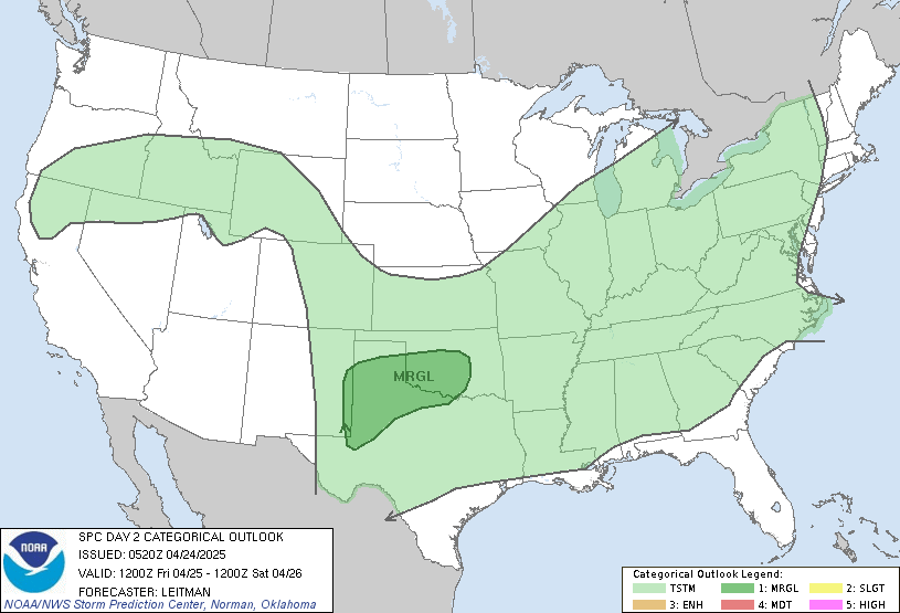
.east Texas eastward to southwest Tennessee/Mississippi/western
Alabama...
A potentially significant severe weather episode is expected to
evolve across portions of the south central U.S. -- focused from the
Arklatex to the lower Mississippi Valley area, as a seasonably
strong southern-stream storm system advances across the region.
...MAXIMUM RISK BY HAZARD...
Tornado: 15% SIG - Moderate
Wind: 45% - Enhanced
Hail: 30% - Enhanced
Posted on 4/12/19 at 1:19 am to lsuman25
quote:
Posted On Thursday 4/11/2019 - A Significant Severe Weather Event remains possible on Saturday and Saturday night across eastern Texas, southern Arkansas, much of Louisiana, much of Mississippi and westernmost Alabama. Tornadoes, damaging winds and large hail will all be a threat.
The severe weather threat will push across Alabama, Georgia and the Florida Panhandle during Sunday with tornadoes, damaging winds and large hail all a threat.
If you live in or have family, friends or colleagues that live in eastern Texas, southern Arkansas, Louisiana, Mississippi, Alabama, Georgia & the Florida Panhandle – It is very important that you are able to receive severe thunderstorm and tornado warnings this weekend.
Have at least 2 ways of receiving warnings (Smart Phone severe weather app, NOAA Weather Radio, TV, Radio). In addition, take some time now to review your severe weather safety plan. Know where you are going and have helmets, portable air horns, and hard sole shoes for everyone in that safe place.
If you live in a manufactured home, identity a shelter or other site built home or business nearby that is available on weekends. And, every church and house of worship must have a way of hearing warnings (NOAA Weather Radio is the best bet), and have a plan to get people into a safe place in the event a tornado warning is issued during services this weekend.
I am monitoring this weekend’s severe weather setup extremely closely and I will continue to have updates for you as conditions warrant.
For our latest severe weather updates, just go to LINK .

Posted on 4/12/19 at 1:47 am to Jim Rockford
Well alright then. Here we go.
Unless the models stop amping up I'm betting on a high risk tomorrow night.
Unless the models stop amping up I'm betting on a high risk tomorrow night.

Posted on 4/12/19 at 2:04 am to GEAUXmedic
quote:
Unless the models stop amping up I'm betting on a high risk tomorrow night.
Wow. I wanna say it's been 2 years since we (NWLA) were included in a high risk setup. Ended up with a PDS tornado watch and this storm in Alexandria

From what I've read on this setup, I'm expecting a PDS in the coming days. Keeping an eye on this thread. Thanks to our resident weather watchers for all the info

Posted on 4/12/19 at 2:22 am to Lsuhoohoo
I'm just reading some Twitter comments and the amount of chasers that are headed toward Shreveport has me concerned. and I feel like I'm informed enough that just the topic of severe weather doesn't automatically spook me..
KFOR Oklahoma City Storm Chaser:
and I feel like I'm informed enough that just the topic of severe weather doesn't automatically spook me.. KFOR Oklahoma City Storm Chaser:
quote:
Chris McBee
@McBeeWX
Saturday evening in northern LA.

quote:
@McBeeWX
·
4h
Shreveport needs to be on guard with a safety plan ready to go.
quote:
Replying to
@McBeeWX
It’s worrying how this event keeps trending up.
?
Chris McBee
@McBeeWX
·
4h
I agree. I'm very concerned for residents of that area.
quote:
Replying to
@McBeeWX
That wind profile is almost perfect.
?
?
Chris McBee
@McBeeWX
·
4h
I know....
quote:
@McBeeWX
I'm sensing a trip to Shreveport in my near future. Who else is planning to head out there?
Replying to
@McBeeWX
I'm heading out.
Replying to
@McBeeWX
Were leaving out from WI this afternoon. Saturday looks pretty bonkers.

 Page 5 of 47

Popular
Back to top
 Follow TigerDroppings for LSU Football News