- My Forums
- Tiger Rant
- LSU Recruiting
- SEC Rant
- Saints Talk
- Pelicans Talk
- More Sports Board
- Fantasy Sports
- Golf Board
- Soccer Board
- O-T Lounge
- Tech Board
- Home/Garden Board
- Outdoor Board
- Health/Fitness Board
- Movie/TV Board
- Book Board
- Music Board
- Political Talk
- Money Talk
- Fark Board
- Gaming Board
- Travel Board
- Food/Drink Board
- Ticket Exchange
- TD Help Board
Customize My Forums- View All Forums
- Show Left Links
- Topic Sort Options
- Trending Topics
- Recent Topics
- Active Topics
Started By
Message
re: Tropical Storm Debby - Flooding Threat Slowly Shifting NE
Posted on 8/6/24 at 11:00 am to Chucktown_Badger
Posted on 8/6/24 at 11:00 am to Chucktown_Badger
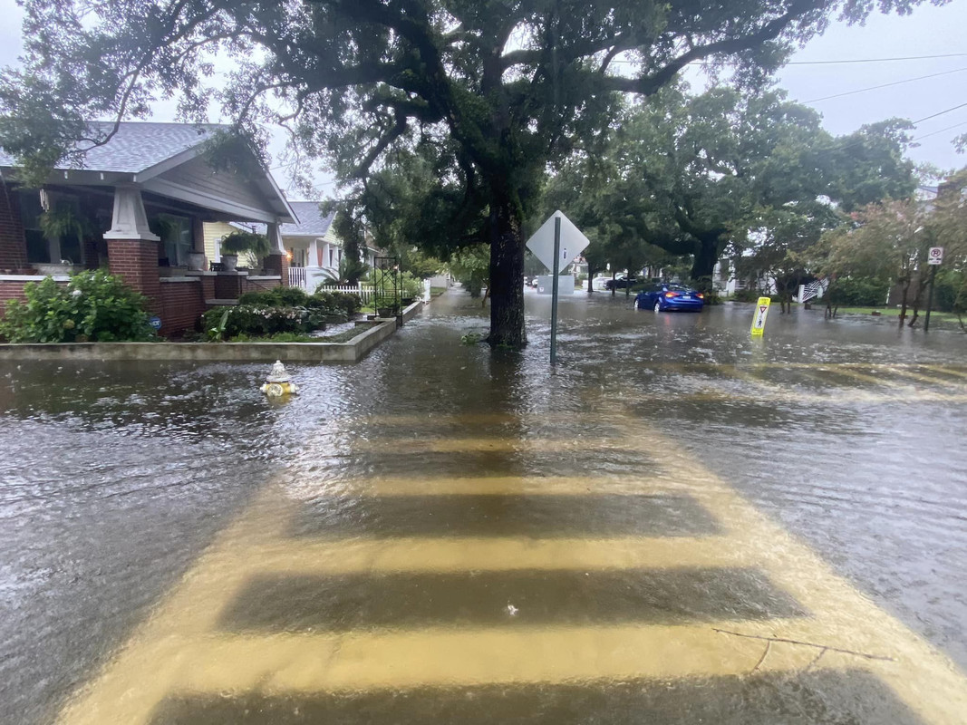
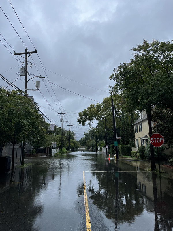
Some pictures from friends in other areas of the peninsula and while it’s flooded it doesn’t look too much worse than usual.
Upper peninsula by Maple and Rutledge
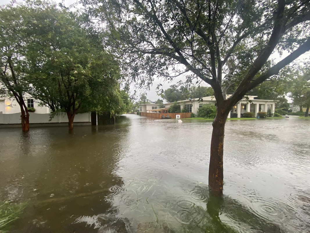
Queen St
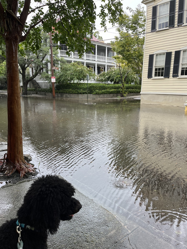
Franklin St
Upper peninsula by Maple and Rutledge
Queen St
Franklin St
 1
1


Posted on 8/6/24 at 11:07 am to Chucktown_Badger
Not that bad at all.
Posted on 8/6/24 at 11:13 am to The Boat
quote:
This was my prediction at work. A strengthening Cat 1 Debby vs a weakening “Cat 3” Idalia which should have been a Cat 1.
The only catch may be that the station at Horshoe Beach may have not yet been replaced, or at least the anemometer, and that may be a model-derived estimate of wind. Is so......come on NOAA, get your shite together.

Posted on 8/6/24 at 11:51 am to PsychTiger
quote:
Not that bad at all.
Yeah as long as they get regular breaks in rain its manageable
Posted on 8/6/24 at 11:53 am to PsychTiger
quote:
At 40 mph it’s barely a TS now, but looks like it’s about to get over water again. I’m no expert though like some on here, so I won’t speculate about Debby’s future.
Its sitting close to the coast where the water is at least 5° cooler than the gulf stream and will get colder the longer debby sits
Not the near ideal conditions debby had in eastern gulf

Posted on 8/6/24 at 11:57 am to Cosmo
Pretty quiet over here in Mt. Pleasant. Had some crazy lightning and thunder last night but hardly any flooding. Not even raining right now.
Posted on 8/6/24 at 12:09 pm to Cosmo
quote:
Its sitting close to the coast where the water is at least 5° cooler than the gulf stream and will get colder the longer debby sits
Just got out of the water near Myrtle Beach. Still a blistering 83. Nothing cold about that.
This post was edited on 8/6/24 at 12:10 pm
Posted on 8/6/24 at 12:19 pm to LegendInMyMind
Looks like there's a heavy band that is supposed to start coming in this afternoon hitting IOP up toward Georgetown. But doesn't look like we're in the crosshairs for that one 
Posted on 8/6/24 at 12:32 pm to Chucktown_Badger
Mom had 10" of rain on the south side of Savannah yesterday and nothing so far today per her rain gauge. No real wind issues in her part of the city.
Said she might get more later as they are between rain bands, but they don't seem to be making it east of I95. She's 8 miles east of the interstate
Said she might get more later as they are between rain bands, but they don't seem to be making it east of I95. She's 8 miles east of the interstate
This post was edited on 8/6/24 at 12:35 pm
Posted on 8/6/24 at 12:35 pm to Chucktown_Badger
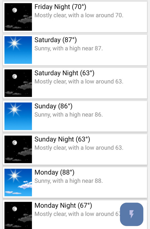
I don't want to get anyone too wound up, but it looks like we're gonna see a nice little mid-Summer cold front roll through this weekend. For some of us it should drop high temps into the low to mid 80s and provide noticeably less humidity. It also doesn't look to be too wet of a pattern with it. Should last a few days.
Posted on 8/6/24 at 12:36 pm to LegendInMyMind
quote:
For some of us it should drop high temps into the low to mid 80s and provide noticeably less humidity.
I want to believe
Posted on 8/6/24 at 12:45 pm to jaytothen
I’ve been checking cameras all over Charleston. Earlier this morning a street (Rutledge near MUSC) was flooded with an abandoned Mini Cooper in it. That street is now accessible with cars and people walking on the sidewalk. It doesn’t look too bad everywhere I’ve checked. It appears the roads are accessible other than the ones the authorities have purposely blocked prior to the storm.
Posted on 8/6/24 at 12:46 pm to LegendInMyMind
Im not seeing that for the deep south
Posted on 8/6/24 at 1:05 pm to Cosmo
quote:
Im not seeing that for the deep south
Look harder.
Posted on 8/6/24 at 1:06 pm to LegendInMyMind
Im showing a high of 97 saturday 

Posted on 8/6/24 at 1:51 pm to LegendInMyMind
quote:
Hurricane Debby
quote:
sustained wind, 72mph
Not a hurricane.
quote:
70mph sustained wind
Not a hurricane.
quote:
and the highest sustained wind officially measured with Idalia was just 2mph higher
Maybe a hurricane but def not Cat 3.
Posted on 8/6/24 at 2:15 pm to Cosmo
quote:
Im showing a high of 97 saturday
samesies, but at least it's a dry heat

Posted on 8/6/24 at 3:35 pm to Cosmo

Posted on 8/6/24 at 3:38 pm to Cosmo
quote:
Im showing a high of 97 saturday
That graphic is from the GFS which has been complete shite. I hope it happens but I don't trust it.
Euro, Icon nor CMC show the cooler temps getting to the deep south.
So if your your forecast app uses the GFS you will see it. If not your app won't show it.
This post was edited on 8/6/24 at 3:40 pm
Posted on 8/6/24 at 3:49 pm to CarolinaGamecock99
Dang looks like it inched up north. Myrtle and north of there is going to get all the rain.

 Page 47 of 49

Popular
Back to top