




- My Forums
- Tiger Rant
- LSU Recruiting
- SEC Rant
- Saints Talk
- Pelicans Talk
- More Sports Board
- Fantasy Sports
- Golf Board
- Soccer Board
- O-T Lounge
- Tech Board
- Home/Garden Board
- Outdoor Board
- Health/Fitness Board
- Movie/TV Board
- Book Board
- Music Board
- Political Talk
- Money Talk
- Fark Board
- Gaming Board
- Travel Board
- Food/Drink Board
- Ticket Exchange
- TD Help Board
Customize My Forums- View All Forums
- Show Left Links
- Topic Sort Options
- Trending Topics
- Recent Topics
- Active Topics
Started By
Message
re: Tornado! High Risk Day w/ 3 Active PDS Watches
Posted on 1/21/17 at 2:41 pm to rds dc
Posted on 1/21/17 at 2:41 pm to rds dc
Tornado watch coming soon for S. Louisiana
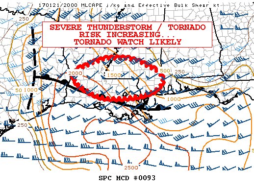
Mesoscale Discussion 0093
NWS Storm Prediction Center Norman OK
0234 PM CST Sat Jan 21 2017
Areas affected...Portions of southern MS...LA
Concerning...Severe potential...Tornado Watch likely
Valid 212034Z - 212300Z
Probability of Watch Issuance...80 percent
SUMMARY...The risk for severe thunderstorms capable of large hail,
damaging winds, and tornadoes will be increasing through the late
afternoon and into the evening. The issuance of a Tornado Watch is
likely within the next few hours.
DISCUSSION...The isallobaric response to 2-hour pressure falls on
the order of 2-4 mb across the lower MS Valley will be the continued
northward advance of a warm front analyzed approximately west-east
across southern LA. The air mass south of this boundary is
characterized by surface dewpoints in the middle 60s to around 70F,
supporting moderate to locally strong buoyancy -- aided by steep
midlevel lapse rates sampled by the 18Z Slidell sounding (around 8
C/km in the 700-500-mb layer). As this air mass continues to spread
northward within a modest warm-advection regime well in advance of
stronger deep ascent farther west, diurnally reduced capping and
modest ascent will likely support an increase in surface-based
thunderstorm development -- especially during the late afternoon and
evening as more vigorous ascent approaches. Initial shallow
convective towers are already evolving along the warm frontal zone
across parts of southern LA, in proximity to pockets of stronger
insolation, per visible imagery.
While there is some uncertainty regarding the timing of more robust
convective development given the aforementioned capping, effective
shear around 45-60 kt will likely support supercell structures.
Initially, large hail will be likely, though elongating/increasingly
curved low-level hodographs into the evening hours suggest that the
tornado risk will likely increase. Damaging winds will also be
possible in conjunction with small-scale, congealing convective
clusters.
..Cohen/Hart.. 01/21/2017
Mesoscale Discussion 0093
NWS Storm Prediction Center Norman OK
0234 PM CST Sat Jan 21 2017
Areas affected...Portions of southern MS...LA
Concerning...Severe potential...Tornado Watch likely
Valid 212034Z - 212300Z
Probability of Watch Issuance...80 percent
SUMMARY...The risk for severe thunderstorms capable of large hail,
damaging winds, and tornadoes will be increasing through the late
afternoon and into the evening. The issuance of a Tornado Watch is
likely within the next few hours.
DISCUSSION...The isallobaric response to 2-hour pressure falls on
the order of 2-4 mb across the lower MS Valley will be the continued
northward advance of a warm front analyzed approximately west-east
across southern LA. The air mass south of this boundary is
characterized by surface dewpoints in the middle 60s to around 70F,
supporting moderate to locally strong buoyancy -- aided by steep
midlevel lapse rates sampled by the 18Z Slidell sounding (around 8
C/km in the 700-500-mb layer). As this air mass continues to spread
northward within a modest warm-advection regime well in advance of
stronger deep ascent farther west, diurnally reduced capping and
modest ascent will likely support an increase in surface-based
thunderstorm development -- especially during the late afternoon and
evening as more vigorous ascent approaches. Initial shallow
convective towers are already evolving along the warm frontal zone
across parts of southern LA, in proximity to pockets of stronger
insolation, per visible imagery.
While there is some uncertainty regarding the timing of more robust
convective development given the aforementioned capping, effective
shear around 45-60 kt will likely support supercell structures.
Initially, large hail will be likely, though elongating/increasingly
curved low-level hodographs into the evening hours suggest that the
tornado risk will likely increase. Damaging winds will also be
possible in conjunction with small-scale, congealing convective
clusters.
..Cohen/Hart.. 01/21/2017
 1
1


Posted on 1/21/17 at 2:42 pm to rds dc
Another watch looks to be coming for Northwest Louisiana also.


Posted on 1/21/17 at 2:43 pm to Pedro
Posted on 1/21/17 at 2:50 pm to Pedro
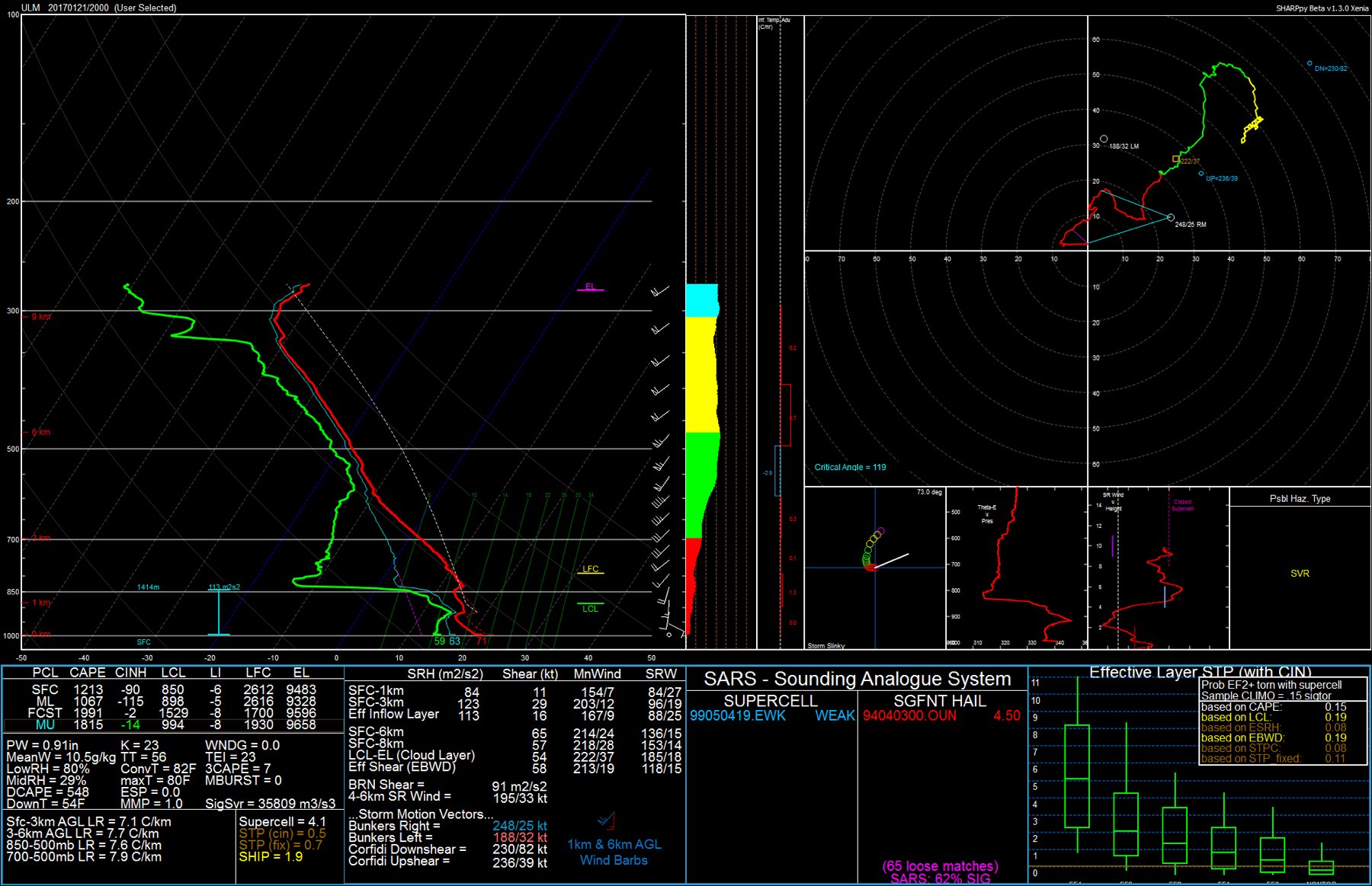
pretty decent profile. relatively nice eml with a good amount of cape and a bit of a backing wind profile wtih some speed sheer.
This post was edited on 1/21/17 at 2:51 pm

Posted on 1/21/17 at 2:52 pm to Pedro
quote:
pretty decent profile. relatively nice eml with a good amount of cape and a bit of a backing wind profile wtih some speed sheer.
Weather talk sounds like you're just making shite up. Again in English, for the rest of us.
This post was edited on 1/21/17 at 2:53 pm
Posted on 1/21/17 at 2:53 pm to lsuman25
quote:
Another watch looks to be coming for Northwest Louisiana also


Posted on 1/21/17 at 2:56 pm to TigerstuckinMS
Honestly I can hardly ever understand what they're saying in these threads.
Posted on 1/21/17 at 2:57 pm to im4LSU
I live in Petal. About a mile west of the Walmart.. But I'm at my parents in McComb.
Friend rode by and said I didn't have any damage.
Scary stuff man.
Stay safe
Friend rode by and said I didn't have any damage.
Scary stuff man.
Stay safe
Posted on 1/21/17 at 2:58 pm to Pedro
quote:
pretty decent profile. relatively nice eml with a good amount of cape and a bit of a backing wind profile wtih some speed sheer.
That should help keep coverage down but may allow for one or two dominate cells to really get going across S. La. Kind of like the 18z 3k NAM.

ETA: I thought that was the 18z LIX but after looking at it more, noticed the differences and then saw it was a 20z from ULM
This post was edited on 1/21/17 at 3:04 pm
Posted on 1/21/17 at 2:58 pm to TigerstuckinMS
cape is the energy available in the atmosphere. high cape = higher likelyhood for severe weather. backing profile = warm air advection = rising air = good chance for storms. sheer is needed for tornadic activity. the sheer isnt really that strong but its there. the main concern from this over NELA out towards jackson will likely be large hail.

Posted on 1/21/17 at 3:01 pm to Pedro
quote:
cape is the energy available in the atmosphere. high cape = higher likelyhood for severe weather. backing profile = warm air advection = rising air = good chance for storms. sheer is needed for tornadic activity. the sheer isnt really that strong but its there. the main concern from this over NELA out towards jackson will likely be large hail.

Posted on 1/21/17 at 3:18 pm to rds dc
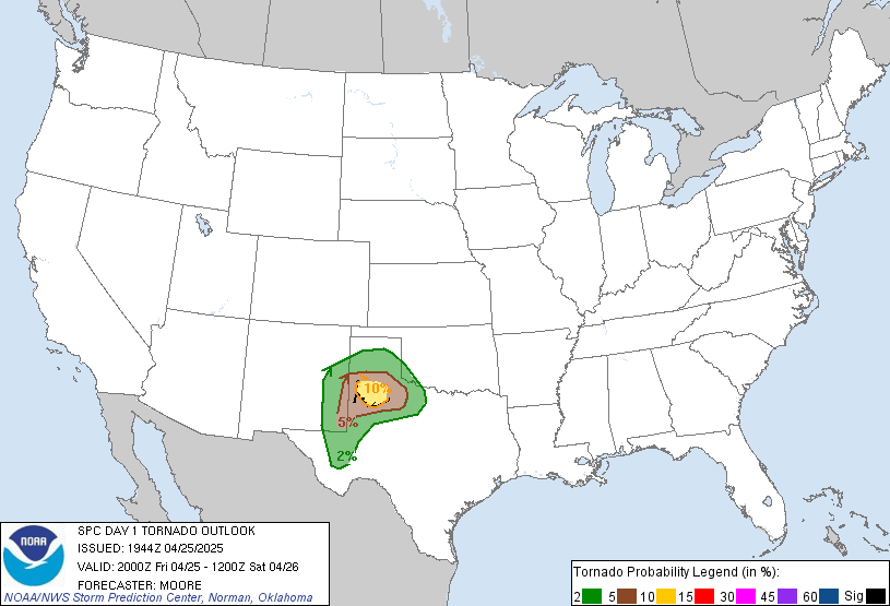
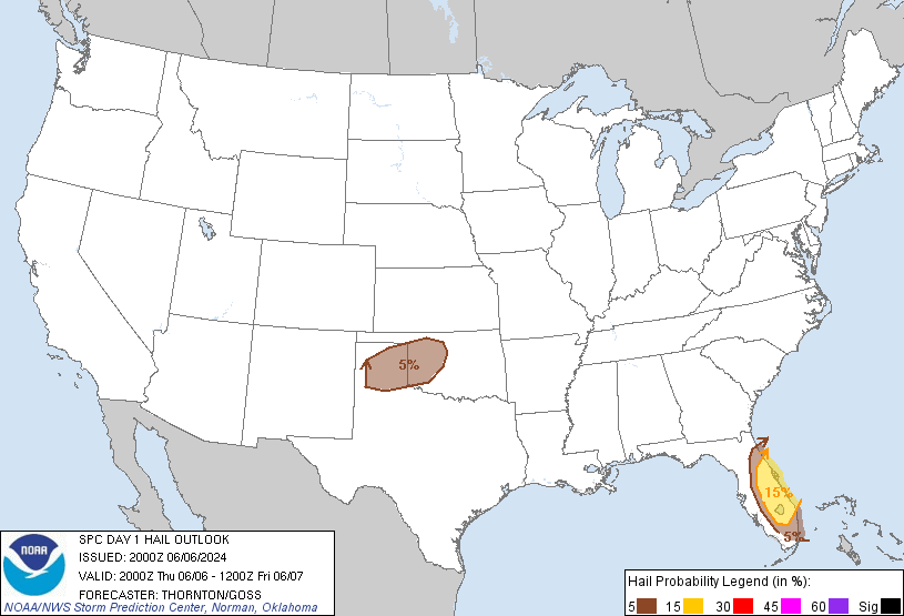
SPC Afternoon Update:
quote:
...LA/MS/AL/GA This Evening and Tonight... Considerable uncertainty exists regarding the evolution of the remnant outflow boundary from this morning's convection and the re-development of thunderstorms tonight over this area. Forecast soundings indicate that the combination of sufficient instability, ample low level moisture, and significant low level vertical shear will promote a tornado risk in any storms that form. A few models suggest another active round of severe storms affecting areas similar to this mornings storms. Therefore will maintain the Enhanced Risk area with minimal changes.
Posted on 1/21/17 at 3:21 pm to Pedro
So Jackson is really only looking at hail today and tonight?
Posted on 1/21/17 at 3:21 pm to SabiDojo
quote:
Honestly I can hardly ever understand what they're saying in these threads.
I used to be able to follow them pretty well, but lately I have also been kinda lost.


Posted on 1/21/17 at 3:24 pm to TigerstuckinMS
I don't know if there have been any confirmed tornadoes today as the system from earlier this morning moved across Alabama, GA, and into SC. That being said, watching the warnings go off across the northern end of the bow echo that accompanied the line of storms has been like clockwork all day. Every spinoff gets a warning, as it should.


Posted on 1/21/17 at 3:25 pm to SabiDojo
quote:
So Jackson is really only looking at hail today and tonight?
My guess would be later tonight if any. There's not much developing west of the Mississippi right now, but that will probably change after the sun goes down and the temps start dropping again. It's showing an estimated time of 11:00pm here, so I'd say about 8-9pm it starts ramping up in western LA and begins pushing eastward.
Posted on 1/21/17 at 3:26 pm to Spankum
quote:
I used to be able to follow them pretty well, but lately I have also been kinda lost.
I don't have a clue what they're discussing in all of the forecasts. All I can do is read a map and post screenshots fairly efficiently.

Posted on 1/21/17 at 3:29 pm to slackster
It all basically comes down to how much is there to promote lift and how the wind speeds and direction differ with height. Lift plus spin is what promotes supercells.


Posted on 1/21/17 at 3:35 pm to Spankum
Next time these frickers ask for mechanic help I'm going to hit them with the heavy shite.

 Page 9 of 27

Popular
Back to top
 Follow TigerDroppings for LSU Football News