




- My Forums
- Tiger Rant
- LSU Recruiting
- SEC Rant
- Saints Talk
- Pelicans Talk
- More Sports Board
- Fantasy Sports
- Golf Board
- Soccer Board
- O-T Lounge
- Tech Board
- Home/Garden Board
- Outdoor Board
- Health/Fitness Board
- Movie/TV Board
- Book Board
- Music Board
- Political Talk
- Money Talk
- Fark Board
- Gaming Board
- Travel Board
- Food/Drink Board
- Ticket Exchange
- TD Help Board
Customize My Forums- View All Forums
- Show Left Links
- Topic Sort Options
- Trending Topics
- Recent Topics
- Active Topics
Started By
Message

 1
1

Posted on 1/21/17 at 6:58 am to tigerinthebueche
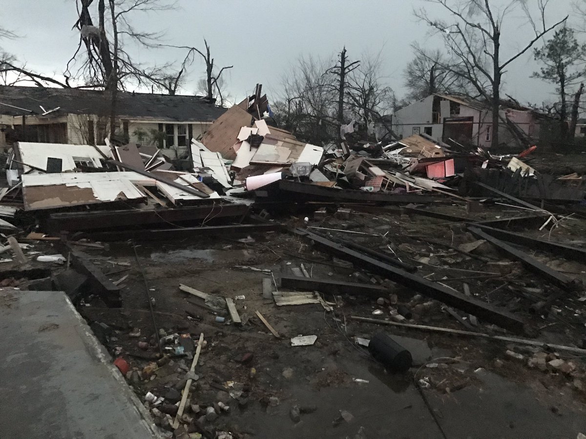
Four confirmed dead in Hattiesburg. Death toll is expected to rise.


Posted on 1/21/17 at 7:55 am to jdutch75
quote:
Four confirmed dead in Hattiesburg. Death toll is expected to rise.
Jesus. I live in Hattiesburg and slept through all the warnings


Posted on 1/21/17 at 8:19 am to Riseupfromtherubble
Consider yourself lucky! That had to be a big tornado that came through.

Posted on 1/21/17 at 8:24 am to Riseupfromtherubble
quote:
Jesus. I live in Hattiesburg and slept through all the warnings
We're in Oak Grove and I have no idea how you slept through that.
First alarms went off at 3:30ish here and we were up until 5 just waiting.
We were lucky, but some friends in Petal weren't so lucky.

Posted on 1/21/17 at 8:26 am to Riseupfromtherubble
quote:
Jesus. I live in Hattiesburg and slept through all the warnings
quote:
Riseupfromtherubble
Nice screenname/post combo.

Posted on 1/21/17 at 8:40 am to urinetrouble
Tornado warning here in Auburn.
Posted on 1/21/17 at 8:40 am to TTsTowel
William Carey suffered a lot of damage last night. It doesn't look good. Students were on campus too which is even scarier


Posted on 1/21/17 at 8:53 am to slackster
quote:
Yeesh.

That is scary looking...
Posted on 1/21/17 at 8:56 am to rds dc
Tend so far today has been a slight westward shift of the threat towards N. Louisiana

Posted on 1/21/17 at 9:10 am to rds dc
Here is the early track estimate, right through town.



Posted on 1/21/17 at 9:16 am to rds dc
Man Prayers to all in Hattisburg, that scares the crap out of me
Posted on 1/21/17 at 9:24 am to Tiger Nation 84
For later today, notice how cells don't build into a line right away. Tornado threat could actually be higher today given more isolated look, a lot depends on how mesoscale features develop today.

Posted on 1/21/17 at 9:25 am to rds dc
So this crap isn't even over with? Jeez man, our weather is the worst


Posted on 1/21/17 at 9:42 am to rds dc
Isn't it strange to have 2 separate enhanced zones so close together?

Posted on 1/21/17 at 9:45 am to rds dc
The Hattisburg area got hit pretty bad with tornadoes overnight
Posted on 1/21/17 at 9:49 am to East Coast Band
quote:
Isn't it strange to have 2 separate enhanced zones so close together?
Not with these very energetic systems. A wave of energy kicked out across Louisiana last night and is now moving into Alabama (orange and yellow blob) with storms out in front. The next wave of energy is back over Texas and will kick off storms later today as it moves east towards Louisiana.


Posted on 1/21/17 at 10:10 am to im4LSU
quote:
We're in Oak Grove and I have no idea how you slept through that.
First alarms went off at 3:30ish here and we were up until 5 just waiting.
That is where they fricked up IMO. Hell, just check this thread - at 3:26 it was pretty clear there was a radar indicated tornado tracking towards Hattiesburg. The NWS didn't issue the warning for Hattiesburg until 3:36 with an announcement it would be in Hattiesburg by 3:40. They could have given a bit more notice.

 Page 7 of 27

Popular
Back to top
 Follow TigerDroppings for LSU Football News