




 0
0






- My Forums
- Tiger Rant
- LSU Recruiting
- SEC Rant
- Saints Talk
- Pelicans Talk
- More Sports Board
- Fantasy Sports
- Golf Board
- Soccer Board
- O-T Lounge
- Tech Board
- Home/Garden Board
- Outdoor Board
- Health/Fitness Board
- Movie/TV Board
- Book Board
- Music Board
- Political Talk
- Money Talk
- Fark Board
- Gaming Board
- Travel Board
- Food/Drink Board
- Ticket Exchange
- TD Help Board
Customize My Forums- View All Forums
- Show Left Links
- Topic Sort Options
- Trending Topics
- Recent Topics
- Active Topics
Started By
Message
re: Hurricane Season - NHC 92L in BOC 80%
Posted on 10/5/26 at 12:25 pm to rds dc
Posted on 10/5/26 at 12:25 pm to rds dc
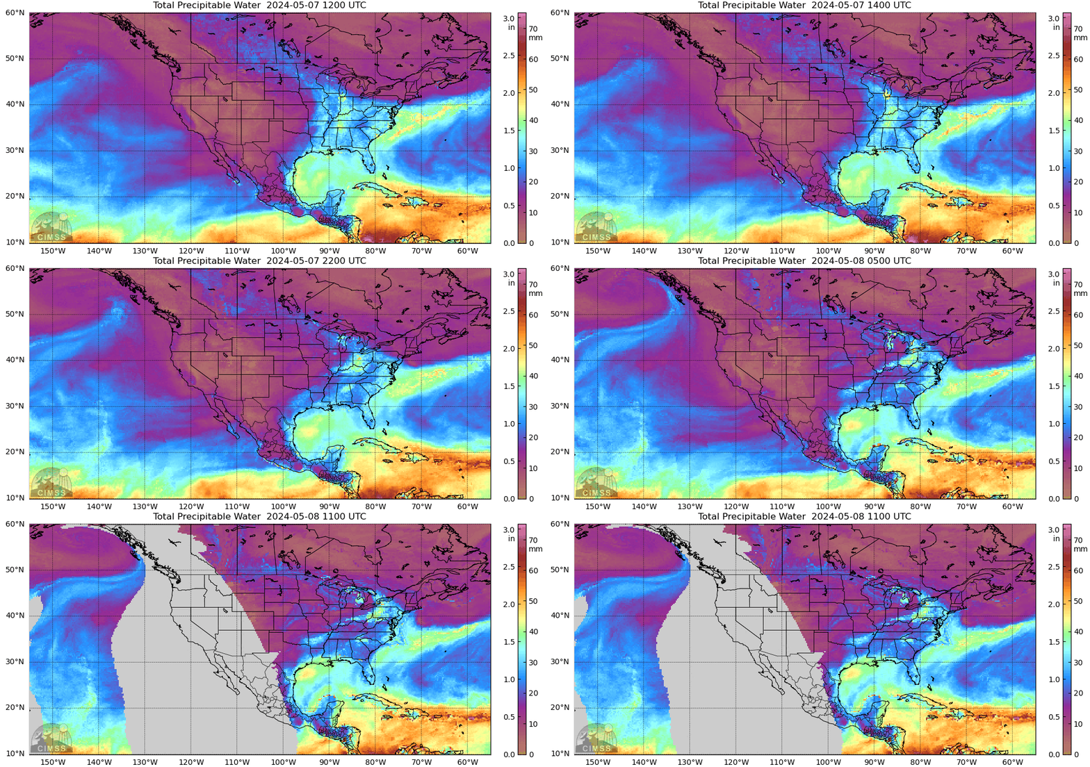
Clear line between the fall weather in the rest of the US and the continuation of the normal 5 month summer along the Gulf coast.
Can also see where the moisture is gathering in the BOC for whatever mess will eventually move north and northeast.
And Rachel is a big circulation off of Pacific coast of Mexico.
Can also see where the moisture is gathering in the BOC for whatever mess will eventually move north and northeast.
And Rachel is a big circulation off of Pacific coast of Mexico.
Posted on 10/5/26 at 12:34 pm to paperwasp
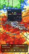
Just like 10 inches of rain was hitting this past weekend and we were going to flood several feet.

Posted on 10/5/26 at 12:35 pm to GEAUXT
quote:
So these are showing something hitting around Saturday?
Yes, but there is a "competing" front that may push southward near the coast, complicating things.
It will most likely weaken, and steering currents could drive it elsewhere. Even if a strong storm is avoided, heavy rains may affect the Gulf Coast.
As usual, we won't know until these models resolve, closer to the weekend. Best thing to do now is just be aware.
Loading Twitter/X Embed...
If tweet fails to load, click here.Posted on 10/5/26 at 12:42 pm to paperwasp
If i had a gun to my hand asking landfall location given the current set up the models are showing, its going to go more East than anticipated. So between MS/AL border,Mobile and Destin.
Posted on 10/5/26 at 12:48 pm to paperwasp
The big thing the models agree on is that there will be that front hugging the coast this weekend
That gives a good chance of this thing catching strong westerly shear and merging with that front
That gives a good chance of this thing catching strong westerly shear and merging with that front
This post was edited on 10/5/26 at 12:50 pm
Posted on 10/5/26 at 12:48 pm to gaetti15
Damn it. Going camping on Friday for a week in Chattanooga area
Posted on 10/5/26 at 12:50 pm to DVinBR
quote:
That gives a good chance of this thing catching strong easterly shear and merging with that front
Yeah I think its going to be very zeta like not saying itll be cat 3 at landfall)
This post was edited on 10/5/26 at 12:51 pm
Posted on 10/5/26 at 12:50 pm to gaetti15
quote:
If i had a gun to my hand asking landfall location given the current set up the models are showing, its going to go more East than anticipated. So between MS/AL border,Mobile and Destin.
Chicken ought to open a weather betting site.
Between this and the other big bet on page 1, Chicken could cash in.
Posted on 10/5/26 at 12:51 pm to Tarps99
quote:
Chicken ought to open a weather betting site.
Between this and the other big bet on page 1, Chicken could cash in.
At the same time you'll shite on the weatherman too

Posted on 10/5/26 at 12:51 pm to gaetti15
TD crypto coin!!
Posted on 10/5/26 at 12:54 pm to gaetti15
quote:
its going to go more East than anticipated
I think that's a logical guess.
Levi Cowan believes it depends on an upper shortwave coming out of Texas (see below).


If the storm moves north quickly it could intensify because of that, and if it's slower, the shortwave could eventually dissipate and force the storm to hang around the Gulf for a while (maybe into next week).
Posted on 10/5/26 at 12:56 pm to PUB
quote:
Just like 10 inches of rain was hitting this past weekend and we were going to flood several feet.
Posted on 10/5/26 at 12:59 pm to Cosmo
quote:
Amateur
Shoulda booked punta cana
We have use of a friend's beach house in Rosemary Beach for free. We couldn't pass that up.
Posted on 10/5/26 at 1:15 pm to paperwasp
quote:
If the storm moves north quickly it could intensify because of that, and if it's slower, the shortwave could eventually dissipate and force the storm to hang around the Gulf for a while (maybe into next week).
so how does this have Cancun looking from Friday to next Tuesday?
Posted on 10/5/26 at 1:15 pm to Cosmo
quote:
12z gfs with a cat 1 into biloxi
12z Euro much slower with a weak system.
Split the difference

Posted on 10/5/26 at 1:21 pm to trussthetruzz
Just bring on a cool front in a hurry.
This post was edited on 10/5/26 at 1:22 pm
Posted on 10/5/26 at 1:26 pm to GCTigahs
quote:
tuna fish
You can just get that at the store, yeah?
Posted on 10/5/26 at 1:28 pm to Cosmo
Gfs is the only model showing a hurricane. Could it be a hurricane sure but most models have this a tropical storm mess at best. A lot will change in the next few days
This post was edited on 10/5/26 at 1:30 pm
Posted on 10/5/26 at 1:29 pm to Ace Midnight
Going east and may get to a tropical storm.
Posted on 10/5/26 at 1:38 pm to dukke v
frick

 Page 6 of 7



Popular

Back to top
 Follow TigerDroppings for LSU Football News