




- My Forums
- Tiger Rant
- LSU Recruiting
- SEC Rant
- Saints Talk
- Pelicans Talk
- More Sports Board
- Fantasy Sports
- Golf Board
- Soccer Board
- O-T Lounge
- Tech Board
- Home/Garden Board
- Outdoor Board
- Health/Fitness Board
- Movie/TV Board
- Book Board
- Music Board
- Political Talk
- Money Talk
- Fark Board
- Gaming Board
- Travel Board
- Food/Drink Board
- Ticket Exchange
- TD Help Board
Customize My Forums- View All Forums
- Show Left Links
- Topic Sort Options
- Trending Topics
- Recent Topics
- Active Topics
Started By
Message
re: Storm Tracking: Bertha - It's Over
Posted on 7/18/26 at 8:52 pm to Macintosh

Posted on 7/18/26 at 8:52 pm to Macintosh
quote:
How long before incest 91 becomes a named storm
Only if it hits Alabama will it get a name.
If it is an incest you may not get hit with a named storm deductible if you have damage.
On the other hand, watch out for the police and Chris Hansen, they may like to have a word with you.
This post was edited on 7/18/26 at 8:53 pm
 1
1


Posted on 7/18/26 at 9:34 pm to rds dc
Leaving Tuesday to bring the RV down to Gulf shores. How shitty is my week going to be?
Posted on 7/18/26 at 9:36 pm to Tarps99


Posted on 7/19/26 at 6:09 am to Mister Hoagie
I think this one over performs if it stays over water
Northeastern gulf is really warm, above average SSTs right now and very low shear environment
Northeastern gulf is really warm, above average SSTs right now and very low shear environment
Posted on 7/19/26 at 6:12 am to trussthetruzz
quote:
Is this gonna move due West? Nothing to pull it north into LA?
High pressure ridge will block northward movement
Posted on 7/19/26 at 6:26 am to deltaland
Tropical Weather Outlook
NWS National Hurricane Center Miami FL
800 AM EDT Sun Jul 19 2026
For the North Atlantic...Caribbean Sea and the Gulf of America:
Northern Gulf of America and near Florida (AL91):
An area of low pressure located over the northeastern Gulf of
America continues to become better defined and the associated shower
and thunderstorm activity is gradually increasing. Continued
gradual development is expected, and a tropical depression is likely
to form later today or on Monday as the system moves slowly
northward or northwestward. Interests along the northern Gulf coast
from Florida, Alabama, Mississippi, and Louisiana should monitor
the progress of this system, as tropical storm watches or warnings
could be required for portions of the area later today. In
addition, this system is expected to bring heavy rains to portions
of the northern Gulf coast during the next several days. An Air
Force Reserve reconnaissance aircraft is scheduled to investigate
the low pressure area later today.
* Formation chance through 48 hours...high...80 percent.
* Formation chance through 7 days...high...80 percent.
NWS National Hurricane Center Miami FL
800 AM EDT Sun Jul 19 2026
For the North Atlantic...Caribbean Sea and the Gulf of America:
Northern Gulf of America and near Florida (AL91):
An area of low pressure located over the northeastern Gulf of
America continues to become better defined and the associated shower
and thunderstorm activity is gradually increasing. Continued
gradual development is expected, and a tropical depression is likely
to form later today or on Monday as the system moves slowly
northward or northwestward. Interests along the northern Gulf coast
from Florida, Alabama, Mississippi, and Louisiana should monitor
the progress of this system, as tropical storm watches or warnings
could be required for portions of the area later today. In
addition, this system is expected to bring heavy rains to portions
of the northern Gulf coast during the next several days. An Air
Force Reserve reconnaissance aircraft is scheduled to investigate
the low pressure area later today.
* Formation chance through 48 hours...high...80 percent.
* Formation chance through 7 days...high...80 percent.

Posted on 7/19/26 at 6:28 am to rds dc
Looks like it will be a fun week. 

Posted on 7/19/26 at 6:37 am to rds dc
Reminder that the GRAF, NAMs, and short range hi-res models aren't really useful at this point. Hurricane and global models are the best bet.
Posted on 7/19/26 at 6:42 am to rds dc
I've only ever followed storms on here and dont recall a storm just form in the gulf rather than run the conveyor belt from CV. Is this really that common?
Posted on 7/19/26 at 6:44 am to UncleFestersLegs
quote:
I've only ever followed storms on here and dont recall a storm just form in the gulf rather than run the conveyor belt from CV. Is this really that common?
Not common but not rare.

Posted on 7/19/26 at 6:53 am to UncleFestersLegs
quote:
I've only ever followed storms on here and dont recall a storm just form in the gulf rather than run the conveyor belt from CV. Is this really that common?
Pretty standard for early season systems to have a genesis pathway that isn't the result of an AEW. That's one of the reasons they are often sloppy and slow to organize.
Posted on 7/19/26 at 6:59 am to DownHome
quote:
Looks like it will be a fun week.
Sticky time.
Posted on 7/19/26 at 7:44 am to rds dc
quote:
Reminder that the GRAF, NAMs, and short range hi-res models aren't really useful at this point. Hurricane and global models are the best bet
There are dozens of local station meteorologists showing these models right now telling their viewers this is what the storm is going to
Some met from se la or Miss - last name Allen is on fb saying he expects a hurricane to be approaching se la by mid week and the reason he gave was he just “could sense it”
This post was edited on 7/19/26 at 7:45 am
Posted on 7/19/26 at 7:45 am to Tarps99
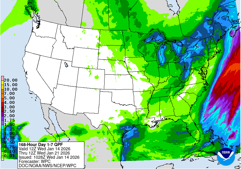
So how’s New Orleans looking? Flooding rains coming again?

Posted on 7/19/26 at 7:47 am to Mockingbird2008
quote:
So how’s New Orleans looking? Flooding rains coming again?
A light drizzle can flood a New Orleans neighborhood.
Posted on 7/19/26 at 7:56 am to Midtiger farm
quote:
Allen is on fb saying he expects a hurricane to be approaching se la by mid week and the reason he gave was he just “could sense it”
"Follow me for more info"
Posted on 7/19/26 at 7:56 am to Midtiger farm
Recon going in later will hopefully help with the models going forward
Posted on 7/19/26 at 7:58 am to Mockingbird2008
Posted on 7/19/26 at 8:09 am to Midtiger farm
quote:
Some met from se la or Miss - last name Allen is on fb saying he expects a hurricane to be approaching se la by mid week and the reason he gave was he just “could sense it”
I guess it's possible, but the system would have to rapidly organize over the next 24 hours. Then, a deeper, more organized system probably takes on a more SW motion, and may miss Louisiana to the south before heading towards Texas. However, dry air and northerly shear over the next couple of days probably result in more slow, steady organization than rapid organization.
Posted on 7/19/26 at 8:09 am to Midtiger farm
quote:
Some met from se la or Miss - last name Allen is on fb saying he expects a hurricane to be approaching se la by mid week and the reason he gave was he just “could sense it”
He must post here

 Page 5 of 38

Popular
Back to top
 Follow TigerDroppings for LSU Football News