




 0
0





- My Forums
- Tiger Rant
- LSU Recruiting
- SEC Rant
- Saints Talk
- Pelicans Talk
- More Sports Board
- Fantasy Sports
- Golf Board
- Soccer Board
- O-T Lounge
- Tech Board
- Home/Garden Board
- Outdoor Board
- Health/Fitness Board
- Movie/TV Board
- Book Board
- Music Board
- Political Talk
- Money Talk
- Fark Board
- Gaming Board
- Travel Board
- Food/Drink Board
- Ticket Exchange
- TD Help Board
Customize My Forums- View All Forums
- Show Left Links
- Topic Sort Options
- Trending Topics
- Recent Topics
- Active Topics
Started By
Message
re: Hurricane Isaias - Pensacola Beach to Navarre Beach Under the Gun
Posted on 10/9/26 at 10:43 am to NorthEndZone
Posted on 10/9/26 at 10:43 am to NorthEndZone
quote:
That's the problem with trees. If they are weak or diseased, all it takes is about 50 mph or so gust to break a limb or stronger gusts snap the tree and then there goes power, if it is near a line.
Hurricanes are like the 2011 LSU offensive line. Trees can handle strong winds, but it's the several hours of strong winds that pound on the trees and before you know it Kenny Hilliard scored again and the power is out.
This post was edited on 10/9/26 at 10:47 am
Posted on 10/9/26 at 10:43 am to deltaland
Damn storm is putting up a wall against that shear and dry air like frick you bitch I finna wreck
—-
You can even see it expanding out. That surely isn’t good
Posted on 10/9/26 at 10:44 am to Triple Bogey
Anyone ever been in one of those high rise condos during a storm. Always wondered what it was like seeing s storm come in from one of the top levels.
We were just in Pensacola at the Beach Club Condos, pretty solid place with Cat 4 window ratings, and garage parking. Would be pretty interesting to see it come in from there.
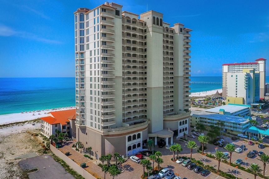
We were just in Pensacola at the Beach Club Condos, pretty solid place with Cat 4 window ratings, and garage parking. Would be pretty interesting to see it come in from there.
This post was edited on 10/9/26 at 10:49 am
Posted on 10/9/26 at 10:44 am to deltaland
quote:
AI nailed it from the beginning
OK…so that puts landfall east of Pcola, correct?
Posted on 10/9/26 at 10:44 am to Ten Bears
Yes.
Posted on 10/9/26 at 10:45 am to Ten Bears
AI nailed Milton a few years ago. That initial track was practically right on top of where we live and that's essentially where he came through.
Long night.
Long night.
Posted on 10/9/26 at 10:46 am to sicboy
Back to my earlier question, any chance this gets to a Cat 4? It's already a 3 and still a bit to go before landfall. Is the sheer doing anything to it?
Posted on 10/9/26 at 10:49 am to sicboy
What's the timeline prediction for this thing over land? When will it get to East TN (where I am) and Lexington?
Posted on 10/9/26 at 10:51 am to Cosmo
quote:
Thought i read there was a mandatory evac for tourists?
It is but, idiots

Posted on 10/9/26 at 10:53 am to CatfishJohn
NHC is showing it passing through central/east Tennessee late Saturday night and making it's way to east Kentucky Sunday morning.
ETA Had my directions backwards, sorry.
ETA Had my directions backwards, sorry.
This post was edited on 10/9/26 at 10:56 am
Posted on 10/9/26 at 10:55 am to Triple Bogey
Call the police to go move them from the property...
Bet they dont try this shite twice.
Bet they dont try this shite twice.
Posted on 10/9/26 at 10:55 am to NorthEndZone
Shout out to the crew of AF309 Mission #12 into Isaias...
First data report was at 1:37 AM CDT this morning.
Last data report was at 10:36 AM CDT.
9 hours of data and more than that in the air.
Most of that time in the actual storm since it was relatively close to the base.
6 center fixes
27 dropsondes launched


First data report was at 1:37 AM CDT this morning.
Last data report was at 10:36 AM CDT.
9 hours of data and more than that in the air.
Most of that time in the actual storm since it was relatively close to the base.
6 center fixes
27 dropsondes launched
Posted on 10/9/26 at 10:55 am to Yellerhammer5
quote:
Some people have family homes with decades of memories tied up in them or are actually local to the area.
The home I grew up in was wiped away by Katrina. I still have those memories.
Posted on 10/9/26 at 10:56 am to Tigahs24Seven
quote:
Call the police to go move them from the property...
Bet they dont try this shite twice.
Settle down, Karen. Thy aren't getting there until Sunday.
Posted on 10/9/26 at 10:56 am to sicboy
quote:
Back to my earlier question, any chance this gets to a Cat 4? It's already a 3 and still a bit to go before landfall. Is the sheer doing anything to it?
IMO its about at its peak. The UL is really starting to dig in on it.
Posted on 10/9/26 at 10:57 am to Duke
I have an 80 year old aunt in Miramar. She’s riding it out but you can’t tell this woman anything.
Posted on 10/9/26 at 10:58 am to dhuck20
Last few satellite frames look like it’s starting to get sheared.
Posted on 10/9/26 at 10:59 am to dhuck20
quote:
I have an 80 year old aunt in Miramar. She’s riding it out but you can’t tell this woman anything.
Is Miramar even supposed to get anything?
Posted on 10/9/26 at 10:59 am to LSUdude247
quote:
Is Miramar even supposed to get anything?
Well Cantore is there now, so there's that...
Posted on 10/9/26 at 11:02 am to dhuck20
quote:
I have an 80 year old aunt in Miramar. She’s riding it out but you can’t tell this woman anything.
A group of my neighbors are staying. Hwy 98 south to the beach is the highest point. North of 98 Closer to the bay might get some water from the backside.

 Page 128 of 130



Popular

Back to top
 Follow TigerDroppings for LSU Football News