- My Forums
- Tiger Rant
- LSU Recruiting
- SEC Rant
- Saints Talk
- Pelicans Talk
- More Sports Board
- Fantasy Sports
- Golf Board
- Soccer Board
- O-T Lounge
- Tech Board
- Home/Garden Board
- Outdoor Board
- Health/Fitness Board
- Movie/TV Board
- Book Board
- Music Board
- Political Talk
- Money Talk
- Fark Board
- Gaming Board
- Travel Board
- Food/Drink Board
- Ticket Exchange
- TD Help Board
Customize My Forums- View All Forums
- Show Left Links
- Topic Sort Options
- Trending Topics
- Recent Topics
- Active Topics
Started By
Message
re: YNP temporarily closing
Posted on 6/13/22 at 3:29 pm to Abstract Queso Dip
Posted on 6/13/22 at 3:29 pm to Abstract Queso Dip
quote:
In the 24 hours before mid-day Monday, more than two inches of rain fell on several cities near Yellowstone, such as: Quadrant, Wyoming (2.68 inches); West Yellowstone, Montana (2.11 inches); Soda Butte, Montana (2.82 inches); and Gardiner, Montana (1.29 inches).
So an afternoon thunderstorm in LA.
It's so interesting how the climate/weather is so different in different parts of the US.
 2
2

Posted on 6/13/22 at 3:37 pm to Abstract Queso Dip
quote:
YNP
Is it generally known by this acronym? Had no clue what the post was referencing until I opened the thread
Posted on 6/13/22 at 3:39 pm to Abstract Queso Dip
Welp. We are flying there in Friday.

Posted on 6/13/22 at 3:41 pm to ThatsMyQB
quote:
Welp. We are flying there in Friday.
Where y'all flying in to?
Posted on 6/13/22 at 3:51 pm to HempHead
Bozeman to be closer to Glacier.
Posted on 6/13/22 at 3:54 pm to ThatsMyQB
Flying in Saturday. Planned to head to YNP, but not sure now
Posted on 6/13/22 at 3:59 pm to ThatsMyQB
Good luck at Glacier. Isnt most of it closed?
Posted on 6/13/22 at 4:02 pm to ThatsMyQB
quote:
Bozeman to be closer to Glacier.
Y'all will probably pass through Missoula on the way, unless you take the Seeley Lake path out of Helena. If you do, I'll be there for work, and I'd be happy to be a short-term guide.
Posted on 6/13/22 at 4:16 pm to Abstract Queso Dip
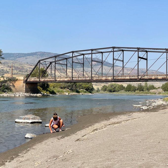
We are up here now in Cody, was supposed to head into the park tomorrow but yes all entrances are closed. Started driving up from Louisiana on Friday so looks like we will be hitting the Tetons a day early. We have been planning this trip over a year….what luck.
This post was edited on 6/13/22 at 4:27 pm
Posted on 6/13/22 at 4:22 pm to cryptkeeper
quote:
planning this trip over a year….hat luck.
You wearing a "daddy" hat?
Posted on 6/13/22 at 4:25 pm to dobiegil
Glacier was open late I checked. They are making everyone mask up again.
Posted on 6/13/22 at 4:29 pm to ThatsMyQB
Lol I was there Thursday and none of the Xanterra outlets, at least on the east entrance, required masking. Even if they did, I don't think anyone gives a damn about enforcement. The only folks in the state who wear masks are the "special" idiots in Missoula.
Posted on 6/13/22 at 4:33 pm to Abstract Queso Dip
Headed up in August. Will hit Y'stone and Glacier.
Posted on 6/13/22 at 5:40 pm to HempHead
Will any of this water make its way down to the Colorado river to help with the lake mead problem
Posted on 6/13/22 at 5:45 pm to deltaland
Yellowstone National Park twitter video of helicopter showing damage from a few minutes ago
It looks like some cars are trapped on the highway.
More video
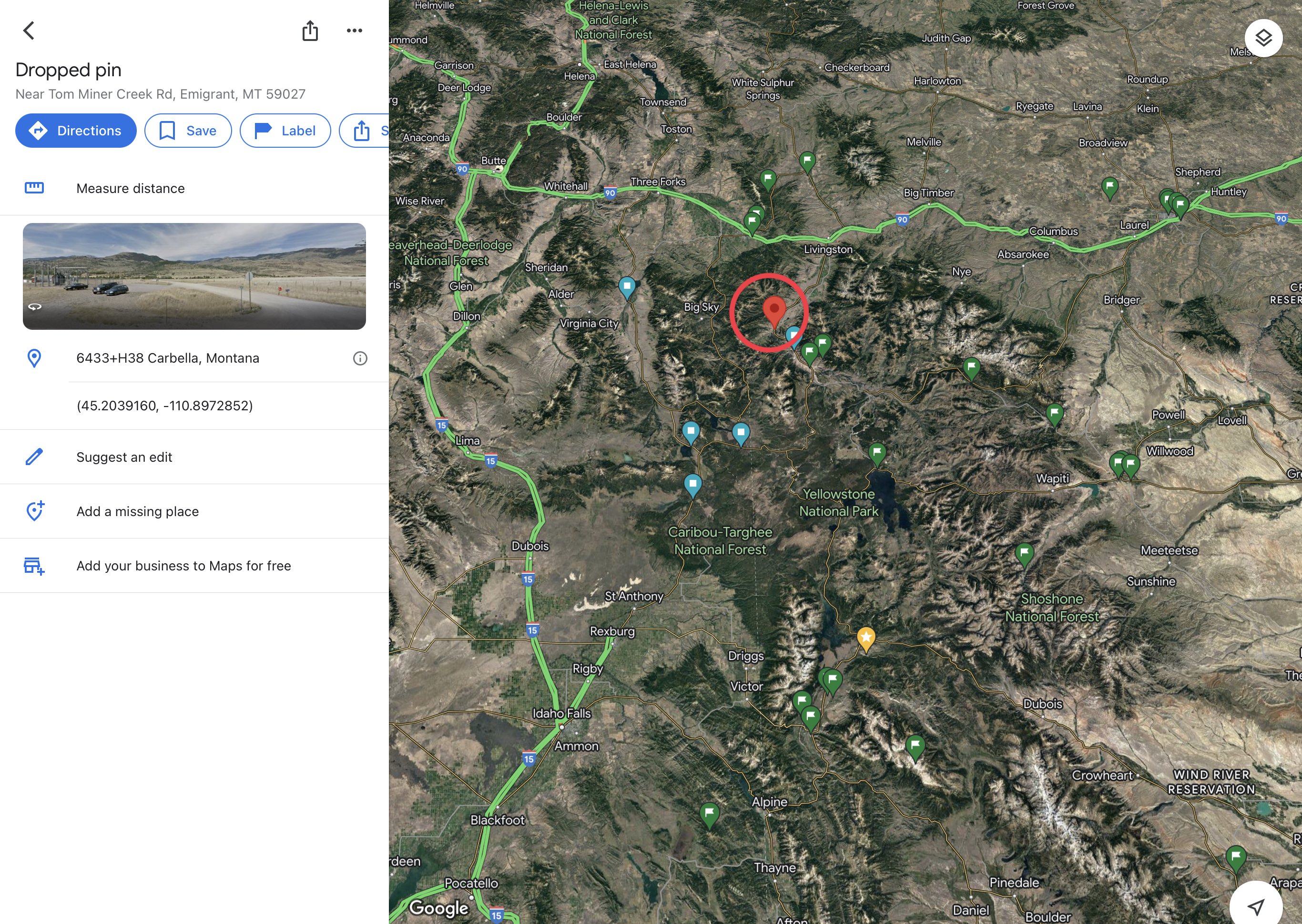
Carbella Bridge on Tom Minor Road
Bridge across the Yellowstone River washes away (Video)
Picture of a house in Gardiner, Mt.

Video of the same house as its deck falls into the River
STATEMENT from Supt. Cam Sholly about temporarily closing all park entrances: “Due to record flooding events in the park and more precipitation in the forecast, we have made the decision to close Yellowstone to all inbound visitation.
SUVs trying to get out of Yellowstone as the waters cut off one of their evacuation routes
Rock Creek Road flooding into Red Lodge


City of Red Lodge flooded
It looks like some cars are trapped on the highway.
More video
Carbella Bridge on Tom Minor Road
Bridge across the Yellowstone River washes away (Video)
Picture of a house in Gardiner, Mt.
Video of the same house as its deck falls into the River
STATEMENT from Supt. Cam Sholly about temporarily closing all park entrances: “Due to record flooding events in the park and more precipitation in the forecast, we have made the decision to close Yellowstone to all inbound visitation.
SUVs trying to get out of Yellowstone as the waters cut off one of their evacuation routes
Rock Creek Road flooding into Red Lodge
City of Red Lodge flooded
This post was edited on 6/13/22 at 6:02 pm

Posted on 6/13/22 at 6:01 pm to LSUFanHouston
quote:
It's so interesting how the climate/weather is so different in different parts of the US.
Read a story a few years ago about 7 Hikers who drowned in Zion. They were in one of the slot canyons and it rained about a half inch. We hiked that canyon last year and I can see how that would happen quickly. Those rocks don’t absorb much water.
Posted on 6/13/22 at 6:08 pm to highcotton2

FLOOD WARNING for the Flathead River at Columbia Falls until further notice. Due to upstream factors including recent warm temperatures, rainfall and another round of heavy precipitation expected to occur Sunday night, the river will rise to 14.5 feet by mid-morning Monday. At 14.0 feet, flooding of farmers crops adjacent to the Flathead River is likely. Sections of the Steel Bridge Road become inundated with water and impassable.
FLOOD WARNING for the Clark Fork River above Missoula. The river will hover around 7.5 feet through Tuesday. At 7.5 feet, flooding of low lying areas adjacent to the river is possible. Flood waters begin to flood streets in the Orchard Homes area, specifically the north end of Tower Street including Kehrwald Drive.
FLOOD WARNING for the Gallatin River at Logan and Gallatin Gateway through Wednesday night. For the Logan, the River is forecast to reach 9.6 feet Tuesday. At 9.9 feet, water begins to flood the USGS gage house. At Gallatin Gateway, the river will reach 6.4 feet Tuesday morning. At 6.3 feet, water flows over the Axtell and Irwin Bridges.
FLOOD WATCH for the West Glacier Region through 6PM. Excessive runoff may result in flooding of rivers, creeks, streams, and other low-lying and flood-prone locations. The Flathead River at Columbia Falls will remain near minor flood stage of 13 feet through Monday.
FLOOD WATCH for the Kootenai/Cabinet Region, Flathead/Mission Valleys, Lower Clark Fork Region, Missoula/Bitterroot Valleys, and the Bitterroot/Sapphire Mountains through 6PM this evening. Flooding caused by excessive rainfall is possible. Excessive runoff may result in flooding of rivers, creeks, streams, and other low-lying and flood-prone locations. Creeks and streams may rise out of their banks. Flooding may occur in poor drainage and urban areas. Rock and mud slides, debris flows, and landslips will be possible during this time.
WINTER STORM WARNING for the Northern Rocky Mountain Front from 6PM Monday through 6 AM Wednesday for locations above 5000 feet. Heavy snow expected for elevations above 6000 feet. Total snow accumulation of between 4 and 8 inches at mountain pass level, and over 20 inches on ridge tops. Winds will gust up to 70 mph at times.
WINTER STORM WARNING for the West Glacier Region from 6PM Monday through 6 AM Wednesday for elevations above 5000 feet. Heavy snow expected above 5000 feet. Total snow accumulations of 3 to 8 inches above 5000 feet...including Marias Pass. Above 6000 feet, snow accumulations of 8 to 15 inches with up to 2 feet above 7000 feet. Winds gusting as high as 45 mph, especially on the ridgetops.
WINTER WEATHER ADVISORY for the Potomac/Seeley Lake Region from 6PM Monday through 6 AM Wednesday. Snow expected above 5000 feet. Total snow accumulations of 2 to 6 inches above 5000 feet. Above 6000 feet, snow accumulations of 7 to 14 inches with up to 20 inches above 7000 feet. Winds gusting as high as 40 mph, especially on the ridgetops.
WINTER WEATHER ADVISORY for the Kootenai/Cabinet Region from 1 AM to noon Tuesday above 4000 feet. Snow expected above 4000 feet. Total snow accumulations 1 to 4 inches above 4000 feet, and 4 to 7 inches above 5000 feet, and up to 1 foot above 6000 feet. Winds gusting as high as 35 mph.
Scattered showers continue today across western Montana, but a trough of low pressure has dug into the area and cut off the atmospheric river. This has already begun to bring a drop in temperatures across the area. Snow levels will drop overnight tonight and into tomorrow morning to around 5,000 feet or perhaps lower at times for portions of northwest Montana. Moderate to heavy snow is expected in the higher terrain, especially the Glacier National Park region. If you are traveling, Marias Pass and Kings Hill Pass could see several inches of snow by Tuesday morning. Gusty winds can be expected tomorrow as well, with gusts to 35 MPH and higher in the higher terrain.
Posted on 6/13/22 at 6:13 pm to deltaland
Nope, nearly all of it drains in to the Missouri and then in to the Mississippi. Theoretically, I could take a raft or kayak from the Madison all the way up the Bitteroots and make my way down to New Orleans. Might try something like that in the next few years.
Posted on 6/13/22 at 6:29 pm to LSUFanHouston
quote:
So an afternoon thunderstorm in LA.
It's so interesting how the climate/weather is so different in different parts of the US.
Yep. In regards to rainfall and flooding, it is all about location, location, location.
The other night East of Montgomery, AL in a town called Eclectic they had radar indicated 4.5"+ in the span a few hours. At times hourly rates were approaching 2" an hour. There was never a Flash Flood Warning issued. If you put those totals in that time period in other areas, you've got big time problems.
Posted on 6/13/22 at 6:32 pm to LegendInMyMind
My dearest baw, how is God's country?

 Page 2 of 3

Back to top