




- My Forums
- Tiger Rant
- LSU Recruiting
- SEC Rant
- Saints Talk
- Pelicans Talk
- More Sports Board
- Fantasy Sports
- Golf Board
- Soccer Board
- O-T Lounge
- Tech Board
- Home/Garden Board
- Outdoor Board
- Health/Fitness Board
- Movie/TV Board
- Book Board
- Music Board
- Political Talk
- Money Talk
- Fark Board
- Gaming Board
- Travel Board
- Food/Drink Board
- Ticket Exchange
- TD Help Board
Customize My Forums- View All Forums
- Show Left Links
- Topic Sort Options
- Trending Topics
- Recent Topics
- Active Topics
Started By
Message
 1
1


Posted on 4/7/19 at 7:20 pm to TigersSEC2010
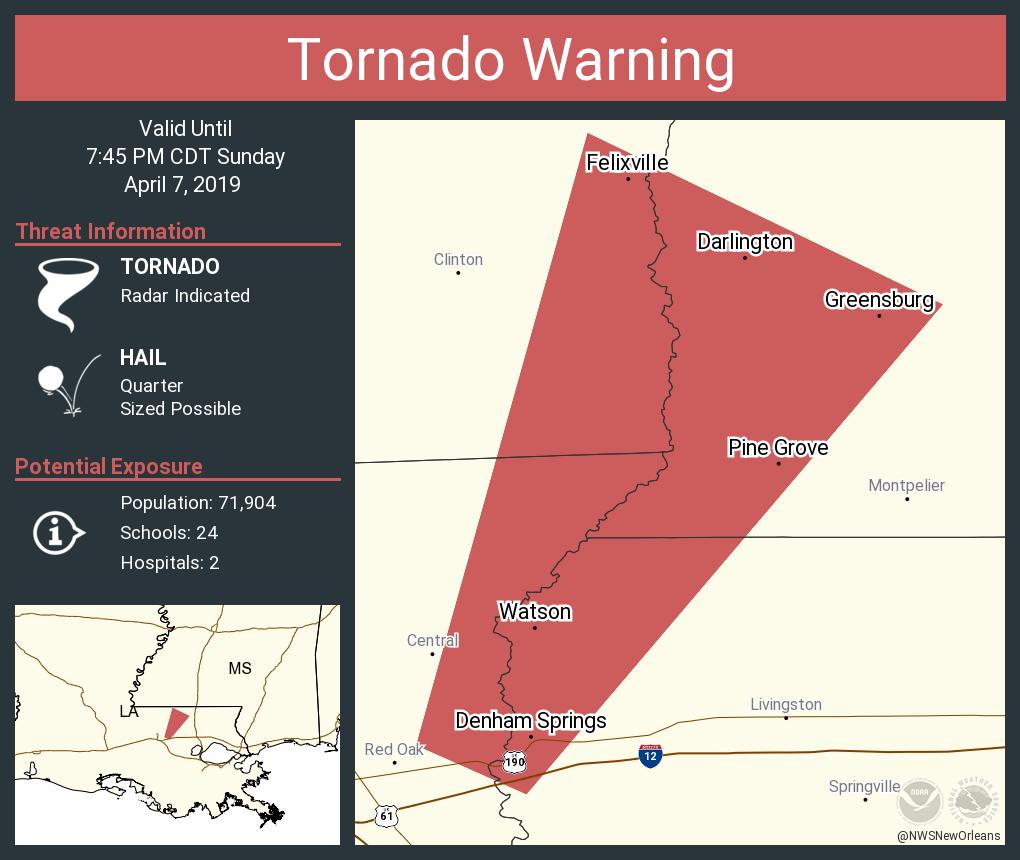
Posted on 4/7/19 at 7:21 pm to Brobocop
Anyone know where one has been spotted?

Posted on 4/7/19 at 7:22 pm to lsuman25
That's pretty much right up my arse


Posted on 4/7/19 at 7:22 pm to iLikeMike
how can you tell after BR has been hit by a tornado
no seriously
how can you tell ?
no seriously
how can you tell ?
Posted on 4/7/19 at 7:23 pm to LSUsmartass
won't have much time moving northeast at 70 mph

Posted on 4/7/19 at 7:23 pm to lsuman25
Not when you want to be in the cone of uncertainty.


Posted on 4/7/19 at 7:27 pm to Scoop
Did anyone else just have an apparent test tornado warning for EBR and some other parishes pop up on TV?

Posted on 4/7/19 at 7:29 pm to red sox fan 13
Is it time to batten down the hatches in BR?
Posted on 4/7/19 at 7:30 pm to Elleshoe


Posted on 4/7/19 at 7:30 pm to lsuman25
My phone just scared the shite out of me.


Posted on 4/7/19 at 7:34 pm to ellunchboxo
Where the hell is Jay with his black pants and rolled up sleeves
Posted on 4/7/19 at 7:39 pm to lsuman25
Basically watching where some of those lead cells start hitting the main line. The SE flow meeting the outflow and due south flow of the line.
Keep an eye out in those spots as this migrates toward the northshore and river parishes.
Keep an eye out in those spots as this migrates toward the northshore and river parishes.

Posted on 4/7/19 at 8:07 pm to Duke
Just had lightning strike right next to my house. I’m in the market for a clean pair of shorts.
Posted on 4/7/19 at 8:11 pm to Scoop
Looks like possibly one South of Albany and one just North of Montpelier. If I had to guess from radar data.
Posted on 4/7/19 at 8:13 pm to Scoop
ornado Warning
LAC063-105-080130-
/O.NEW.KLIX.TO.W.0012.190408T0105Z-190408T0130Z/
BULLETIN - EAS ACTIVATION REQUESTED
Tornado Warning
National Weather Service New Orleans LA
805 PM CDT Sun Apr 7 2019
The National Weather Service in New Orleans has issued a
* Tornado Warning for...
Northeastern Livingston Parish in southeastern Louisiana...
West central Tangipahoa Parish in southeastern Louisiana...
* Until 830 PM CDT.
* At 805 PM CDT, severe thunderstorms capable of producing both
tornadoes and extensive straight line wind damage were located near
Albany, or 10 miles west of Hammond, moving northeast at 25 mph.
HAZARD...Tornado.
SOURCE...Radar indicated rotation.
IMPACT...Flying debris will be dangerous to those caught without
shelter. Mobile homes will be damaged or destroyed.
Damage to roofs, windows, and vehicles will occur. Tree
damage is likely.
* These dangerous storms will be near...
Albany around 815 PM CDT.
Independence and Natalbany around 830 PM CDT.
Other locations impacted by this tornadic thunderstorm include
Tickfaw.
PRECAUTIONARY/PREPAREDNESS ACTIONS...
TAKE COVER NOW! Move to an interior room on the lowest floor of a
sturdy building. Avoid windows. If you are outdoors, in a mobile
home, or in a vehicle, move to the closest substantial shelter and
protect yourself from flying debris.
Tornadoes are extremely difficult to see and confirm at night. Do not
wait to see or hear the tornado. TAKE COVER NOW!
This cluster of thunderstorms is capable of producing tornadoes and
widespread significant wind damage. Do not wait to see or hear the
tornado. For your protection move to an interior room on the lowest
floor of a building.
LAC063-105-080130-
/O.NEW.KLIX.TO.W.0012.190408T0105Z-190408T0130Z/
BULLETIN - EAS ACTIVATION REQUESTED
Tornado Warning
National Weather Service New Orleans LA
805 PM CDT Sun Apr 7 2019
The National Weather Service in New Orleans has issued a
* Tornado Warning for...
Northeastern Livingston Parish in southeastern Louisiana...
West central Tangipahoa Parish in southeastern Louisiana...
* Until 830 PM CDT.
* At 805 PM CDT, severe thunderstorms capable of producing both
tornadoes and extensive straight line wind damage were located near
Albany, or 10 miles west of Hammond, moving northeast at 25 mph.
HAZARD...Tornado.
SOURCE...Radar indicated rotation.
IMPACT...Flying debris will be dangerous to those caught without
shelter. Mobile homes will be damaged or destroyed.
Damage to roofs, windows, and vehicles will occur. Tree
damage is likely.
* These dangerous storms will be near...
Albany around 815 PM CDT.
Independence and Natalbany around 830 PM CDT.
Other locations impacted by this tornadic thunderstorm include
Tickfaw.
PRECAUTIONARY/PREPAREDNESS ACTIONS...
TAKE COVER NOW! Move to an interior room on the lowest floor of a
sturdy building. Avoid windows. If you are outdoors, in a mobile
home, or in a vehicle, move to the closest substantial shelter and
protect yourself from flying debris.
Tornadoes are extremely difficult to see and confirm at night. Do not
wait to see or hear the tornado. TAKE COVER NOW!
This cluster of thunderstorms is capable of producing tornadoes and
widespread significant wind damage. Do not wait to see or hear the
tornado. For your protection move to an interior room on the lowest
floor of a building.
Posted on 4/7/19 at 8:14 pm to GeauxOCDP
Probably short lived spin ups turning into "just" severe thunderstorms. Keep an eye out on the northshore for those spin ups as the line approaches. As the outflow of the line runs into the SE flow the cells in front are riding, those spots are having brief spin ups.
Posted on 4/7/19 at 8:19 pm to Duke
(no message)
This post was edited on 10/19/21 at 1:44 pm

Posted on 4/7/19 at 8:19 pm to Duke
impressive lightning show on the north shore.
Front is about three miles away.
Front is about three miles away.
Posted on 4/7/19 at 8:20 pm to GeauxOCDP
Hunkered down in Albany here, ready for this shite to pass!
This post was edited on 4/7/19 at 8:21 pm

 Page 2 of 3

Popular
Back to top
 Follow TigerDroppings for LSU Football News