




- My Forums
- Tiger Rant
- LSU Recruiting
- SEC Rant
- Saints Talk
- Pelicans Talk
- More Sports Board
- Fantasy Sports
- Golf Board
- Soccer Board
- O-T Lounge
- Tech Board
- Home/Garden Board
- Outdoor Board
- Health/Fitness Board
- Movie/TV Board
- Book Board
- Music Board
- Political Talk
- Money Talk
- Fark Board
- Gaming Board
- Travel Board
- Food/Drink Board
- Ticket Exchange
- TD Help Board
Customize My Forums- View All Forums
- Show Left Links
- Topic Sort Options
- Trending Topics
- Recent Topics
- Active Topics
Started By
Message



 3
3


Posted on 4/13/19 at 1:41 pm to TigerstuckinMS

I got distracted.
The high lower level winds are setting up over western Louisiana now (I misread that a second ago and had to correct). Just another piece of information showing the tornado risk increasing.
Posted on 4/13/19 at 1:41 pm to TigerstuckinMS
completely random TOR:CON in the Carolinas
Posted on 4/13/19 at 1:43 pm to Duke
quote:
Just another piece of information showing the tornado risk increasing.

Posted on 4/13/19 at 1:43 pm to rt3

quote:
SUMMARY...Severe weather potential, including the risk for
tornadoes, is expected to continue to gradually increase through 3-4
PM CDT. One or two strong tornadoes is possible.
DISCUSSION...Peak measured (3-second mean wind) winds along the
eastward advancing gust front have generally been on the order of
40-45 kts, generally focused along the warm frontal zone. It
appears that the apex of the bowing reflectivity structure and
leading edge of outflow will reach the Sabine Valley around 20Z.
Downstream, discrete supercell development continues immediately
ahead of the gust front, near/just north of the warm front, with
additional discrete storms also beginning to initiate in the warm
sector, inland of the coast, near/north of Houston into southwestern
Louisiana. 50+ kt south-southwesterly deep layer mean flow will
support northward motion of developing warm sector cells across a
rapidly destabilizing boundary layer air mass, roughly along a zone
Lufkin TX eastward into the Alexandria LA vicinity (near the current
position of the warm front), during the next few hours. This is
where near surface hodographs appear largest and the environment
most supportive of tornadic potential through 20-21Z.

Posted on 4/13/19 at 1:44 pm to Duke

Posted on 4/13/19 at 1:45 pm to rt3
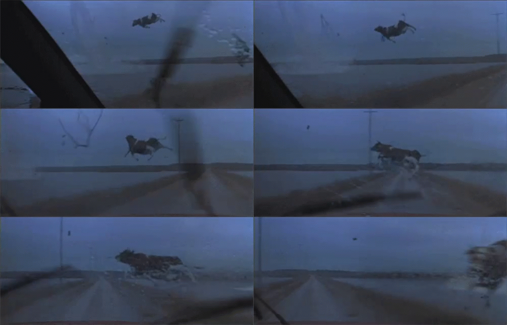
Posted on 4/13/19 at 1:48 pm to rds dc
At least across LA, storms are taking on more of a cluster look vs supercells and that is currently keeping things in check.
Posted on 4/13/19 at 1:50 pm to Duke
quote:
well... that sucks for me
looks like that cell between DeRidder & Oakdale will stay to my west if its current trend holds
Posted on 4/13/19 at 1:53 pm to rt3
Looking at the Ft. Polk radar, I think we have a tornado forming up in that big cell sitting west of Forest Hill.
It's an area I'm watching close, as stuff starts to interact with that warm front boundary.
It's an area I'm watching close, as stuff starts to interact with that warm front boundary.
This post was edited on 4/13/19 at 1:56 pm

Posted on 4/13/19 at 1:53 pm to rt3
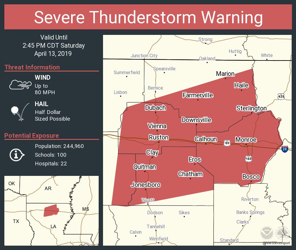


Posted on 4/13/19 at 1:54 pm to rt3
So I’m guessing I shouldn’t drive back to Jackson from Gulfport this evening


Posted on 4/13/19 at 1:55 pm to SabiDojo
Are you in the Prius or Prelude?
Posted on 4/13/19 at 1:56 pm to Duke
quote:
Looking at the Ft. Polk radar, I think we have a tornado forming up in that big cell sitting west of Forest Hill.
It's an area I'm watching close, as stuff starts to interact with that warm front boundary.
quote:
NOAA's National Weather Service
NOAA's National Weather Service
NWSChat
NWSChat
NWS home page
Search
NWS All NOAA
NWSChat Home Change Password Documentation/Help Contacts Online Tools NWS Toolbox
000
WWUS84 KLCH 131853
SPSLCH
SPECIAL WEATHER STATEMENT
NATIONAL WEATHER SERVICE LAKE CHARLES LA
153 PM CDT SAT APR 13 2019
LAZ027-028-131945-
VERNON LA-RAPIDES LA-
153 PM CDT SAT APR 13 2019
...SPECIAL WEATHER STATEMENT...
AT 153 PM CDT, DOPPLER RADAR WAS TRACKING A STRONG THUNDERSTORM NEAR
HINESTON, MOVING NORTHEAST AT 65 MPH.
HALF INCH HAIL AND WINDS IN EXCESS OF 30 MPH WILL BE POSSIBLE WITH
THIS STORM.
LOCATIONS IMPACTED INCLUDE...
ALEXANDRIA, BOYCE, HINESTON, LENA, ALEXANDRIA INTERNATIONAL AIRPORT,
TIMBER TRAILS, OTIS, ELMER, LEANDER, SIEPER, GARDNER, CALCASIEU AND
UNION HILL.
PRECAUTIONARY/PREPAREDNESS ACTIONS...
FREQUENT CLOUD TO GROUND LIGHTNING IS OCCURRING WITH THIS STORM.
LIGHTNING CAN STRIKE 10 MILES AWAY FROM A THUNDERSTORM. SEEK A SAFE
SHELTER INSIDE A BUILDING OR VEHICLE.
THIS STORM MAY INTENSIFY, SO BE CERTAIN TO MONITOR LOCAL RADIO
STATIONS AND AVAILABLE TELEVISION STATIONS FOR ADDITIONAL INFORMATION
AND POSSIBLE WARNINGS FROM THE NATIONAL WEATHER SERVICE.
&&
LAT...LON 3149 9270 3150 9268 3147 9269 3147 9271
3145 9271 3145 9268 3143 9269 3142 9268
3141 9269 3140 9269 3139 9263 3142 9245
3096 9272 3104 9294 3146 9280 3152 9272
TIME...MOT...LOC 1853Z 203DEG 56KT 3110 9280
$$
RM12
US Dept of Commerce
National Oceanic and Atmospheric Administration
National Weather Service
1325 East West Highway
Silver Spring, MD 20910
Page Author: NWSChat Administration Team Disclaimer
Information Quality
Credits
Glossary
Privacy Policy
Freedom of Information Act (FOIA)
About Us
Career Opportunities


Posted on 4/13/19 at 1:57 pm to SabiDojo
I’m just curious how all of the storms over north LA will impact the development of supercells in that area later today.
Posted on 4/13/19 at 1:58 pm to Roll Tide Ravens
TWC dude says there's been 80 mph wind gusts in Louisiana but doesn't say where

Posted on 4/13/19 at 1:58 pm to TigerstuckinMS
Everything still looks crowded and the east Texas stuff has lined out. So far, so good.


Posted on 4/13/19 at 1:59 pm to Roll Tide Ravens
Hope everyone stays safe. 
Posted on 4/13/19 at 1:59 pm to Paul Allen
I’m in the Isuzu Rodeo rn
Posted on 4/13/19 at 2:01 pm to SabiDojo
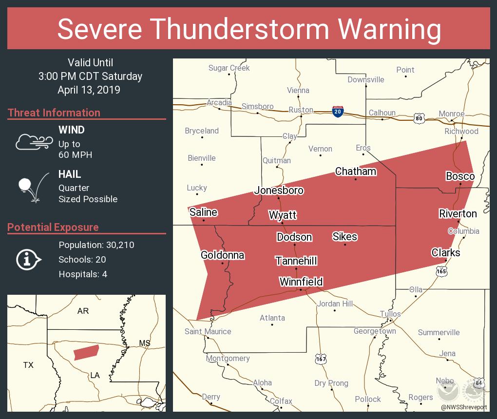

 Page 27 of 47

Popular
Back to top
 Follow TigerDroppings for LSU Football News