




- My Forums
- Tiger Rant
- LSU Recruiting
- SEC Rant
- Saints Talk
- Pelicans Talk
- More Sports Board
- Fantasy Sports
- Golf Board
- Soccer Board
- O-T Lounge
- Tech Board
- Home/Garden Board
- Outdoor Board
- Health/Fitness Board
- Movie/TV Board
- Book Board
- Music Board
- Political Talk
- Money Talk
- Fark Board
- Gaming Board
- Travel Board
- Food/Drink Board
- Ticket Exchange
- TD Help Board
Customize My Forums- View All Forums
- Show Left Links
- Topic Sort Options
- Trending Topics
- Recent Topics
- Active Topics
Started By
Message


 3
3



Posted on 4/6/18 at 8:08 pm to 50_Tiger
All we got at my house was some hail. God speed to those folks down there.
Posted on 4/6/18 at 8:09 pm to 50_Tiger
New warning for cell farther west


Posted on 4/6/18 at 8:15 pm to rds dc
Ton of rain in Desoto Parish too.
Posted on 4/6/18 at 8:28 pm to 50_Tiger
heavy rains hitting central MS now...hope this stuff peters out or it may be a damn long night....
Posted on 4/6/18 at 8:32 pm to rds dc
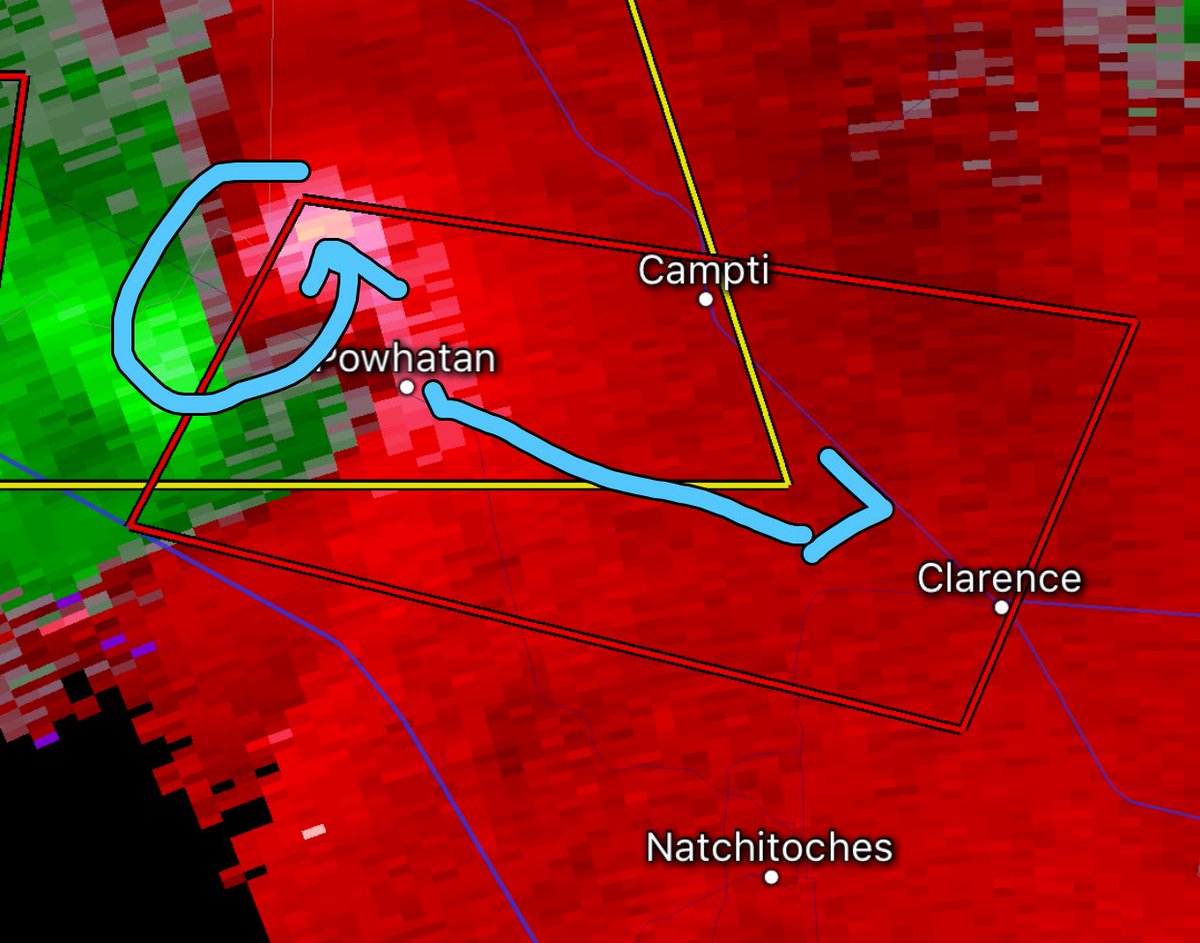
Cell from earlier is wrapping back up

Posted on 4/6/18 at 8:32 pm to rds dc
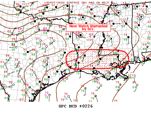
quote:
Mesoscale Discussion 0226
NWS Storm Prediction Center Norman OK
0812 PM CDT Fri Apr 06 2018
Areas affected...Southeast TX...Southern LA...Southern MS
Concerning...Severe potential...Watch likely
Valid 070112Z - 070215Z
Probability of Watch Issuance...95 percent
SUMMARY...Severe threat will spread south of ww36 in the next few
hours. New watch will likely be issued by 02z.
DISCUSSION...East-west squall line is sagging south of the I-20
corridor and is progressing toward the southern portions of ww36 at
roughly 25kt. Over the last hour or so there appears to be a gradual
evolution toward less pre-squall line supercells, though this threat
can not be ruled out. Latest thinking is a linear MCS will be the
predominant convective mode and damaging winds should become the
primary severe threat, along with some large hail. While a tornado
can not be ruled out, given the observed shear/instability, storm
mode is becoming less favorable for discrete structures.
Sliding down to South LA overnight but luckily it should have lined out by then.
Unfortunately the dangerous stuff is still rolling up north.


Posted on 4/6/18 at 8:36 pm to Duke
I hate these severe fricking weather threads but I can't seem to stop following them intently 
Posted on 4/6/18 at 8:38 pm to Duke
Any news out of Coushatta cell?
Posted on 4/6/18 at 8:39 pm to ForeverLSU02
quote:
I hate these severe fricking weather threads but I can't seem to stop following them intently
I love the radar watching and seeing storms grow and stuff, but hate there are people in the way.
Some scary storms on the radar tonight too, unfortunately my phone has decided Radarscope isn't going to work properly tonight.
quote:
Any news out of Coushatta cell?
There will be reports soon, but haven't seen any yet. I'm afraid it won't be good news.
This post was edited on 4/6/18 at 8:41 pm


Posted on 4/6/18 at 8:40 pm to 50_Tiger
Starting to see some of the hail pics from N. Plano and McKinney. Racquetball size and bigger. Impressive.
Posted on 4/6/18 at 8:43 pm to Twenty 49
quote:
He is a serious runner and stays very skinny. Looks poor compared to the average chubby cheeked overweight local, but he is fit as a fiddle.
Oh I know that, dude has ran the New York City marathon a few times and a few other big name marathons, I used to see him running down Benton Rd. all the time. He used to be pretty muscular though. Now he just looks like your quintessential runner, skinny as frick.

Posted on 4/6/18 at 8:48 pm to 50_Tiger
quote:
Any news out of Coushatta cell?
I heard it blew the roof off a store at Armistead, small crossroad of Hwy 1 and 371 near Coushatta.
Posted on 4/6/18 at 8:56 pm to Duke
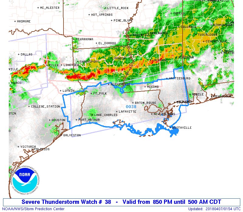
Svr Thunderstorm Watch as cells have mostly lined out.


Posted on 4/6/18 at 9:23 pm to rds dc
not the important part of Texas

Posted on 4/6/18 at 9:31 pm to white perch
quote:
Thor can meet my arse at sonic. We comin Delta stacked Weather fricked
Thor blew a tree down in my yard today
Posted on 4/6/18 at 9:33 pm to rds dc
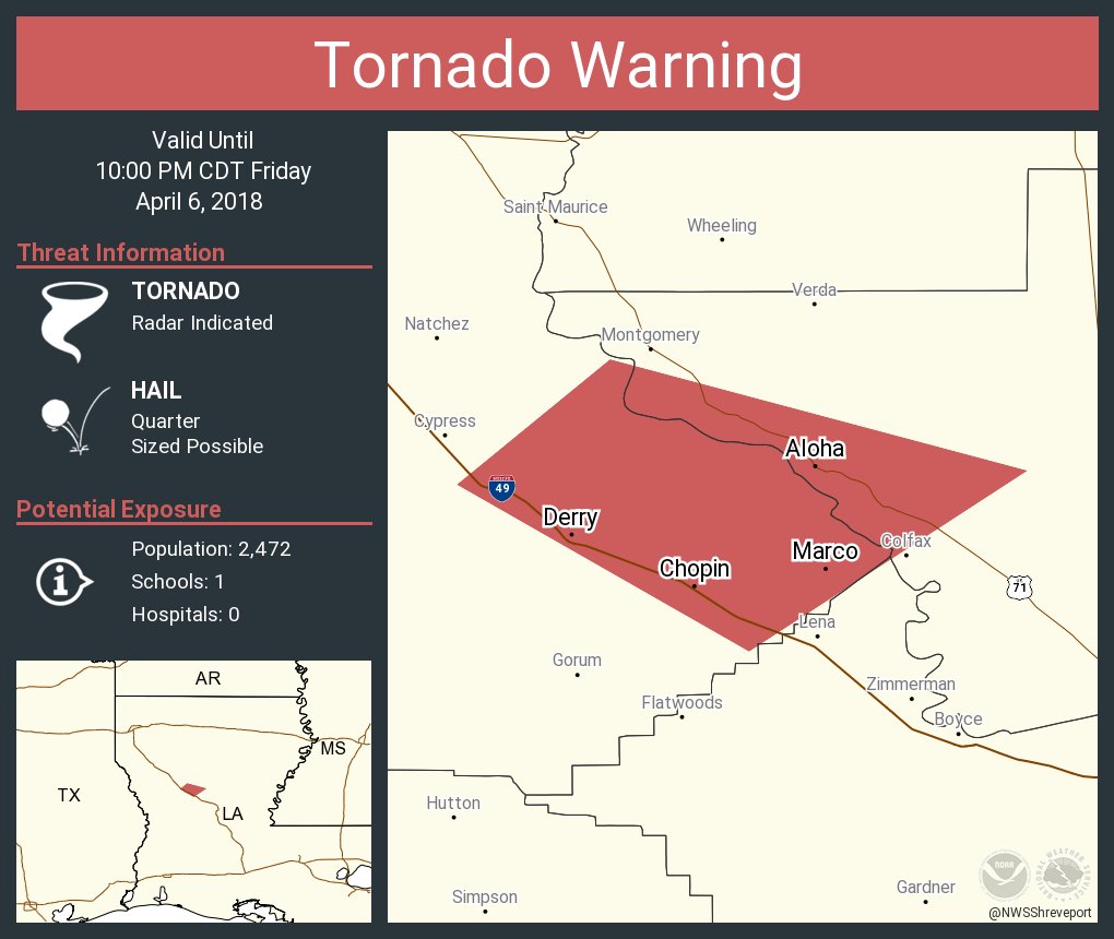
That bow echo moving down I49 is nasty.

Posted on 4/6/18 at 9:35 pm to rds dc
What’s NOLA in for tonight, just some solid storming for a while?
Posted on 4/6/18 at 9:39 pm to rds dc
quote:
Stormy Night with Multiple Watches

Sounds good

 Page 4 of 5

Popular
Back to top
 Follow TigerDroppings for LSU Football News