- My Forums
- Tiger Rant
- LSU Recruiting
- SEC Rant
- Saints Talk
- Pelicans Talk
- More Sports Board
- Coaching Changes
- Fantasy Sports
- Golf Board
- Soccer Board
- O-T Lounge
- Tech Board
- Home/Garden Board
- Outdoor Board
- Health/Fitness Board
- Movie/TV Board
- Book Board
- Music Board
- Political Talk
- Money Talk
- Fark Board
- Gaming Board
- Travel Board
- Food/Drink Board
- Ticket Exchange
- TD Help Board
Customize My Forums- View All Forums
- Show Left Links
- Topic Sort Options
- Trending Topics
- Recent Topics
- Active Topics
Started By
Message
re: Southeast Severe Weather: January 8-9, 2024
Posted on 1/8/24 at 2:23 pm to tide06
Posted on 1/8/24 at 2:23 pm to tide06
quote:
All I know is I routinely see what would be called a funnel cloud in Central AL and they are only warned ~50% of the time.
most likely they are Scud clouds - look like a forming tornado but aren't - they have gotten me a few times
 1
1


Posted on 1/8/24 at 2:23 pm to goofball
Temp has dropped two degrees here and the dewpoint has held steady at 53. Wind is picking up some, gusting to 18 mph. So far, a lot has to change in order for severe storms to develop. That low/boundary has to arrive in order for anything significant to occur otherwise it'll remain simply a cool, damp winter day.

Posted on 1/8/24 at 2:25 pm to goofball
quote:
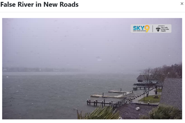
False River is looking a little choppy with a steady wind.
Looks like a steady wind from east to west in that camera feed. I'd probably get sea sick on that floating pier they use for rowing.
Will the wind shift directly back from west to east?
Posted on 1/8/24 at 2:26 pm to Thracken13
quote:
most likely they are Scud clouds - look like a forming tornado but aren't - they have gotten me a few times
They are hard to photograph. Usually they look like that for a few minutes before a torrential downpour happens.

Posted on 1/8/24 at 2:28 pm to TDsngumbo
quote:
That low/boundary has to arrive in order for anything significant to occur otherwise it'll remain simply a cool, damp winter day.
Good thing we sounded the alarm. Can never be too careful.

Posted on 1/8/24 at 2:29 pm to The Pirate King
Sticky. rip louisiana
Posted on 1/8/24 at 2:29 pm to The Pirate King
I wasn't trying to call this a bust. This evening/tonight was always supposed to be the greatest risk and that warm front boundary is forecast to move in later today so there's still time for this all to take shape. It's just that I've never seen a severe outbreak occur when the temp is struggling to touch 60 degrees in January.
Posted on 1/8/24 at 2:30 pm to The Pirate King
Im in no way defending the schools decisions, but the severe weather wasn’t supposed to start until tonight in SELA anyway.

Posted on 1/8/24 at 2:31 pm to trussthetruzz
Definitely kicking up a notch in southwest BR
Posted on 1/8/24 at 2:32 pm to trussthetruzz
I think the primary focus for schools was on the high wind warnings/advisories and their impact on school bus routes.
Posted on 1/8/24 at 2:36 pm to MrBarry
quote:
as he should. The overeaction by schools and what not to this is ridiculous. Would it have been so hard for everyone to say "this is what we are prepared to do if the weather situation is as predicted, and we will make that call at ____O'clock." Instead lets cancel schools and let's not have basketball practice or games either. We've done this several times recently, and it turns into nothing. I"m not saying do nothing, just stop making these stupid arse decisions this far in advance. Weather is unpredictable. Have a plan to implement in due time. 24 hours is way too much time. this ain't a hurricane. No one is evacuating. 2 hours is more than enough time, especially if you already said what the plan was going to be. These planned hurricane/weather days off are stupid. If we don't have a hurricane then it's like they have to find a reason to use those planned days off somewhere else
Tell us you hate your kids being at home around you without telling us.

Posted on 1/8/24 at 2:38 pm to TDsngumbo
Going to be flying over this mess shortly from salt lake to Orlando. Looks like straight east from UT over CO, KS, and MO then cut down over Memphis, NE Miss, central AL, amd finally FL. Expecting this to be very bumpy
Posted on 1/8/24 at 2:39 pm to goofball
quote:
WAFB has live camera feeds around the Baton Rouge metro area here: WAFB Sky9 Cameras
Looks calm now, but the wind is picking up. Some rain around Essen and out in Livingston and False River is looking a little choppy with a steady wind. But otherwise all is fairly calm so far.
Very good find. Going to add the Traffic Cameras from LADOTD to this so we can watch the storms roll in.
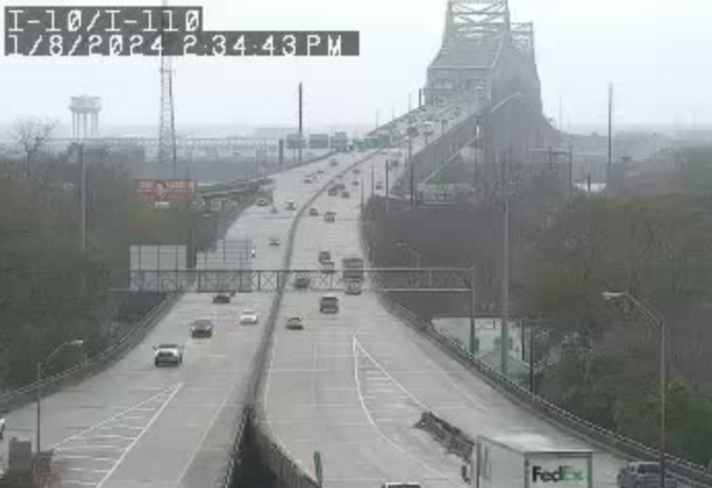
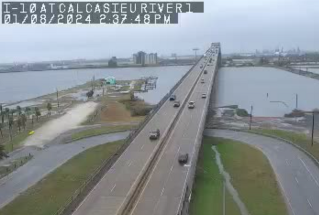
511la -- Traffic cameras around the state. You can see some of the weather around the Lake Charles cameras and the Baton Rouge cameras.
WAFB Weather Cameras - weather cameras around the BR area.
You guys on False River are starting to get some white caps.
Posted on 1/8/24 at 2:41 pm to frequent flyer
There's a nasty storm coming onshore near Vermillion Bay and heading into the general direction of Assumption, Iberville, and Ascension Parishes. I believe that storm was producing a significant rotation signal over the Gulf earlier.

Posted on 1/8/24 at 2:42 pm to red sox fan 13
It is raining with some wind.
Reporting live from Perkins/College area for Waffle news……..
Reporting live from Perkins/College area for Waffle news……..
Posted on 1/8/24 at 2:42 pm to frequent flyer
The wind is gusting pretty hard in Kenner with some storms rolling in.

Posted on 1/8/24 at 2:44 pm to The Pirate King
quote:
Good thing we sounded the alarm. Can never be too careful.
how are you so insufferable on literally every board you post on?

Posted on 1/8/24 at 2:58 pm to FrankandBeans
quote:
Tell us you hate your kids being at home around you without telling us.
OR
Tell us you’re a teacher/admin without telling us
Posted on 1/8/24 at 3:00 pm to TDsngumbo
I am watching the same storm from Vermillion Bay. Reporting live from the Arts District of Oak Grove.

Posted on 1/8/24 at 3:01 pm to Roll Tide Ravens
This is from SPC when they updated the convective outlook earlier. They mentioned the possibility of an upgrade to a moderate risk.
quote:
An extensive QLCS is still expected to develop this evening and move eastward along the Gulf Coast, with recent HRRR runs suggesting some potential for prefrontal supercell development. Any mature pre-frontal supercells could pose a strong tornado threat late tonight across parts of the central Gulf Coast, with damaging wind and line-embedded tornadoes also possible with the primary QLCS. A Moderate Risk upgrade remains possible with the 01Z update, depending on observational and short-term guidance trends regarding northward advance of the warm front and potential for mature prefrontal supercells overnight.

 Page 16 of 36

Popular
Back to top