




- My Forums
- Tiger Rant
- LSU Recruiting
- SEC Rant
- Saints Talk
- Pelicans Talk
- More Sports Board
- Fantasy Sports
- Golf Board
- Soccer Board
- O-T Lounge
- Tech Board
- Home/Garden Board
- Outdoor Board
- Health/Fitness Board
- Movie/TV Board
- Book Board
- Music Board
- Political Talk
- Money Talk
- Fark Board
- Gaming Board
- Travel Board
- Food/Drink Board
- Ticket Exchange
- TD Help Board
Customize My Forums- View All Forums
- Show Left Links
- Topic Sort Options
- Trending Topics
- Recent Topics
- Active Topics
Started By
Message

Severe weather outbreak Central and Southern Plains States - DFW, OKC, Wichita
Posted on 4/25/16 at 8:13 pm

Posted on 4/25/16 at 8:13 pm
I know there are quite a few DFW people on TD as well as a few in OK, KS, and NE. Stay safe out there...
ETA: 1130 CDT Updated Graphics - DFW now in Moderate risk and strong HAIL risk
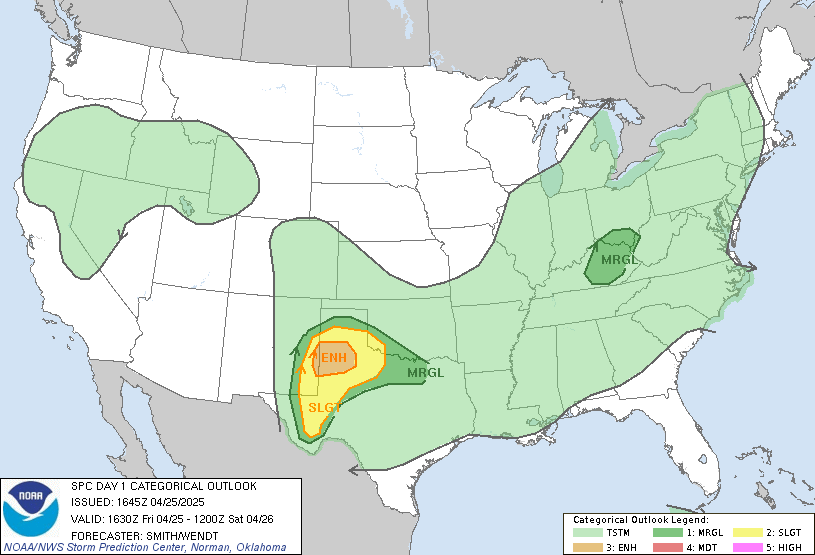
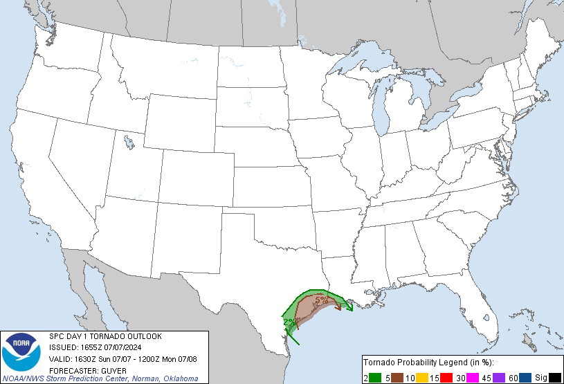
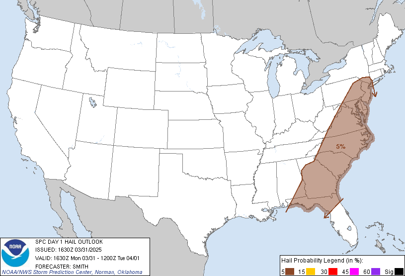
ETA: 1130 CDT Updated Graphics - DFW now in Moderate risk and strong HAIL risk
This post was edited on 4/26/16 at 12:12 pm
 17
17


Posted on 4/25/16 at 8:13 pm to NorthEndZone
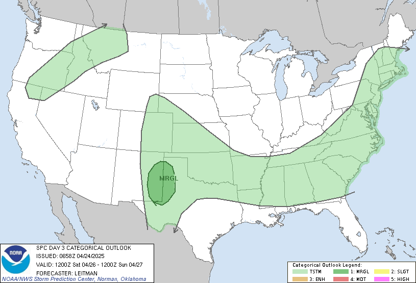
Where should this system be on Wednesday?

Posted on 4/25/16 at 8:14 pm to NorthEndZone
Where should this system be on thursday?
Posted on 4/25/16 at 8:16 pm to Walt OReilly
We just moved to KC three weeks ago, not looking forward to this.
My mom, and my in laws are driving up tomorrow also for their first visit to KC. Hopefully they will get here early before the stuff hits.
My mom, and my in laws are driving up tomorrow also for their first visit to KC. Hopefully they will get here early before the stuff hits.
Posted on 4/25/16 at 8:18 pm to Walt OReilly
Not as strong for Wednesday...
Posted on 4/25/16 at 8:20 pm to NorthEndZone
quote:
Severe weather outbreak
Thanks for posting an accurate description of what might happen tomorrow. There really isn't anything that points to a "tornado outbreak" even though there may be tornadoes as part of the severe weather tomorrow.

Posted on 4/25/16 at 8:24 pm to NorthEndZone
Looking at Cape numbers around 3 kJ/kg and higher along the western edge of the moderate risk. Dat hail.
This post was edited on 4/25/16 at 8:25 pm
Posted on 4/25/16 at 9:23 pm to Duke
quote:
Looking at Cape numbers around 3 kJ/kg and higher along the western edge of the moderate risk. Dat hail.
Yea, some areas could push 5,000 tomorrow. Any discrete cell in that environment could briefly put down a tornado to go along with that monster hail. Hopefully, things grow upscale rather quickly diminishing the tornado and larger hail threat. One thing to watch, any areas that get storms overnight could end up with a locally enhanced tornado risk tomorrow afternoon.

Posted on 4/25/16 at 9:24 pm to NorthEndZone
Flying into OKC tomorrow around noon.
Should be a fun afternoon.
Should be a fun afternoon.
Posted on 4/25/16 at 9:43 pm to MLSter
Likely afternoon and into the evening.

Posted on 4/25/16 at 10:17 pm to NorthEndZone
frick tornadoes, they scare the shite out of me. I will take a cat3-5 hurricane any day than wake up to sirens


Posted on 4/25/16 at 10:26 pm to rantfan
I'm working in Stephenville, Texas right now.
I survived a tornado about a month and a half ago, but it did about $9K in damage to my truck. I got it back on Thursday.
I'm currently wondering what the frick to do tomorrow. I don't have a garage or anything with a roof near me to put that bitch in.
I survived a tornado about a month and a half ago, but it did about $9K in damage to my truck. I got it back on Thursday.
I'm currently wondering what the frick to do tomorrow. I don't have a garage or anything with a roof near me to put that bitch in.
Posted on 4/25/16 at 10:39 pm to Shotgun Willie
I'm from Wichita. If they are driving north up I-35, please advise them to arrive a few hours before the storms are supposed to hit around 1-3pm or to consider coming on Wednesday. That I-35 corridor notoriously get hit hard with these storms, especially between El Dorado and Topeka. I wouldn't worry too much being in the city/metro. These storms come every year and tend to miss the large areas. It is kind of eerie that tomorrow is the 25th anniversary of the F-5 that ripped through Wichita though.
This post was edited on 4/25/16 at 10:41 pm
Posted on 4/25/16 at 10:52 pm to dewster
quote:
Flying into OKC tomorrow around noon.
I flew into Wichita May 19, 2013 on a day that The Weather Channel said there was a 10/10 chance for a tornado within 50 miles. Tomorrow is 7/10. Jim Cantore was broadcasting 500 yards from my front door. We landed at 1pm into 60 mph winds. I was looking down therunway 100 feet off the ground in a CRJ regional. Talk about nerve wracking. 4 hours later golf ball sized hail broke the windshield on two of our cars and a tornado touched down about 5 miles away. I'll never forget watching the news in my basement and the weathermen abandoned the set to take cover. It was an intense day, but I love these storms.
This post was edited on 4/25/16 at 10:53 pm
Posted on 4/25/16 at 10:55 pm to LSUShock
quote:
We landed at 1pm into 60 mph winds. I was looking down therunway 100 feet off the ground in a CRJ regional.
Ugh
Posted on 4/25/16 at 11:06 pm to LSUShock
quote:
I flew into Wichita May 19, 2013 on a day that The Weather Channel said there was a 10/10 chance for a tornado within 50 miles. Tomorrow is 7/10.
wow... hadn't seen that... the 7 they're giving tomorrow is the highest I've ever personally seen it
quote:
Jim Cantore was broadcasting 500 yards from my front door.
I like to call him the "angel of death"... when's he's out doing a live shot... you don't want to be anywhere close by
ETA: if he's doing a hurricane shot in like Biloxi or Lafayette or LC a day or 2 out while I was living in NOLA... that was too close for comfort
This post was edited on 4/25/16 at 11:11 pm

Posted on 4/25/16 at 11:41 pm to NorthEndZone
Im more worried about hail from this than I am of a tornado.

Posted on 4/26/16 at 6:03 am to NorthEndZone
Bringin' my raincoat today.
Posted on 4/26/16 at 8:11 am to dewster
be careful man, it's supposed to get bad here, around 2 pm.
Posted on 4/26/16 at 8:15 am to TigersHuskers
Hail is the biggest concern. Low level flow isn't especially strong, which should help limit tornado risks. There's also a question of storm mode. How many discrete cells will pop off or will it be a messy semilinear mode.
Hence why the spc hasn't upped the risk to high anywhere. The model soundings look juiced for large hail, just not as strong of a signal for tornado outbreak.
Hence why the spc hasn't upped the risk to high anywhere. The model soundings look juiced for large hail, just not as strong of a signal for tornado outbreak.

 Page 1 of 16

Popular
Back to top
 Follow TigerDroppings for LSU Football News