




- My Forums
- Tiger Rant
- LSU Recruiting
- SEC Rant
- Saints Talk
- Pelicans Talk
- More Sports Board
- Fantasy Sports
- Golf Board
- Soccer Board
- O-T Lounge
- Tech Board
- Home/Garden Board
- Outdoor Board
- Health/Fitness Board
- Movie/TV Board
- Book Board
- Music Board
- Political Talk
- Money Talk
- Fark Board
- Gaming Board
- Travel Board
- Food/Drink Board
- Ticket Exchange
- TD Help Board
Customize My Forums- View All Forums
- Show Left Links
- Topic Sort Options
- Trending Topics
- Recent Topics
- Active Topics
Started By
Message
re: Severe weather outbreak Central and Southern Plains States - DFW, OKC, Wichita
Posted on 4/27/16 at 12:26 pm to fishfighter

Posted on 4/27/16 at 12:26 pm to fishfighter
so today's just a rest day and prep for more real severe weather for tomorrow?
 1
1


Posted on 4/27/16 at 12:30 pm to rt3
another pic from yesterdays storm


Posted on 4/27/16 at 12:35 pm to stlslick
Holy shite
Posted on 4/27/16 at 12:40 pm to stlslick
quote:
another pic from yesterdays storm
did I miss an alien attack?

Posted on 4/27/16 at 12:41 pm to stlslick

Posted on 4/27/16 at 12:43 pm to Janky
This was a weird storm
it had the capabilities of butt fricking about 10-12 states. Yet it was a shite load of bark, with little bite.
It would pour, then stop for 5 seconds, then pour again, then stop, then pour. I was expecting a shite load of nasty golf bal lsized hail, yet we got none.
20minutes south, they got hail
it had the capabilities of butt fricking about 10-12 states. Yet it was a shite load of bark, with little bite.
It would pour, then stop for 5 seconds, then pour again, then stop, then pour. I was expecting a shite load of nasty golf bal lsized hail, yet we got none.
20minutes south, they got hail

Posted on 4/27/16 at 4:37 pm to stlslick


Posted on 4/27/16 at 6:05 pm to Jim Rockford
Whats the outlook for Alabama tomorrow?
Posted on 4/27/16 at 6:15 pm to Funky Tide 8
quote:
THIS HAZARDOUS WEATHER OUTLOOK IS FOR THE COUNTIES SERVED BY THE
NATIONAL WEATHER SERVICE OFFICE IN BIRMINGHAM.
.DAY ONE...OUTLOOK THROUGH TONIGHT.
THERE IS A LIMITED THREAT OF SEVERE THUNDERSTORMS...WITH DAMAGING
STRAIGHT LINE WINDS AND LARGE HAIL...THROUGH AROUND 9 PM THIS
EVENING. THE MAIN THREAT AREA IS FROM THE CITIES OF ROCKFORD...
ALEX CITY...AND WEDOWEE...SOUTHWARD TO MONTGOMERY...TROY...
CLAYTON...AND EUFAULA.
.DAYS TWO THROUGH SEVEN...THURSDAY THROUGH TUESDAY.
MORE THUNDERSTORMS ARE EXPECTED TO FORM IN PORTIONS OF CENTRAL
ALABAMA ON THURSDAY. A FEW OF THESE STORMS MAY GROW STRONG ENOUGH
TO PRODUCE DAMAGING STRAIGHT LINE WINDS OR LARGE HAIL. THE AREA
WITH THE HIGHEST THREAT IS GENERALLY SOUTH OF INTERSTATE 20.
.SPOTTER INFORMATION STATEMENT...
ACTIVATION OF STORM SPOTTERS AND EMERGENCY MANAGEMENT MAY BE
NEEDED AGAIN ON THURSDAY.
Posted on 4/27/16 at 6:32 pm to Jim Rockford
Thanks, Jim. 
Posted on 4/29/16 at 1:22 pm to rds dc
quote:
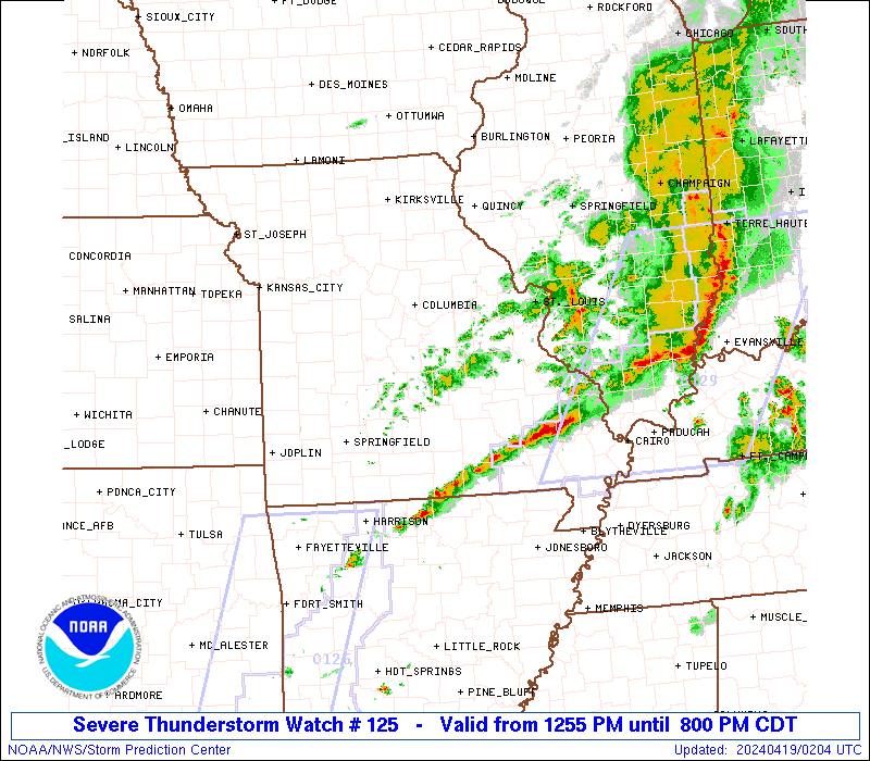
DFW could be under the gun again tomorrow and Friday.



 Page 16 of 16


Popular
Back to top
 Follow TigerDroppings for LSU Football News