




- My Forums
- Tiger Rant
- LSU Recruiting
- SEC Rant
- Saints Talk
- Pelicans Talk
- More Sports Board
- Fantasy Sports
- Golf Board
- Soccer Board
- O-T Lounge
- Tech Board
- Home/Garden Board
- Outdoor Board
- Health/Fitness Board
- Movie/TV Board
- Book Board
- Music Board
- Political Talk
- Money Talk
- Fark Board
- Gaming Board
- Travel Board
- Food/Drink Board
- Ticket Exchange
- TD Help Board
Customize My Forums- View All Forums
- Show Left Links
- Topic Sort Options
- Trending Topics
- Recent Topics
- Active Topics
Started By
Message
re: Severe weather outbreak Central and Southern Plains States - DFW, OKC, Wichita
Posted on 4/26/16 at 2:28 pm to jlu03

Posted on 4/26/16 at 2:28 pm to jlu03
quote:
I tend to watch TVN storm chasing during severe weather outbreaks and there are usually 5 - 10 chasers streaming live video or offline waiting to stream live. Right now there are over 50 chasers between OK and KS who are streaming or about to stream. Doesn't look good.
Damn, the TVN map makes it look like Oklahoma has chicken pox. Either the weather is about to get real or OU is giving out class credit for catching bad weather on camera.
This post was edited on 4/26/16 at 2:32 pm
 0
0


Posted on 4/26/16 at 2:29 pm to DoUrden
That thing is dropping some big hail, but not showing tight rotation. It's all alone out there and soon entering the cool outflow boundary from earlier storms, so it has potential to go tornadic.
ETA: first real severe set up in the plains, those chasers are hard up for some action. Much better terrain for storm chasing than the deep south.
ETA: first real severe set up in the plains, those chasers are hard up for some action. Much better terrain for storm chasing than the deep south.
This post was edited on 4/26/16 at 2:31 pm


Posted on 4/26/16 at 2:34 pm to MLSter
Just got the alert that we're under a tornado watch until midnight.

Posted on 4/26/16 at 2:35 pm to Duke
PDS Tornado Watch for Oklahoma and Northern Texas now
Includes Dallas, Oklahoma City, Moore, San Angelo just to name a few cities. Stay safe everyone
Includes Dallas, Oklahoma City, Moore, San Angelo just to name a few cities. Stay safe everyone
This post was edited on 4/26/16 at 2:38 pm
Posted on 4/26/16 at 2:35 pm to MLSter
Hail is more likely, but you're sitting in some of the best tornado conditions in this system imo. Just be ready to act if you need to. Hopefully my thinking is on point and the tornadoes will be isolated.

Posted on 4/26/16 at 2:36 pm to Duke
Thanks for the explanations.
This post was edited on 4/26/16 at 3:01 pm

Posted on 4/26/16 at 2:39 pm to Duke
quote:
my thinking is on point and the tornadoes will be isolated.

Posted on 4/26/16 at 2:40 pm to Bullfrog
quote:
Thanks for the explanations. Got some family in the zone and passing info along to them.
Hope I can help, but please note I'm not a meteorologist or studying it. They should pay attention to what their local NWS office has to say.
Posted on 4/26/16 at 2:40 pm to Duke
quote:
They should pay attention to what their local NWS office has to say.
Following the NWS in Ft. Worth on Twitter was one of the most useful follows I've given in the last couple of years.

Posted on 4/26/16 at 2:40 pm to MLSter
Here we go... Strong cells moving from the OK & KS border towards Wichita. TVN storm chasers are live streaming

Posted on 4/26/16 at 2:43 pm to jlu03
The Brian Emfinger camera... looks like he's closest to the best storm going right now
ETA: though he's ahead of it and moving to stay ahead... so his camera's facing the wrong way
ETA: though he's ahead of it and moving to stay ahead... so his camera's facing the wrong way
This post was edited on 4/26/16 at 2:45 pm

Posted on 4/26/16 at 2:44 pm to 50_Tiger
quote:
It's sad I trust the OT for DFW weather more than DFW weather broadcasts..
Cone on, yiu know Delkus and Finfrock are going to postpone programming and be on air. They live for this stuff
Posted on 4/26/16 at 2:47 pm to lsuman25
quote:
PDS Tornado Watch for Oklahoma and Northern Texas now
Includes Dallas, Oklahoma City, Moore, San Angelo just to name a few cities. Stay safe everyone
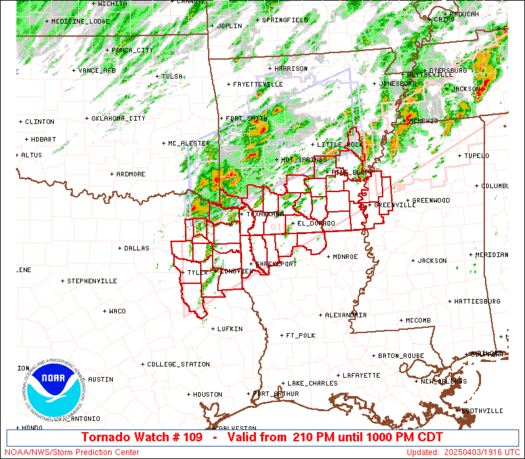
This does not sound good...
URGENT - IMMEDIATE BROADCAST REQUESTED
TORNADO WATCH NUMBER 109
NWS STORM PREDICTION CENTER NORMAN OK
230 PM CDT TUE APR 26 2016
THE NWS STORM PREDICTION CENTER HAS ISSUED A
* TORNADO WATCH FOR PORTIONS OF
SOUTHWEST AND SOUTH CENTRAL THROUGH NORTH CENTRAL AND NORTHEAST
OKLAHOMA
WEST CENTRAL THROUGH NORTH CENTRAL TEXAS
* EFFECTIVE THIS TUESDAY AFTERNOON FROM 230 PM UNTIL MIDNIGHT
CDT.
...THIS IS A PARTICULARLY DANGEROUS SITUATION...
* PRIMARY THREATS INCLUDE...
SEVERAL TORNADOES AND A FEW INTENSE TORNADOES LIKELY
WIDESPREAD LARGE HAIL AND SCATTERED VERY LARGE HAIL EVENTS TO 4
INCHES IN DIAMETER EXPECTED
WIDESPREAD DAMAGING WINDS LIKELY WITH ISOLATED SIGNIFICANT GUSTS
TO 80 MPH POSSIBLE
SUMMARY...NUMEROUS SEVERE THUNDERSTORMS EXPECTED TO RAPIDLY FORM IN
THE NEXT COUPLE HOURS OVER WESTERN PART OF WATCH...INCLUDING A FEW
STRONG SUPERCELLS CAPABLE OF VERY LARGE HAIL...DAMAGING WIND...AND
TORNADOES. THE STORMS SHOULD MERGE INTO BROKEN LINES AND
CLUSTERS...WITH EMBEDDED SUPERCELLS CONTINUING TO POSE A RISK FOR
VERY LARGE HAIL...DAMAGING WIND.. AND A FEW TORNADOES AS THEY
MOVE/DEVELOP EAST-NORTHEAST INTO TONIGHT.
This post was edited on 4/26/16 at 2:49 pm
Posted on 4/26/16 at 2:47 pm to rt3
Not seeing anything to indicate a tornado looking at the velocities on radar, but that cell around the OK/KS line is developing a hook echo on the last traditional radar frame.
Worth keeping an eye on.
Worth keeping an eye on.
Posted on 4/26/16 at 2:48 pm to NorthEndZone
Thanks for posting the graphic
Posted on 4/26/16 at 2:48 pm to rt3
I was watching his camera but now I'm watching Bryce Kintigh. He is in perfect position just waiting at this point.

Posted on 4/26/16 at 2:49 pm to NorthEndZone
Still sunny and clear in Plano.
I'm sure it'll fire up in a couple of hours when i'm making the drive home towards Frisco/McKinney.
I'm sure it'll fire up in a couple of hours when i'm making the drive home towards Frisco/McKinney.
Posted on 4/26/16 at 2:50 pm to MLSter
quote:
links? im pretty bored at work
TVNWeather
Bryce Kintigh looks like he's pulled up from a distance and got his popcorn out to watch the storm
Posted on 4/26/16 at 2:51 pm to shel311
quote:
Still sunny and clear in Plano. I'm sure it'll fire up in a couple of hours when i'm making the drive home towards Frisco/McKinney.
I'm in Stephenville and Weather Channel says no rain here until around 7 pm. Also sunny here.
Posted on 4/26/16 at 2:52 pm to McCaigBro69
You've got a good cap overhead from the earlier sounding I posted. It'll take time to erode, so hopefully you metroplex posters can get home before the weather hits.

 Page 5 of 16

Popular
Back to top
 Follow TigerDroppings for LSU Football News