- My Forums
- Tiger Rant
- LSU Recruiting
- SEC Rant
- Saints Talk
- Pelicans Talk
- More Sports Board
- Fantasy Sports
- Golf Board
- Soccer Board
- O-T Lounge
- Tech Board
- Home/Garden Board
- Outdoor Board
- Health/Fitness Board
- Movie/TV Board
- Book Board
- Music Board
- Political Talk
- Money Talk
- Fark Board
- Gaming Board
- Travel Board
- Food/Drink Board
- Ticket Exchange
- TD Help Board
Customize My Forums- View All Forums
- Show Left Links
- Topic Sort Options
- Trending Topics
- Recent Topics
- Active Topics
Started By
Message

 1
1


Posted on 6/29/24 at 8:04 am to PhillyTiger90

Posted on 6/29/24 at 8:11 am to stout
I think it is now built into the hurricane models as a control measure that at least one possible path must go through Lake Charles. It use to be Morgan City in the 70’- ‘00’s, but the models have become more accurate
Posted on 6/29/24 at 8:43 am to stout
So I'm supposed to leave for Jamaica tomorrow for my honeymoon... Is it time to consider pushing that back?

Posted on 6/29/24 at 8:47 am to GeauxOn
quote:
So I'm supposed to leave for Jamaica tomorrow for my honeymoon... Is it time to consider pushing that back?
No bra, go for it. It’ll be a great test of your marriage.

Posted on 6/29/24 at 8:49 am to GeauxOn
quote:
So I'm supposed to leave for Jamaica tomorrow for my honeymoon... Is it time to consider pushing that back?
Nah. Just be sure you and your husband write your social security numbers on your arms with a sharpie. Enjoy the trip and congrats!
Posted on 6/29/24 at 8:49 am to Alt26
quote:
I think it is now built into the hurricane models as a control measure that at least one possible path must go through Lake Charles.
That is the ISM2024 Model (Insurance Scare Model). Normally calibrated to pass through New Orleans.
This post was edited on 6/29/24 at 8:55 am

Posted on 6/29/24 at 9:17 am to Alt26
quote:I remember us puckering quite a bit growing up through the 00’s and only really getting hit by one (Lilly in ‘02). Remember us freaking out thinking we were gonna get wrecked by it then only having a few shingles missing when we got back home.
It use to be Morgan City in the 70’- ‘00’s
Posted on 6/29/24 at 9:18 am to GeauxOn
I’d rebook for punta cana tbh.
Posted on 6/29/24 at 9:37 am to Pedro
quote:
I remember us puckering quite a bit growing up through the 00’s and only really getting hit by one (Lilly in ‘02). Remember us freaking out thinking we were gonna get wrecked by it then only having a few shingles missing when we got back home.
Hurricane experts are still baffled at Lilly’s immediate drop in intensity. If I remember correctly, Lilly went from a Cat 4 to Cat 1 in less than 12 hours which was right at landfall also
Posted on 6/29/24 at 9:41 am to rds dc
There have been some favorable upper air pattern changes in the models over the past 24 hrs. The upper trough that the models have imparting shear on Beryl as it moves through the Caribbean has started to trend weaker. The result, in some models, Beryl is getting deeper into the Caribbean as a stronger system, and this opens the door for a potential track into the Gulf.
Yesterday's 12z GFS had a pretty stout upper trough digging across Florida and into the Southern Gulf. Flow around this feature produces shear that negatively impacts the system. In this run, the system is sheared apart, with only the remnant vort making it westward before dissipating over the Yucatan.

This morning's 06z GFS has a weaker trough across Florida and into the southern Gulf. A weaker trough imparts less shear to the system, and the orientation allows for better outflow. Also, a stronger system might be able to fend off this shear as it moves westward. On this run, Beryl is weakened by this interaction but eventually restrengthens in the Gulf.

The trend over recent GFS runs.

Also, similar trends on the Euro from 12z yesterday to 06z this morning.
12z yesterday

06z today

Yesterday's 12z GFS had a pretty stout upper trough digging across Florida and into the Southern Gulf. Flow around this feature produces shear that negatively impacts the system. In this run, the system is sheared apart, with only the remnant vort making it westward before dissipating over the Yucatan.
This morning's 06z GFS has a weaker trough across Florida and into the southern Gulf. A weaker trough imparts less shear to the system, and the orientation allows for better outflow. Also, a stronger system might be able to fend off this shear as it moves westward. On this run, Beryl is weakened by this interaction but eventually restrengthens in the Gulf.
The trend over recent GFS runs.
Also, similar trends on the Euro from 12z yesterday to 06z this morning.
12z yesterday
06z today
Posted on 6/29/24 at 9:45 am to lsusteve1
I think i speak for all of the folks that live in the southeast especially the ones near a coast this needs to go to Mexico. Seems any major Hurricane that hits the Southeast all our Insurance rates go up. Where does it end?
Posted on 6/29/24 at 9:50 am to rds dc
...BERYL EXPECTED TO BECOME A DANGEROUS MAJOR HURRICANE BEFORE REACHING THE WINDWARD ISLANDS... ...HURRICANE WATCHES ISSUED...
Posted on 6/29/24 at 9:56 am to 4x4tiger


Posted on 6/29/24 at 9:57 am to rds dc
This means we are screwed?
Posted on 6/29/24 at 10:01 am to tarzana
quote:
The NOAA climate predictions over the next 6-10 days, and 8-14 days, are much more alarming. In each case all of Dixie will experience temps 60-70% above what they should be, and rainfall will be scarce. It looks like a redux of the Great 2023 Heat Dome.
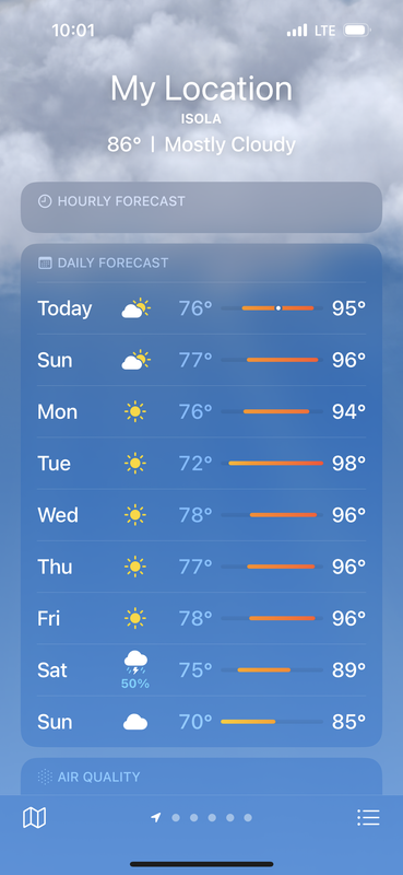
Looks fine to me for July
Posted on 6/29/24 at 10:07 am to rds dc
Just seeing this development. Has Peej given his prediction and forecast for this storm's landfall yet? TIA
Posted on 6/29/24 at 10:08 am to Classy Doge
My kid is supposed to be in the keys for the 4th and then comes back the 9th what do you guys think?
Posted on 6/29/24 at 10:10 am to rds dc
Trump will keep this shite going to Mexico! MAGA!
This post was edited on 6/29/24 at 10:11 am

 Page 31 of 39

Popular
Back to top