- My Forums
- Tiger Rant
- LSU Recruiting
- SEC Rant
- Saints Talk
- Pelicans Talk
- More Sports Board
- Fantasy Sports
- Golf Board
- Soccer Board
- O-T Lounge
- Tech Board
- Home/Garden Board
- Outdoor Board
- Health/Fitness Board
- Movie/TV Board
- Book Board
- Music Board
- Political Talk
- Money Talk
- Fark Board
- Gaming Board
- Travel Board
- Food/Drink Board
- Ticket Exchange
- TD Help Board
Customize My Forums- View All Forums
- Show Left Links
- Topic Sort Options
- Trending Topics
- Recent Topics
- Active Topics
Started By
Message
re: May 4th Severe Weather Threat Thread (Flash Flood Emergency - Birmingham & Hoover, Ala.)
Posted on 5/3/21 at 9:55 pm to Bobby OG Johnson
Posted on 5/3/21 at 9:55 pm to Bobby OG Johnson
quote:
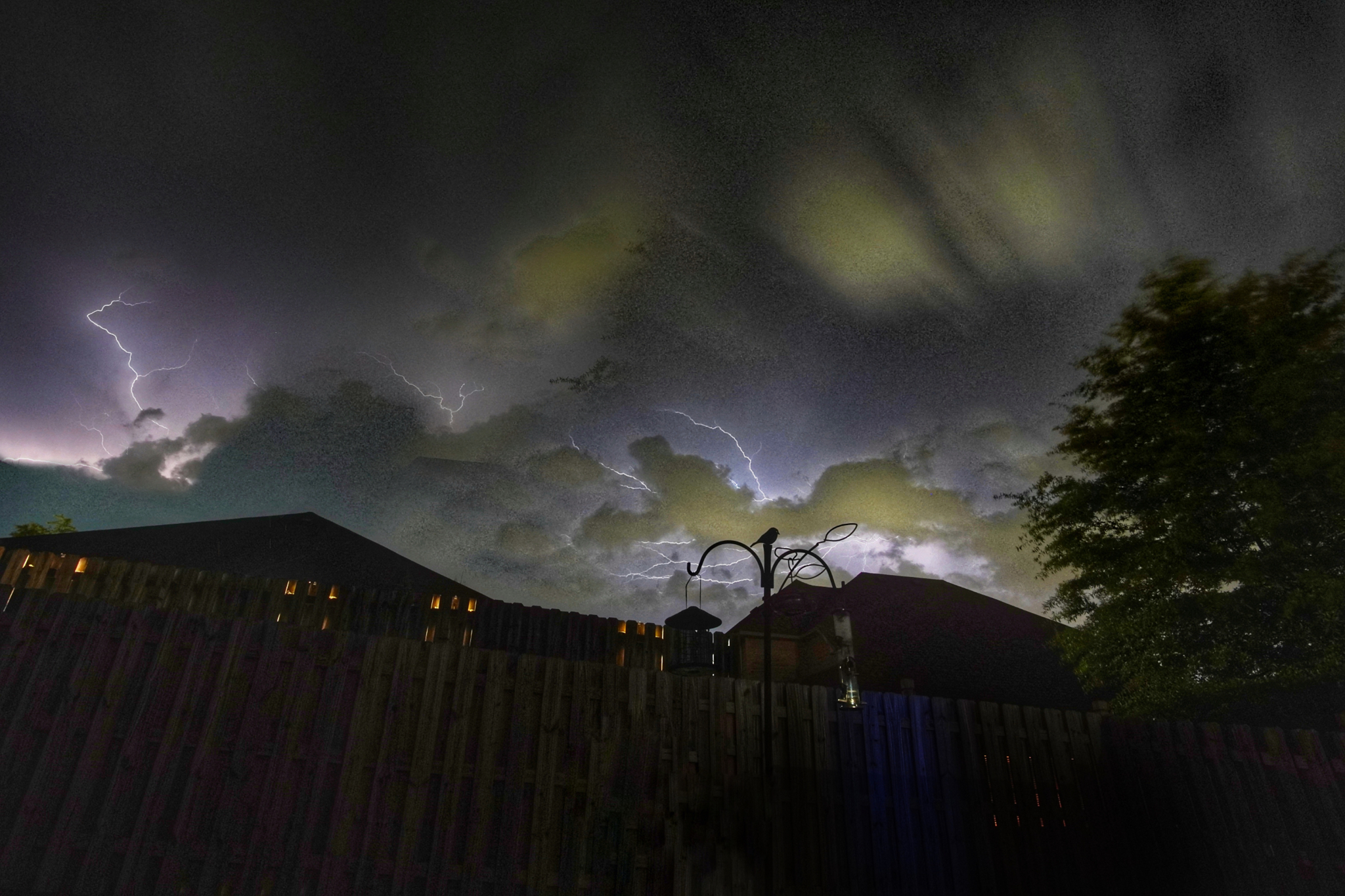
James Spann
@spann
Lightning tonight in Calera… from @bobthebanker1977 (IG)
 2
2

Posted on 5/3/21 at 9:56 pm to McCaigBro69
quote:
McCaigBro69
I'll once again note that you should read the forecast discussions from DFW. It's faster than watching the weather on the news and you end up well informed about potential timings and when there's some risk of severe weather.
Posted on 5/3/21 at 9:56 pm to 50_Tiger
Looks like it. It is packing a punch, too. Watching the radar loop of it is kind of cool.

Posted on 5/3/21 at 9:56 pm to Bobby OG Johnson
I'm at my mom's place right now in Indian Springs and all I hear is distant thunder. Waiting for some shite to hit.
Posted on 5/3/21 at 9:57 pm to Duke
quote:
Duke
Go back and check out some of the storms this morning in SC. I posted a few interesting radar grabs.
Posted on 5/3/21 at 9:59 pm to Bobby OG Johnson
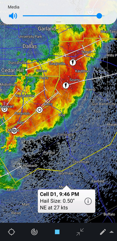
That wind coming into the Kemp area is going to be rough
Posted on 5/3/21 at 9:59 pm to 50_Tiger
quote:
Is that a bow echo forming South of the Metroplex?
It's going to be a nasty QLCS for a while. Theres some strong wind building behind the north/south running part of the line.

Posted on 5/3/21 at 10:02 pm to Duke
The latest Severe TS Warning polygon backs that up. It is shaped with the bowing segment.
This post was edited on 5/3/21 at 10:03 pm
Posted on 5/3/21 at 10:06 pm to LegendInMyMind
Some pretty cool feature going on there.
Nevermind all the extra shite going on on my phone.
Nevermind all the extra shite going on on my phone.
This post was edited on 5/3/21 at 10:07 pm

Posted on 5/3/21 at 10:07 pm to Duke
Found out today I finished 2nd in the department semester forecast contest by 1 point. Almost KMS'd
Posted on 5/3/21 at 10:07 pm to LegendInMyMind
quote:
Go back and check out some of the storms this morning in SC. I posted a few interesting radar grabs
Will do.
Posted on 5/3/21 at 10:11 pm to The Boat
quote:
Found out today I finished 2nd in the department semester forecast contest by 1 point. Almost KMS'd
Just beat that fricker next semester.
Great job though Boat, can't say I'm at all surprised.
Posted on 5/3/21 at 10:15 pm to Duke
Thanks bro. One more week and I would have won. I rolled off a string of nailed forecasts the last four weeks or so to close the gap.
Posted on 5/3/21 at 10:19 pm to LegendInMyMind
Posted on 5/3/21 at 10:22 pm to NorthEndZone
This current line is supposed to kind of dissipate and move into Arkansas. Then a new line will form in the morning and work into Louisiana.
Posted on 5/3/21 at 10:34 pm to The Boat
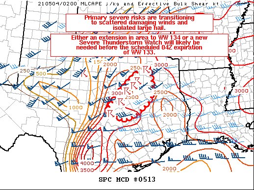
First sentence of the SPC Synopsis part of the discussion for tomorrow:
quote:
The severe weather forecast for Tuesday remains complex with lingering uncertainty.
Posted on 5/3/21 at 10:38 pm to LegendInMyMind
@NWSHuntsville


quote:
[10:34 PM] An evening look at tomorrow's threat for severe weather with a focus on the timing of arrival for the storms. More confident that we will see storms in the morning, less confident about afternoon storms. Heavy rain, damaging winds, hail, and tornadoes possible. #HUNwx LINK
Posted on 5/3/21 at 10:38 pm to LegendInMyMind
At least one death from the wrecks on 35 by Waxahachie.

 Page 16 of 28

Popular
Back to top