- My Forums
- Tiger Rant
- LSU Recruiting
- SEC Rant
- Saints Talk
- Pelicans Talk
- More Sports Board
- Fantasy Sports
- Golf Board
- Soccer Board
- O-T Lounge
- Tech Board
- Home/Garden Board
- Outdoor Board
- Health/Fitness Board
- Movie/TV Board
- Book Board
- Music Board
- Political Talk
- Money Talk
- Fark Board
- Gaming Board
- Travel Board
- Food/Drink Board
- Ticket Exchange
- TD Help Board
Customize My Forums- View All Forums
- Show Left Links
- Topic Sort Options
- Trending Topics
- Recent Topics
- Active Topics
Started By
Message

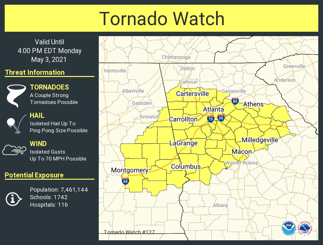
May 4th Severe Weather Threat Thread (Flash Flood Emergency - Birmingham & Hoover, Ala.)
Posted on 5/3/21 at 9:04 am
Posted on 5/3/21 at 9:04 am
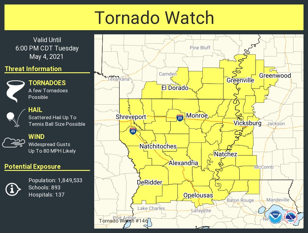
Tuesday Update: Tornado Watch for north & central Louisiana
----------------------------------------------------------------------------------------------------------------------------------------------------------------
----------------------------------------------------------------------------------------------------------------------------------------------------------------
quote:
Meteorologist Nick Mikulas
I’m back, and ready to roll! It looks like we are headed right back into another severe threat on Tuesday. Preliminary reports show 22 tornadoes touched down yesterday from northeast Louisiana, through a big chunk of Mississippi. Locally, we dodged the worst, and had some solid rainbows. Win win. Tomorrow is a pretty interesting day. Definitely a garage the cars day.
Storms should be in progress over northeast Texas and northwest Louisiana by early to mid morning Tuesday. As these early storms move this way, they will hit some very unstable air. Instability is a key ingredient for severe weather, and when it’s on the high end like this, and the freezing levels are low enough, we get the threat for isolated damaging hail. SPC has outlined our area with a 10% risk of 2 inch or larger, diameter hail. That most definitely can leave several marks. Hail typically remains pretty isolated, so it’s likely you won’t see it. But if you find yourself under a warning, garage that car if possible. I think damaging wind is the secondary threat, and while an isolated tornado is possible, I’d think the higher risk of that is northeast of us. You can also see in the SPC risk map, that we are in a level 3/5, enhanced risk. The enhanced risk is generally from Alexandria, to the east and northeast, and this is where the highest chance of severe weather will be.
The good news is, after this, we should quiet down for a good bit. I’ll update things this evening.


This post was edited on 5/4/21 at 5:50 pm
 11
11


Posted on 5/3/21 at 9:06 am to rt3
90 degrees with a nice southerly wind today
In April and early May that means hold onto your butthole
In April and early May that means hold onto your butthole
Posted on 5/3/21 at 9:12 am to rt3
El nino?

Posted on 5/3/21 at 9:13 am to rt3
I hope most of the people in the at risk areas survive.
Posted on 5/3/21 at 9:13 am to The Boat
She's my kind of rain.
Posted on 5/3/21 at 9:19 am to rt3
This post was edited on 5/3/21 at 9:21 am
Posted on 5/3/21 at 9:20 am to OysterPoBoy
quote:
Reed Timmer Extreme Meteorologist
Storm chase mode today will have to both focus on my target area eastern OK into the Ozarks but also a distant tornado threat at my mom’s place in Upstate SC where Gizmo is located. These events always produce out there. Stay tuned everyone. Live briefing coming with 12z models


Posted on 5/3/21 at 9:29 am to rt3
Overnight storm back in mid April blew a large branch out of a tree, and it crushed my windshield.
Posted on 5/3/21 at 9:29 am to Bobby OG Johnson
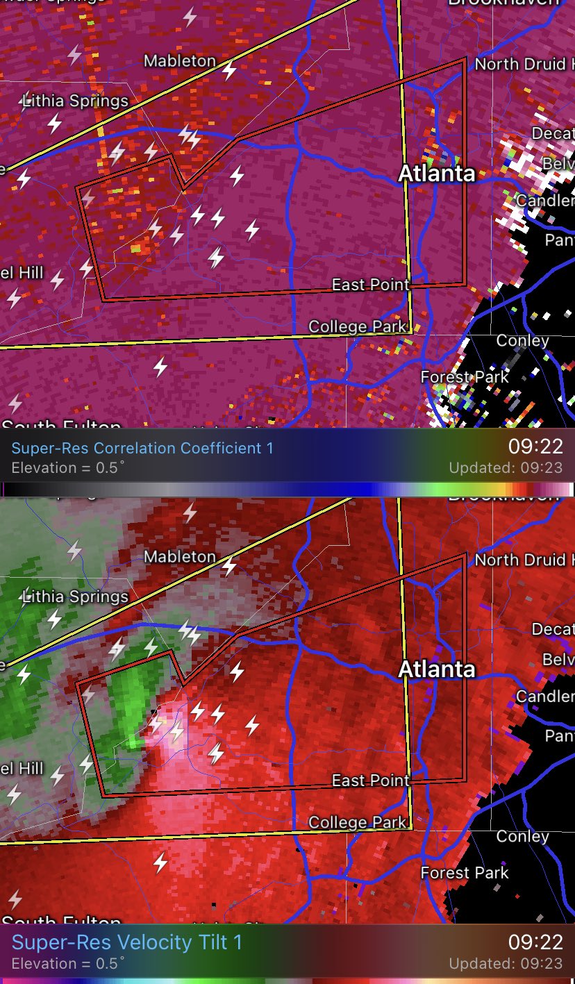
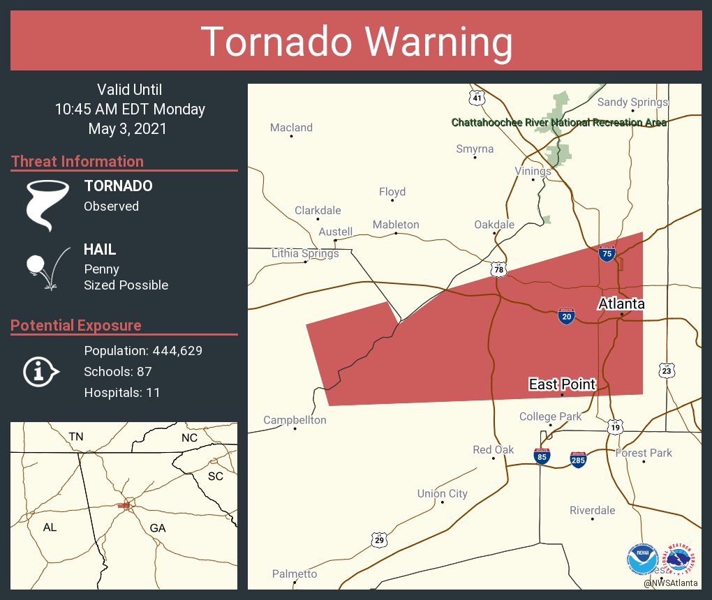
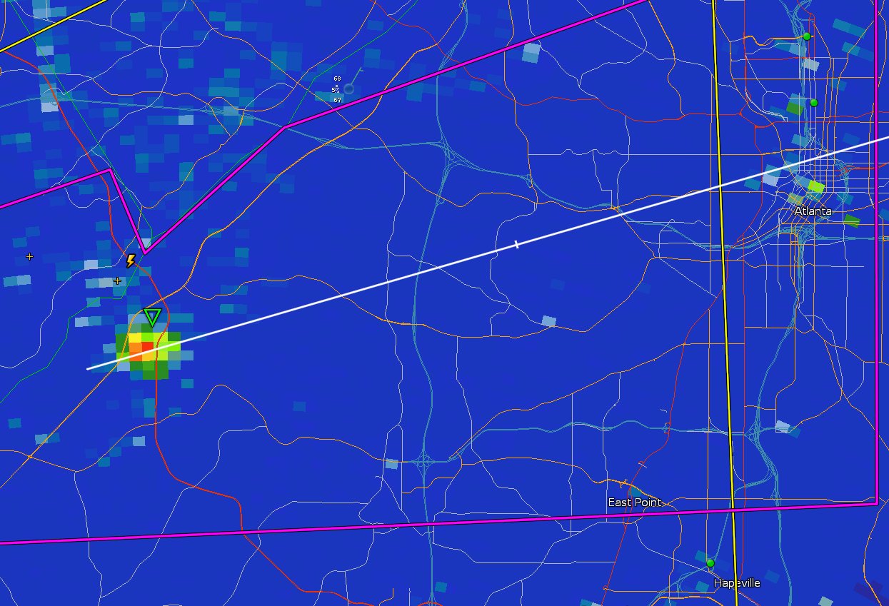
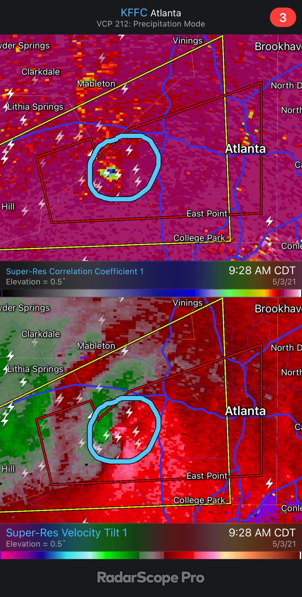
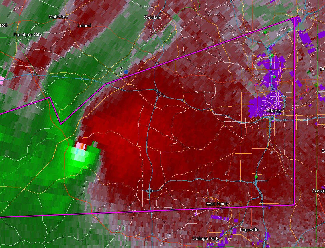
Atlanta about to get smoked?
Posted on 5/3/21 at 9:29 am to Bobby OG Johnson
quote:
@USTornadoes
That didn't take long. Tornado debris signature now evident on radar. Crossing just S of the GA70 and GA6 intersection in west Atlanta. This is now a confirmed tornado.
Posted on 5/3/21 at 9:31 am to rt3
quote:

Posted on 5/3/21 at 9:31 am to rt3
quote:
Atlanta about to get smoked?
Looks like it
Posted on 5/3/21 at 9:34 am to Bobby OG Johnson
WSB meteorologist says it's heading for the area of the Sphincter Stadium

Posted on 5/3/21 at 9:35 am to rt3
SEC Championship game should get moved to New Orleans

 Page 1 of 28

Popular
Back to top