- My Forums
- Tiger Rant
- LSU Recruiting
- SEC Rant
- Saints Talk
- Pelicans Talk
- More Sports Board
- Fantasy Sports
- Golf Board
- Soccer Board
- O-T Lounge
- Tech Board
- Home/Garden Board
- Outdoor Board
- Health/Fitness Board
- Movie/TV Board
- Book Board
- Music Board
- Political Talk
- Money Talk
- Fark Board
- Gaming Board
- Travel Board
- Food/Drink Board
- Ticket Exchange
- TD Help Board
Customize My Forums- View All Forums
- Show Left Links
- Topic Sort Options
- Trending Topics
- Recent Topics
- Active Topics
Started By
Message
re: Hurricane/Tropical Storm Idalia Discussion Thread
Posted on 8/28/23 at 2:27 pm to Funky Tide 8

Posted on 8/28/23 at 2:27 pm to Funky Tide 8
quote:
Sopchoppy?
Not too far off, the worm grunting festival is a sight to behold.
 1
1


Posted on 8/28/23 at 2:32 pm to Jwho77
If it turns south or pulls that loop, I have 12 cases of water. I should be good for a few days 
Posted on 8/28/23 at 2:33 pm to danilo
quote:
It’s possible… so is winning the lottery while being struck my lightening
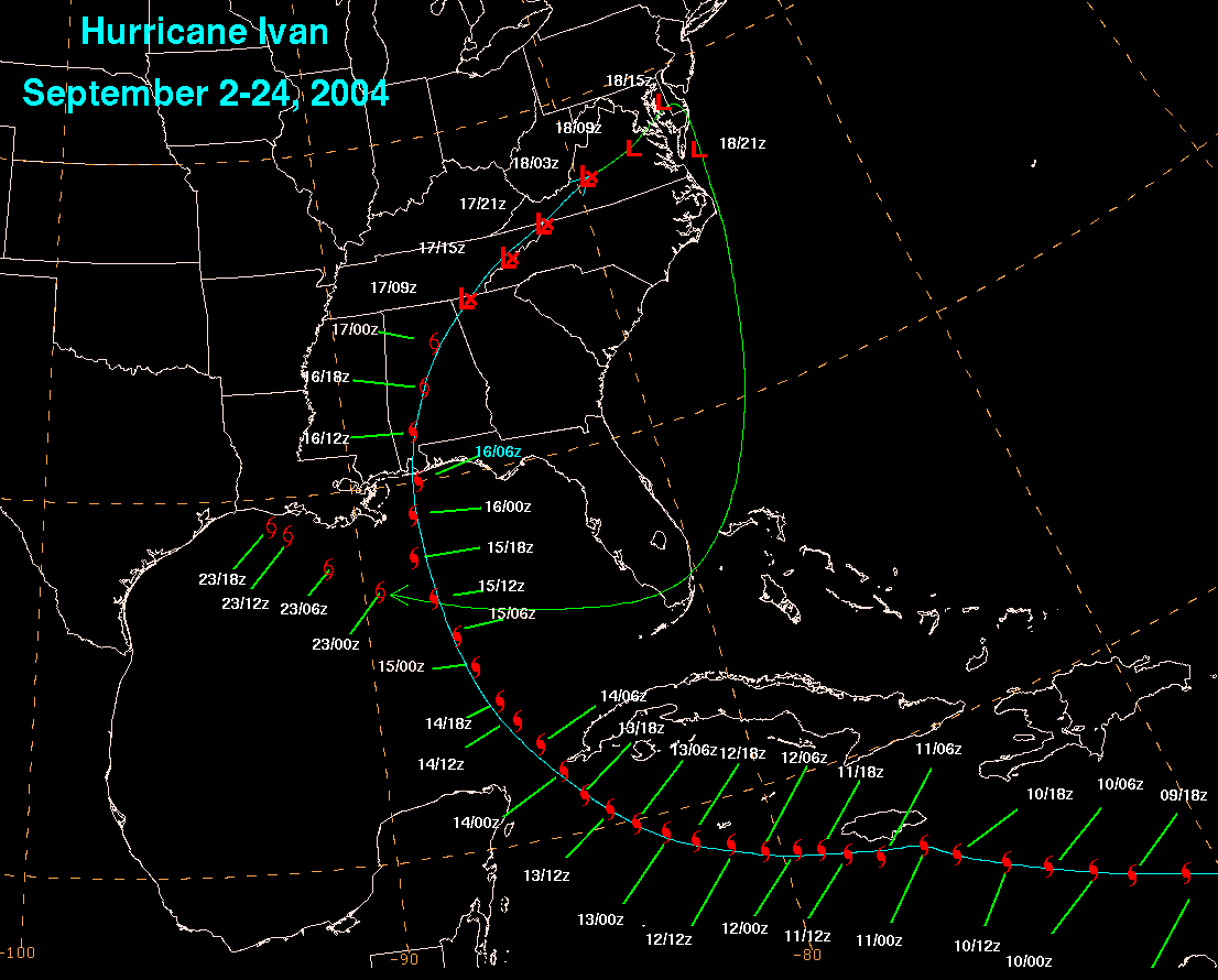
Ivan in 2004 did that
Posted on 8/28/23 at 2:37 pm to Cosmo
quote:
Nice to see monsters like that just spinning harmlessly OTS
Just chewing up some ACE while its at it.
Posted on 8/28/23 at 2:38 pm to Tigris
quote:
worm grunting festival
Do I even want to know what this is
This post was edited on 8/28/23 at 2:39 pm

Posted on 8/28/23 at 2:38 pm to Duke
quote:
Just chewing up some ACE while its at it.
Thing is gonna chew up 20-30
Posted on 8/28/23 at 2:38 pm to TheFonz
Because that's a long projection outward and even if it did do that, you have risks in peak season. That model run there isn't that bad assuming it didn't sit on top of Louisiana for days. It would help our drought situation assuming it's not dumping inches of rain per hour. If it did sit on us with the drought the flooding could be much worse.
But I'd imagine the scare is everyone here knows with a model run like that 10 days out showing a mess hitting Louisiana seldom does it end up being a mess in peak season.
But I'd imagine the scare is everyone here knows with a model run like that 10 days out showing a mess hitting Louisiana seldom does it end up being a mess in peak season.
Posted on 8/28/23 at 3:07 pm to deuce985


Posted on 8/28/23 at 3:12 pm to lsuman25
the curve down back south 
Posted on 8/28/23 at 3:14 pm to Nitrogen
We know bro, that’s what everyone’s talking about
Posted on 8/28/23 at 3:23 pm to lsuman25
People in Tampa better hope those right outliers are wrong.

Posted on 8/28/23 at 3:25 pm to RockChalkTiger
quote:
People in Tampa better hope those right outliers are wrong.
Yeah, and even if the center makes landfall near Cedar Key as the current NHC track forecasts, Tampa Bay is still likely to have very significant storm surge, along with flooding from rainfall.
Posted on 8/28/23 at 3:29 pm to RockChalkTiger
I would not be shocked to see Idalia shift east. Look at the clouds way north of the storm moving off to the North East
Posted on 8/28/23 at 3:34 pm to Roll Tide Ravens
Fiancé has a friend staying in their house in Clearwater. I think that's insane but it's their choice. Supposedly they aren't in a flood plain.
Posted on 8/28/23 at 3:42 pm to jfan244888
quote:
Fiancé has a friend staying in their house in Clearwater. I think that's insane but it's their choice. Supposedly they aren't in a flood plain.
It's still too early to make a decision. Since Katrina, surge predictions are always over exaggerated. If the storm stays on the westerly side of the track, metro Tampa, for the most part, should be ok. If it starts to trend east, it could be bad.

Posted on 8/28/23 at 3:50 pm to Roll Tide Ravens
quote:
Yeah, and even if the center makes landfall near Cedar Key
Damn, I hope not.

Posted on 8/28/23 at 3:51 pm to SippyCup
quote:
Since Katrina, surge predictions are always over exaggerated.
C'mon page 75
It was time for an appearance
This post was edited on 8/28/23 at 3:52 pm
Posted on 8/28/23 at 3:53 pm to Funky Tide 8
4:00 PM CDT advisory is coming out now. Idalia is still not quite a hurricane yet.
Tropical Storm Idalia Advisory Number 9
NWS National Hurricane Center Miami FL AL102023
400 PM CDT Mon Aug 28 2023
...IDALIA NEARING HURRICANE STRENGTH AS IT APPROACHES WESTERN
CUBA...
...LIFE-THREATENING STORM SURGE AND DANGEROUS WINDS BECOMING
INCREASINGLY LIKELY FOR PORTIONS OF FLORIDA...
SUMMARY OF 400 PM CDT...2100 UTC...INFORMATION
----------------------------------------------
LOCATION...21.4N 85.1W
ABOUT 35 MI...60 KM SSW OF THE WESTERN TIP OF CUBA
ABOUT 265 MI...430 KM SSW OF THE DRY TORTUGAS
MAXIMUM SUSTAINED WINDS...70 MPH...110 KM/H
PRESENT MOVEMENT...N OR 360 DEGREES AT 8 MPH...13 KM/H
MINIMUM CENTRAL PRESSURE...987 MB...29.15 INCHES
Posted on 8/28/23 at 3:54 pm to Roll Tide Ravens
NHC calling for 120 mph winds now.
FORECAST POSITIONS AND MAX WINDS
INIT 28/2100Z 21.4N 85.1W 60 KT 70 MPH
12H 29/0600Z 22.7N 85.2W 75 KT 85 MPH
24H 29/1800Z 24.9N 85.0W 90 KT 105 MPH
36H 30/0600Z 27.6N 84.4W 105 KT 120 MPH
48H 30/1800Z 30.4N 82.9W 80 KT 90 MPH...INLAND
60H 31/0600Z 32.7N 80.4W 50 KT 60 MPH...INLAND
72H 31/1800Z 34.0N 76.8W 50 KT 60 MPH...OVER WATER
96H 01/1800Z 34.1N 71.4W 45 KT 50 MPH
120H 02/1800Z 34.0N 69.0W 45 KT 50 MPH
$$
Forecaster Brown
This post was edited on 8/28/23 at 3:56 pm
Posted on 8/28/23 at 3:56 pm to RockChalkTiger
quote:
People in Tampa better hope those right outliers are wrong.
The center doesn't have to track that far south Tampa folks will have a bigger impact from this one than they did Ian with any of those tracks.

 Page 75 of 139

Popular
Back to top