- My Forums
- Tiger Rant
- LSU Recruiting
- SEC Rant
- Saints Talk
- Pelicans Talk
- More Sports Board
- Fantasy Sports
- Golf Board
- Soccer Board
- O-T Lounge
- Tech Board
- Home/Garden Board
- Outdoor Board
- Health/Fitness Board
- Movie/TV Board
- Book Board
- Music Board
- Political Talk
- Money Talk
- Fark Board
- Gaming Board
- Travel Board
- Food/Drink Board
- Ticket Exchange
- TD Help Board
Customize My Forums- View All Forums
- Show Left Links
- Topic Sort Options
- Trending Topics
- Recent Topics
- Active Topics
Started By
Message
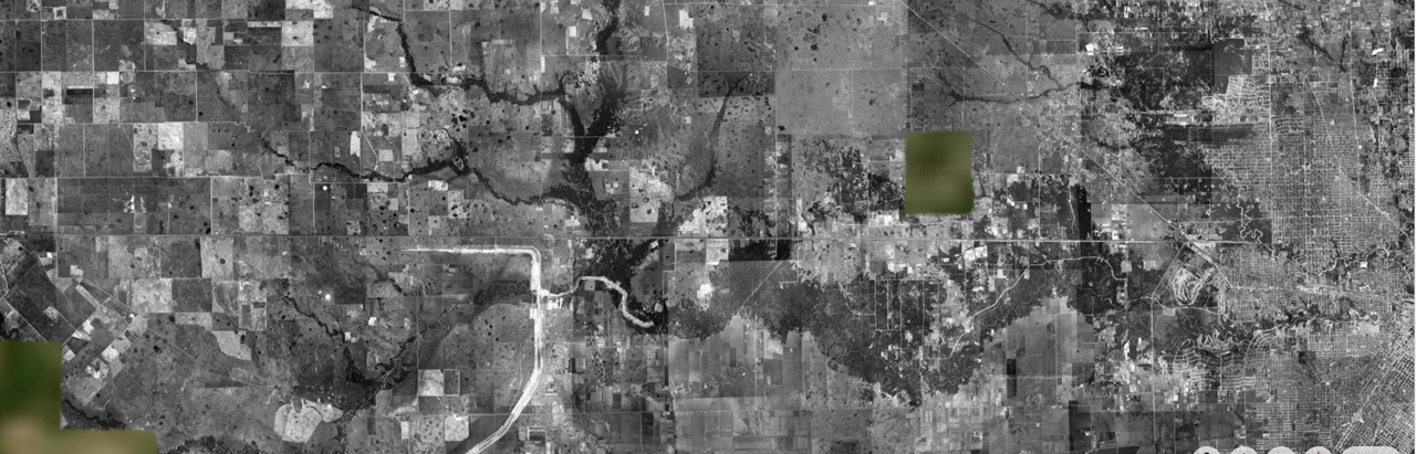
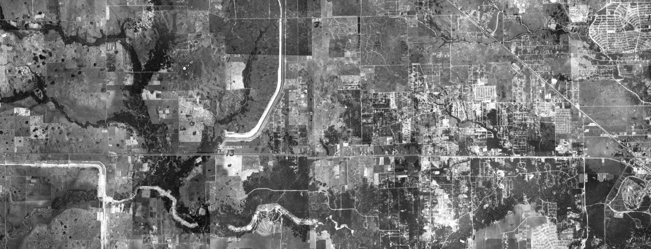
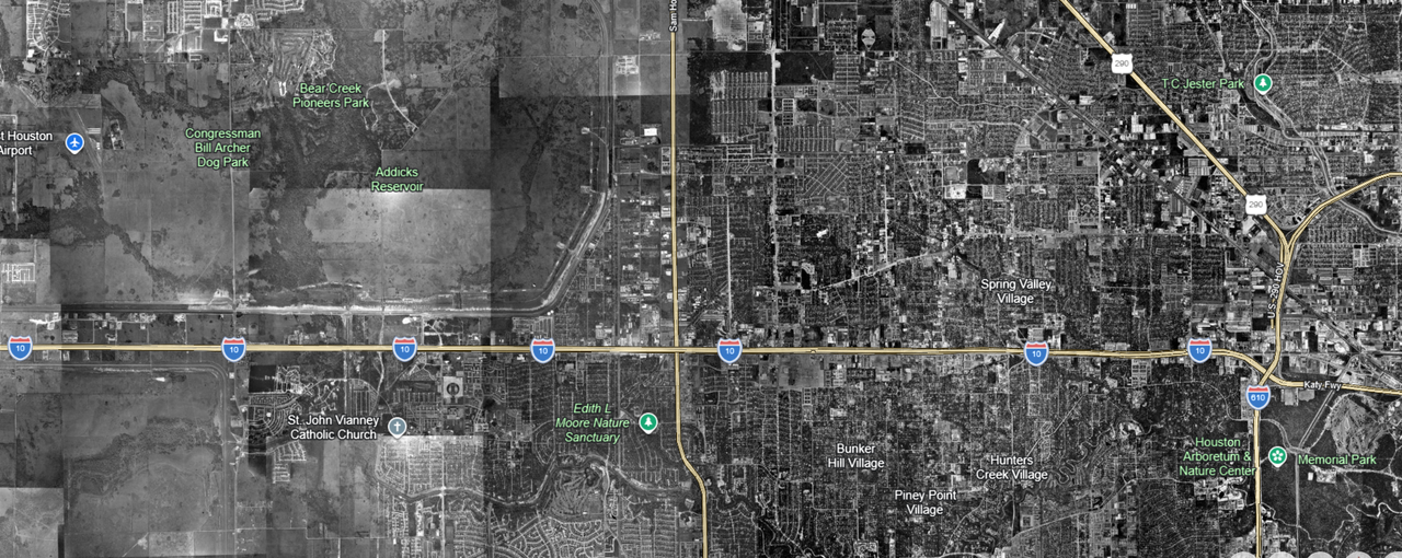
Google Maps showing satellite images of Katy, Tx & Houston area from 1944 & 1953
Posted on 6/17/26 at 1:37 pm

Posted on 6/17/26 at 1:37 pm
Is this a glitch? Sputnik was launched in 1957, and Explorer 1 was launched 1958.
I'm going too far down the rabbit hole of government conspiracies and cover-ups.
Coincidence that it is Houston?
1943 along future I10 Corridor between Katy & Houston
1953: zoom in closely and you will see '53
1978
I'm going too far down the rabbit hole of government conspiracies and cover-ups.
Coincidence that it is Houston?
1943 along future I10 Corridor between Katy & Houston
1953: zoom in closely and you will see '53
1978
 16
16

Posted on 6/17/26 at 1:38 pm to LOL
They had planes before satellites

Posted on 6/17/26 at 1:41 pm to LOL
quote:
Is this a glitch?
We had these things called airplanes

Posted on 6/17/26 at 1:42 pm to LOL
What are you wanting us to look at?

Posted on 6/17/26 at 1:42 pm to Salmon
quote:
We had these things called airplanes


Posted on 6/17/26 at 1:45 pm to LOL
Were you born an idiot or did you have to work at it?
Posted on 6/17/26 at 1:46 pm to RummelTiger
quote:
What are you wanting us to look at?
Probably confused how I10 is yellow in these pictures but looks like regular concrete while driving on the freeway.

Posted on 6/17/26 at 1:46 pm to Salmon
quote:
We had these things called airplanes
Those are just for the contrails to seed the clouds.
Posted on 6/17/26 at 1:52 pm to LOL
quote:
The earliest true aerial photos of New Orleans date back to June 1922. The U.S. Army Air Service and Ensign Campbell Keene captured overlapping biplane photos to create a massive 40-square-foot mosaic map of the city
If you zoom in, you can see Looty on horseback riding down Gentilly on his way to the Fairgrounds.

This post was edited on 6/17/26 at 4:36 pm
Posted on 6/17/26 at 3:27 pm to LOL
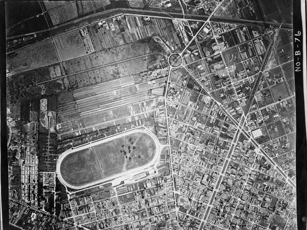
An aerial photo of the LSU campus from the 1920s has been posted here.
There was no El Cid yet.
There was no El Cid yet.
Posted on 6/17/26 at 3:45 pm to LOL
And thats the Eastern edge of Katy in all 3 of those photos

Posted on 6/17/26 at 3:49 pm to LOL
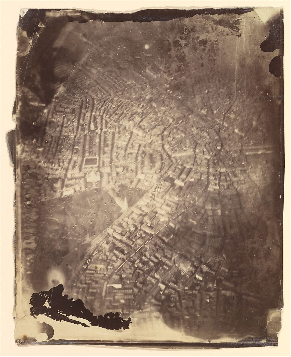
One of the oldest aerials. Shot in 1860 from a balloon.
Posted on 6/17/26 at 3:50 pm to fightin tigers

Posted on 6/17/26 at 3:53 pm to LOL
Explain to me what you think the Allies Air Force did for recon during WW2 in Germany and Japan OP. I'd love to hear this.

Posted on 6/17/26 at 3:54 pm to LOL
Aerial view of San Francisco in 1906 showing damages after the earthquake. They used cameras mounted on kites.
.jpg)
Posted on 6/17/26 at 4:01 pm to LOL
Conspiracies are born out of just pure ignorance.
Posted on 6/17/26 at 4:01 pm to Bestbank Tiger
Bad news for the OT Lounge…
EL Cid will be no more here soon. RIP
EL Cid will be no more here soon. RIP

Posted on 6/17/26 at 4:29 pm to Lonnie Utah
quote:Both
Were you born an idiot or did you have to work at it?
His granpy told him to be the best at whatever he was and the moron listened.
Posted on 6/17/26 at 4:33 pm to LOL
quote:
1953: zoom in closely and you will see '53
The jews or the aliens did it, there is no other explanation.
PS.. how fricking high are you?
Posted on 6/17/26 at 4:44 pm to LOL
quote:
LOL
Also, obligatory, user name check out.

 Page 1 of 2

Popular
Back to top