- My Forums
- Tiger Rant
- LSU Recruiting
- SEC Rant
- Saints Talk
- Pelicans Talk
- More Sports Board
- Coaching Changes
- Fantasy Sports
- Golf Board
- Soccer Board
- O-T Lounge
- Tech Board
- Home/Garden Board
- Outdoor Board
- Health/Fitness Board
- Movie/TV Board
- Book Board
- Music Board
- Political Talk
- Money Talk
- Fark Board
- Gaming Board
- Travel Board
- Food/Drink Board
- Ticket Exchange
- TD Help Board
Customize My Forums- View All Forums
- Show Left Links
- Topic Sort Options
- Trending Topics
- Recent Topics
- Active Topics
Started By
Message
165 and 169 years ago today Major Hurricanes hit Louisiana and Mississippi coasts
Posted on 8/11/25 at 5:31 pm
Posted on 8/11/25 at 5:31 pm
Yesterday/today was the 169th anniversary of the infamous Last Island hurricane


************************************************************************************
Today is the 165th anniversary of a Category 3 hurricane that hit Grand Isle,. Plaquemines, St. Bernard with 125 mph sustained winds and then hit Gulfport / Biloxi with 115 mph winds.

quote:
On August 10, 1856, a severe hurricane struck the Louisiana coast, cutting a channel through Last Island (Isle Dernière) and destroying the resort there. The storm was first detected near the Dry Tortugas the day before. It crossed the Gulf of America and rapidly gained strength. There were no measurements of the wind, but some have estimated them to be near 150 mph (240 km/hr). 183 people perished in ships at sea as the storm swept up the Gulf.
There was little warning of the approaching storm, but once it became apparent, many vacationers on Last Island wanted to leave. However, the only means off the island was by ferry ship, which ran a regular route between Last Island and New Orleans. To allay the fears of the waiting guests, the owners of the main hotel on the island opened up the ballroom for music and dancing. Meanwhile, the ferry ship Star was blown off course, and only arrived at Last Island at the height of the storm. It became beached and could only rescue people swept off shore. The eye moved over the island, and its storm surge completely inundated the resort, destroying the hotel and associated vacation cottages. 198 of the 401 people at the resort were killed. The island remained underwater for several days and when the waters receded a channel carved by the storm surge had split Last Island in two.
The hurricane continued inland, demolishing Abeville and inundating New Orleans with heavy rainfall. An additional 200 people died on mainland Louisiana. News of the disaster at the resort spread once survivors were able to reach New Orleans by bateaux. It was a shock to the nation, as some of the cream of Louisiana society were among the dead. The story of the storm became iconic for generations of the destruction of hurricanes and inspired Lafcadio Hearn to write the novel “Chita: A Memory of Last Island” in 1889.
quote:
August 10-12th, 1856: Hurricane strikes Isle Dernieres, Last Island, a pleasure resort southsouthwest of New Orleans. The highest points were under five feet of water. The resort hotel was destroyed, along with the island’s gambling establishments. The steamer Nautilus foundered during the storm. The lone survivor clung to a bale of cotton and washed ashore sometime later.
Every house in the town of Abbeville was leveled. Rain from the storm flooded the Mermentau River and destroyed crops along bottom lands. Area rice fields in Plaquemines parish went under several feet of salt water. Nearly all rice was lost to the storm. Orange trees were stripped of their fruit. The rain total at New Orleans reached 13.14". In Lake Charles,it rained most of the day on the 12th.
************************************************************************************
Today is the 165th anniversary of a Category 3 hurricane that hit Grand Isle,. Plaquemines, St. Bernard with 125 mph sustained winds and then hit Gulfport / Biloxi with 115 mph winds.
quote:
1860: Number 1 on August 11th: On the fourth anniversary of the Last Island Disaster,
another hurricane made landfall across southeast Louisiana. A twelve foot storm surge inundated the Mississippi Delta (Landsea, personal communication). The old site of Proctorville (now Yscloskey) had hardly a house that remained standing and its lighthouse was leveled. The lighthouse at Bayou St. John was destroyed. The light keeper’s dwelling was demolished, and the Cat Island tower was devastated. Cat Island was inundated, causing 300 cows to drown. The Mississippi rose three feet during the storm. Storm surges were seen eastward along the entire Mississippi shore. The sugar cane crop laid in ruin. Trees were uprooted in Plaquemines parish at the Balize (Pilottown). Up to ten feet of water invaded from the Gulf. Crops of rice and corn were entirely ruined. The influence of the storm extended eastward to Pensacola, where it rained 3.03" and a strong gale ensued on the 11th. Over 47 people died...damages totaled $260,000 (equivalent of at least $10 million today).
This post was edited on 8/11/25 at 8:35 pm
 7
7

Posted on 8/11/25 at 5:34 pm to NorthEndZone
Last island we let the liquor talk
Posted on 8/11/25 at 5:36 pm to NorthEndZone
quote:
The storm was first detected near the Dry Tortugas the day before.
Weather forecasting and tracking has come a long way. Dang. Surprised no boats at sea saw it building.
Posted on 8/11/25 at 5:40 pm to Chucktown_Badger
quote:
Weather forecasting and tracking has come a long way. Dang. Surprised no boats at sea saw it building.
And now if they give a five day forecast that misses landfall by 20 miles people's vaginas bleed uncontrollably.

Posted on 8/11/25 at 5:40 pm to Chucktown_Badger
quote:
Weather forecasting and tracking has come a long way. Dang. Surprised no boats at sea saw it building.
They probably did, but there was no radio to call it in.
Posted on 8/11/25 at 5:42 pm to NorthEndZone
Stop spreading misinformation.
Everyone knows Bush invented hurricanes
Everyone knows Bush invented hurricanes
Posted on 8/11/25 at 5:43 pm to LegendInMyMind
quote:and Inbetween those 5 days the cone bobbled the coast 300 miles left and right
And now if they give a five day forecast that misses landfall by 20 miles people's vaginas bleed uncontrollably.
Posted on 8/11/25 at 6:08 pm to NorthEndZone
I have read this book and recommend it for anyone else that likes this kind of stuff.
Posted on 8/11/25 at 6:42 pm to NorthEndZone
Crazy that a storm that was powerful enough where it hit to destroy an island due South of Houma was also able to to:
That’s quite an impact that far west.
Thank you for posting this. I never knew about this storm and the impacts. I’ve read a lot about the hurricane that destroyed Cheniere Caminada.
quote:
Every house in the town of Abbeville was leveled. Rain from the storm flooded the Mermentau River and destroyed crops along bottom lands.
That’s quite an impact that far west.
Thank you for posting this. I never knew about this storm and the impacts. I’ve read a lot about the hurricane that destroyed Cheniere Caminada.
This post was edited on 8/11/25 at 6:43 pm
Posted on 8/11/25 at 7:00 pm to NorthEndZone
What the hell is an “Opelousas car”?
Posted on 8/11/25 at 7:02 pm to ragincajun03
quote:
That’s quite an impact that far west.
You have to take into account the lack of building codes back then. Homes and other structures just didn't hold up to near what they can now, so the threshold for damage was a lot lower.
Posted on 8/11/25 at 7:02 pm to RanchoLaPuerto
quote:
What the hell is an “Opelousas car”?
Nope, first you tell me what a Soddy Daisy Piledriver is.
Posted on 8/11/25 at 7:08 pm to ragincajun03
quote:
That’s quite an impact that far west.
The center tracked over New Iberia and was estimated at 80 knots (90 mph) there and 110 knots (125 mph) at the coast south of Franklin 6 hours before.
Between it moving slowly, passing about 20 miles east of Abbeville, and likely with an average eye diameter of 25 to 30 miles, that would have put Abbeville in the western eye wall (5 to 10 miles west of the western edge of the eye) for several hours.
Posted on 8/11/25 at 7:23 pm to RanchoLaPuerto
quote:
What the hell is an “Opelousas car”?
I believe it was just the way the writer described the train cars on the train that went between New Orleans and Brashear (Morgan City) in 1856. The railroad was eventually extended to Opelousas which was the planned route.
quote:
The New Orleans, Opelousas and Great Western Railroad (NOO&GW) was chartered in 1852. Construction began at Algiers, across the Mississippi River from New Orleans, in late 1852. By 1857, the track had reached Brashear (now Morgan City) on Berwick Bay, and this remained the end of the line for over 20 years.[1] The 83 miles (134 km) NOO&GW was built to the "Texas gauge" of 5 ft 6 in (1,676 mm),[2] the only such railroad in the New Orleans area to use that gauge; the line was converted to 4 ft 8+1/2 in (1,435 mm) standard gauge in 1872.
In 1869, steamship operator Charles Morgan bought the NOO&GW[3] and began operating it as owner. In 1878 he organized his railroad property as Morgan's Louisiana and Texas Railroad and Steamship Company,[4][5] and it eventually became part of the Southern Pacific Company's main line. The line is currently owned and operated by BNSF.
Posted on 8/11/25 at 7:25 pm to RanchoLaPuerto
quote:
What the hell is an “Opelousas car”?
At the time, rail travel from new orleans to opelousas was quick...and expensive
3 or 4 bucks if I remember right.
Todays money $150 or more.
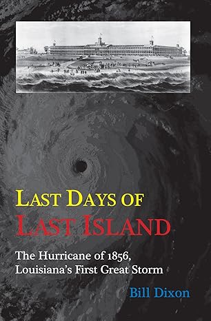
The hotel on that book cover was never built. It was planned. The real hotel was 40 rooms or so. Smaller one being 25 on the other end.
Nichols has a lot of great info on the island.
Posted on 8/11/25 at 7:31 pm to X123F45
quote:
The hotel on that book cover was never built
Yeah. The book does a good job of explaining the plans compared to the reality of what was built. It still was a 'nice' place for 1856 since some of the rich and famous (doctors, politicians, businessmen) of the region vacationed there, but it was nowhere near the size shown in the artist's rendering.
This post was edited on 8/11/25 at 7:34 pm
Posted on 8/11/25 at 7:51 pm to NorthEndZone
Got it. Thank you!
I’ve consumed many a bottle of MD 20 20 on Railroad Avenue in Opelousas.
I’ve consumed many a bottle of MD 20 20 on Railroad Avenue in Opelousas.
Posted on 8/11/25 at 9:19 pm to ragincajun03
I think I read somewhere that last island in that storm was several miles south from the current location of the island chain.

 Page 1 of 1


Popular
Back to top