- My Forums
- Tiger Rant
- LSU Recruiting
- SEC Rant
- Saints Talk
- Pelicans Talk
- More Sports Board
- Fantasy Sports
- Golf Board
- Soccer Board
- O-T Lounge
- Tech Board
- Home/Garden Board
- Outdoor Board
- Health/Fitness Board
- Movie/TV Board
- Book Board
- Music Board
- Political Talk
- Money Talk
- Fark Board
- Gaming Board
- Travel Board
- Food/Drink Board
- Ticket Exchange
- TD Help Board
Customize My Forums- View All Forums
- Show Left Links
- Topic Sort Options
- Trending Topics
- Recent Topics
- Active Topics
Started By
Message
 1
1

Posted on 10/5/16 at 10:21 pm to Duke
Dropsonde just recorded a pressure of 958.5 mb, 3mb lower than their last pass.
That isn't official though.
That isn't official though.
Posted on 10/5/16 at 10:22 pm to rds dc
Remember when Boston was in the cone?


Posted on 10/5/16 at 10:23 pm to Roll Tide Ravens
That was my point it will be affecting such a large area and alot of people.
Posted on 10/5/16 at 10:24 pm to Roll Tide Ravens
quote:
The thing that is rather unusual about this storm is the way it is going to roll up the coast and stay close to it. Usually hurricanes go directly into an area, and therefore impact a narrower area, but with Matthew it isn't moving directly in but rather scraping right along the coast.
IIRC, this will be the only major to impact the coast at this angle in that area in recorded history going back to the 1800's.
Posted on 10/5/16 at 10:25 pm to rds dc
The models did get that 90 degree turn a few days ago correct.

Posted on 10/5/16 at 10:26 pm to FLBooGoTigs1
quote:
They are shutting down for 36 hours starting tomorrow at 6 am.
who is?
eta: oh, nevermind, your employer..duh Ellis
This post was edited on 10/5/16 at 10:31 pm

Posted on 10/5/16 at 10:26 pm to FLBooGoTigs1
Another thing that makes this situation worse is that Matthew has a good chance of staying just close enough to the water to keep it from rapidly weakening if the center does indeed get over land.
Posted on 10/5/16 at 10:26 pm to LSUwag
Wag, I don't know if your position is far/safe enough from the predicted storm surge, but I hope so.
I lived in St. Aug in 1999-2001, so I remember the area and fleeing Hurricane Floyd.
Best of luck to you. Best of luck to all of you on this board who live there.
I lived in St. Aug in 1999-2001, so I remember the area and fleeing Hurricane Floyd.
Best of luck to you. Best of luck to all of you on this board who live there.
Posted on 10/5/16 at 10:27 pm to slackster
quote:
This is going to be a crazy storm surge situation - if it stays off the coast, the coastline will see generally higher water but the strongest wins will essentially be north winds that push water parallel to the coast. However, if it strays inland you obviously have the northeast quadrant storm surge issues. Obviously we want the former to be the case, but it is something to monitor.
If it rides up the coast like expected now, when it is just South of Jacksonville, the NE quadrant is going to push the whole St. Johns river in (flows south to north).
Posted on 10/5/16 at 10:27 pm to rds dc
quote:
rds dc
Why is a model like the HRRR wrong the moment it initializes?
2z HRRR initialized at 975mb. The storm hasn't been that high in days.
Posted on 10/5/16 at 10:28 pm to quail man
quote:
does anyone else think about how crazy it is that hurricanes are a thing? like that nature can put together something like that. shite is ridiculous. God speed, Florida.
Consider how long they have been impacting the earth as well, there have to have been some doozies that we have no idea about.
Additionally, consider what that must have been like before all of this early warning and weather tracking. You go to sleep one night and wake up to that kind of beast at your doorstep with no other warning. Holy cow...
Posted on 10/5/16 at 10:28 pm to Uncle JackD
quote:
why the frick risk it?? I'm far from an expert but this seems incredibly irresponsible of the UF admins.
Chicken already established that this thread isn't for debating the football game. This is just to be about weather (and snarky comments)
Posted on 10/5/16 at 10:28 pm to NYNolaguy1
It is a useful technique but not nearly as accurate as flying a plane into it and measuring it. It does suggest it's getting stronger. Just wanted to clarify that's not a measured value.
Too many people reading here. That's all.
Too many people reading here. That's all.
Posted on 10/5/16 at 10:28 pm to Tiger in NY
quote:
If it rides up the coast like expected now, when it is just South of Jacksonville, the NE quadrant is going to push the whole St. Johns river in (flows south to north).
Yeah, but that is much better than a storm coming due west into Jacksonville.
Posted on 10/5/16 at 10:29 pm to FLBooGoTigs1
quote:
We are shutting down for 36 hours starting tomorrow at 6 am
Glad to hear you'll have time
Posted on 10/5/16 at 10:30 pm to Roll Tide Ravens
Also, don't give what people are saying on SEC Rant about the game/storm a lot of thought, most of them down know anything about this type of thing.
Posted on 10/5/16 at 10:31 pm to TennesseeFan25
quote:
Additionally, consider what that must have been like before all of this early warning and weather tracking. You go to sleep one night and wake up to that kind of beast at your doorstep with no other warning. Holy cow...
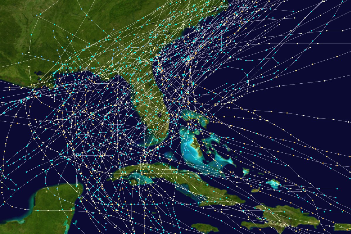
I'll take it even a step further - this map is supposed to be of hurricanes that impacted Florida from 1851-1899. How the frick do they know shite about storms from the 1860s.
Posted on 10/5/16 at 10:31 pm to rds dc
More of a dying sperm than a cone at this point

Posted on 10/5/16 at 10:31 pm to Duke
Thanks for clarifying.

 Page 110 of 181

Popular
Back to top