- My Forums
- Tiger Rant
- LSU Recruiting
- SEC Rant
- Saints Talk
- Pelicans Talk
- More Sports Board
- Fantasy Sports
- Golf Board
- Soccer Board
- O-T Lounge
- Tech Board
- Home/Garden Board
- Outdoor Board
- Health/Fitness Board
- Movie/TV Board
- Book Board
- Music Board
- Political Talk
- Money Talk
- Fark Board
- Gaming Board
- Travel Board
- Food/Drink Board
- Ticket Exchange
- TD Help Board
Customize My Forums- View All Forums
- Show Left Links
- Topic Sort Options
- Trending Topics
- Recent Topics
- Active Topics
Started By
Message
re: Hurricane Lee Forecast to be 150MPH+
Posted on 9/7/23 at 7:35 pm to NorthEndZone
Posted on 9/7/23 at 7:35 pm to NorthEndZone
Prayers for Lake Charles
 0
0

Posted on 9/7/23 at 7:39 pm to Tyga Woods
I like to happen upon Frankie's updates organically, in their natural environment. He adds a certain feel to a Xwitter feed.
Posted on 9/7/23 at 7:40 pm to McGruff21
This one is gonna be a problem
Posted on 9/7/23 at 7:45 pm to Rebel
quote:
has there ever been cat 5's in the pacific and atlantic at the same time?
IDK for sure but Id think yes.
This is the sort of thing that autist tBoat would probably know offhand.
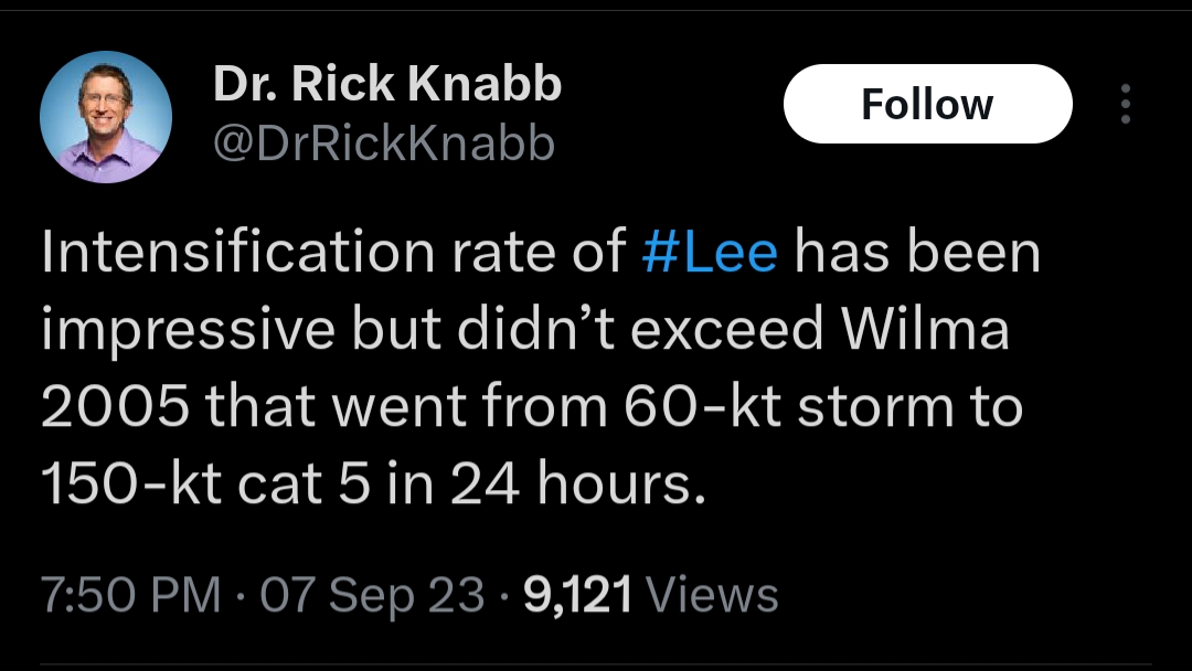
Posted on 9/7/23 at 7:48 pm to Duke

Posted on 9/7/23 at 7:54 pm to Cracker
quote:
This one is gonna be a problem
Doesn't that mainly depend on what the trough currently in the upper mid-west does?
Posted on 9/7/23 at 8:04 pm to Obtuse1
quote:
Doesn't that mainly depend on what the trough currently in the upper mid-west does?
Thats a big player, in terms of where our north window opens.
The other is all the damn outflow Lee is going to put out. It'll help to "pump" the Atlantic ridge and try and force the turn farther west. In addition, this could serve to get Lee farther SW before any turn.
Cant trust the modeling on these level of details this far out in time. So we wait.
Posted on 9/7/23 at 8:16 pm to Duke
quote:
Cant trust the modeling on these level of details this far out in time. So we wait.
Levi had a great write up yesterday covering the long range models.
After day five all of the dozens of model runs of the GFS and the Euro were in good agreement. They were all clustered north of Puerto Rico.
But after that the projected tracks diversified. There was no consensus on direction or speed of movement. He explained that a very complex situation in the mid latitudes was causing a lot of uncertainty.
But I will stress, westerlies at a rather low level were protecting the Gulf and Caribbean.
Posted on 9/7/23 at 8:17 pm to Duke
Kinda not the kinda news we are all hoping for. But then again, I guess Peej sealed our fates.
Posted on 9/7/23 at 8:26 pm to Duke
quote:
The other is all the damn outflow Lee is going to put out. It'll help to "pump" the Atlantic ridge and try and force the turn farther west. In addition, this could serve to get Lee farther SW before any turn.
Euro is leaning the farthest west right now. It also has a shallower trough, maybe slower, too, I didn't look that close.
Posted on 9/7/23 at 9:02 pm to LegendInMyMind
930 mb on second pass through eye.

quote:
881
URNT12 KNHC 080156
VORTEX DATA MESSAGE AL132023
A. 08/01:28:50Z
B. 17.12 deg N 052.18 deg W
C. 700 mb 2538 m
D. 930 mb
E. 355 deg 20 kt
F. CLOSED
G. C15
H. 143 kt
I. 005 deg 6 nm 01:27:00Z
J. 048 deg 145 kt
K. 343 deg 9 nm 01:25:30Z
L. 123 kt
M. 139 deg 8 nm 01:31:00Z
N. 252 deg 124 kt
O. 139 deg 8 nm 01:31:00Z
P. 7 C / 3056 m
Q. 27 C / 3024 m
R. 4 C / NA
S. 12345 / 7
T. 0.02 / 1 nm
U. AF306 0213A LEE OB 12
MAX FL WIND 148 KT 064 / 9 NM 23:38:00Z
;
Posted on 9/7/23 at 9:11 pm to NorthEndZone
Are we gonna just ignore Margot squirming around out there?


Posted on 9/7/23 at 9:18 pm to LegendInMyMind


Posted on 9/7/23 at 9:38 pm to McGruff21
Where in the hell is rds??????
Posted on 9/7/23 at 9:53 pm to Legion of Doom
...LEE BECOMES A CATEGORY 5 HURRICANE... ...DANGEROUS BEACH CONDITIONS EXPECTED TO DEVELOP AROUND THE WESTERN ATLANTIC THROUGH EARLY NEXT WEEK...
11:00 PM AST Thu Sep 7
Location: 17.3°N 52.4°W
Moving: WNW at 14 mph
Min pressure: 928 mb
Max sustained: 160 mph
11:00 PM AST Thu Sep 7
Location: 17.3°N 52.4°W
Moving: WNW at 14 mph
Min pressure: 928 mb
Max sustained: 160 mph
Posted on 9/7/23 at 9:53 pm to lsuman25
quote:
lsuman25...LEE BECOMES A CATEGORY 5 HURRICANE... ...DANGEROUS BEACH CONDITIONS EXPECTED TO DEVELOP AROUND THE WESTERN ATLANTIC THROUGH EARLY NEXT WEEK... 11:00 PM AST Thu Sep 7 Location: 17.3°N 52.4°W Moving: WNW at 14 mph Min pressure: 928 mb Max sustained: 160 mph
Talk about rapid intensification. Heck of a run Lee has been on today.
Posted on 9/7/23 at 9:54 pm to lsuman25
FORECAST POSITIONS AND MAX WINDS
INIT 08/0300Z 17.3N 52.4W 140 KT 160 MPH
12H 08/1200Z 18.1N 54.0W 155 KT 180 MPH
24H 09/0000Z 19.1N 56.1W 150 KT 175 MPH
36H 09/1200Z 20.1N 58.0W 145 KT 165 MPH
48H 10/0000Z 20.9N 59.6W 140 KT 160 MPH
60H 10/1200Z 21.5N 60.9W 135 KT 155 MPH
72H 11/0000Z 22.1N 62.2W 130 KT 150 MPH
96H 12/0000Z 23.2N 64.7W 125 KT 145 MPH
120H 13/0000Z 24.1N 66.6W 115 KT 130 MPH
$$
Forecaster Berg
Posted on 9/7/23 at 9:55 pm to Roll Tide Ravens
FORECAST POSITIONS AND MAX WINDS
INIT 08/0300Z 17.3N 52.4W 140 KT 160 MPH
12H 08/1200Z 18.1N 54.0W 155 KT 180 MPH
24H 09/0000Z 19.1N 56.1W 150 KT 175 MPH
36H 09/1200Z 20.1N 58.0W 145 KT 165 MPH
48H 10/0000Z 20.9N 59.6W 140 KT 160 MPH
60H 10/1200Z 21.5N 60.9W 135 KT 155 MPH
72H 11/0000Z 22.1N 62.2W 130 KT 150 MPH
96H 12/0000Z 23.2N 64.7W 125 KT 145 MPH
120H 13/0000Z 24.1N 66.6W 115 KT 130 MPH
$$
Forecaster Berg

 Page 10 of 18

Popular
Back to top