




 0
0








- My Forums
- Tiger Rant
- LSU Recruiting
- SEC Rant
- Saints Talk
- Pelicans Talk
- More Sports Board
- Fantasy Sports
- Golf Board
- Soccer Board
- O-T Lounge
- Tech Board
- Home/Garden Board
- Outdoor Board
- Health/Fitness Board
- Movie/TV Board
- Book Board
- Music Board
- Political Talk
- Money Talk
- Fark Board
- Gaming Board
- Travel Board
- Food/Drink Board
- Ticket Exchange
- TD Help Board
Customize My Forums- View All Forums
- Show Left Links
- Topic Sort Options
- Trending Topics
- Recent Topics
- Active Topics
Started By
Message
re: Hurricane Isaias - Pensacola Beach to Navarre Beach Under the Gun
Posted on 10/9/26 at 7:33 am to East Coast Band
Posted on 10/9/26 at 7:33 am to East Coast Band
quote:
Typically, of course not always, hurricanes, by the time the center reaches Tuscaloosa, will have diminished greatin strength and the storms or no worse than one of your summertime afternoon thunderstorms.
Certainly, treses might be blown over,but widespread damage would not be expected
Holy shite man.
Posted on 10/9/26 at 7:33 am to Craft
Ok drama queen. Keep bleeding all over this thread
Posted on 10/9/26 at 7:33 am to lsupride87
That little tropical storm that hit in June spun a tornado that blew the windows out in my car. I don’t dismiss any tropical system from storm to Cat 5. They can all frick off.
Posted on 10/9/26 at 7:34 am to LSUlefty
quote:
I can't believe this thing has grown to a Cat 3.
I’m not a storm2k’er but yesterday morning there were some in here laughing at them, calling them “wishcasters” for talking about it getting to a cat 3, even though most models were showing that.
Nobody paying attention should be surprised by this strength this morning.
Posted on 10/9/26 at 7:35 am to TDsngumbo
whatever they project add a category or two. it’s always worse than they project.
Posted on 10/9/26 at 7:35 am to TDsngumbo
The only thing I’m surprised about is the level of stupidity people have about weather, but I shouldn’t and that’s on me, because that’s been a constant across history and will continue in perpetuity unfortunately.
Posted on 10/9/26 at 7:37 am to tigersownall
quote:
I wish we’d get at least some showers out of this in south la.
Nope.
It was nice seeing the edge of the system to east of us this morning in Houma. Clear line of dry stable air to the west.
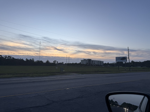
Posted on 10/9/26 at 7:37 am to Mempho
quote:Ok you want a non nerd answer
Oh no- that’s a post-tropical- hence no TS warnings north of there. So it’s all good no matter the wind speed if we make the circle white. People wonder why nerds are hated and this is why.
My hunting property is nearly 300 miles from the coast inland. During Laura it saw 55mph winds ( a nerd calls that a tropical storm) and there were 1000s of trees down and no power for nearly a week in the entire area
Posted on 10/9/26 at 7:39 am to lsupride87
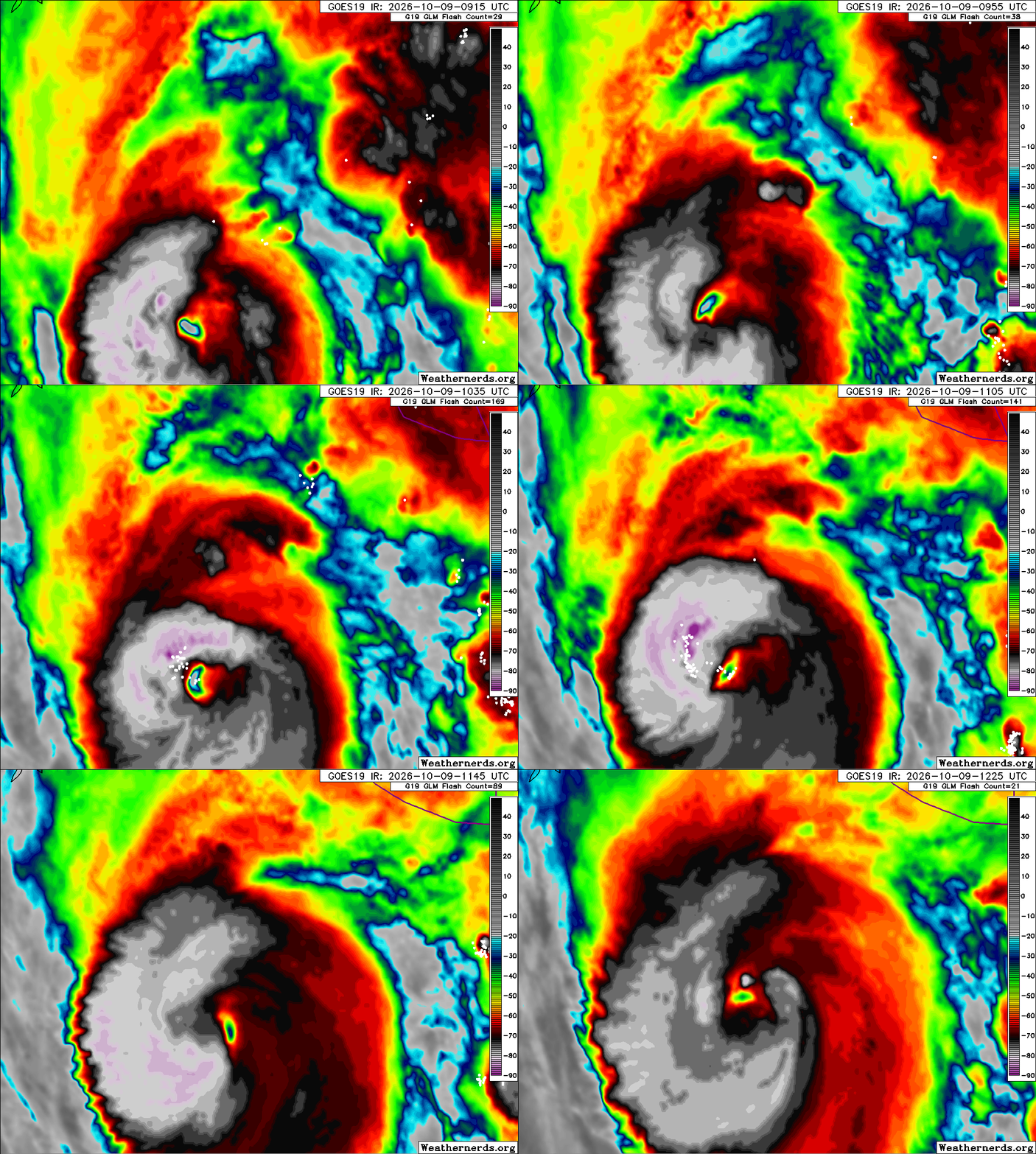
Posted on 10/9/26 at 7:41 am to Craft
quote:
so projected cat 1 and original track not even in cone. that’s the type of shite that’s gonna get people hurt.
I wish I could go through the day with the level of confidence of a dumbass with an IQ of ~80.
Posted on 10/9/26 at 7:42 am to lsupride87
quote:
Ok you want a non nerd answer
My hunting property is nearly 300 miles from the coast inland. During Laura it saw 55mph winds ( a nerd calls that a tropical storm) and there were 1000s of trees down and no power for nearly a week in the entire area
So, would you have had a problem if they'd just called that a tropical storm warning and moved on?
I'm arguing that they should just issue one set of products that is consistent with the system at hand.
Posted on 10/9/26 at 7:43 am to Roll Tide Ravens
Definitely see it heading north
Posted on 10/9/26 at 7:44 am to Mempho
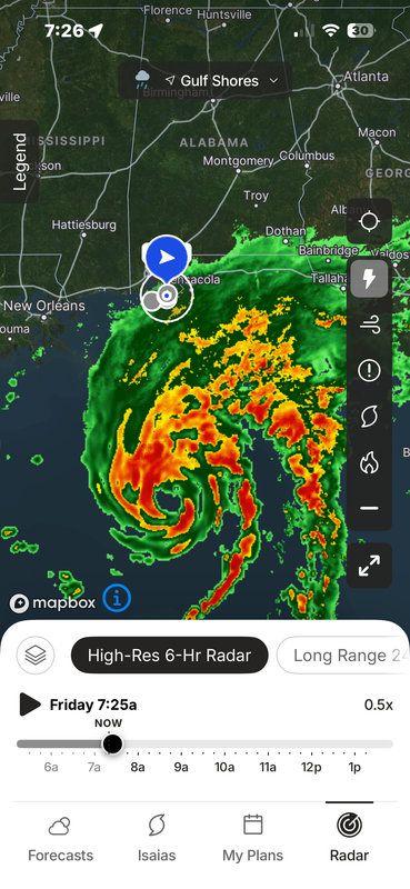
It’s moved east of me but not far. Still in the line of fire but on West side.
Posted on 10/9/26 at 7:45 am to lsupride87
This will be the worst storm Tuscaloosa has encountered since Katrina. There will definitely be trees down with 60 mph gusts projected. If the damage is too much, the university and powers that be will react. What they don’t want to do is overreact now.
Posted on 10/9/26 at 7:46 am to Mempho
quote:The issue is people. They could do whatever they want warning wise and it wouldn’t really work
would you have had a problem if they'd just called that a tropical storm warning and moved on? I'm arguing that they should just issue one set of products that is consistent with the system at hand.
Posted on 10/9/26 at 7:46 am to AHM21
The center of circulation as depicted on satellite and as tagged on recon flight is on the eastern side of the midline of the NHC cone. I know we always expect to see jogs east and west, but if it doesn’t course correct, this could end up being a more eastern landfall than the current midpoint of east Pensacola Beach / Tiger Point.
Posted on 10/9/26 at 7:47 am to AHM21
quote:They will likely still have 50k plus people outside on campus during the Storm
This will be the worst storm Tuscaloosa has encountered since Katrina. There will definitely be trees down with 60 mph gusts projected. If the damage is too much, the university and powers that be will react. What they don’t want to do is overreact now.
At this point they have to pray the projection is wrong it’s too late
This post was edited on 10/9/26 at 7:48 am
Posted on 10/9/26 at 7:49 am to lsupride87
I’m driving through Tuscaloosa saturday morning about 11am to Birmingham up towards Chattanooga.
Posted on 10/9/26 at 7:49 am to Crawdaddy
quote:Godspeed
I’m driving through Tuscaloosa saturday morning about 11am to Birmingham up towards Chattanooga
Posted on 10/9/26 at 7:53 am to lsupride87
it’s crazy to think about. this time tomorrow some posters here will have gone through such great pain and destruction. it’s so sad. nothing we can do. prey, i say. for everyone. in jesus name we do

 Page 118 of 131



Popular

Back to top
 Follow TigerDroppings for LSU Football News