




- My Forums
- Tiger Rant
- LSU Recruiting
- SEC Rant
- Saints Talk
- Pelicans Talk
- More Sports Board
- Fantasy Sports
- Golf Board
- Soccer Board
- O-T Lounge
- Tech Board
- Home/Garden Board
- Outdoor Board
- Health/Fitness Board
- Movie/TV Board
- Book Board
- Music Board
- Political Talk
- Money Talk
- Fark Board
- Gaming Board
- Travel Board
- Food/Drink Board
- Ticket Exchange
- TD Help Board
Customize My Forums- View All Forums
- Show Left Links
- Topic Sort Options
- Trending Topics
- Recent Topics
- Active Topics
Started By
Message
re: February 2019 Cold blast and southern snow discussion thread
Posted on 1/28/19 at 9:25 am to Duke

Posted on 1/28/19 at 9:25 am to Duke
quote:
BR and our bridges mean freezing precip is an everything is shut down kind of situation. If we have to deal with that, better last December and the 4" vs last January's brutal cold and a pile of graupel.
we had like a sleet/ice storm like 2 years ago... oh that was miserable

 1
1

Posted on 1/28/19 at 9:35 am to rt3
quote:
A Winter Weather Advisory is in effect from 9 PM this evening through 9 AM Tuesday morning for Union County Arkansas and much of Northcentral Louisiana. Rain will transition over to snow by mid to late evening over Southern Arkansas and extreme Northern Louisiana, and across the remainder of Northcentral Louisiana after midnight. Snow amounts of 0.5-1.0 inches, with isolated higher amounts up to 2 inches, will be possible across the Advisory area.


Posted on 1/28/19 at 9:38 am to rt3
The new GFS has widespread snow for the BR area tomorrow morning, why is everyone backing off on predictions?


Posted on 1/28/19 at 9:39 am to rt3
quote:
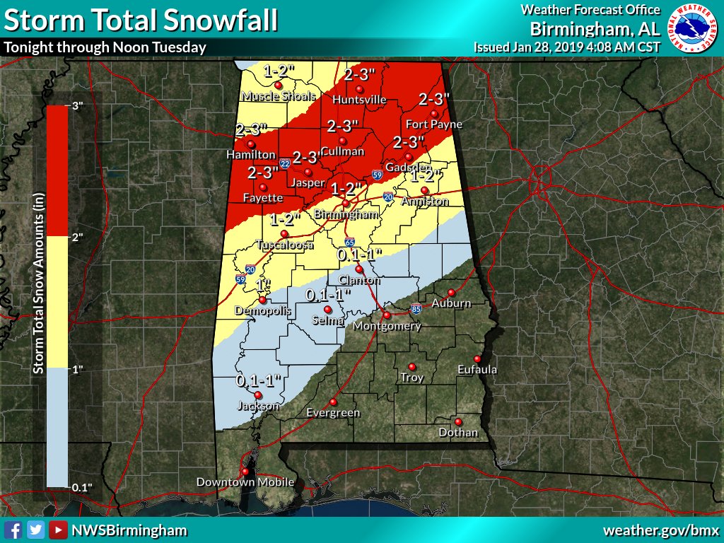
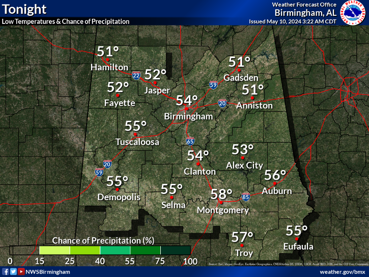
URGENT - WINTER WEATHER MESSAGE National Weather Service Birmingham AL 352 AM CST Mon Jan 28 2019 ...SNOW EXPECTED LATE MONDAY NIGHT INTO TUESDAY MORNING... .A strong cold front will move into Central Alabama late Monday night and Tuesday morning. Rain will change over to snow as early as midnight Monday night in the Northwest, with the rain to snow transition line moving southeastward through the morning on Tuesday. Snow will come to an end around noon on Tuesday in the East. While snow may fall for only one to three hours at a given location, it could be heavy at times, with accumulations of 2 to 3 inches across the warning area. Amounts under two inches are expected in the advisory area. Temperatures will fall below freezing across the warning area and portions of the advisory area, resulting in potentially dangerous travel conditions. This will impact the morning commute especially along the Interstate 20 corridor. ALZ011>015-017-018-020-022>024-026-282200- /O.UPG.KBMX.WS.A.0001.190129T0600Z-190129T1800Z/ /O.NEW.KBMX.WS.W.0001.190129T0600Z-190129T1800Z/ Marion-Lamar-Fayette-Winston-Walker-Blount-Etowah-Cherokee- Pickens-Tuscaloosa-Jefferson-St. Clair- Including the cities of Hamilton, Sulligent, Vernon, Fayette, Double Springs, Jasper, Oneonta, Gadsden, Centre, Carrollton, Tuscaloosa, Birmingham, Hoover, Pell City, and Moody 352 AM CST Mon Jan 28 2019 ...WINTER STORM WARNING IN EFFECT FROM MIDNIGHT TONIGHT TO NOON CST TUESDAY... * WHAT...Heavy snow possible. Total snow accumulations of two to three inches. Temperatures falling below freezing may result in dangerous travel conditions. * WHERE...Portions of Central Alabama, including areas along and north of a line from Carrollton to Birmingham to Centre. * WHEN...From midnight tonight to noon CST Tuesday. * ADDITIONAL DETAILS...Travel could become dangerous. The hazardous conditions could impact the morning commute. PRECAUTIONARY/PREPAREDNESS ACTIONS... A Winter Storm Warning for snow means severe winter weather conditions will make travel very hazardous or impossible. If you must travel, keep an extra flashlight, food and water in your vehicle in case of an emergency. The latest road conditions for the state you are calling from can be obtained by calling 5 1 1. && $$
quote:
Hazardous Weather Outlook National Weather Service Birmingham AL 510 AM CST Mon Jan 28 2019 ALZ011>015-017>050-291415- Marion-Lamar-Fayette-Winston-Walker-Blount-Etowah-Calhoun-Cherokee- Cleburne-Pickens-Tuscaloosa-Jefferson-Shelby-St. Clair-Talladega- Clay-Randolph-Sumter-Greene-Hale-Perry-Bibb-Chilton-Coosa-Tallapoosa- Chambers-Marengo-Dallas-Autauga-Lowndes-Elmore-Montgomery-Macon- Bullock-Lee-Russell-Pike-Barbour- 510 AM CST Mon Jan 28 2019 This Hazardous Weather Outlook is for the counties served by the National Weather Service office in Birmingham. .DAY ONE...Outlook through Tonight. A strong cold front is expected to bring a transition from rain to snow overnight. The transition could begin as early as midnight in the northwest and progress southeastward through the morning hours. Snow accumulations of one half inch to 3 inches are anticipated through Tuesday morning. Some isolated higher amounts are also possible. Impacts to travel appear likely near and north of a line from Demopolis to Pelham to to Cedar Bluff by 6 AM. Due to recent rainfall, minor river flooding is expected along portions of the Black Warrior River through tonight. Please refer to river statements for details. .DAYS TWO THROUGH SEVEN...Tuesday through Sunday. The transition from rain to snow will continue through Noon for areas generally along and north of a Selma to Prattville to Valley. Additional snow accumulations of one half inch to 2 inches through Noon Tuesday. Total snow accumulation of one half to 3 inches can be expected, with isolated higher totals. Stay tuned to the latest forecast issuances concerning the snow impacts. Temperatures overnight Wednesday night into Thursday morning could drop to or just below 15 degrees in the far northern portion of Central Alabama. Confidence is low at this time. .SPOTTER INFORMATION STATEMENT... Activation of storm spotters and emergency management will be needed into Tuesday morning. $$
Posted on 1/28/19 at 9:41 am to LSUsmartass
Those 6 hour maps can be misleading with showing snow. I find this to be more useful. As you can see, it shows precip ending with temps at 36 degrees. And 850 temps are just above freezing. No snow from that.
LINK
LINK
This post was edited on 1/28/19 at 9:42 am
Posted on 1/28/19 at 9:42 am to LSUsmartass
The new GFS is all alone, has been overdoing the set up for days. It'd be a hell of a coup if it got this right. Just looking at the ensemble results from the GFS and Euro, fewer than 10% have anything for BR much less south of here.
If everything else was wrong, it's a great look for the new GFS but it would be folly to forecast based on that outlier.
BigB above is dead on with critique of the six hour maps. It's why I've been grabbing GFS soundings to confirm the snow the six hour maps are showing. I've only seen a run that was in any way in the ballpark.
If everything else was wrong, it's a great look for the new GFS but it would be folly to forecast based on that outlier.
BigB above is dead on with critique of the six hour maps. It's why I've been grabbing GFS soundings to confirm the snow the six hour maps are showing. I've only seen a run that was in any way in the ballpark.
This post was edited on 1/28/19 at 9:44 am
Posted on 1/28/19 at 9:42 am to BigB0882
The GFS is misleading?
Posted on 1/28/19 at 9:50 am to bayoubengals88
Looks like it's not happening in SLA

Around Alexandria:

Around Alexandria:
This post was edited on 1/28/19 at 9:52 am


Posted on 1/28/19 at 9:51 am to Duke
Rapides will announce school closures. There is no way they put buses on the road in the dark without knowing about all roadways.
Posted on 1/28/19 at 9:51 am to biggsc
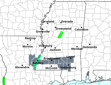
The pink are winter storm warnings
the purple/blue are winter weather advisories

Posted on 1/28/19 at 9:53 am to DVinBR
Too soon of a cut off or the models were way too aggressive on the cold. HRRR has BR at 50 when that run ends. Not trusting that just yet, despite agreeing with my position south Louisiana goes snowless.
Posted on 1/28/19 at 9:54 am to rt3

Posted on 1/28/19 at 9:55 am to rt3
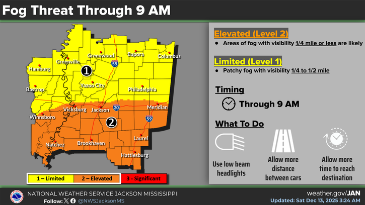
Thanks for the Jackson MS forecast
No one cares
No one cares
Posted on 1/28/19 at 9:56 am to Mr Perfect
Slam.
Posted on 1/28/19 at 9:56 am to rt3
NWS Lake Charles Facebook
If you want to see what they're saying about the snow situation for tonight
If you want to see what they're saying about the snow situation for tonight
Posted on 1/28/19 at 9:57 am to Mr Perfect
quote:
Thanks for the Jackson MS forecast
No one cares
I put in Jackson b/c that office actually covers far ENE Louisiana


Posted on 1/28/19 at 9:57 am to tigerfoot
quote:
There is no way they put buses on the road in the dark without knowing about all roadways.
A 2 hour delay should suffice, but I'd put money on St tammany closing the night before, and tangi closing the morning of, when everyone is halfway through getting their teenagers up instead.

Posted on 1/28/19 at 9:58 am to rt3
I fielded a question about central Mississippi somewhere in the three or four threads that came up about this. Someone cares. Hell I care.


Posted on 1/28/19 at 10:00 am to rt3
I think anyone who lives in Jackson has a whole lot more to worry about than snow
Posted on 1/28/19 at 10:01 am to Duke
it's just gonna be a boring cold arse miserable rain 

 Page 15 of 29

Popular
Back to top
 Follow TigerDroppings for LSU Football News