- My Forums
- Tiger Rant
- LSU Recruiting
- SEC Rant
- Saints Talk
- Pelicans Talk
- More Sports Board
- Coaching Changes
- Fantasy Sports
- Golf Board
- Soccer Board
- O-T Lounge
- Tech Board
- Home/Garden Board
- Outdoor Board
- Health/Fitness Board
- Movie/TV Board
- Book Board
- Music Board
- Political Talk
- Money Talk
- Fark Board
- Gaming Board
- Travel Board
- Food/Drink Board
- Ticket Exchange
- TD Help Board
Customize My Forums- View All Forums
- Show Left Links
- Topic Sort Options
- Trending Topics
- Recent Topics
- Active Topics
Started By
Message
re: Beta - Downgraded to TD - Now Short Break in Storms or Season Over?
Posted on 9/19/20 at 9:08 am to soccerfüt
Posted on 9/19/20 at 9:08 am to soccerfüt
Man we need a few strong arse cold fronts in the worst way. Gulf needs to be shut the f@*k down. Ever since I flooded in'16 hurricane season is a big long drawn out panic attack for me. Especially since these damn storms don't seem to move along anymore. Just park themselves and dump rain for days. I'm so sick of this shite i'm considering moving out of state. Sorry for the rant.
 1
1

Posted on 9/19/20 at 9:22 am to deltaland
Sucks but at least NHC is projecting it to pick up speed from wed - thu. Hopefully it has something to steer it out faster. It's already dumping on SELA and has been since yesterday. Luckily, it's about the lightest rain possible in most parts but it's steady. This system is sloppy af.
This post was edited on 9/19/20 at 9:23 am

Posted on 9/19/20 at 9:22 am to Bobby OG Johnson
quote:
Philip Klotzbach
@philklotzbach
The 2020 Atlantic hurricane season has now generated 90 ACE (Accumulated Cyclone Energy). That’s more than the ACE generated in 34 full Atlantic #hurricane seasons since 1950. ACE is integrated metric accounting for intensity and duration of storms:
#Teddy #Wilfred #Beta
We now have Advanced Stats for hurricanes. Beautiful.

Posted on 9/19/20 at 9:31 am to ShamelessPel
quote:
We now have Advanced Stats for hurricanes. Beautiful.
What’s this hurricanes WAR?

Posted on 9/19/20 at 9:31 am to rds dc
GFS is drunk
Posted on 9/19/20 at 9:35 am to Bronsonburner
ok dude. only been here few years and wondering if this stuff is normal. bc this is annoying. ngl
Posted on 9/19/20 at 9:37 am to Mr Perfect
Last time this many storms was 2005. So not normal to get this many.

Posted on 9/19/20 at 9:37 am to Mr Perfect
quote:
ok dude. only been here few years and wondering if this stuff is normal. bc this is annoying. ngl
"Normal" for 2005. Not normal for normal. 2020 is a full service year.

Posted on 9/19/20 at 9:38 am to Bobby OG Johnson
quote:
Philip Klotzbach
@philklotzbach
The 2020 Atlantic hurricane season has now generated 90 ACE (Accumulated Cyclone Energy). That’s more than the ACE generated in 34 full Atlantic #hurricane seasons since 1950. ACE is integrated metric accounting for intensity and duration of storms:
#Teddy #Wilfred #Beta
2005 still takes a dump on 2020
Posted on 9/19/20 at 9:38 am to Mr Perfect
Is this the first time in recorded history that 85% of the gulf coast shores will have experienced an impact by a tropical disturbance?
After these next two storms it seems like every coastline will have at least been touched by a feeder band this year
After these next two storms it seems like every coastline will have at least been touched by a feeder band this year
Posted on 9/19/20 at 9:40 am to NorthEndZone
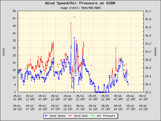
Buoy about 50 miles north of center that is about 200 feet high on platform...Garden Banks block 783 / Magnolia TLP for those of you that are familiar

Posted on 9/19/20 at 9:40 am to The Boat
2020 was lined up to be a strong year for a while.

Posted on 9/19/20 at 9:43 am to Cosmo
quote:
ABC13 Houston
@abc13houston
BREAKING NEWS: A voluntary evacuation has been issued for areas west of the Galveston seawall ahead of Tropical Storm Beta
Posted on 9/19/20 at 9:45 am to Tigeralum2008
okay thanks for the feedback @everyone
ready for this to be over. hope this thing just peters out and no one gets hit
ready for this to be over. hope this thing just peters out and no one gets hit
Posted on 9/19/20 at 9:49 am to NorthEndZone
quote:
Garden Banks block 783 / Magnolia TLP for those of you that are familiar
Was on my to do list to fish there.
Posted on 9/19/20 at 9:59 am to fishfighter
Tropical Storm Warning Port Aransas, TX to Intracoastal City, LA
000
WTNT22 KNHC 191454
TCMAT2
TROPICAL STORM BETA FORECAST/ADVISORY NUMBER 8
NWS NATIONAL HURRICANE CENTER MIAMI FL AL222020
1500 UTC SAT SEP 19 2020
CHANGES IN WATCHES AND WARNINGS WITH THIS ADVISORY...
A TROPICAL STORM WARNING IS NOW IN EFFECT FROM PORT ARANSAS TEXAS
TO INTRACOASTAL CITY LOUISIANA.
SUMMARY OF WATCHES AND WARNINGS IN EFFECT...
A STORM SURGE WATCH IS IN EFFECT FOR...
* PORT MANSFIELD TX TO CAMERON LA INCLUDING BAFFIN BAY...CORPUS
CHRISTI BAY...COPANO BAY...ARANSAS BAY...SAN ANTONIO BAY...MATAGORDA
BAY...GALVESTON BAY...SABINE LAKE AND CALCASIEU LAKE
A HURRICANE WATCH IS IN EFFECT FOR...
* PORT ARANSAS TEXAS TO HIGH ISLAND TEXAS
A TROPICAL STORM WARNING IS IN EFFECT FOR...
* PORT ARANSAS TEXAS TO INTRACOASTAL CITY LOUISIANA
A TROPICAL STORM WATCH IS IN EFFECT FOR...
* SOUTH OF PORT ARANSAS TEXAS TO THE MOUTH OF THE RIO GRANDE
* EAST OF INTRACOASTAL CITY LOUISIANA TO MORGAN CITY LOUISIANA
A STORM SURGE WATCH MEANS THERE IS A POSSIBILITY OF LIFE-
THREATENING INUNDATION...FROM RISING WATER MOVING INLAND FROM THE
COASTLINE...IN THE INDICATED LOCATIONS DURING THE NEXT 48 HOURS.
FOR A DEPICTION OF AREAS AT RISK...PLEASE SEE THE NATIONAL WEATHER
SERVICE STORM SURGE WATCH/WARNING GRAPHIC...AVAILABLE AT
HURRICANES.GOV.
A HURRICANE WATCH MEANS THAT HURRICANE CONDITIONS ARE POSSIBLE
WITHIN THE WATCH AREA. A WATCH IS TYPICALLY ISSUED 48 HOURS
BEFORE THE ANTICIPATED FIRST OCCURRENCE OF TROPICAL-STORM-FORCE
WINDS...CONDITIONS THAT MAKE OUTSIDE PREPARATIONS DIFFICULT OR
DANGEROUS.
A TROPICAL STORM WARNING MEANS THAT TROPICAL STORM CONDITIONS ARE
EXPECTED SOMEWHERE WITHIN THE WARNING AREA WITHIN 36 HOURS.
A TROPICAL STORM WATCH MEANS THAT TROPICAL STORM CONDITIONS ARE
POSSIBLE WITHIN THE WATCH AREA...GENERALLY WITHIN 48 HOURS.
A HURRICANE WARNING MAY BE REQUIRED FOR PORTIONS OF THE TEXAS COAST
LATER TODAY OR TONIGHT.
TROPICAL STORM CENTER LOCATED NEAR 26.6N 92.6W AT 19/1500Z
POSITION ACCURATE WITHIN 40 NM
PRESENT MOVEMENT TOWARD THE NORTHWEST OR 315 DEGREES AT 3 KT
ESTIMATED MINIMUM CENTRAL PRESSURE 994 MB
MAX SUSTAINED WINDS 50 KT WITH GUSTS TO 60 KT.
50 KT....... 60NE 0SE 0SW 50NW.
34 KT.......150NE 40SE 40SW 90NW.
12 FT SEAS.. 0NE 0SE 30SW 90NW.
WINDS AND SEAS VARY GREATLY IN EACH QUADRANT. RADII IN NAUTICAL
MILES ARE THE LARGEST RADII EXPECTED ANYWHERE IN THAT QUADRANT.
REPEAT...CENTER LOCATED NEAR 26.6N 92.6W AT 19/1500Z
AT 19/1200Z CENTER WAS LOCATED NEAR 26.5N 92.4W
FORECAST VALID 20/0000Z 26.9N 93.0W
MAX WIND 50 KT...GUSTS 60 KT.
50 KT... 60NE 0SE 0SW 60NW.
34 KT...150NE 60SE 40SW 100NW.
FORECAST VALID 20/1200Z 27.1N 93.8W
MAX WIND 55 KT...GUSTS 65 KT.
50 KT... 70NE 30SE 0SW 60NW.
34 KT...150NE 60SE 40SW 100NW.
FORECAST VALID 21/0000Z 27.5N 94.8W
MAX WIND 60 KT...GUSTS 75 KT.
50 KT... 70NE 40SE 40SW 60NW.
34 KT...150NE 80SE 60SW 100NW.
FORECAST VALID 21/1200Z 27.8N 95.5W
MAX WIND 65 KT...GUSTS 80 KT.
64 KT... 35NE 25SE 25SW 30NW.
50 KT... 70NE 50SE 50SW 60NW.
34 KT...150NE 80SE 80SW 100NW.
FORECAST VALID 22/0000Z 28.2N 96.2W
MAX WIND 65 KT...GUSTS 80 KT.
50 KT... 70NE 50SE 50SW 50NW.
34 KT...140NE 80SE 80SW 90NW.
FORECAST VALID 22/1200Z 28.6N 96.2W...INLAND
MAX WIND 55 KT...GUSTS 65 KT.
50 KT... 70NE 60SE 50SW 50NW.
34 KT...120NE 100SE 80SW 80NW.
EXTENDED OUTLOOK. NOTE...ERRORS FOR TRACK HAVE AVERAGED NEAR 150 NM
ON DAY 4 AND 175 NM ON DAY 5...AND FOR INTENSITY NEAR 15 KT EACH DAY
OUTLOOK VALID 23/1200Z 29.5N 95.0W...INLAND
MAX WIND 60 KT...GUSTS 75 KT.
OUTLOOK VALID 24/1200Z 30.5N 93.0W...INLAND
MAX WIND 50 KT...GUSTS 60 KT.
REQUEST FOR 3 HOURLY SHIP REPORTS WITHIN 300 MILES OF 26.6N 92.6W
INTERMEDIATE PUBLIC ADVISORY...WTNT32 KNHC/MIATCPAT2...AT 19/1800Z
NEXT ADVISORY AT 19/2100Z
$$
FORECASTER BEVEN

Posted on 9/19/20 at 9:59 am to fishfighter
10am advisory information:
Tropical Storm Beta Advisory Number 8
NWS National Hurricane Center Miami FL AL222020
1000 AM CDT Sat Sep 19 2020
...BETA STARTING ITS WESTWARD TURN...
...TROPICAL STORM WARNING ISSUED FOR PORTIONS OF THE TEXAS AND
LOUISIANA COASTS...
SUMMARY OF 1000 AM CDT...1500 UTC...INFORMATION
-----------------------------------------------
LOCATION...26.6N 92.6W
ABOUT 305 MI...495 KM ESE OF CORPUS CHRISTI TEXAS
ABOUT 245 MI...395 KM S OF LAKE CHARLES LOUISIANA
MAXIMUM SUSTAINED WINDS...60 MPH...95 KM/H
PRESENT MOVEMENT...NW OR 315 DEGREES AT 3 MPH...6 KM/H
MINIMUM CENTRAL PRESSURE...994 MB...29.36 INCHES
Posted on 9/19/20 at 10:01 am to fishfighter
a Beta turning west? shocking
quote:
Tropical Storm Beta
...BETA STARTING ITS WESTWARD TURN... ...TROPICAL STORM WARNING ISSUED FOR PORTIONS OF THE TEXAS AND LOUISIANA COASTS...
10:00 AM CDT Sat Sep 19
Location: 26.6°N 92.6°W
Moving: NW at 3 mph
Min pressure: 994 mb
Max sustained: 60 mph
Posted on 9/19/20 at 10:02 am to Roll Tide Ravens

Posted on 9/19/20 at 10:06 am to rt3

 Page 34 of 63

Popular
Back to top