- My Forums
- Tiger Rant
- LSU Recruiting
- SEC Rant
- Saints Talk
- Pelicans Talk
- More Sports Board
- Fantasy Sports
- Golf Board
- Soccer Board
- O-T Lounge
- Tech Board
- Home/Garden Board
- Outdoor Board
- Health/Fitness Board
- Movie/TV Board
- Book Board
- Music Board
- Political Talk
- Money Talk
- Fark Board
- Gaming Board
- Travel Board
- Food/Drink Board
- Ticket Exchange
- TD Help Board
Customize My Forums- View All Forums
- Show Left Links
- Topic Sort Options
- Trending Topics
- Recent Topics
- Active Topics
Started By
Message
 2
2

Posted on 3/24/23 at 9:26 pm to OneEyedWillie
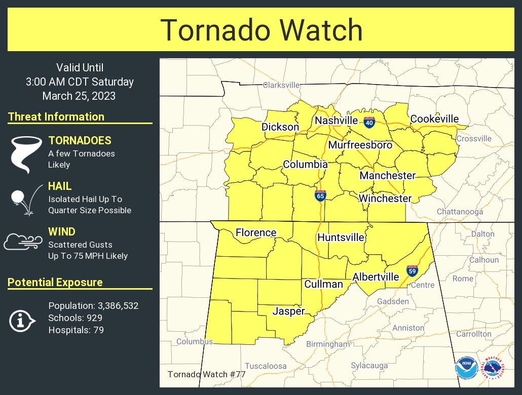
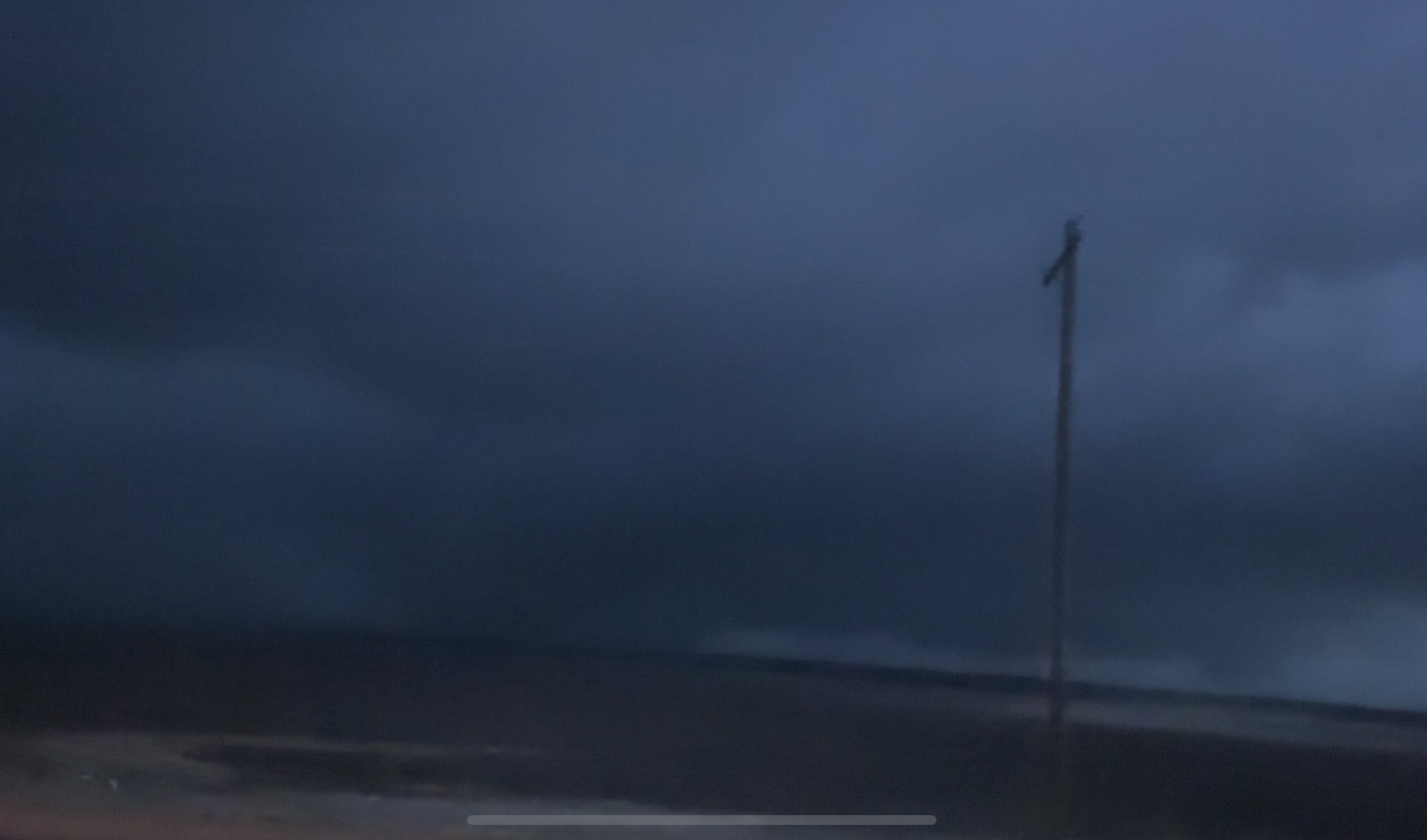
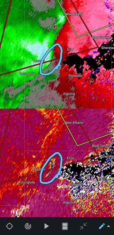
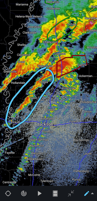
That trailing rotation may tor if it doesn't get cut off. A bit of a BWER on Reflectivity now with it.

Posted on 3/24/23 at 9:26 pm to Bobby OG Johnson
New watch
Posted on 3/24/23 at 9:28 pm to LegendInMyMind
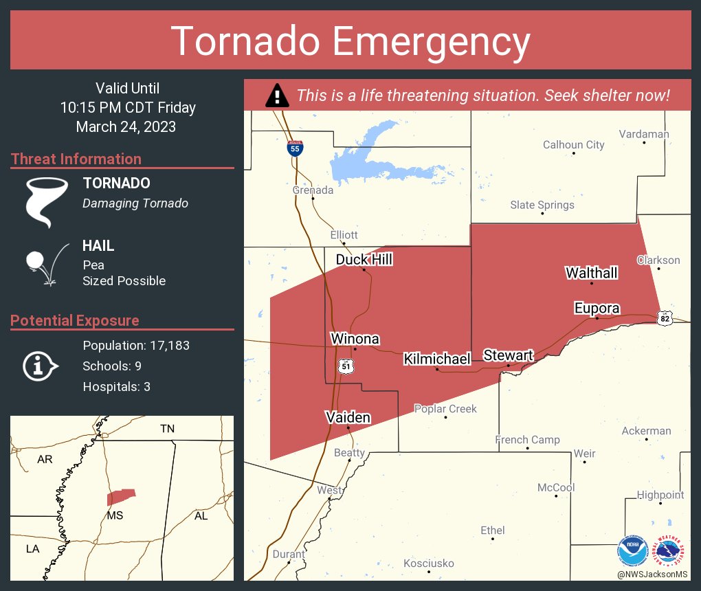
This thing is about to go right through Winona that’s not good. Town of about 10k

Posted on 3/24/23 at 9:28 pm to LegendInMyMind
Well, if nothing else, this storm has lived up to the threat. Long lived cell dropping multiple large tornadoes along its path. Not good.

Posted on 3/24/23 at 9:28 pm to Bobby OG Johnson
Winona aint looking too good right now
Posted on 3/24/23 at 9:29 pm to Bobby OG Johnson
quote:
Reed Timmer, PhD
@ReedTimmerAccu
·
5s
Here are some frame captures of the destructive #tornado as a wedge on approach to Rolling Fork, MS. We are heading back to assist in transport
Posted on 3/24/23 at 9:29 pm to Bobby OG Johnson
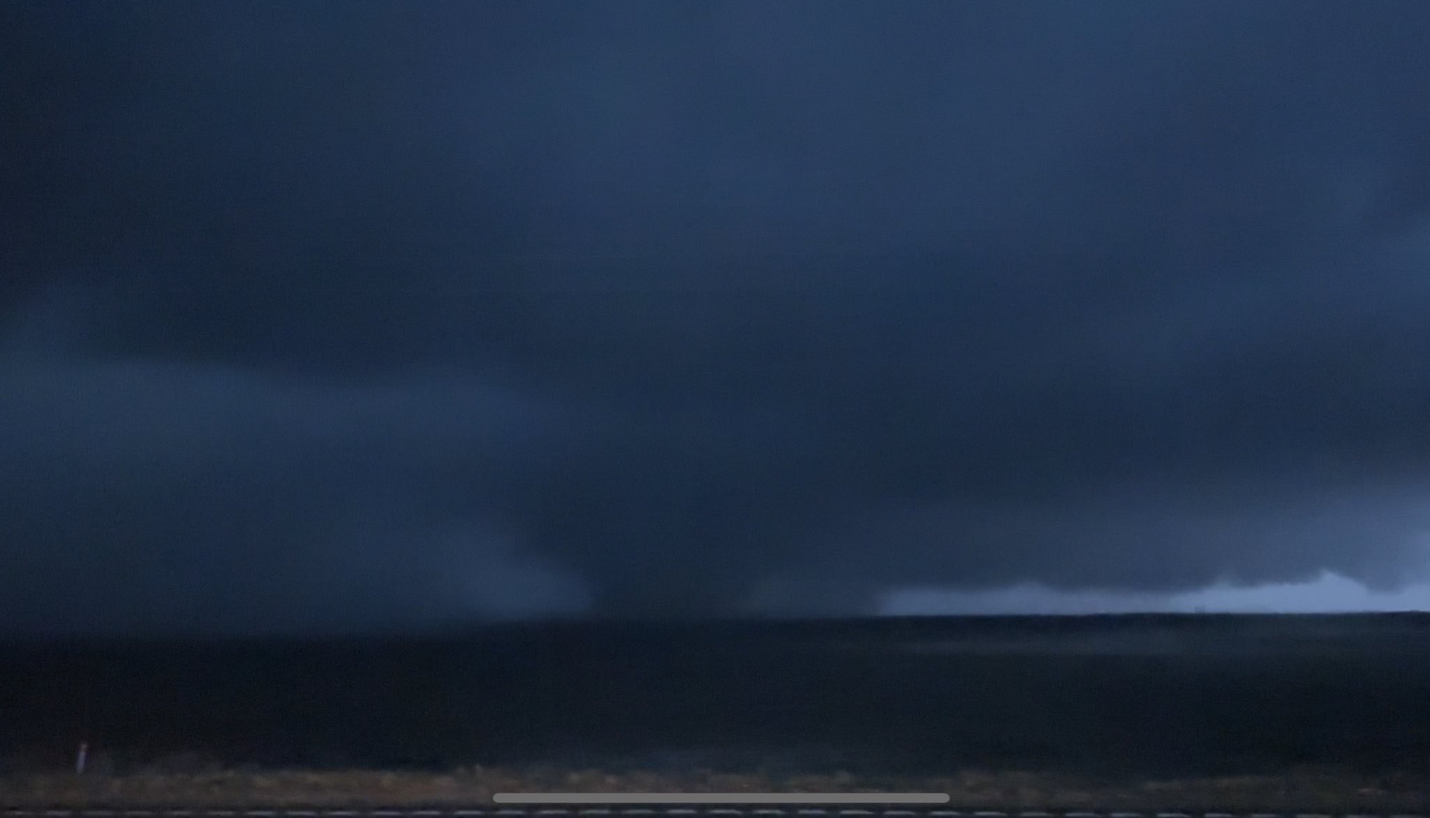
Debris being kicked up along the gust front on the northern storm/warning.
Posted on 3/24/23 at 9:30 pm to Bobby OG Johnson
Foltz about to get fud up
Posted on 3/24/23 at 9:30 pm to Bobby OG Johnson
Continued
Posted on 3/24/23 at 9:31 pm to LegendInMyMind
quote:
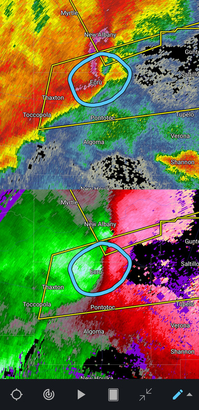
Maybe another one brewing:
Worst case scenario is one right behind the first when people crawl out of their homes she’ll shocked and have no clue it’s coming
Posted on 3/24/23 at 9:32 pm to Bobby OG Johnson
quote:
NWS Birmingham
@NWSBirmingham
·
40s
9:30 pm: HEADS UP! This is a very dangerous storm headed toward the northwestern part of central Alabama. Please pay attention to the weather over the upcoming hours! #alwx
Birmingham trying to get ahead of it
Posted on 3/24/23 at 9:32 pm to Bobby OG Johnson
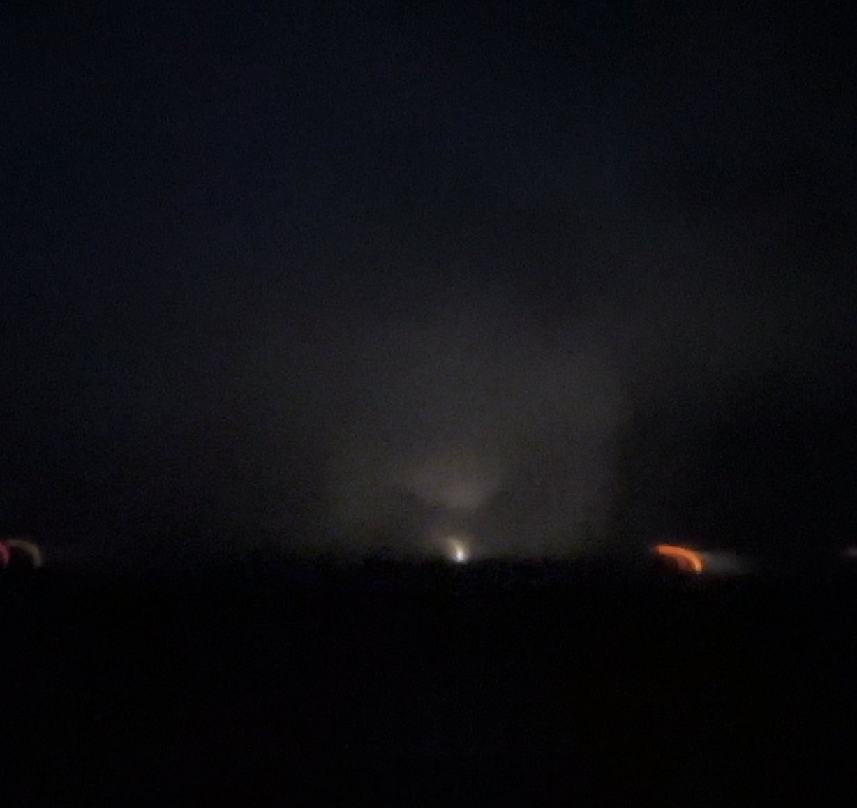
tornado's on I-55 right now by Foltz
Posted on 3/24/23 at 9:33 pm to rt3
Brutal wind gusts tonight.
Posted on 3/24/23 at 9:33 pm to LegendInMyMind
Keep an eye on all these trailing storms, particularly any towards the end of the line.
Posted on 3/24/23 at 9:34 pm to OneEyedWillie
I know a bunch of people from silver city and a few fish farmers in midnight, silver city, and Louise.
My deer camp is in kilmichael. Know people from Winona. Really hope they’re all ok
My deer camp is in kilmichael. Know people from Winona. Really hope they’re all ok
Posted on 3/24/23 at 9:35 pm to deltaland
quote:
NWS Jackson MS
@NWSJacksonMS
·
32s
9:31 PM - Confirmed tornado is on the ground moving across I-55 moving into the city of Winona in Montgomery County shortly. Take cover now! #mswx
Posted on 3/24/23 at 9:36 pm to LegendInMyMind
storm chaser Brandon Copic apparently almost slammed into a tree that was on the road

Posted on 3/24/23 at 9:36 pm to deltaland
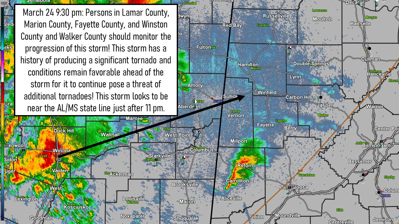
Spann just said if the supercell holds together, it’ll be crossing the state line around 10:00 pm. Probably between Hamilton and Red Bay

 Page 12 of 32

Popular
Back to top