- My Forums
- Tiger Rant
- LSU Recruiting
- SEC Rant
- Saints Talk
- Pelicans Talk
- More Sports Board
- Coaching Changes
- Fantasy Sports
- Golf Board
- Soccer Board
- O-T Lounge
- Tech Board
- Home/Garden Board
- Outdoor Board
- Health/Fitness Board
- Movie/TV Board
- Book Board
- Music Board
- Political Talk
- Money Talk
- Fark Board
- Gaming Board
- Travel Board
- Food/Drink Board
- Ticket Exchange
- TD Help Board
Customize My Forums- View All Forums
- Show Left Links
- Topic Sort Options
- Trending Topics
- Recent Topics
- Active Topics
Started By
Message
 1
1

Posted on 5/20/19 at 12:38 pm to Cincinnati Bowtie
quote:
I'm in a 2nd floor room at a hotel in OKC. I don't know what to do in a tornado scenario.
Go talk to the front desk people. I'm sure they have a protocol for the entire building.
Posted on 5/20/19 at 12:38 pm to Cincinnati Bowtie
quote:
I'm in a 2nd floor room at a hotel in OKC. I don't know what to do in a tornado scenario.
Talk to the front desk and see what they tell you to do. I'm sure they've got a safe place to go. Just keep an eye out for warnings. NWS Norman is an excellent office, one of the best. So pay attention when they put out warnings.
This thread will probably post them too, but make sure you can get warnings on your phone.
Posted on 5/20/19 at 12:39 pm to rt3
quote:
seriously though... get on a low floor and in a hallway or bathroom... since you're in OKC they may even have a special severe storm room to go to so you may want to get a lay of the land quickly
Just called the front desk, they told me to kiss my arse goodbye too, they're going home.
They have a plan. gotta go down and there's an area to go to.
Posted on 5/20/19 at 12:40 pm to ElOsoBlanco7
My best friend and his family live in the Clinton area

So they could be in the thick of shite today. Just called him and he said he's been sent home from work for the day. Hes got a basement and his folks have an underground shelter.
So they could be in the thick of shite today. Just called him and he said he's been sent home from work for the day. Hes got a basement and his folks have an underground shelter.
Posted on 5/20/19 at 12:40 pm to ElOsoBlanco7
quote:
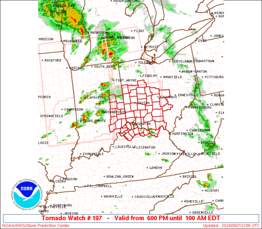
URGENT - IMMEDIATE BROADCAST REQUESTED
Tornado Watch Number 197
NWS Storm Prediction Center Norman OK
1235 PM CDT Mon May 20 2019
The NWS Storm Prediction Center has issued a
* Tornado Watch for portions of
West Texas including much of the Panhandle
* Effective this Monday afternoon and evening from 1235 PM until
800 PM CDT.
...THIS IS A PARTICULARLY DANGEROUS SITUATION...
* Primary threats include...
Numerous tornadoes expected with a few intense tornadoes likely
Widespread large hail and scattered very large hail events to 4
inches in diameter expected
Widespread damaging wind gusts to 70 mph likely
SUMMARY...Intense tornadic supercell thunderstorms are expected to
develop across west Texas as the eastern half of the Texas
Panhandle. In addition to the risk of strong tornadoes, very large
hail and damaging winds are likely in the strongest cells.
The tornado watch area is approximately along and 55 statute miles
east and west of a line from 50 miles east northeast of Amarillo TX
to 35 miles east of Big Spring TX. For a complete depiction of the
watch see the associated watch outline update (WOUS64 KWNS WOU7).
PRECAUTIONARY/PREPAREDNESS ACTIONS...
REMEMBER...A Tornado Watch means conditions are favorable for
tornadoes and severe thunderstorms in and close to the watch
area. Persons in these areas should be on the lookout for
threatening weather conditions and listen for later statements
and possible warnings.
&&
OTHER WATCH INFORMATION...CONTINUE...WW 196...
AVIATION...Tornadoes and a few severe thunderstorms with hail
surface and aloft to 4 inches. Extreme turbulence and surface wind
gusts to 60 knots. A few cumulonimbi with maximum tops to 600. Mean
storm motion vector 24035.
...Hart
This post was edited on 5/20/19 at 12:42 pm
Posted on 5/20/19 at 12:41 pm to rt3
PDS (Particularly Dangerous Situation) Watch
quote:
The NWS Storm Prediction Center has issued a * Tornado Watch for portions of West Texas including much of the Panhandle *
Effective this Monday afternoon and evening from 1235 PM until 800 PM CDT.
...THIS IS A PARTICULARLY DANGEROUS SITUATION...
quote:
* Primary threats include...
Numerous tornadoes expected with a few intense tornadoes likely
Widespread large hail and scattered very large hail events to 4 inches in diameter expected
Widespread damaging wind gusts to 70 mph likely
quote:
SUMMARY...Intense tornadic supercell thunderstorms are expected to develop across west Texas as the eastern half of the Texas Panhandle. In addition to the risk of strong tornadoes, very large hail and damaging winds are likely in the strongest cells.
Posted on 5/20/19 at 12:43 pm to Duke
quote:
...THIS IS A PARTICULARLY DANGEROUS SITUATION...
Always nerve racking when they throw up a PDS and there isn't a current supercell in the area to be seen.
It's coming though.
Posted on 5/20/19 at 12:43 pm to Duke
can see some showers developing in the watch, won't be long.
Posted on 5/20/19 at 12:49 pm to Cincinnati Bowtie
Ive been in OKC during a tornado before. Its just another day to those people up there. There was a warning issued so Im freaking out and the front desk said man you need to chill, we dont stress untill they are a mile away. Here is some drink vouchers go relax. I was then standning at a window a 10 minutes later watching a tornado in the distance like the rest of them. Still pretty stressful but was cool to see.
Posted on 5/20/19 at 12:50 pm to BeauxPete
quote:
Ive been in OKC during a tornado before. Its just another day to those people up there. There was a warning issued so Im freaking out and the front desk said man you need to chill, we dont stress untill they are a mile away. Here is some drink vouchers go relax. I was then standning at a window a 10 minutes later watching a tornado in the distance like the rest of them. Still pretty stressful but was cool to see.
hmmmmm... how can I use this information to my advantage?
This post was edited on 5/20/19 at 12:51 pm

Posted on 5/20/19 at 12:51 pm to Lsuhoohoo
quote:
Hes got a basement and his folks have an underground shelter.
This is one of those sleep in the basement nights
Posted on 5/20/19 at 12:52 pm to slackster
quote:
Always nerve racking when they throw up a PDS and there isn't a current supercell in the area to be seen.
No joke. It's got every parameter you look for in spades in the watch region. Thinking it'll be about 3 pm before you really see it popping off. The dry line should provide a focus as it swings in.

Posted on 5/20/19 at 12:53 pm to Duke
The overnight threat is especially worrisome
Posted on 5/20/19 at 12:54 pm to GEAUXmedic
Overnight tornadoes are not terribly common for the region either.
Posted on 5/20/19 at 12:56 pm to Duke
What does convective inhibition bode for us in the Falls
Thank you
Thank you
Posted on 5/20/19 at 12:58 pm to wfallstiger
quote:
What does convective inhibition bode for us in the Falls
It means there's something keeping the air from rising. I expect it won't be there for too much longer there though.

Posted on 5/20/19 at 1:01 pm to Duke
I left my office and am working from home the rest of the day. My Arkansas arse did not grow up around this mess. When people in the office who are from Oklahoma get worried, I get even more worried. Though, the thought seems to be there is a chance a lot of the storms may stay to the west of or along I-44. I am just a bit southeast of Tulsa in Wagoner County.
Posted on 5/20/19 at 1:01 pm to Duke
quote:
No joke. It's got every parameter you look for in spades in the watch region. Thinking it'll be about 3 pm before you really see it popping off. The dry line should provide a focus as it swings in.
17z HRRR Sig Tornado Potential @ 3PM:

4PM:

I don't know much about the scale of this kind of image, but the 4PM image has an 11.7 in there...
Posted on 5/20/19 at 1:02 pm to slackster
5PM - a 15.1 max...


 Page 8 of 31

Popular
Back to top