




- My Forums
- Tiger Rant
- LSU Recruiting
- SEC Rant
- Saints Talk
- Pelicans Talk
- More Sports Board
- Fantasy Sports
- Golf Board
- Soccer Board
- O-T Lounge
- Tech Board
- Home/Garden Board
- Outdoor Board
- Health/Fitness Board
- Movie/TV Board
- Book Board
- Music Board
- Political Talk
- Money Talk
- Fark Board
- Gaming Board
- Travel Board
- Food/Drink Board
- Ticket Exchange
- TD Help Board
Customize My Forums- View All Forums
- Show Left Links
- Topic Sort Options
- Trending Topics
- Recent Topics
- Active Topics
Started By
Message


 1
1


Posted on 4/13/19 at 9:45 am to 50_Tiger
I am traveling from New Orleans to Baton Rouge around 4pm - 5pm.
If I watch the radar, is the tornadic threat mainly limited to the “line” of the storm as seen on radar? Like, the below. So, if it doesn’t look like I will run through this line of storm on my drive, it’s reasonable to assume it will be safe?

If I watch the radar, is the tornadic threat mainly limited to the “line” of the storm as seen on radar? Like, the below. So, if it doesn’t look like I will run through this line of storm on my drive, it’s reasonable to assume it will be safe?
This post was edited on 4/13/19 at 9:46 am


Posted on 4/13/19 at 9:47 am to MiloDanglers
While not exact, this should give you some idea of how the storms are expected to evolve throughout the day. Slow down the speed and hit play.
Future Radar
Future Radar
This post was edited on 4/13/19 at 9:48 am
Posted on 4/13/19 at 9:51 am to MiloDanglers
While I believe tornadoes can still spin up in lined weather, the real threat are discrete cells that have no inhibiting features that doesn’t allow rotation.
The line is usually a good thing.
The line is usually a good thing.
Posted on 4/13/19 at 9:51 am to HogX
quote:
While not exact, this should give you some idea of how the storms are expected to evolve throughout the day. Slow down the speed and hit play.
Ok, I see. Looks like they expect more “lines” to develop, in addition to the one currently shown on the radar moving across Texas. Based on that future cast, if I can get out by 4pm I should be OK, otherwise I am putting myself at some risk on the drive.
Posted on 4/13/19 at 9:53 am to 50_Tiger
quote:
While I believe tornadoes can still spin up in lined weather, the real threat are discrete cells that have no inhibiting features that doesn’t allow rotation. The line is usually a good thing.
That makes sense. But these cells still tend to be directly in front of, or behind, the line. No?

Posted on 4/13/19 at 9:54 am to MiloDanglers
I'm right in the middle of Helotes and it was a strong line. Penny sized hail. The skyscreamer on tv kept hanging on the tornado hope but it didn't have that look or vibe at all. Moved thru really fast.
Posted on 4/13/19 at 9:57 am to MiloDanglers
In front

Posted on 4/13/19 at 10:06 am to danfraz
3-inch size hail reported by NWS near Helotes via SA’s Spectrum News channel
This post was edited on 4/13/19 at 10:08 am

Posted on 4/13/19 at 10:09 am to rds dc
1/4 size hail reported in Bulverde
Posted on 4/13/19 at 10:10 am to jlc05
reporting for weather watch duty from CenLA
Posted on 4/13/19 at 10:11 am to rt3
Weather Channel (yes I know... keep the jokes to yourself) has 1 of their people in S-port


Posted on 4/13/19 at 10:13 am to rt3
The sun is out in Tuscaloosa.
We rebuke and bind up this weather in the name of Jesus. Amen!
We rebuke and bind up this weather in the name of Jesus. Amen!
Posted on 4/13/19 at 10:14 am to biggsc
from 11 minutes ago

Posted on 4/13/19 at 10:15 am to Duke
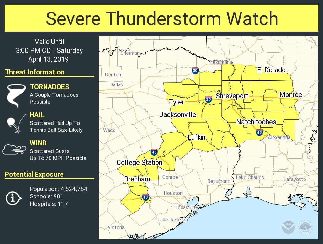
It is 60 degrees in Desoto Parish South of Shreveport. I hope the clouds and rain stick around.
Eta. Then I see the severe ts warning above my post.
Eta. Then I see the severe ts warning above my post.
This post was edited on 4/13/19 at 10:17 am
Posted on 4/13/19 at 10:16 am to jlc05
quote:
3-inch size hail reported by NWS near Helotes via SA’s Spectrum News channel
Yeah I've seen pics of some large chunks. Couple golf ball sized. Tennis ball as well :yikes:
2nd line coming thru now. Not as strong, no hail, just rain. Looks like it took about four hours to get from the border to San Antonio
Posted on 4/13/19 at 10:16 am to biggsc
quote:
The sun is out in Tuscaloosa.
when people say this with the weather that's forecast today...
all I can think about is the ABC 33/40 (James Spann and Jason Simpson) from the day of the big Tuscaloosa tornado... after the early morning line and the clouds cleared out right after dawn and the sun came out
they're like "this isn't good for what's to come this afternoon"

Posted on 4/13/19 at 10:19 am to biggsc
It tried to pop out here earlier. Ah reckon we prayed it away. Don't need no sunshine today, not me.
Posted on 4/13/19 at 10:19 am to rt3
Weather Channel showing the hail from Helotes, Texas claiming it's baseball size
shite... Alex has a TOR:Con of 7 by TWC
shite... Alex has a TOR:Con of 7 by TWC

 Page 18 of 47

Popular
Back to top
 Follow TigerDroppings for LSU Football News