




- My Forums
- Tiger Rant
- LSU Recruiting
- SEC Rant
- Saints Talk
- Pelicans Talk
- More Sports Board
- Fantasy Sports
- Golf Board
- Soccer Board
- O-T Lounge
- Tech Board
- Home/Garden Board
- Outdoor Board
- Health/Fitness Board
- Movie/TV Board
- Book Board
- Music Board
- Political Talk
- Money Talk
- Fark Board
- Gaming Board
- Travel Board
- Food/Drink Board
- Ticket Exchange
- TD Help Board
Customize My Forums- View All Forums
- Show Left Links
- Topic Sort Options
- Trending Topics
- Recent Topics
- Active Topics
Started By
Message
re: Tornado! Rampaging Tri-State TX-LA-MS - Threat Continues Overnight
Posted on 4/23/20 at 1:23 pm to Bobby OG Johnson

Posted on 4/23/20 at 1:23 pm to Bobby OG Johnson
That's pretty close to Waycross. Hopefully it doesn't intensify. Looks to be fairly weak rotation at the moment.
 1
1

Posted on 4/23/20 at 1:42 pm to NorthEndZone
quote:
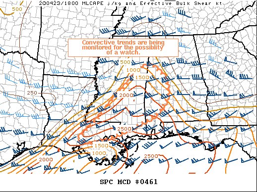
Mesoscale Discussion 0461
NWS Storm Prediction Center Norman OK
0137 PM CDT Thu Apr 23 2020
Areas affected...southeastern Louisiana and Mississippi into
west-central Alabama
Concerning...Severe potential...Watch possible
Valid 231837Z - 232030Z
Probability of Watch Issuance...40 percent
SUMMARY...Thunderstorms are starting to develop across southeastern
Louisiana and east-central Mississippi in an unstable, yet narrow,
warm sector. Given the complexities created by the earlier and
ongoing widespread convection to the south and east, the need for a
watch is uncertain.
DISCUSSION...Multiple rounds of deep convection across the Florida
panhandle and coastal areas of Louisiana have complicated the
evolution of the pre-convective environment across inland portions
of Louisiana, Mississippi, and Alabama. Extensive cloud cover
across the region, resulting from strong convection over the Gulf,
has limited heating and destabilization over the warm sector.
Nevertheless, thunderstorms are trying to develop ahead of the
surface front/pressure trough as a midlevel shortwave trough
approaches. If enough clearing/destabilization is able to occur
across the warm sector to get vigorous updraft and thunderstorm
development, sufficient shear is in place to support organized
storms with a threat of large hail and damaging winds.
..Jirak/Hart.. 04/23/2020
...Please see www.spc.noaa.gov for graphic product...
ATTN...WFO...BMX...MOB...JAN...LIX...LCH...
LAT...LON 30219188 31069096 31589051 32138998 32488962 33138898
33588851 33578793 33018728 32308720 31908734 31638756
31278796 30628942 30319028 30089126 30219188
aka... sunshine is BAD
This post was edited on 4/23/20 at 1:47 pm


Posted on 4/23/20 at 1:44 pm to rt3
I'm already "watching" it.



Posted on 4/23/20 at 1:49 pm to Bobby OG Johnson
Looks like it's tracking toward Darien GA
Which is a cool little seafood town
Which is a cool little seafood town
Posted on 4/23/20 at 1:51 pm to Pettifogger
about to trash north Waynesville, Ga.

Posted on 4/23/20 at 1:56 pm to TDsngumbo
Hail cell around St. Martinville heading East.
This post was edited on 4/23/20 at 2:01 pm
Posted on 4/23/20 at 2:00 pm to Bobby OG Johnson
Max Hail: 4"
Damn, those folks don't see that very often.
Damn, those folks don't see that very often.


Posted on 4/23/20 at 2:04 pm to SATNIGHTS
quote:
Hail cell around St. Martinville heading East.
Good, I hope it keeps it up and makes its way into the AP. I need a new roof!
ETA: Looks like it's 1" sized hail but it's probably going to end up going north of the AP.

This post was edited on 4/23/20 at 2:09 pm
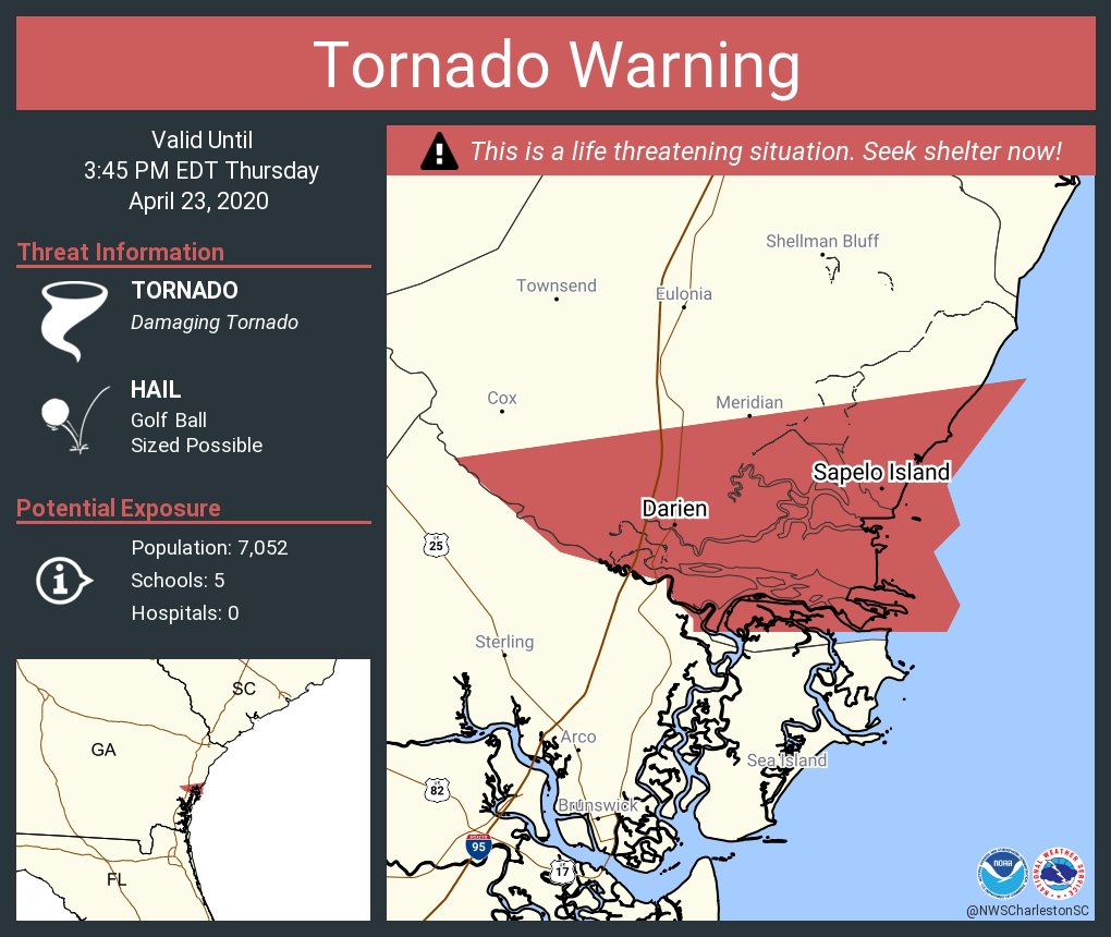
Posted on 4/23/20 at 2:06 pm to Bobby OG Johnson
really... Charleston, SC has that area
wouldn't have figured that would be in a SC office's coverage area
wouldn't have figured that would be in a SC office's coverage area
Posted on 4/23/20 at 2:07 pm to Bobby OG Johnson
I want no part of softballs falling from the sky.


Posted on 4/23/20 at 2:09 pm to SATNIGHTS
quote:
Hail cell around St. Martinville heading East.
just noticed that on radar. If it blossoms it's gonna be bad news for BTR
Posted on 4/23/20 at 2:12 pm to udtiger
quote:
If it blossoms it's gonna be bad news for BTR
Yea, looks like it's holding its own so far. If it intensifies, look out.
Posted on 4/23/20 at 2:12 pm to Bobby OG Johnson

Pretty cool drone shot of the cell as it passed over Moultrie
Posted on 4/23/20 at 2:13 pm to rt3
Weather STEM camera in Brantley Co., Ga.
is that hail falling on cam?
is that hail falling on cam?
Posted on 4/23/20 at 2:13 pm to TDsngumbo
quote:
James Spann
@spann
·
2m
Large hail, possibly baseball size, is falling in the storm over northern Sumter County… about 10 miles north of York/Livingston. Will move into Greene County in a bit.

Posted on 4/23/20 at 2:14 pm to Pettifogger
quote:
Pretty cool drone shot of the cell as it passed over Moultrie
if by cool you mean scary AF
but yeah... that's mesmerizing

 Page 39 of 43

Popular
Back to top
 Follow TigerDroppings for LSU Football News